PACIFIC HIGHWAY
Section: Chatsworth/Mororo
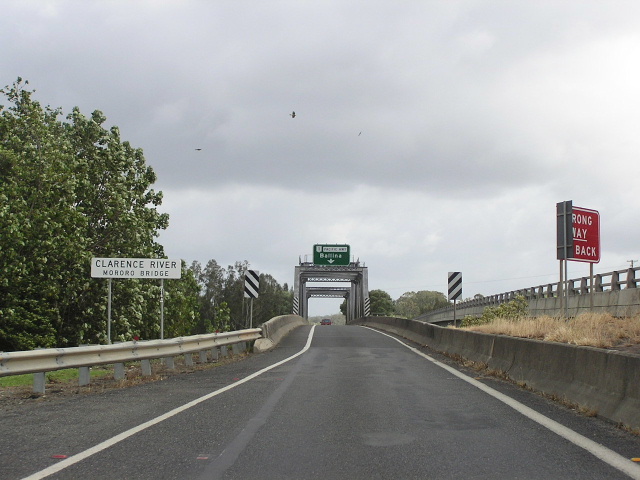
Looking north across Mororo Bridge over the Clarence River North Arm. Hard to believe that this bridge carried two-way traffic until 1993! Nov 2005.
This 9km section of the Pacific Highway stretches from the northern end of Harwood Bridge to just north of Iluka Road , most of which is located on islands in the middle of the Clarence River .
Between Harwood Bridge and North Bank Road , the alignment has not changed since 1928 (as far as I know). There was a suggestion that the highway once followed Watts Lane and Martins Point Road from Harwood Sugar Refinery to Chatsworth, however I have seen no evidence to either confirm or reject this idea. The bridge over Serpentine Creek (or is it Channel?) was constructed during the 1980s and the section of the highway south of North Bank Road has had extensive formation widening undertaken to provide wider and more spaced out centre lines as well as decent shoulders. I imagine this work was undertaken during the 1980s as well.
On Chatsworth Island the alignment was markedly different. Until December 1986, when the 2km Chatsworth Deviation was opened to traffic, the Pacific Highway followed what is now Chatsworth Road, going rather circuitously into the village of Chatsworth (or “Chatsworth Island” according to the old DMR sign, before rejoining the current alignment at Mororo Bridge. The old alignment was about 1.5km longer than the current route. Interestingly, the Chatsworth Deviation was built with four lanes, but not as a dual carriageway. This is even more surprising when one remembers that for the first seven years after opening the wide, four-lane deviation narrowed to two very narrow lanes to cross the old Mororo Bridge - a bridge so narrow that heavy vehicles could not pass each other for fear of clipping mirrors. This has since been rectified, which leads me to the next chapter of the story.
The North Arm of the Clarence River was originally crossed by a punt at Mororo - just downstream from the current bridge location - but it was replaced much earlier than its sister ferry at Harwood. Construction of a bridge across the river at Mororo was chosen as one of the priorities for Commonwealth unemployment relief funding during the Depression, along with similar bridges on the highway at Taree, Coopernook, Macksville, Raleigh , Chinderah and Boyds Bay . It was selected ahead of its busier and arguably more important sister ferry at Harwood for replacement due the limited amount of funding available - it would require a much shorter structure and did not require an opening span as river traffic used the wider and deeper South Arm. Construction was commenced in early 1932, following completion of works on the Macksville bridge over the Nambucca River, and traffic began using the new bridge via temporary side-tracks (because the approaches had yet to be finished) on 16 March 1935. Following the completion of the approaches, the bridge was officially opened on 8 June 1935 .
Like other bridges constructed in the Depression (particularly those at Taree and Coopernook) the deck was quite narrow and soon became too narrow to handle modern traffic volumes and heavy vehicles. Truckies would not pass each other on the bridge for the fear of clipping mirrors or even having a head-on collision - they would call ahead on the radio to make sure only one crossed at a time. However, the allocation of National Highway status to the New England Highway and other, more pressing, priorities along the highway meant replacing the bridge would have to wait. It wasn’t until an injection of funding into the highway by the Greiner Government in 1991 that construction got underway. Rather than replacing the original steel-truss bridge, which was in good structural condition, a new two-lane bridge was constructed just downstream from the original bridge to provide for southbound traffic. The original bridge was narrowed to one lane and is now used by northbound traffic only. Jersey barriers on either side protect the vertical trusses from damage - this necessitated the narrowing to one lane. The new bridge was opened to traffic in December 1993. On the north side of the river, as part of this project, a 1.8km realignment of the highway was undertaken, including the construction of a new junction with Iluka Road and nearly 1km of dual carriageways.
As part of the Pacific Highway Upgrading Programme, planning commenced in November 2004 for the upgrade of the highway to dual carriageway standard between Wells Crossing and Iluka Road . A preferred route was selected in December 2005 which involves the duplication of the existing highway and small realignments to achieve the desired horizontal alignment across Chatsworth Island . It is unlikely that a new bridge will be constructed to replace the original steel-truss Mororo Bridge until well into the future, and it is also unlikely that the dual carriageways on the north side of the bridge will be altered as part of any upgrade.
Current Route of Pacific Highway |
|
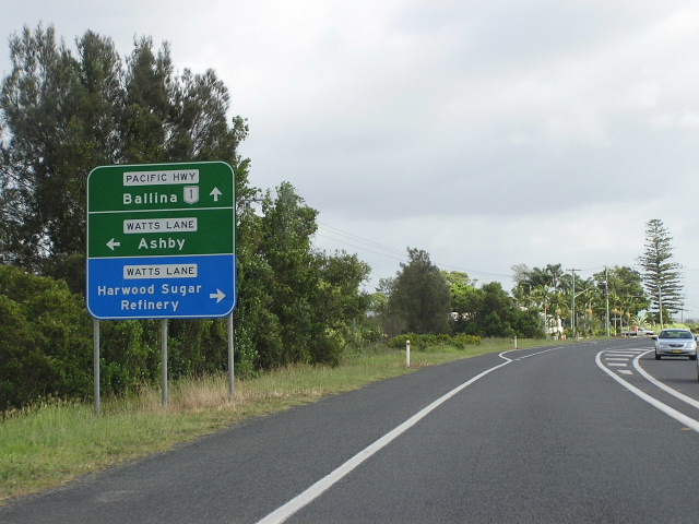 |
Northbound AD sign approaching Watts Lane at Harwood. Nov 2005. |
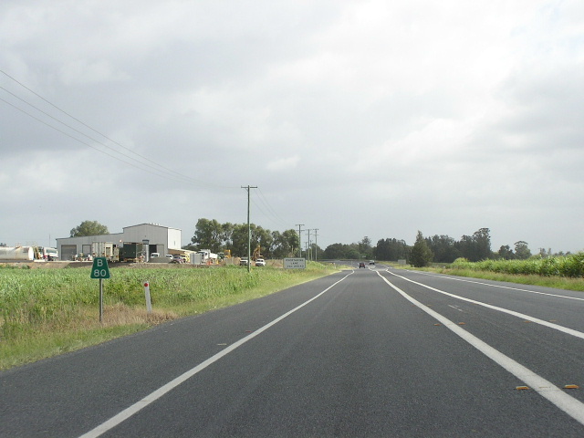 |
Looking north towards Serpentine Creek. Nov 2005. |
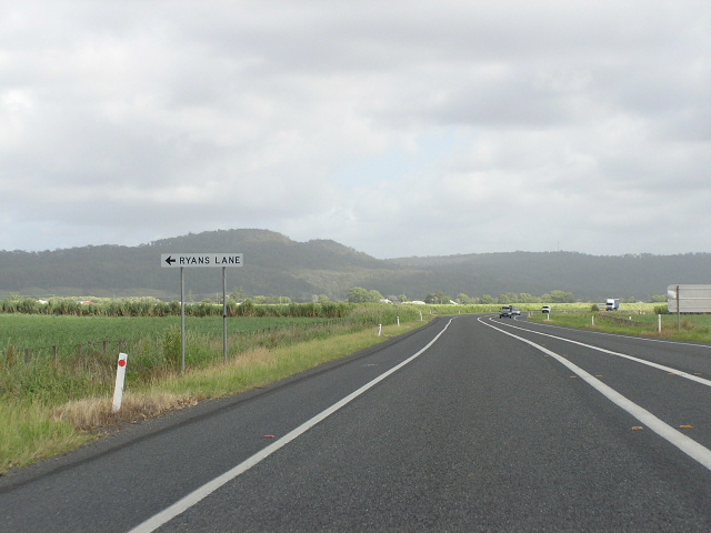 |
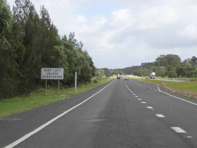
Looking north approaching Ryans Lane. Note the double unbroken centre lines are separated to make sure there is a safe distance between opposing traffic flows and minimise head-on collisions. Nov 2005. |
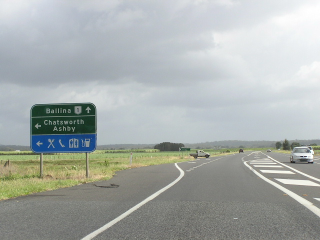 |
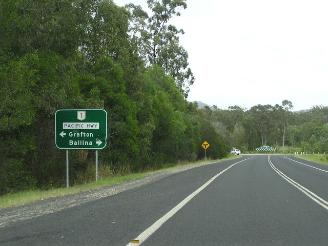
Looking north at the southern end of the Chatsworth Deviation. The highway used to turn left here until the deviation was opened in 1986. Nov 2005. |
 |
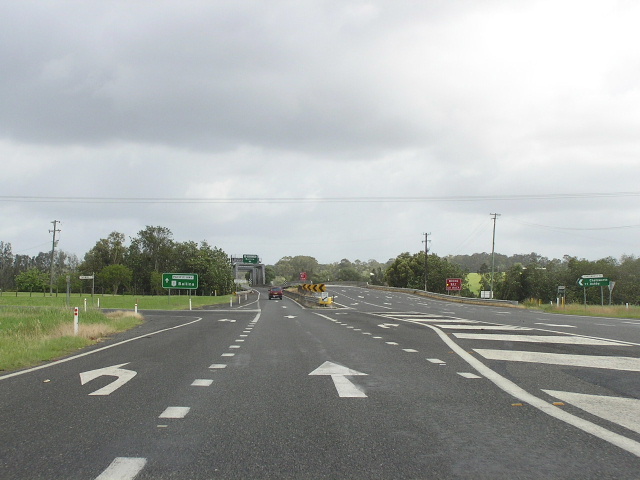
Looking north along the Chatsworth Deviation. Interesting how it was constructed as a four lane undivided road, narrowing to two very narrow lanes across the Mororo Bridge until 1993. Nov 2005. |
 |
Looking north at the northern end of the Chatsworth Deviation. In the distance are the two bridges over the Clarence River North Arm. Nov 2005. |
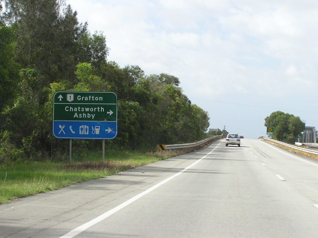 |
Looking south approaching Mororo Bridge and Chatsworth Rd (old Pacific Hwy). Nov 2005. |
 |
Looking north along the 1.2km long (including the Mororo bridges) dual carriageway section on the north side of the river. Nov 2005. |
 |
AD sign westbound on Iluka Road approaching the Pacific Hwy. Nov 2005. |
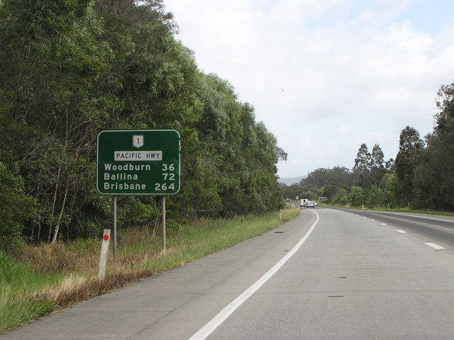 |
Distance sign heading north from Iluka Road. Back to the single-carriageway but you can't really tell can you? Nov 2005. |
|
Old Pacific Highway (Chatsworth Rd & Old Pacific Hwy) |
|
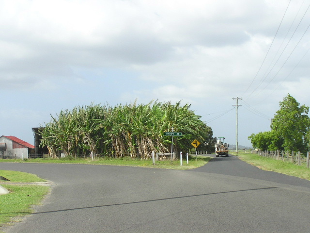 |
Looking south along Chatsworth Rd at its junction with Martins Pt Rd (i think). The sign in the picture points to Ashby. Nov 2005. |
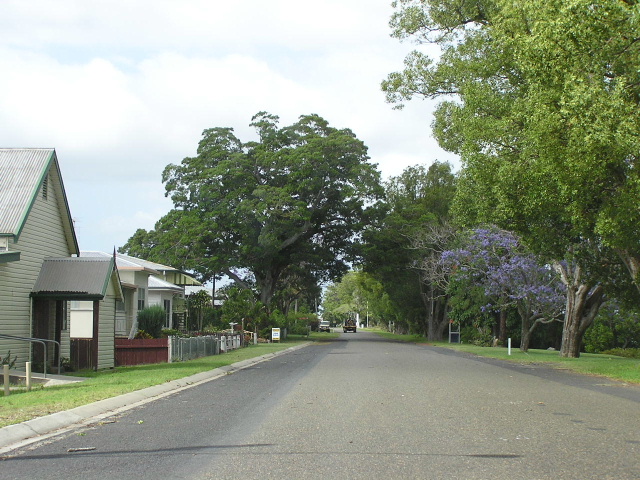 |
Looking south through the tiny village of Chatsworth. Nov 2005. |
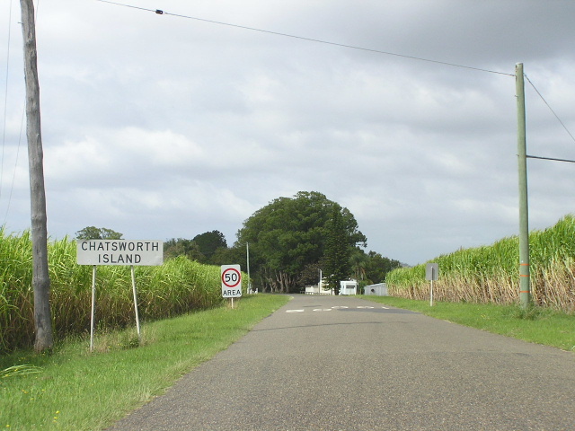 |
Looking south entering the tiny village of "Chatsworth Island" according to the sign. Nov 2005. |
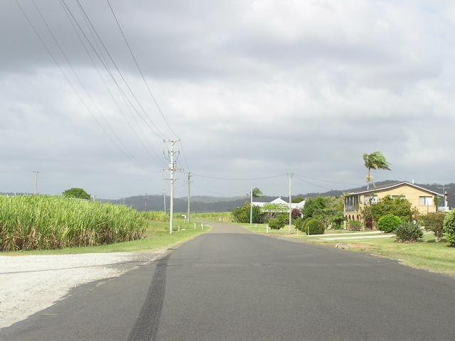 |
Looking south along Chatsworth Rd near Mororo. Nov 2005. |
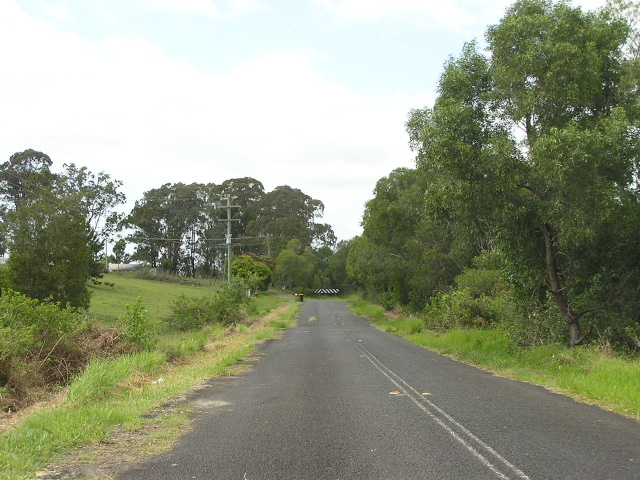 |
Old Pacific Highway (north side of river) looking south towards Mororo Bridge. Nov 2005. |
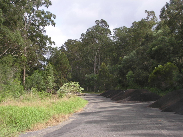 |
Old Pacific Hwy looking north from Iluka Rd. Nov 2005. |