PACIFIC HIGHWAY
Section: Bulahdelah
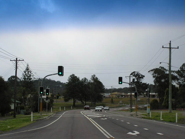
Pacific Highway looking north at the pedestrian signals near Stuart Street. Photo taken: August 2004.
This 8km section of the Pacific Highway through Bulahdelah (Booral Rd to Lakes Way) was not originally part of the Pacific Highway. It was not until 22 August 1952 that the route of the Pacific Highway was changed to pass through Karuah, Bulahdelah and Nabiac, rather than Booral, Stroud and Gloucester. However, through traffic did not immediately begin using the new route of the highway due to the poor state of existing roads along the new alignment. To allow through traffic to use the new route as early as possible, the Department of Main Roads sealed the Booral-Bulahdelah road in December 1955 and thus through traffic began flowing through the town of Bulahdelah.
A bridge over the Myall River was first constructed as unemployment relief work during the Depression and was completed in September 1933. However, the bridge was found to be too narrow for increasing volumes of highway traffic and was replaced in November 1969 by the current bridge. Just prior to this, the highway was realigned through Bulahdelah. The old route through town of Stroud St and Richmond St was replaced with a new alignment via Boolambayte St, as it would provide a more suitable connection to the existing Myall River Bridge. One year earlier, in 1965, the Department of Main Roads reported in its Annual Report that “between Main Road No. 110 (Booral Rd) and Myall River the Highway was reconstructed and raised above flood level.” The former route of the highway remains partially intact on the eastern side of the current highway as Restavenas Road.
In March 2000 planning began for an upgrade of the Pacific Highway through Bulahdelah, with a view to providing a bypass for through traffic as the town is currently physically segregated by the highway. The preferred option, Option E which passes to the immediate east of Bulahdelah but west of Alum Mountain, was announced in November 2001 and preparation of the EIS began. Option E was chosen because of the following advantages:
- Proximity to town, providing enhanced opportunities to attract passing trade and visitors, and supporting the concept of Bulahdelah as a highway service town;
- Opportunities to improve town drainage;
- Opportunities for a whole-of-town focus and urban design enhancement;
- Shorter route, which would have construction program benefits and reduced impact on the natural environment;
- Utilisation of the new road infrastructure to the north;
- Higher benefit–cost ratio;
- Fewer impacts on potential sites of Aboriginal cultural significance;
- Fewer impacts on prime agricultural land and rural enterprises; and
- Minimisation of potential environmental impacts on local drinking water catchment.1
However, what appears to have not been taken into account is the impacts of construction on the Alum Mountain and its lower slopes. This website explains the impacts of Option E in great detail, including potentially fatal alum dusts which would be uncovered during construction and the destruction of two extremely rare species of plants which cannot be cultivated.
The Environmental Impact Statement was exhibited during December 2004 and January 2005. After over 2 years of inactivity, the upgrade receved planning approval in July 2007. Following the completion of detailed design, construction was commenced in July 2010. Completion is expected in 2013.
On 30 November 2012, two-way traffic was shifted onto an approximately 2km long section the bypass from its southern end to the southern interchange.
Photos - existing highway, pre-2010
 |
Southbound AD sign for Booral Rd. Between 1955 and 1963 NR1 traffic was detoured via Booral Rd and Bucketts Way to allow construction of the highway between Bulahdelah and 12 Mile Creek to proceed uninhibited. Aug 2004. |
 |
Looking south at the beginning of the 100km/h zone. Note the wire rope fencing on either side of the highway - protecting the several metre drop to the low-lying land below. The fencing was installed in 2005. Nov 2005. |
 |
Looking south between the Myall River and Bulahdelah. This section was reconstructed and raised above the flood level in 1965. After a bad accident where a speeding truck ran up the back of a ute waiting to turn right into Keels Rd this u-turn bay was constructed to allow the RTA to close right turn access into Keels Rd. A knee-jerk reaction in my opinion - why is no longer the responsibility of the driver to drive safely? Nov 2005. |
 |
Construction of the u-turn bay underway, 95km north of Newcastle. Aug 2004. |
 |
An August 2004 view of the southbound approach to the Keels Rd intersection. Note how overtaking has been hastily prohibited and a large warnin gsign has been installed - all temporary measures until the wire rope fencing and u-turn bay could be installed in 2005. |
 |
Looking south across the Myall River bridge, opened in 1969. Aug 2004. |
 |
Looking north where the highway transitions into Boolambayte Street. Nov 2005. |
 |
Looking south along Boolambayte Street near Blanch Street. Nov 2005. |
 |
Looking north through the northern outskirts of town. Nov 2005. |
 |
Looking south as you enter the 60km/h zone on the north side of Bulahdelah. Nov 2005. |
Photos - construction of Bulahdelah Upgrade (2010-2012)
May 2011 |
|
 |
Looking south from Bombah Point Road, showing construction of the twin bridges over the Myall River well underway. Note the temporary bridge in the bottom right of the photo which provides construction access across the river. Source: Adam Sadler, May 2011. |
 |
An easterly view along Bombah Point Road showing the bridge supports under construction for the bridge to carry Bombah Point Road over the Pacific Highway. Source: Adam Sadler, May 2011. |
 |
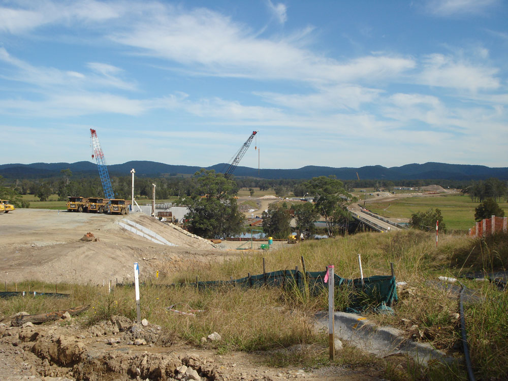
Looking north from Bombah Point Road, showing the extensive earthworks underway alongside Alum Mountain. Source: Adam Sadler, May 2011. |
 |
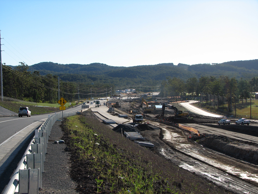
Earthworks and formation underway, looking north towards the bridge over Frys Creek, 3km north of Bulahdelah. Source: Adam Sadler, May 2011. |
 |
Looking south towards the bridge over Frys Creek. The works have included replacing the northbound bridge, which dates from the 1960s and originally carried two-way highway traffic. Source: Adam Sadler, May 2011. |
June/July 2011 |
|
Southerly view across the twin bridges over the Myall River. Source: Peter Renshaw, June 2012. |
|
 |
A westerly view along Bombah Point Road towards the bridge being constructed over the new Pacific Highway. Source: Peter Renshaw, June 2012. |
 |
The new bridge carrying Bombah Point Road over the new alignment of Pacific Highway. Source: Peter Renshaw, June 2012. |
 |
An easterly view along Bombah Point Road towards the new bridge. Source: Peter Renshaw, June 2012. |
 |
A southerly view along the bypass from the bridge near the end of Meade Street. Photo taken: July 2012. |
 |
A view of the bridge across the bypass connecting the town with Alum Mountain. Photo taken: July 2012. |
 |
Looking north from the same location. Photo taken: July 2012. |
 |
Looking south at the northern interchange. The current highway, on the right, will become the northbound on-ramp once the bypass opens. Photo taken: July 2012. |
 |
Looking north from the northern interchange, showing the tie-in with the existing dual carriageways at Frys Creek. Photo taken: July 2012. |
 |
Looking south towards the northern interchange. Photo taken: July 2012. |
December 2012/January 2013 |
|
 |
Partially covered AD sign northbound on the new bypass, approaching the southern interchange. It appears that the old highway will be renamed 'Old Pacific Highway. Photo taken: December 2012. |
 |
Partially covered ID sign northbound on the new bypass, approaching the southern interchange. It appears that the old highway will be renamed 'Old Pacific Highway. Photo taken: December 2012. |
 |
Looking north along the bypass at the southern interchange, showing the as yet unpaved route northwards. Photo taken: December 2012. |
 |
A southerly view of the bypass from the southern interchange. Photo taken: December 2012. |
 |
Looking south to the overpass at the southern interchange. The overpass carries the future southbound on-ramp, as well as northbound traffic from a handful of properties on the southern side of the bypass. Photo taken: December 2012. |
 |
Looking north along the bypass route into the morning sun. Photo taken: December 2012. |
 |
The interim highway looking north from the southern interchange to the junction with the old highway. Note the reference to Old Pacific Highway - I'm not sure what is under the coverplate; perhaps 'To Booral Road'? Photo taken: December 2012. |
 |
New fingerboard sign at the junction of the old highway and interim highway alignments. Note the road name is now 'Bulahdelah Way' - perhaps RMS have changed their mind about the road name? Better fix the rest of the signs... Photo taken: December 2012. |
 |
Looking south towards the southern interchange. Note the reference to Booral Road instead of Old Pacific Highway which is shown in the other direction. Photo taken: December 2012. |
 |
The bypassed section of highway between the southern interchange and Booral Road, showing dodgy modifications to the old AD sign following the closure of the highway alignment south of Booral Road. Photo taken: December 2012. |
1. Roads and Traffic Authority; Bulahdelah Upgrading the Pacific Highway Environmental Impact Statement Summary; November 2004; p.S.6-S.7
Last updated 18 January 2013 © Ozroads 2003-2013. |