PACIFIC HIGHWAY
Section: Bulahdelah to Coolongolook
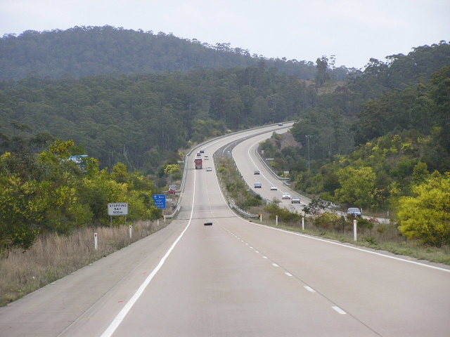
Looking south near Stoney Creek Rd. Aug 2004.
This 22km section of the Pacific Highway , from The Lakes Way junction near Bulahdelah to south of Kennedys Gap Road near Coolongolook was not originally part of the Pacific Highway . The Government Gazette of 22 August 1952 made official a change in route of the Pacific Highway , routing it through Karuah, Bulahdelah and Nabiac, rather than via what is now Bucketts Way . The new route made use of existing roads where possible which would be upgraded to highway standard over the next eleven years. In this particular case, a road had been constructed between Bulahdelah and Nabiac via Wootton during 1940 as unemployment relief. At the time of gazettal as part of the Pacific Highway , the road was nothing more than a gravel-surface developmental road. The Department of Main Roads began sealing the road immediately and, fortunately, only minor improvements to the alignment were needed to bring it up to highway standard - although the route still would feature the notorious O’Sullivans Gap and Wootton Bends. Sealing of this section of the highway was completed in December 1955.
For many years the route remained unchanged and, as other sections of the Pacific Highway were upgraded to higher standards of safety and alignment, it gradually became one of the worst sections of the highway. Safety measures, including extra curve signposting and New Jersey median barriers, were installed at O’Sullivans Gap and Wootton Bends as an interim measure until construction of the highway on a completely new alignment could proceed. An Environmental Impact Statement was completed in 1990 but it wasn’t until an injection of Federal Funding into the Pacific Highway in September 1996 allowed the fast tracking of this important project. Construction commenced in April 1997, involving the construction of a new 22km freeway-standard alignment for the Pacific Highway passing well to the east of the existing highway. Hand-in-hand with the project was to be an upgrade of The Lakes Way but the State Government since reneged on that promise.1 Incorporated into the construction of the new route were innovative environmental measures, including fauna overpasses, which were later incorporated into other projects on the Pacific Highway.2 Completion of the Bulahdelah-Coolongolook Freeway was celebrated by a community day on 24 October 1999 and it was opened to traffic a few days later.
The old Pacific Highway through Wootton is now a local road and remained name “Old Pacific Highway” until late in October 2005 when it was renamed “Wootton Way”.
Current highway alignment (Bulahdelah-Coolongolook Freeway) 1999-present |
|
 |
Looking north at the beginning of the dual carriageway near the Wootton Way and The Lakes Way intersections, 4km north of Bulahdelah. Note that southbound traffic gets a nice new bridge while northbound traffic uses the older (1950s) bridge over Frys Creek. Nov 2005. |
 |
Diagrammatic AD sign for the staggered T-junctions with Wootton Way (named Old Pacific Hwy when this photo was taken) and The Lakes Way. Aug 2004. |
 |
Looking south approaching The Lakes Way and the end of the dual carriageways, 4km north of Bulahdelah. Aug 2004. |
 |
Distance sign heading north from The Lakes Way. Aug 2004. |
 |
Looking north from Squires Hill Rd towards the Meyers Range cutting. Nov 2005. |
 |
Looking south through the Meyers Range cutting. Nov 2005. |
 |
Looking north at the Coolongolook River and Herivals Rd underpass. Nov 2005. |
 |
Distance sign heading south from Wootton Way along the Bulahdelah-Coolongolook Freeway. Nov 2005. |
 |
Northbound AD sign for Wootton Way (Old Pacific Hwy) at the northern end of the Bulahdelah-Coolongolook Freeway. Nov 2005. |
 |
Southbound AD sign for Wootton Way (Old Pacific Hwy) at the northern end of the Bulahdelah-Coolongolook Freeway. Nov 2005. |
Wootton Way (Pacific Hwy from 1952 to 1999 then Old Pacific Hwy 1999-2005) |
|
 |
Remnant distance sign heading north on Wootton Way from Pacific Hwy near Bulahdelah. This sign was subsequently removed in 2005. Aug 2004. |
 |
Wootton Way looking north at the intersection with Stony Knob Road. Source: Michelle Smith, Feburary 2007. |
 |
Looking south at the final hairpin curve at O'Sullivans Gap. Nov 2005. |
 |
40km/h truck and bus speed limit down O'Sullivans Gap. Nov 2005. |
 |
Overtaking lane southbound through O'Sullivans Gap. Note the poor quality of the pavement, getting worse as nature encroaches on it - free from the rumble of 10,000 vpd. Nov 2005. |
 |
This jersey barrier, installed in the 1980s, separates opposing traffic flows at the northern end of O'Sullivans Gap. Note how overgrown the road is becoming only 6 years after being bypassed. Nov 2005. |
 |
Tight curve heading south through O'Sullivans Gap. Nov 2005. |
 |
Looking north at the last hairpin at the northern end of O'Sullivans Gap. Source: Michelle Smith, February 2007. |
 |
Looking south where the speed limit drops from 100km/h to 80km/h for O'Sullivans Gap. Nov 2005. |
 |
Pavement in very poor condition southbound between Wootton and O'Sullivans Gap. Nov 2005. |
 |
Looking north across the Coolongolook River at Wootton. Nov 2005. |
 |
Remnant NR1 fingerboard signage at the junction with Wattley Hill Rd at Wootton. Nov 2005. |
 |
Looking south through Wootton Bends. This section of the old highway has had a fresh coat of bitumen since its decommissioning. Nov 2005. |
 |
Looking south through Wootton Bends. Nov 2005. |
 |
Looking south across Coolongolook River near Herivals Rd. Nov 2005. |
Footnotes
1. NSW Legislative Assembly Hansard; Pacific Highway Upgrade - 104/2002 - URG MOT [Online]; Accessed: 4/11/2005 ; Available from: http://www.parliament.nsw.gov.au/prod/parlment/hansart.nsf/V3Key/LA20020410020 |
Last updated 26 January 2009 © Ozroads 2004-2009. |