PACIFIC HIGHWAY
Section: Ballina
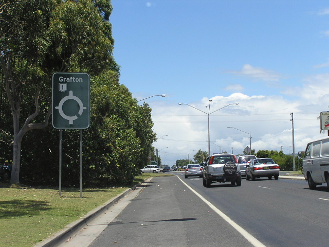
Black AD sign southbound on Kerr Street at Fox Street. Nov 2005.
This 5km section of the Pacific Highway covers the township of Ballina , from Burns Point Ferry Rd to North Creek Road . Currently the highway is mostly single carriageway, but with a short four-lane divided section between Burns Point Ferry Rd and Boat Harbour Road . A bypass of Ballina has been in the advanced stages of planning since an EIS was published in 1998 but no construction work has been commenced.
On the southern approach to Ballina, the Pacific Highway crosses Fishery Creek on a composite steel and concrete structure constructed in 1955 (along with the bridge over Emigrant Creek near the Bruxner Highway junction and the bridge over North Creek Canal ). Previously, the Pacific Highway had followed what is now Fishery Creek Road , crossing Fishery Creek on a timber beam truss bridge, then returning to the current alignment ( River Street ) via Canal Road and Tweed Street . Thanks to Lachaln Sims for alerting me to this one!
In Ballina town centre, the original alignment of the highway was via River Street , Cherry Street and Bangalow Road - passing right through the middle of Ballina. In 1982 the route of the highway was altered to follow Kerr Street , cutting nearly 1km of the route of the highway whilst freeing Ballina town centre from oppressive highway traffic. Interestingly, Kerr Street is wide enough to permit six traffic lanes and so is Cherry Street (the old highway alignment). Perhaps a rare example of road planning foresight?
The removal of highway traffic from River Street has allowed is beautification, with increased parking areas as well as a more pedestrian-friendly environment. This work was undertaken between 2000 and 2003.
A bypass of Ballina had been in the pipeline for a number of years. An Environmental Impact Statement was published in 1998 and the route was subsequently approved, however it has been patiently awaiting funding from either tier of government. In mid-2005, construction of the bypass was put on hold while route options for upgrading the highway at the northern end of the bypass are finalized as part of the Tintenbar-Ewingsdale planning project. According to the RTA website1 development work has been commenced in the SEPP 14 wetland and geotechnical investigations and property negotiations are continuing.
|
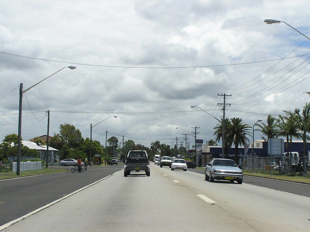
Current route of Pacific Highway (River St & Kerr St) |
|
 |
Very Northern Territory styled design for this AD sign on Brampton Street. Note the incorrect National Highway shield. Nov 2005. |
 |
Looking west along River Street. Jan 2005. |
 |
ID signage at the River St/Kerr St roundabout. Note how East Ballina/Byron Bay is signed away from the town centre. Nov 2005. |
 |
Distance sign heading north along Kerr Street. Jan 2005. |
 |
Black AD sign heading north on Kerr St at Fox St. Jan 2005. |
 |
Heading south on Pacific Hwy approaching the junction with Bangalow Rd. Lennox Head is signed via the Angels Beach Rd, which was opened to traffic in the late 1990s (i think) as a bypass of East Ballina. Jan 2005. |
 |
Looking north approaching "The Canal" (according to the signs) or "North Creek Canal" according to the maps. Nov 2005. |
|
Old Pacific Hwy (Fishery Creek Rd, Canal Rd, Tweed St, River St, Cherry St & Bangalow Rd) |
|
 |
Map created by Lachlan Sims showing the original alignment of Pacific Hwy at Fishery Creek. The current bridge was constructed in 1955, along with bridges over North Creek Canal and Emigrant Creek. |
 |
Looking west along River St towards Pacific Hwy. Nov 2005. |
 |
Looking east along River Street through Ballina town centre. Nov 2005. |
 |
Another eastbound view of River St, this time showing pedestrian signals about to be activated. Photo by Vi Ong in Nov 2003. |
 |
Looking north along Cherry Street. Nov 2005. |
 |
Looking northwest along Bangalow Rd approaching Pacific Highway. Nov 2005. |
1. http://www.rta.nsw.gov.au/constructionmaintenance/majorconstructionprojectsregional/pacifichighwayupgrade/programdetails/ballinabypass.html Accessed: 9 December 2005