State Route 116 Bindoon-Moora Road & Midlands Road |
Black ID sign at the intersection of Midlands Road (Roberts Street) & Dandaragan Street, Moora. Photo taken: March 2011.
Introduced: 1986
Length: 326km
Northern Terminus: Brand Highway & Midlands Road, 8km east of Dongara
Southern Terminus: Great Northern Highway & Bindoon-Moora Road, 4km north of Bindoon
Route taken: Bindoon-Moora Road, Midlands Road (includes Padbury Street, Clinch Street & Roberts Street through Moora and Railway Road through Three Springs)
Focal Points: Perth/Bindoon, Moora, Carnamah, Coorow, Three Springs, Mingenew, Dongara/Geraldton
Main Roads Act 1930 classification: Main Road No. 2 (Bindoon-Moora Road), Main Road No. 28 (Midlands Road)
Notable Events:
April 1986 - State Route 116 introduced1
Description:
State Route 116 is a secondary radial route north of Perth, paralleling the Midlands railway line through the northern wheatbelt. It is a route steeped in history, partly following the original overland routes north to Geraldton.
The route branches off Great Northern Highway on the southern side of Bindoon Hill, heading west for a short distance, then generally north along the Brockman River valley. This section is quite hilly with a couple of short sharp pinches. Approaching Wannamal the terrain flattens out considerably and the railway is followed closely from here northwards for over 200km. Moora, the largest town between Perth and Geraldton, is reached after about 85km and the Midlands Road moniker is picked up for the journey northward.
Between Moora and Watheroo, the route runs alongside the railway line, crossing it once at Namban and then again just north of Watheroo. From here to Coorow the once infamous sand plain is crossed, although on today's sealed road it is an easy and uneventful drive. Coorow, Carnamah and Three Springs, three rather small wehatbelt towns, are passed through in close succession before Mingenew is reached after a further 50km stretch. Here the Midlands Road turns due west, following the Irwin River to the coast near Dongara. The route terminates at Pells Bridge, at a junction with Brand Highway 7km east of Dongara.
Along its full length, it is constructed to a consistent two-lane standard. Due to the low traffic volumes and flat terrain, overtaking opportunities are plentiful and there are no overtaking lanes.
History:
Prior to 1975, the section of State Route 116 between Moora and Dongara formed part of the Geraldton Highway, carrying the National Route 1 shield. With the completion of Brand Highway in 1975, through traffic to the north and the National Route 1 shield were both moved off the Midlands Road, reducing the route to its present role as a spine serving the northern Wheatbelt towns.
After being rejected as a Main Road in 1930s by the Main Roads Department, who preferred the longer route via New Norcia and Walebing which served both the Geraldton and Meekatharra roads, the Bindoon-Moora Road played second fiddle for many years. Despite the all-bitumen route being available via New Norcia, the 15km saving in distance meant the Bindoon-Moora Road attracted plenty of use and plenty of calls for upgrading. Reconstruction and sealing began in the late 1950s and was completed in the mid-1970s. Replacement of the two-lane timber bridge over the Moore River in Mogumber in 19842 largely completed the upgrade to modern standards.
When it came time to implement State Routes in Western Australia, the MRD again reviewed the merits of the Bindoon-Moora Road versus the route via New Norcia and Walebing. It was acknowledged that by this stage the Bindoon-Moora Road was the preferred route for almost all traffic and State Route 116 was allocated accordingly.
|
Photos of State Route 116 (south to north) |
|
 |
AD sign northbound on Great Northern Highway approaching the junction with Bindoon-Moora Road, 5km north of Bindoon. |
 |
AD sign southbound on Great Northern Highway approaching the junction with Bindoon-Moora Road, 5km north of Bindoon. No mnetion of Moora or Geraldton from this direction as traffic bound for these destinations would have turned off much earlier. |
 |
ID sign facing SR116 traffic at the junction of Great Northern Highway & Bindoon-Moora Road, 5km north of Bindoon. Photo taken: June 2011. |
 |
AD sign eastbound on Bindoon-Moora Road approaching the junction with Great Northern Highway, 5km north of Bindoon. This is the southern terminus of State Route 116. |
 |
The first RD sign facing northbound SR116 traffic, westbound on Bindoon-Moora Road near the junction with Great Northern Highway. The bridge in the middle distance crosses the Brockman River. Photo taken: March 2011. |
 |
Bindoon-Moora Road looking west across rolling hills alongside the Brockman River, 6km north of Bindoon. Photo taken: June 2011. |
  |
Old and new RD signs eastbound on Bindoon-Moora Road at the junction with Mooliabeenee Road, 8km north of Bindoon. |
AD sign westbound on Bindoon-Moora Road approaching the junction with Mooliabeenee Road, 8km north of Bindoon. Photo taken: March 2011. |
|
 |
ID sign facing eastbound traffic at the junction of Bindoon-Moora Road & Mooliabeenee Road, 8km north of Bindoon. Bindoon-Moora Road swings northwards at this junction. Photo taken: March 2011. |
 |
Older AD sign eastbound on Mooliabeenee Road approaching the junction with Bindoon-Moora Road, 8km north of Bindoon. Photo taken: March 2011. |
 |
AD sign southbound on Bindoon-Moora Road approaching the junction with Mooliabeenee Road, 8km north of Bindoon. Photo taken: March 2011. |
 |
RD sign northbound on Bindoon-Moora Road after the junction with Mooliabenee Road, 9km north of Bindoon. Photo taken: March 2011. |
 |
ID sign at the southern junction of Bindoon-Moora Road & Wells Glover Road, 12km north of Bindoon. Photo taken: March 2011. |
 |
Bindoon-Moora Road looking south from the northern junction with Wells Glover Road, across the Brockman River towards the southern junction with Wells Glover Road. Photo taken: March 2011. |
 |
ID sign at the northern junction of Bindoon-Moora Road & Wells Glover Road, 12km north of Bindoon. Photo taken: March 2011. |
 |
Bindoon-Moora Road looking north from the northern junction with Wells Glover Road, 12km north of Bindoon. Photo taken: March 2011. |
 |
Bindoon-Moora Road looking south, 15km north of Bindoon, showing older, narrower pavement and the transition onto a recently upgraded section. Photo taken: March 2011. |
 |
Bindoon-Moora Road looking south near Ashman Road, 19km north of Bindoon. There are a number of pairs of trailblazers between Bindoon and Moora. Photo taken: March 2011. |
  |
Bindoon-Moora Road looking south through the hills, 21km north of Bindoon. Photos taken: March 2011. |
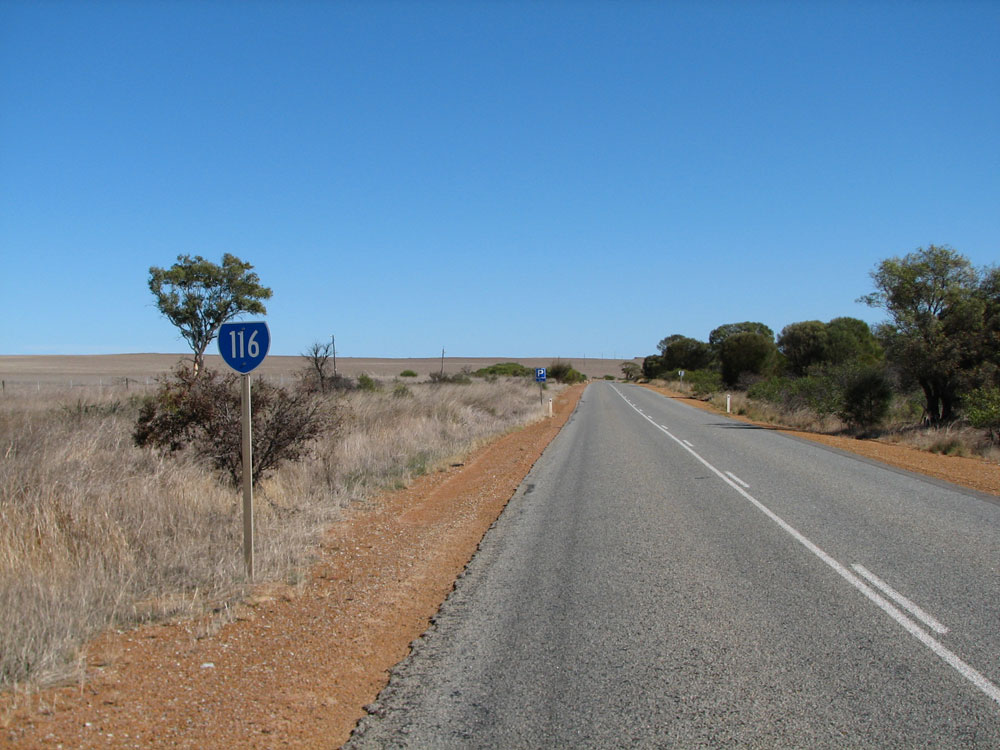
SR116 trailblazer northbound on Bindoon-Moora Road, 29km north of Bindoon. Photo taken: March 2011. |
|
 |
Bindoon-Moora Road looking south at Wannamal, 31km north of Bindoon. The rest area ahead is located on the banks of Udamung Brook. Photo taken: March 2011. |
 |
Bindoon-Moora Road looking south at the locality of Wannamal, 32km north of Bindoon. Photo taken: March 2011. |
 |
Bindoon-Moora Road looking north near the boundary of Chittering and Victoria Plains Shires, 40km north of Bindoon. Photo taken: March 2011. |
 |
Bindoon-Moora Road looking south at Mogumber, with the Mogumber Tavern on the left. Photo taken: March 2011. |
 |
Bindoon-Moora Road looking south at the Mogumber Bridge over the Moore River. This bridge was built in 19842 to replace a single lane timber structure constructed in 1932.3 |
 |
Bindoon-Moora Road looking south towards the junction with Gillingarra New Norcia Road at Gillingarra, 61km north of Bindoon. Photo taken: March 2011. |
 |
Bindoon-Moora Road looking south at Gillingarra, 58km north of Bindoon. Note the sandy soil. Photo taken: March 2011. |
 |
Bindoon-Moora Road looking south across the railway level crossing at the boundary of Victoria Plains and Moora Shires, 67km north of Bindoon. Photo taken: March 2011. |
 |
Bindoon-Moora Road looking south towards the railway level crossing, 67km north of Bindoon. The tourist sign marks the location of Mangiri Cottage. Photo taken: March 2011. |
 |
SR116 trailblazer southbound on Bindoon-Moora Road at Koojan, 71km north of Bindoon. Photo taken: March 2011. |
 |
Bindoon-Moora Road looking south across Wanery Creek at Barberton, 80km north of Bindoon. Photo taken: March 2011. |
 |
SR116 trailblazer southbound on Bindoon-Moora Road at Barberton, 81km north of Bindoon. Photo taken: March 2011. |
 |
Bindoon-Moora Road looking south across the bridge over Yadgena Brook, 3km south of Moora. Photo taken: March 2011. |
 |
RD sign southbound on Bindoon-Moora Road at the southern edge of Moora. Photo taken: March 2011. |
 |
Padbury Street (Bindoon-Moora Road) looking north through the southern part of Moora, towards the junction with Clinch Street (Midlands Road) where SR116 makes a left turn. Moora Town Hall can be seen on the left. Photo taken: March 2011. |
 |
AD sign on Clinch Street (Midlands Road) westbound approaching the junction with Padbury Street (Bindoon-Moora Road), Moora. Photo taken: March 2011. |
 |
Clinch Street (Midlands Road) looking east towards the junction with Padbury Street, Moora. When the Geraldton Highway passed through Moora, it headed straight ahead here towards New Norcia, however these days SR116 uses the more direct Bindoon-Moora Road. Photo taken: March 2011. |
 |
Clinch Street (Midlands Road) looking west towards the junction with Roberts Street, Moora. SR116 makes a right turn here. Photo taken: March 2011. |
 |
ID sign at the junction of Clinch Street & Roberts Street, Moora. Photo taken: March 2011. |
 |
AD sign southbound on Roberts Street (Midlands Road) approaching Clinch Street, Moora. Southbound SR116 traffic makes a left turn here. Photo taken: March 2011. |
 |
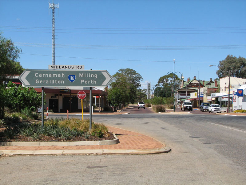
Black ID sign at the intersection of Roberts Street (Midlands Road) & Dandaragan Street, Moora. The main street of Moora can be seen beyond the intersection. Photo taken: March 2011. |
 |
Roberts Street (Midlands Road) looking south towards the junction with Dandaragan Street, Moora. Photo taken: March 2011. |
 |
RD sign northbound on Midlands Road on the northern outskirts of Moora. Photo taken: March 2011. |
 |
AD sign assembly southbound on Midlands Road approaching Tootra Street on the northern edge of Moora. Tootra Street provides an alternative route for heavy vehicles which avoids the two turns in the town centre. Photo taken: March 2011. |
 |
Services signage facing southbound traffic through an avenue of trees as you approach Moora from the north. Photo taken: March 2011. |
 |
Midlands Road looking north, 5km north of Moora. Photo taken: March 2011. |
 |
Midlands Road looking north, 14km north of Moora. Photo taken: March 2011. |
 |
Midlands Road looking south across Prye Brook at Coomberdale, 20km north of Moora. Photo taken: March 2011. |
 |
Faded Tourist Way 360 trailblazer facing southbound traffic on Midlands Road at Coomberdale West Road, Coomberdale. Photo taken: March 2011. |
 |
Midlands Road looking north at the locality of Coomberdale, 21km north of Moora. Photo taken: March 2011. |
 |
Midlands Road looking south approximately 23km north of Moora. Photo taken: March 2011. |
 |
Midlands Road looking south towards the level crossing of the Midland Junction-Geraldton railway line at Namban, 29km north of Moora. Photo taken: March 2011. |
 |
SR116 trailblazer facing northbound traffic as you approach the small town of Watheroo, 39km north of Moora. Photo taken: March 2011. |
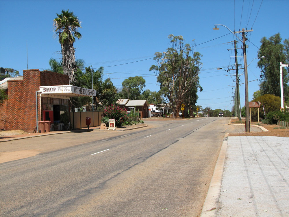 |
Midlands Road looking south through Watheroo. Photo taken: March 2011. |
 |
Close-up of ageing tourist sign for the historic Watheroo Railway Station which is now the Watheroo Station Tavern. Photo taken: March 2011. |
 |
SR116 trailblazer facing southbound traffic on the northern approach to Watheroo. Photo taken: March 2011. |
 |
Services signage facing southbound traffic at the railway crossing, 2km north of Watheroo. Photo taken: March 2011. |
 |
Midlands Road looking north across the railway crossing, 2km north of Watheroo. Photo taken: March 2011. |
 |
Tourist sign marking the start of the Midlands Way (Tourist Way 360) southbound on Midlands Road, just north of Eagle Hill Road, 45km north of Moora. Photo taken: March 2011. |
 |
Midlands Road looking north across the sand plains north of Eagle Hill Road, 45km north of Moora. Photo taken: March 2011. |
 |
RD sign southbound on Midlands Road near the junction with Gunyidi Wubin Road, 58km north of Moora. Photo taken: March 2011. |
 |
Old black AD sign northbound on Midlands Road approaching the junction with Gunyidi Wubin Road, 58km north of Moora. The original junction location is marked by the white sign - Gunyidi Wubin Road was realigned to avoid a four-way junction. Photo taken: March 2011. |
 |
ID sign assembly at the junction of Midlands Road & Gunyidi Wubin Road, 58km north of Moora. Note the name plate which refers to the wrong road name, and doesn't include the word 'Road'! Photo taken: March 2011. |
 |
Ageing black AD sign southbound on Midlands Road approaching the junction with Gunyidi Wubin Road. You can see remnants of the original green paint which is weathering to reveal a black background. Photo taken: May 2010. |
 |
RD sign northbound on Midlands Road near the junction with Gunyidi Wubin Road, 58km north of Moora. Photo taken: March 2011. |
 |
Midlands Road looking south at the level crossing at Marchagee. The junction with Buntine Marchagee Road is in the foreground. Photo taken: March 2011. |
 |
Midlands Road looking south at Marchagee, with the large grain recevial bins on the right. Photo taken: March 2011. |
 |
Midlands Road looking north across the lakes between Marchagee and Coorow, 75km north of Moora. Photo taken: March 2011. |
 |
Midlands Road looking south, 85km north of Moora. Photo taken: March 2011. |
 |
RD sign southbound on Midlands Road on the southern outskirts of Coorow. Photo taken: March 2011. |
  |
ID signs at the junction of Midlands Road & Coorow Green Head Road just south of Coorow. Top photo: May 2010. Bottom photo: March 2011. |
 |
Midlands Road looking south towards South Street, Coorow, with the grain receival depot on the right. Photo taken: May 2010. |
 |
ID sign at the junction of Midlands Road & Main Street, Coorow. Photo taken: May 2010. |
 |
Midlands Road looking south on the northern outskirts of Coorow. Photo taken: March 2011. |
 |
RD sign northbound on Midlands Road as you leave Coorow. Photo taken: March 2011. |
 |
A combination of old and new service signs, southbound on Midlands Road, 2km north of Coorow. Photo taken: March 2011. |
 |
Typical view of Midlands Road between Coorow and Carnamah, looking south 15km north of Coorow. Photo taken: May 2010. |
 |
RD sign southbound on Midlands Road as you leave Carnamah. Photo taken: May 2010. |
 |
Dodgy AD sign assembly northbound on Midlands Road, approaching the junction with Bowman Street at Carnamah. Note the missing SR116 shield. Photo taken: March 2011. |
 |
Another dodgy AD sign, this time eastbound on Carnamah Eneabba Road (Bowman Street) approaching the junction with Midlands Road at Carnamah. I'm not sure why this sign is split into two, and I'm also not sure why the SR116 shields are missing! Photo taken: March 2011. |
 |
A third dodgy AD sign at the same intersection, this time westbound on Bowman Street approaching the junction with Midlands Road at Carnamah. Photo taken: May 2010. |
 |
Midlands Road looking south through Carnamah town centre. Most of the shops are located to the left, along Macpherson Street. Photo taken: May 2010. |
 |
RD sign northbound on Midlands Road at Carnamah as you look into the harsh afternoon sun. Photo taken: May 2010. |
 |
Services signage southbound on Midlands Road, 2km north of Carnamah. Photo taken: May 2010. |
 |
SR116 trailblazer facing southbound traffic, midway between Carnamah and Three Springs. Photo taken: May 2010. |
 |
Midlands Road looking south across Yarra Yarra Lakes, 5km south of Three Springs. Photo taken: May 2010. |
 |
Midlands Road looking south through a curving section, 2km south of Three Springs. Photo taken: May 2010. |
 |
RD sign southbound on Midlands Road as you leave Three Springs. Photo taken: March 2011. |
 |
ID sign at the junction of Midlands Road (Railway Road) & Thomas Street (Eneabba Three Springs Road), Three Springs. Photo taken: May 2010. |
 |
Midlands Road (Railway Road) looking south through Three Springs. Photo taken: May 2010. |
 |
ID sign at the junction of Midlands Road (Railway Road) & Glyde Street (Three Springs Morawa Road), Three Springs. Photo taken: May 2010. |
 |
Midlands Road looking south on the northern outskirts of Three Springs. Photo taken: May 2010. |
 |
RD sign northbound on Midlands Road as you leave Three Springs. Photo taken: May 2010. |
 |
Midlands Road looking south, 10km north of Three Springs. Photo taken: May 2010. |
 |
Midlands Road looking south at the locality of Arrino, 18km north of Three Springs. Photo taken: May 2010. |
 |
SR116 trailblazer facing northbound traffic on Midlands Road, 25km north of Three Springs. Photo taken: March 2011. |
 |
Midlands Road looking south, 40km north of Three Springs. Photo taken: May 2010. |
 |
RD sign southbound on Midlands Road as you leave Mingenew. Photo taken: May 2010. |
 |
Midlands Road looking east along the main street of Mingenew. Midlands Road swings from its north-south course onto an east-west course to reach the coast at Dongara. Photo taken: May 2010. |
 |
Very old and faded black AD sign southbound on Mingenew Mullewa Road approaching the junction with Midlands Road at Mingenew. Note the missing SR116 shields - this sign was manufactured in 1994 so who knows why they weren't included! Photo taken: May 2010. |
 |
Midlands Road looking east towards Mingenew town centre, with the AD sign for the Mullewa/Morawa turnoff visible in the middle distance. Photo taken: May 2010. |
 |
RD sign westbound on Midlands Road as you leave Mingenew. Photo taken: May 2010. |
 |
Midlands Road looking east across the rolling countryside, 7km west of Mingenew. Photo taken: May 2010. |
 |
Midlands Road looking west, 16km west of Mingenew. Photo taken: May 2010. |
 |
SR116 trailblazer facing westbound traffic, 28km west of Mingenew. Photo taken: May 2010. |
 |
SR116 trailblazer facing westbound traffic, 39km west of Mingenew. Photo taken: May 2010. |
 |
Midlands Road looking west across the Mountain Bridge across Irwin River, 41km west of Mingenew. Photo taken: May 2010. |
 |
Lovely old black RD sign eastbound on Midlands Road near the junction with Brand Highway, 8km west of Dongara. Photo taken: March 2011. |
 |
AD sign westbound on Midlands Road approaching the junction with Brand Highway, 7km west of Dongara. Photo taken: May 2010. |
  |
Old and new ID sign assemblies at the junction of Brand Highway & Midlands Road. Note the missing NR1 shield on the ID sign pointing towards Perth. Top photo: May 2010. Bottom photo: March 2011. |
 |
Lovely old black AD sign northbound on Brand Highway approaching the junction with Midlands Road. Plans to construct a deviation of Brand Highway have not yet eventuated so for now Brand Highway traffic must make a turn at this junction to remain on the route. Photo taken: March 2011. |
 |
AD sign eastbound on Brand Highway approaching the junction with Midlands Road, with Pells Bridge over the Irwin River in the middle distance. Photo taken: May 2010. |
 |
Supplementary AD sign eastbound on Brand Highway at the junction with Midlands Road, 7km east of Dongara. Construction of the Brand Highway resulted in a saving of nearly 80km for the Perth-Geraldton journey. Photo taken: May 2010. |


References:
1. Main Roads Department, Annual Report 1985/86, p. 16
2. Shire of Victoria Plains, Annual Report 1983/84, cited in Spillman, K. (2005) Hands to the Plough: The Shire of Victoria Plains since 1945, Calingiri, WA, The Shire of Victoria Plains.
3. The West Australian, Wednesday 10 August 1932, p. 13
Last updated 28 October 2012 © Ozroads 2003-2012. |