ALTERNATIVE NATIONAL ROUTE 1
Formerly Lincoln & Flinders Highways, SA
Heading north along Lincoln Highway from Louth Bay. Photo thanks to Transport SA, taken Jan 2004.
Lifespan: 1978-1999 (21 years)
Length: 765km
Eastern Terminus: Eyre Highway & Lincoln Hwy, 26km west of Port Augusta
Western Terminus: Eyre Highway & Flinders Hwy, 6km east of Ceduna
Route taken: Lincoln Highway, Flinders Highway
Focal Points: Port Augusta, Whyalla, Cowell, Arno Bay, Tumby Bay, Port Lincoln, Elliston, Streaky Bay, Ceduna
Alternative National Route 1 was signed along the Lincoln and Flinders Highways during 1977/78, at the same time as the Southern Ports Highway route was being signed and just prior to the Murray Bridge route being introduced. The signposting of the route was completed in February 1978, when the Flinders Highway was officially opened, following an extensive program to completely seal it. The Lincoln Highway had been completely sealed in October 1960. Alternative NR1 was decommissioned in 1999 but many signs are yet to be replaced/coverplated, as u can see from the remnants below.
Remnants of Alternative National Route 1 - Lincoln Hwy & Flinders Hwy, SA |
|
 |
A rather premature Alt-1 shield on the Eyre Highway in Port Augusta. Fair enough that this sign shows NH87, as it starts less than 1km ahead, however, it is still 27km before you reach Alt-1. Eyre Hwy & Flinders Tce, Port Augusta. Jan 2005. |
 |
The first remnant on the Lincoln Hwy is at its northern terminus, this shows the first southbound RD sign at the Eyre Highway junction. Jan 2005. |
 |
My preferred style of Alt-1 shield southbound on Lincoln Hwy at the Norrie Ave Extension, Whyalla. Jan 2005. |
 |
Remnant Alt-1 shield and incorrect NH1 shield on this sign, on Norrie Ave Extension approaching Lincoln Hwy, Whyalla. Jan 2005. |
 |
My preferred style of Alt-1 shield at the intersection of Lincoln Hwy & Broadbent Tce, Whyalla. Jan 2005. |
 |
Same intersection, this time heading north on Lincoln Hwy. Jan 2005. |
 |
Heading south from Whyalla along Lincoln Highway. Jan 2005. |
 |
Northbound on Lincoln Highway at Lipson. Thanks to Transport SA for this photo, taken Jan 2004. |
 |
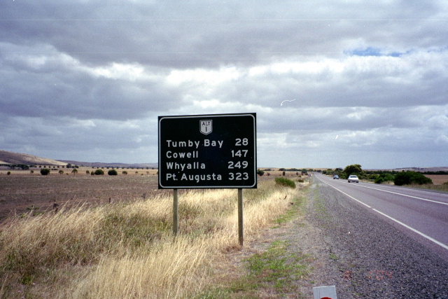
Heading north from Tumby Bay. Note the absence of an Alt-1 shield despite the sign's age. Perhaps it outdates the signposting of the route? I doubt it. Thanks to Transport SA for this photo, taken Jan 2004. |
 |
Approaching the Lincoln Hwy from Louth Bay. Thanks to Transport SA for this photo, taken Jan 2004. |
 |
Heading south from Louth Bay.Thanks to Transport SA for this photo, taken Jan 2004. |
 |
Looking north at the Port Lincoln Airport turnoff. Thanks to Transport SA for this photo, taken Jan 2004. |
 |
Heading north on the Lincoln Highway leaving Port Lincoln. Thanks to Transport SA for this photo, taken Jan 2004. |