State Route 57 Maryborough - Hervey Bay |
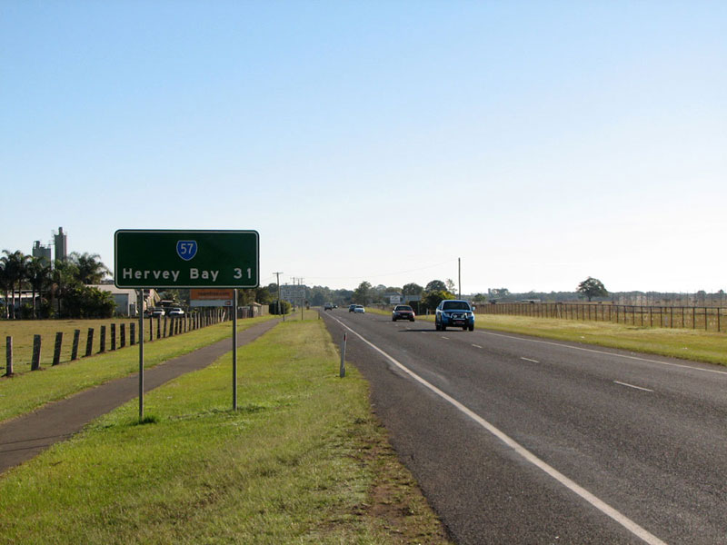
RD sign northbound on Saltwater Creek Road as you leave Maryborough. Photo taken: July 2008.
Introduced: 19901
Length: 45km
Northern Terminus: Boat Harbour Drive & Elizabeth Street, Urangan
Southern Terminus: Bruce Highway & Gympie Road, Tinana
Route taken: Gympie Road, Ferry Street, Walker Street, John Street, Saltwater Creek Road, Hervey Bay Road, Boat Harbour Drive
Focal Points: Gympie, Maryborough, Hervey Bay, Boat Harbour Marine Terminal
Transport Infrastructure Act 1994 classification: 163 Maryborough - Hervey Bay Road
Notable Events:
30 October 1986 - Official opening of Lamington Bridge over Mary River, Maryborough2
1970 - Lamington Bridge over Mary River widened2
1990 - introduction of State Route 571
September 1990 - Opening of Maryborough Bypass (Bruce Highway) and relocation of National Highway Route 13
Description:
State Route 57 is a short but important route linking the Bruce Highway near Maryborough with the growing coastal city of Hervey Bay. Commencing at a grade-separated junction with Bruce Highway at Tinana, SR57 follows the former Bruce Highway route (Gympie Road, Ferry Street) into Maryborough, crossing the Mary River via the heritage-listed Lamington Bridge. After a short dog-leg north of the city centre, the route leaves Maryborough to the north, passing through rural land before reaching the Hervey Bay urban area. At Eli Waters (a suburb of Hervey Bay) the route swings right onto Boat Harbour Drive, following it until its terminus at Elizabeth Street, 1.5km short of the Boat Harbour Marine Terminal.
Significant growth in traffic volumes over the past 20 years means there are now numerous overtaking lanes in the rural section between Maryborough and Hervey Bay. The Boat Harbour Drive section has also been constructed as a four-lane divided carriageway.
References:
1. In typical Queensland fashion, the introduction date of this route is hard to determine. State Route 57 first appears in the June 1989 edition of Guide to Queensland Roads, however this is no certainty that it was comprehensively signed at this time. It is unlikely that a major signposting scheme on this route would have been implemented until the opening of the Maryborough Bypass and associated re-routing of National Highway Route 1. This project opened in September 1990 so I have therefore assumed an indicative date of 1990 for the introduction of State Route 57. Interestingly, RAC maps of this area do not show SR57 until well into the 1990s.
2.
Queensland Heritage Register, Lamington Bridge, accessed: 6 February 2012
3. Queensland Department of Main Roads, Annual Report 1989/1990, p. 35 - notes that the project is on track for a September 1990 opening
|
Photos of State Route 57 - Maryborough to Hervey Bay |
|
 |
AD sign northbound on Bruce Highway approaching the junction with Gympie Road at Tinana. |
 |
AD sign northbound on Bruce Highway approaching the junction with Gympie Road at Tinana. Note the right-hand exit for SR57 which is the former route of Bruce Highway. |
 |
Sun-affected view northbound on Bruce Highway towards the junction with Gympie Road. Photo taken: July 2008. |
 |
Another AD sign northbound on Bruce Highway approaching the junction with Gympie Road. Note the now obsolete National Highway Route A1 shield. |
 |
Overhead signs on the northbound carriageway of Bruce Highway at the Gympie Road junction. Note the omission of the NHRA1 shield - these signs were installed following the decision to abandon the use of this route marker in Queensland. Photo taken: July 2008. |
 |
AD sign southbound on the Maryborough Bypass section of Bruce Highway approaching the junction with Gympie Road. Note the omission of the SR57 shield for the left turn. Photo taken: July 2008. |
 |
'END SR57' sign facing southbound traffic as you enter Bruce Highway from Gympie Road at Tinana. |
 |
Gympie Road looking south towards the junction with Bruce Highway at Tinana. Photo taken: July 2008. |
Gympie Road looking south to the junction with Iindah Road at Tinana. Iindah Road provides access to Bruce Highway northbound via an on-ramp a short distance north of the southern end of the bypass. Photo taken: July 2008. |
|
 |
Gympie Road looking south at Schultz Bridge, Tinana. This view is typical of the former Bruce Highway south of the Mary River. Photo taken: July 2008. |
 |
Ferry Street looking south to the bridge over the Mary River, Maryborough. Photo taken: July 2008. |
Incorrectly designed and located 'ID' signage at the junction of Ferry Street & Alice Street, Maryborough. Note the 2nd and 3rd photos show signs that are located well beyond the intersection! Photos taken: July 2008. |
|
 |
AD sign eastbound on Alice Street approaching the junction with Ferry Street, Maryborough. Note that 'Business Centre' should be in a blue panel. Photo taken: July 2008. |
 |
AD sign southbound on Ferry Street approaching Alice Street, Maryborough. The former Bruce Highway route, which entered Maryborough via Ferry Street, turned west at this junction leaving Maryborough via Alice Street. Photo taken: July 2008. |
 |
Ferry Street looking south towards Kent Street, Maryborough. The hump in the distance is the bridge over the railway line which leads into Maryborough Railway Station, the riverfront and the EDI Rail workshops which manufacture much of Queensland Rail's locomotives and rolling stock. Photo taken: July 2008. |
 |
AD sign eastbound on Walker Street approaching the junction with SR57 at Ferry Street. Note the incorrect use of a black/white patch for Business Centre, instead of the correct white/blue colours. Also note the omission of SR57 for the right turn! Photo taken: July 2008. |
 |
ID sign facing westbound traffic at the junction of Walker & Ferry Streets, Maryborough. Note the use of 'To Bruce Highway' as the focal point rather than Gympie/Brisbane as was used on the sign in the previous photo. Photo taken: July 2008. |
 |
Walker Street looking west towards the junction with Ferry Street, Maryborough. Note the omission of the SR57 shield! Photo taken: July 2008. |
 |
Dodgy AD sign eastbound on Walker Street approaching the junction with John Street, Maryborough. Again note the incorrect colours used for 'Business Centre'. Photo taken: July 2008. |
ID sign facing southbound traffic at the junction of Walker & John Streets, Maryborough. Photo taken: July 2008. |
|
AD sign southbound on John Street approaching the junction with Walker Street, Maryborough. Again note the incorrect colours used for 'Business Centre' patch. Photo taken: July 2008. |
|
 |
ID sign facing northbound traffic as SR57 curves left from John Street into Saltwater Creek Road. Note the missing SR57 shield. Photo taken: July 2008. |
 |
Saltwater Creek Road looking south as you curve into John Street, Maryborough. Note the green sign on the left verge which reads 'END Limited Access Road'. Photo taken: July 2008. |
 |
Saltwater Creek Road looking south with the Woodcock Street signalised junction in the distance. The brown sign refers to Tourist Drive 12 which turns left into Woodcock Street. Photo taken: July 2008. |
 |
Saltwater Creek Road looking south outside Maryborough Airport. Photo taken: July 2008. |
 |
AD sign northbound on Saltwater Creek Road approaching the junction with Pallas Street. The four-lane road ends ahead with the left lane turning left into Pallas Street. Photo taken: July 2008. |
 |
Saltwater Creek Road looking south towards Pallas Street on the northern outskirts of Maryborough. This is the transition from urban to rural environment for the journey to Hervey Bay. Photo taken: July 2008. |
 |
RD sign northbound on Saltwater Creek Road as you leave Maryborough, north of Pallas Street. Photo taken: July 2008. |


Last updated 6 February 2012 © Ozroads 2003-2012. |