State Route 95 |
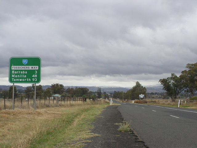
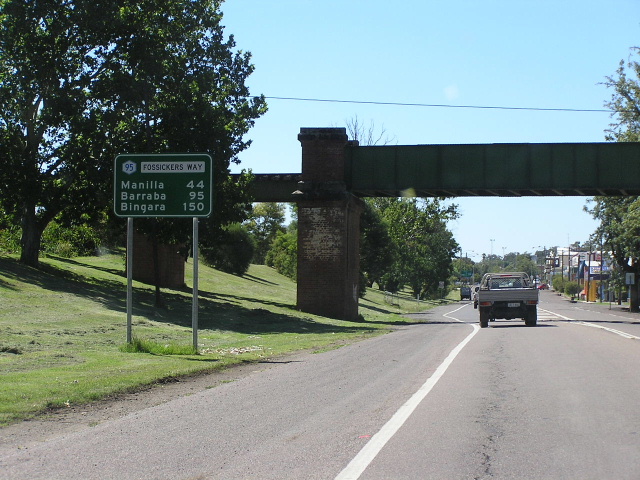
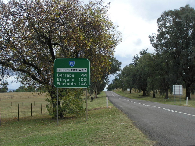
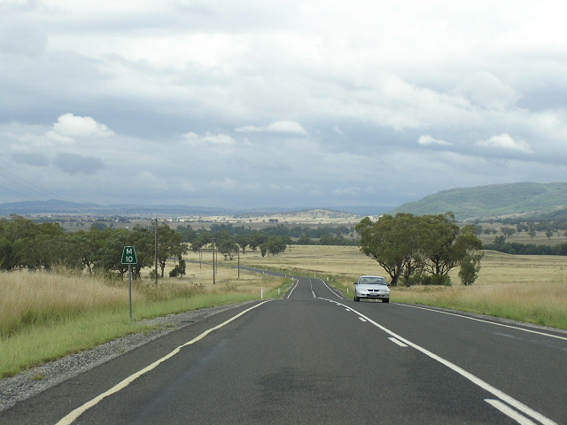
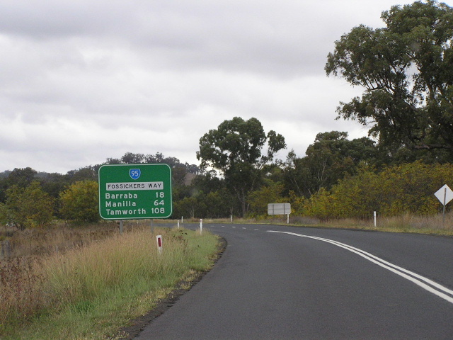
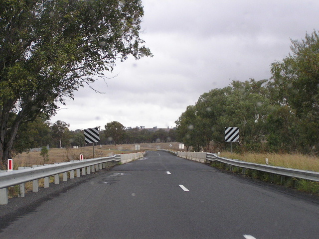
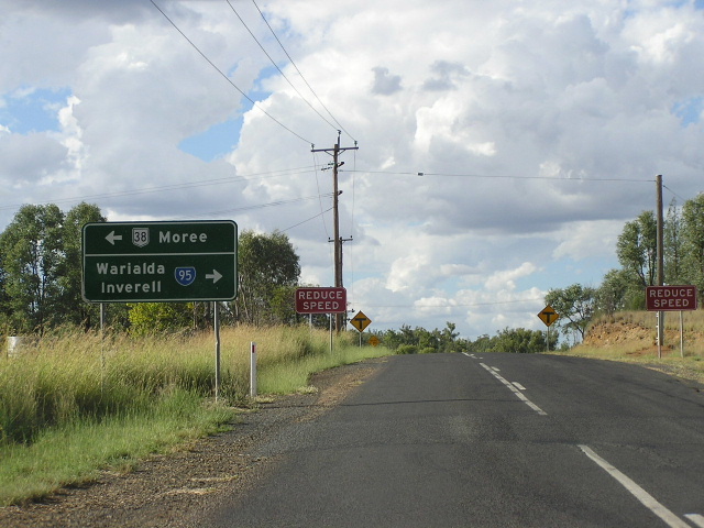
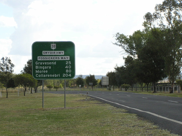
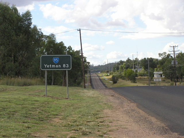
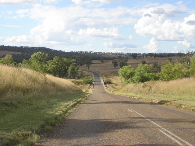
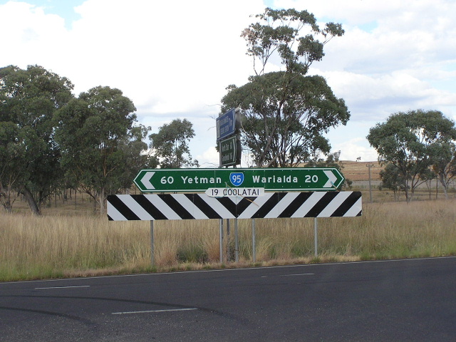
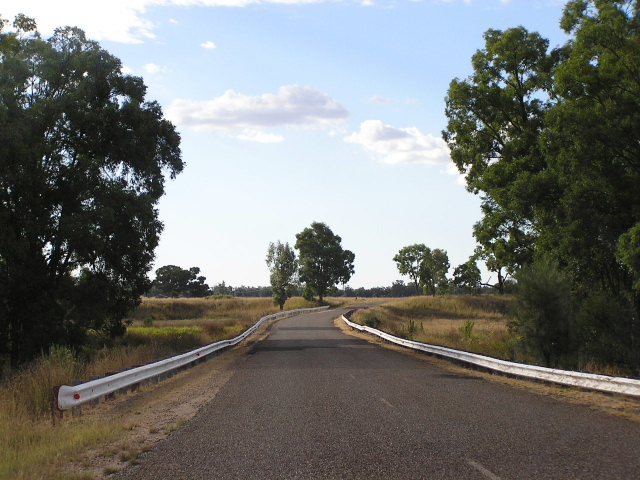
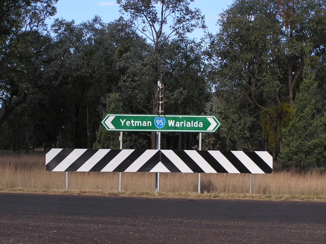
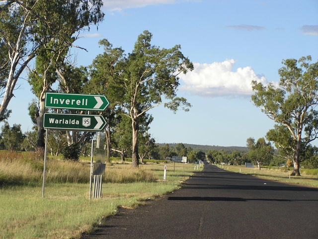
Distance sign on State Route 95, heading south towards Barraba from the Bundarra turnoff (Woodsreef Rd). April 2006.
In 2013, RMS will be implementing a new alpha-numeric route numbering system. For more information, visit the RMS Website. |
||
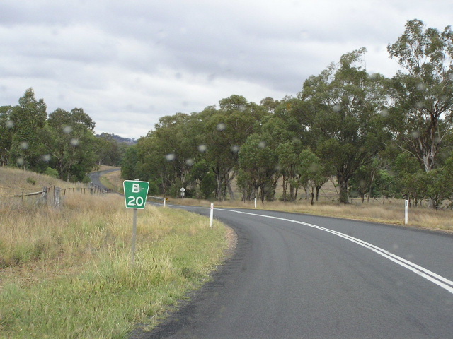
Forthcoming alpha-numeric route number: |
(Tamworth to Warialda section only) |
|
Length: 264km
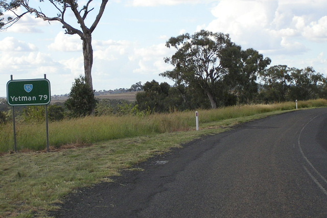
Northern Terminus: Bruxner Hwy, Yetman
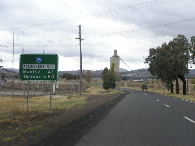
Southern Terminus: Oxley Hwy (Marius St & Brisbane St) & Fossickers Way (Marius St), Tamworth
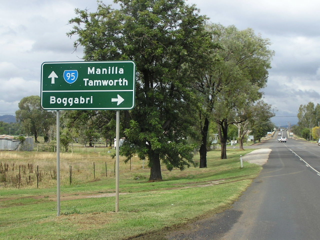
Route taken: From the Oxley Hwy at Tamworth, via Marius St, Darling St, Peel St, Manilla Rd, Manilla, Barraba, Bingara, Gwydir Hwy, Warialda and Coolatai to the Bruxner Hwy at Yetman, that portion of the route between the Oxley and Gwydir Highways being "Fossickers Way".
Focal Points: Tamworth, Manilla, Barraba, Bingara, Warialda, Yetman
RTA Internal Classification: Main Road No. 63 (Tamworth to Gwydir Hwy), State Highway No. 12 (Gwydir Hwy), Main Road No. 63 (Gwydir Hwy to Yetman)
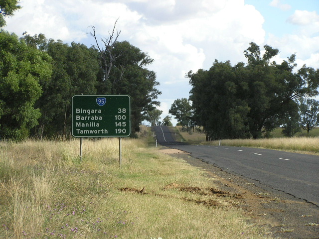
State Route 95 is a north-south route in northern New South Wales, branching off the New England Hwy (via a short section of the Oxley Highway) at Tamworth and passing through Manilla, Barraba, Bingara and Warialda en route to a fairly innocuous ending at the un-numbered Bruxner Highway at Yetman. It is not a high-standard route with a large portion having no edge lines and thus no sealed shoulders. However, traffic volumes don't exactly scream for an upgrade - especially north of Warialda where the volume of traffic drops to only 131 vehicles per day (at Rocky Dam, in 2004). The low traffic volumes have been reflected by the loss of line-markings on the road surface and the RTA's decision to hand over responsibility for the road to local government authorities north of Warialda. South of Warialda, traffic generally hovers near 1,000 vpd but increases to more than 3,000 vpd between Manilla and Tamworth.
State Route 95 was first introduced in 1974. The story behind its terminus at the un-numbered Bruxner Highway in Yetman is that National Route 44, which was also introduced in that same year, was planned to extend along the entire length of the Bruxner Highway. However, the fact that a 4.7km section of the Bruxner Highway between Yetman and Boggabilla still remains to be sealed gives us a clue as to why this never happened. Thus, State Route 95 has remained a dead-end route and probably will remain so for the rest of its lifespan.
During 2004 the route of Main Road No. 63, and thus State Route 95, in Tamworth was altered from its original course of Peel Street to a new route via Darling and Marius Streets, bypassing the central business district. As part of this change many new signs were installed, however unfortunately the sign designers appear to have been incompetent gits and now a ridiculous collection of incorrect shields exists at the Oxley Hwy junction, and as far west as Jewry Street. Examples of these signposting travesties can be seen below.
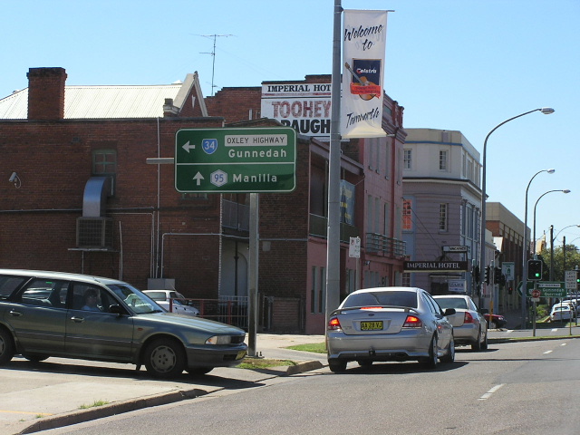 |
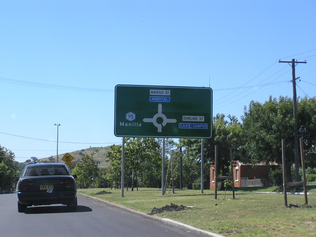
Heading west on Oxley Hwy (Marius St) approaching the beginning of State Route 95 at Brisbane St in Tamworth. Note the disgracefully designed sign - firstly, the lower panel should actually be the top panel; secondly the shield for Manilla should be State Route 95 NOT Metroad 95; and lastly the shield for the Oxley Hwy should be National Route 34 NOT State Route 34. Pot smoking gnomes strike again? Jan 2005. |
 |
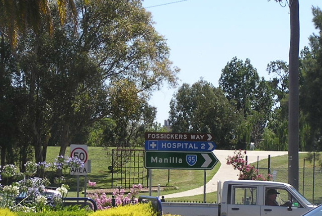
Just about the only correct State Route 95 sign in all of Tamworth! Located on the corner of Oxley Hwy, Marius and Brisbane Streets, Tamworth. Jan 2005. |
 |
This is the sign facing traffic approaching the southern terminus of State Route 95. What is wrong with this sign? Well firstly, all the shields are incorrect, the 34's should be in a National Route shield and the 15's should not be there (if they must be included they should be a National Highway shield and have the legend "To" next to them. Secondly, parenthesis should not be used on any signs except for RD signs in NSW. Thirdly, there is no need to have the same shield twice on the same panel. Jan 2005. |
 |
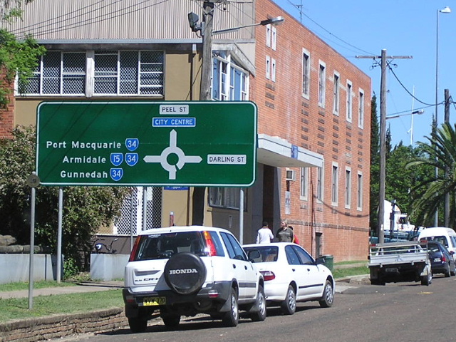
Diagrammatic AD sign heading northwest along Marius St approaching Darling St, Tamworth. If the sign designer can't tell the different between a Metroad (Met = Metropolitan, duh!) and a State Route, how the hell did they get a job designing directional signs? Jan 2005. |
 |
Extremely rare correct State Route 95 sign (probably escaped the fellow who committed the above travesties :p) at the junction of Peel and Darling Streets in Tamworth. Jan 2005. |
 |
Uh-oh here we go again. The errors are pretty obvious, so instead I'll just point out that Peel St (straight ahead) is the original alignment of SR95. Jan 2005. |
 |
Oh dear, here we are on Metroad 95 leaving Tamworth along Peel St beneath the railway line. Btw, it should be a STATE ROUTE shield. Was this designer retarded? Jan 2005. |
 |
Well it seems as if someone has recognised that the Metroad 95 shield was incorrect and has attempted to fix it. But a Tourist Drive shield? At least this conforms to standards even if the shield is incorrect. Thankfully, once we escape Tamworth the signage improves and is generally correct all the way to Yetman. Jan 2005. |
 |
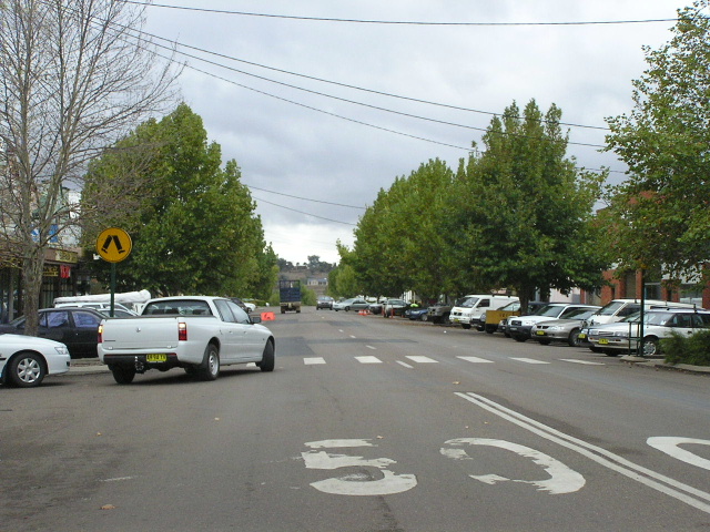
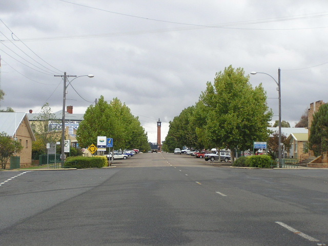
Looking south along Arthur Street in Manilla. April 2006. |
Badly located distance sign (right behind a street name blade sign) on Fossickers Way (Arthur St) heading south in Manilla. April 2006. |
|
 |
Prior to about the mid-1990s, Fossickers Way and State Route 95 used Court St and Manilla St through Manilla town centre. Nowadays the route is signposted via Arthur and Market Streets so that through traffic avoids the historic main street (Manilla St). This is a northbound view of Manilla St. April 2006. |
 |
Looking south at the junction of Manilla and Market Streets in Manilla. As the sign says, SR95 now bypasses the commercial centre via Market and Arthur Streets. April 2006. |
 |
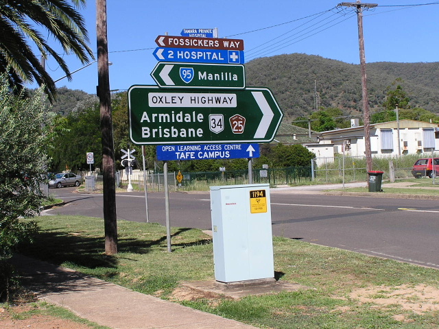
AD sign acting as an ID sign with a typical Fossickers Way nameplate at the above intersection. April 2006. |
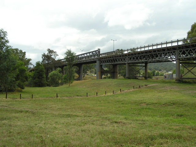 |
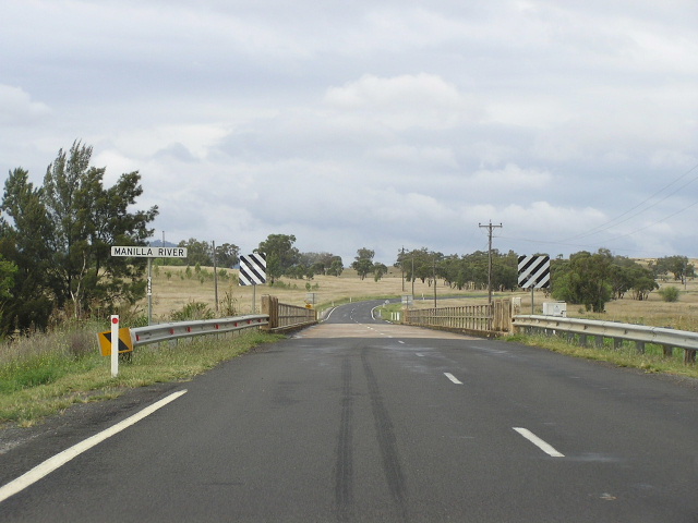
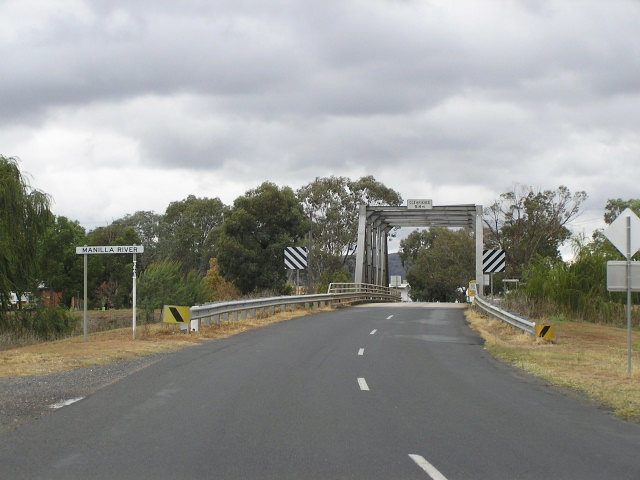
A view of the iron lattice bridge over the Namoi River at Manilla, constructed in 1886 by the Public Works Department and designed by famous NSW bridge engineer John McDonald. April 2006. |
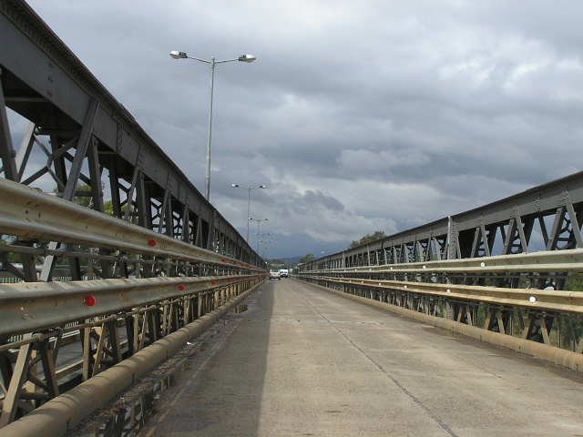 |
A southbound view of the narrow (5.5m wide) deck of the Namoi River bridge, which still manages to carry two-way traffic. April 2006. |
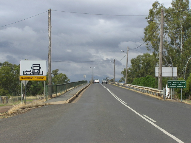 |
The northern approach to the Namoi River bridge, complete with narrow bridge signage. I would be very interested to see what happens when trucks need to cross the bridge as it is impossible to see vehicles coming the other direction until you are on the bridge itself. The green sign on the right hand side of the road advises heavy vehicles to bypass the commercial centre via Market St. April 2006. |
 |
Non-standard AD sign southbound on Fossickers Way approaching Lloyd Street (Manilla-Boggabri road) in Manilla. April 2006. |
 |
Distance sign heading north from Manilla along Fossickers Way. April 2006. |
 |
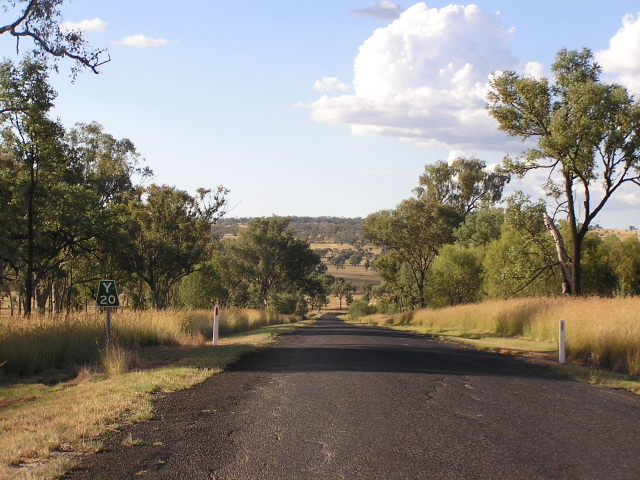
Looking south on a better section of road, about 6km north of Manilla. April 2006. |
 |
Looking south about 8km north of Manilla, showing the change in road quality along with a narrow culvert. April 2006. |
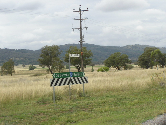 |
Typical SR95 fingerboard but without a Fossickers Way nameplate at Wimborne Lane, 9km north of Manilla. April 2006. |
 |
Looking south into the Manilla River valley, 10km north of Manilla. April 2006. |
 |
Looking south across a 1950s/1960s bridge over the Manilla River at Upper Manilla. April 2006. |
 |
State Route 95 fingerboard sign at Wimborne Rd, Upper Manilla. April 2006. |
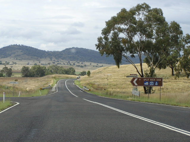 |
Looking south at the turnoff for Split Rock Dam. The white sign on the left of the road reads "Upper Manilla". April 2006. |
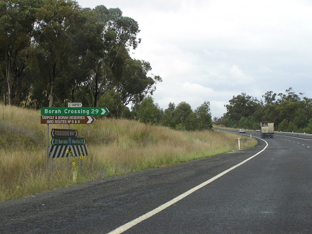 |
Fingerboard sign assembly at the turnoff for Borah Crossing, 25km north of Manilla. Note the brown fingerboard, which mentions "Bird Routes". There are several of these signs along Fossickers Way between Manilla and Bingara. April 2006. |
 |
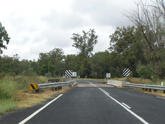
Looking south along a newly reconstructed section towards a widened culvert over Spring Gully. April 2006. |
 |
A narrow and badly patched section of Fossickers Way, looking south about 10km south of Barraba. April 2006. |
 |
Looking south along a section with badly deteriorating pavement, about 8km south of Barraba. The pooling water indicates the cause of the pavement deterioration - poor drainage. April 2006. |
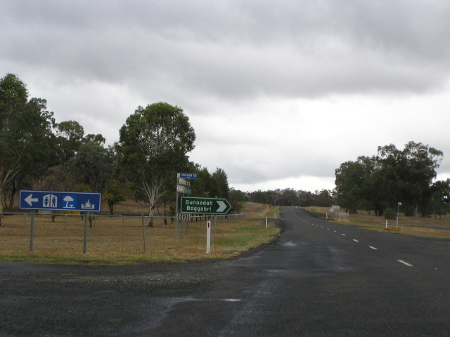 |
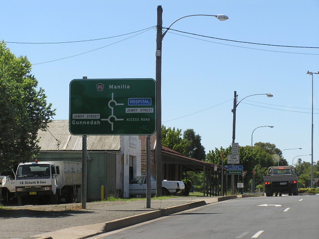
Looking south at the Gunnedah/Boggabri turnoff, 5km south of Barraba. April 2006. |
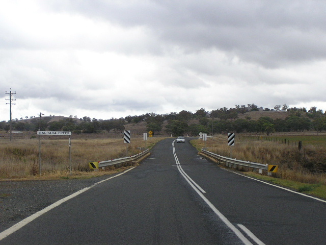 |
Looking south across a narrow culvert over Barraba Creek, 2km south of Barraba. Note yet another significant change in the road quality. April 2006. |
 |
Distance sign heading south from Barraba. April 2006. |
 |
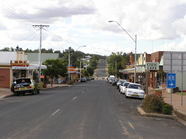
Looking south along Fossickers Way (Queen St) through Barraba town centre. April 2006. |
 |
Looking south along Fossickers Way (Queen St) towards Barraba town centre. April 2006. |
 |
Looking south to the narrow steel-truss bridge over the Manilla River at Barraba. April 2006. |
 |
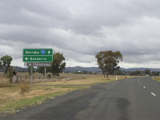
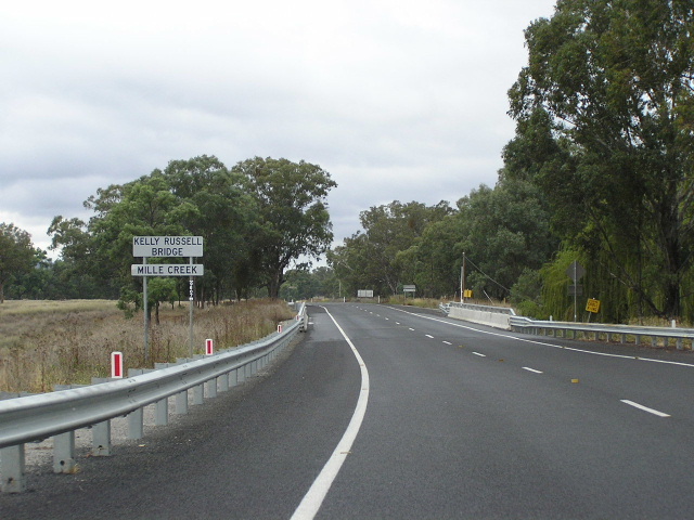
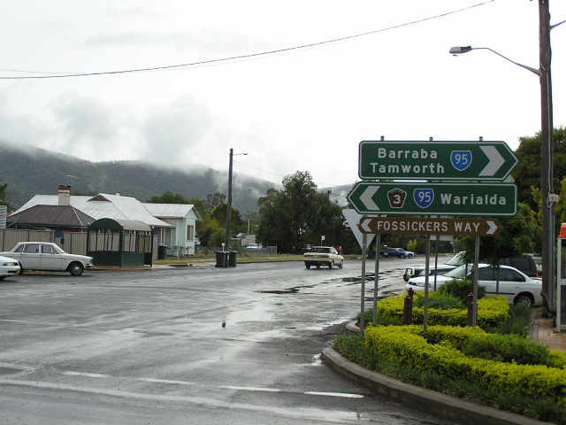
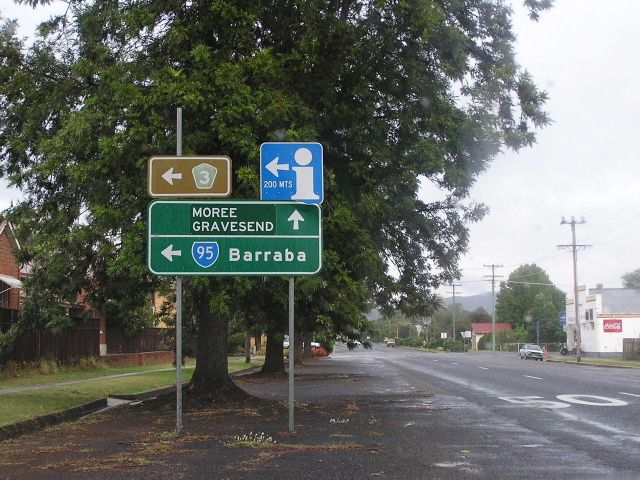
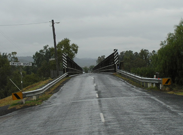
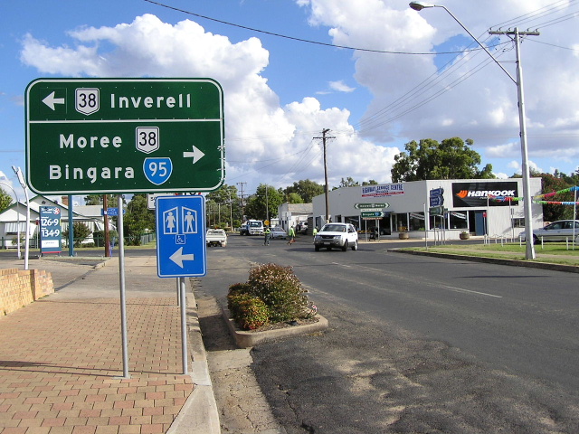
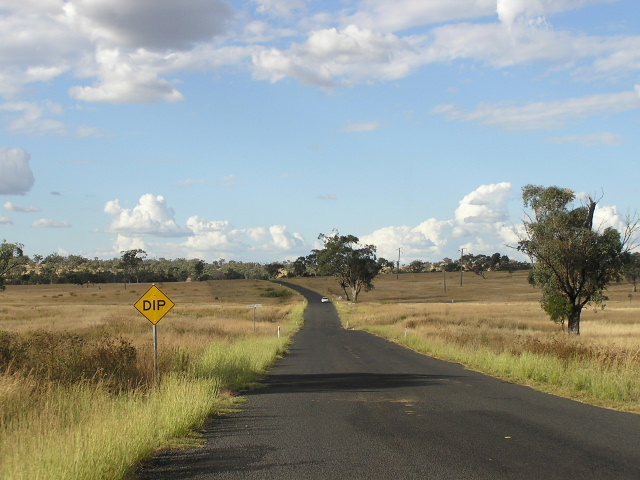
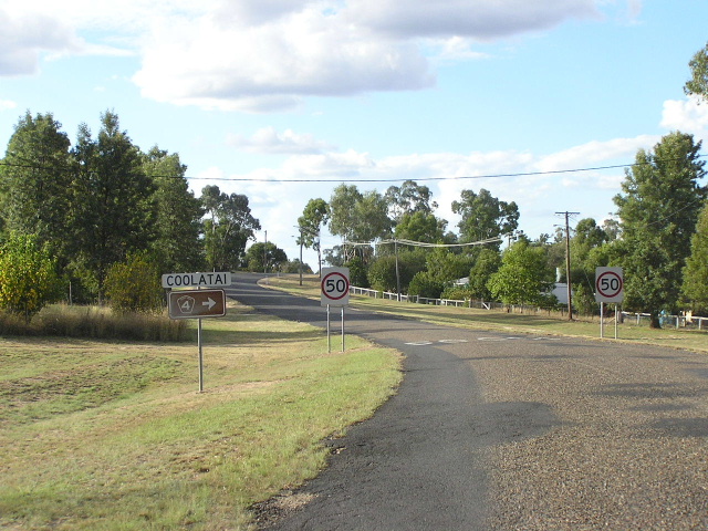
Distance sign heading north from the Bundarra turnoff (Woodsreef Road), 3km north of Barraba. April 2006. |
 |
Southbound AD sign for Woodsreef Road, 3km north of Barraba. Note the "Fossicking" fingerboard, which indicates the tourist attraction after which Fossickers Way was named. April 2006. |
 |
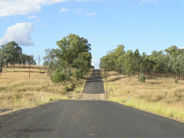
A nice new bridge over Mille Creek on an excellent section of the road, 6km north of Barraba. April 2006. |
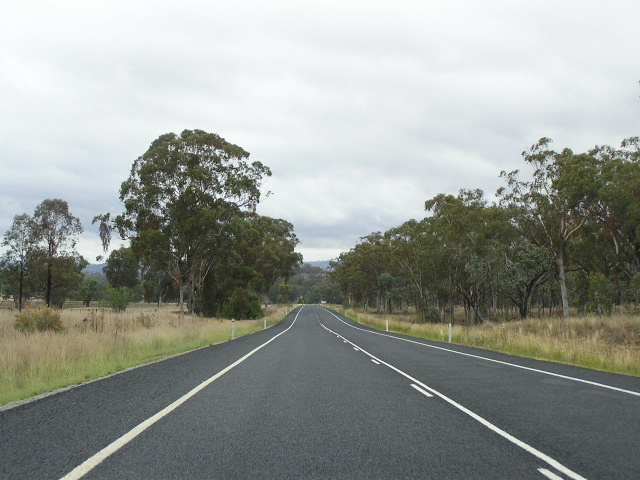 |
Another view of the surprisingly excellent quality road, 7km north of Barraba. April 2006. |
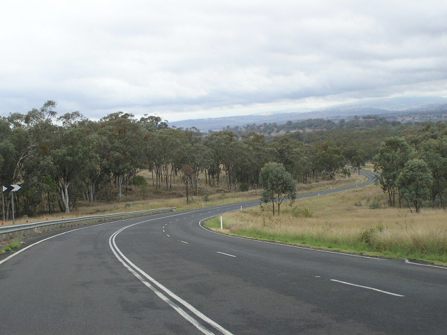 |
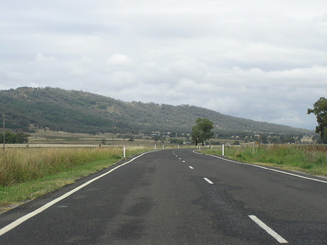
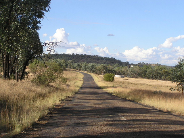
Looking south as Fossickers Way descends the Nandewar Range from Bells Mountain, 10km north of Barraba. April 2006. |
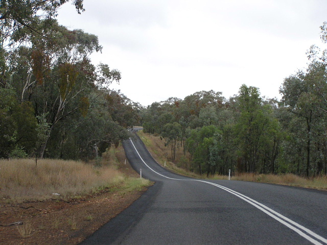 |
The northern approach to Bells Mountain, showing narrow pavement and poor alignment. April 2006. |
 |
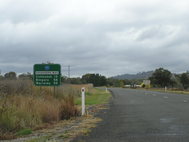
Distance sign heading south from Cobbadah. April 2006. |
 |
Northbound AD sign for the junction with Horton Rd at Cobbadah. April 2006. |
 |
Black double-chevron ID sign at the junction with Horton Rd, Cobbadah. April 2006. |
 |
Black AD sign on Horton Road approaching Fossickers Way at Cobbadah. April 2006. |
 |
Looking south across a narrow bridge over Cobbadah Creek. This bridge appears to have been strengthened yet not widened, which seems quite unsual considering how narrow it is. April 2006. |
 |
The northern approach to the narrow bridge over Cobbadah Creek showing the poor alignment and unusual structure. April 2006. |
 |
Silly attempt at a kilometre plate, southbound 20km north of Barraba. April 2006. |
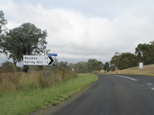 |
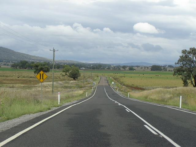
Unusual black-on-white fingerboard sign at Noumea Road, 25km south of Bingara. April 2006. |
 |
Looking south across another narrow bridge structure that appears to have been recently strengthened but not widened. April 2006. |
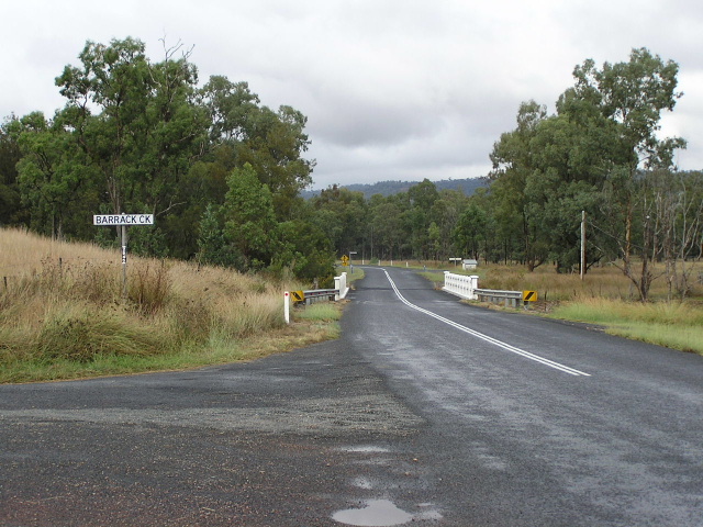 |
Looking south across Barrack Creek at Dinoga. April 2006. |
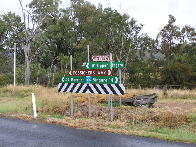 |
Fingerboard sign assembly at Upper Bingara Road, Dinoga. April 2006. |
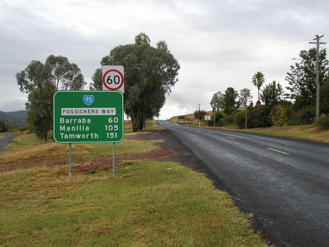 |
Distance sign heading south from Bingara. April 2006. |
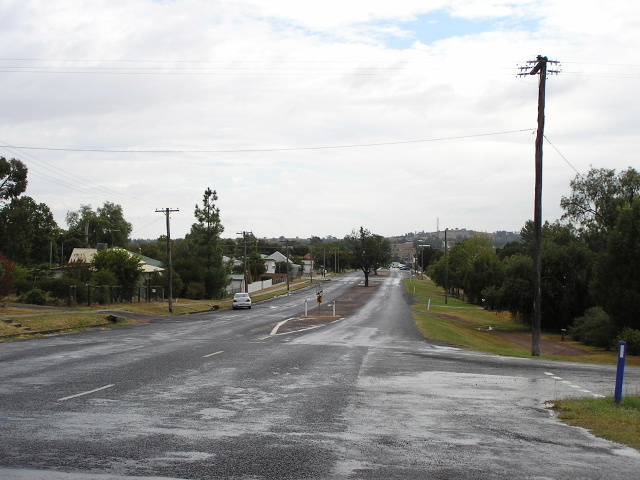 |
Looking north into Barraba. April 2006. |
ID sign assembly facing westbound traffic at the junction of Fossickers Way (Maitland St) and Cunningham St, Bingara. April 2006. |
|
 |
ID sign assembly facing eastbound traffic at the junction of Fossickers Way (Maitland St) and Cunningham St, Bingara. April 2006. |
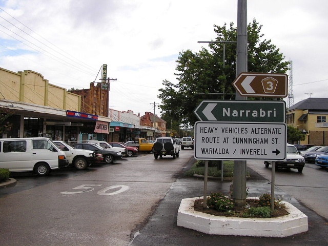 |
Black ID sign for the Narrabri-Bingara road at the same intersection. Also note the heavy vehicles detour around Bingara's main street, which is incorrectly shown in many maps as the route of Fossickers Way/SR95. April 2006. |
 |
AD sign southbound on Fossickers Way (Maitland St) approaching Cunningham St in Bingara town centre. April 2006. |
 |
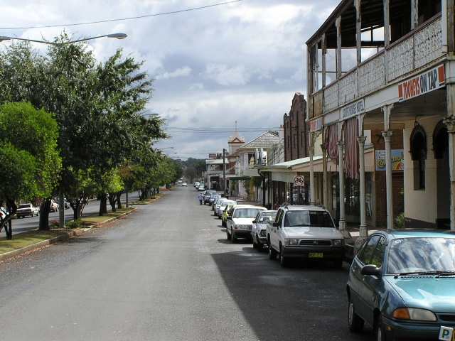
Looking south along Fossickers Way (Maitland St) between Finch and Cunningham Streets, showing Bingara's attractive commercial precinct. April 2006. |
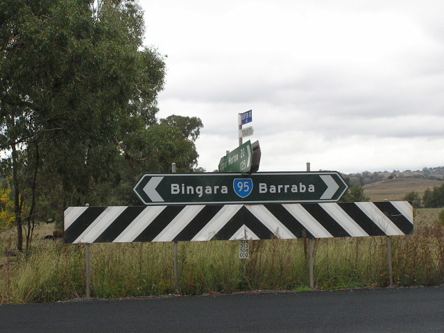
ID sign assembly (with some acting as fingerboards) at the junction of Maitland and Finch Streets in Bingara. Note the missing SR95 shield (Should appear on the Warialda/Delungra ID sign) and the lower two signs which look as if they were once one large double-chevron ID sign. April 2006. |
|
 |
AD sign westbound on Finch St approaching Maitland St in Bingara. The Moree/Gravesend coverplate covers the focal point of "Elcombe" which I had some trouble trying to locate on a map. Perhaps this is a clue as to why it was removed from the sign. April 2006. |
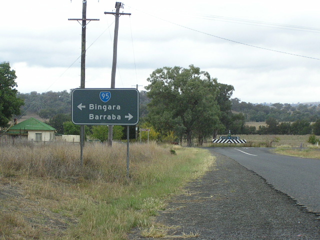
ID sign assembly at the junction of Link and Finch Streets in Bingara. Note how SR95 is included in the Barraba/Tamworth ID sign but not in the Warialda/Delungra sign, which it should be. April 2006. |
|
 |
The iron lattice truss bridge over Halls Creek, which serves as an approach span to the main structure across the Gwydir River. This bridge was designed by famous NSW bridge engineer John McDonald and constructed by the Public Works Department in 1886. April 2006. |
 |
A slightly odd-looking fingerboard sign missing a Fossickers Way nameplate at the junction with Keera Rd (Bundarra turnoff), between Halls Creek and the Gwydir River. April 2006. |
 |
The iron lattice truss bridge which carries State Route 95 across the Gwydir River at Bingara. This bridge was designed by famous NSW bridge engineer John McDonald and constructed by the Public Works Department in 1886. April 2006. |
 |
Looking south to the Gwydir River bridge. As you can see, the deck is quite narrow, being only 5.5m wide. April 2006. |
 |
Distance sign heading south from Old Inverell Road, 4km north of Bingara. April 2006. |
 |
ID sign assembly at the junction with Old Inverell Road. Note the spelling mistake. April 2006. |
 |
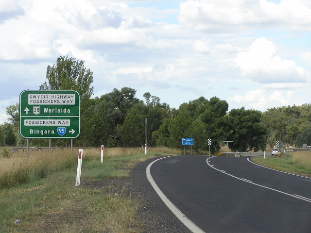
Distance sign heading north from Old Inverell Road. It is unusal that no focal points beyond Warialda are included on this sign - its almost as if the route has been divided into two completely unrelated sections: north and south of Warialda. April 2006. |
 |
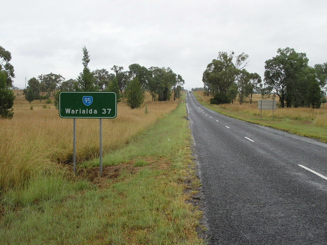
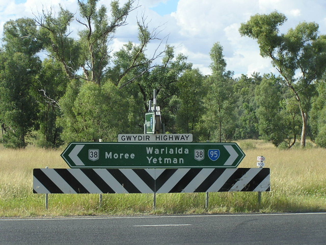
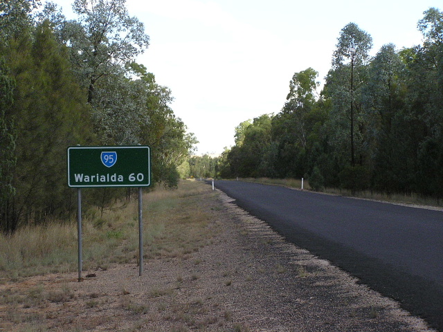
Distance sign heading south from Gwydir Highway, 3km west of Warialda. April 2006. |
 |
Northbound AD sign approaching the junction with Gwydir Highway. Note there is no NR38 shield for right, which there should be! It is also interesting to note that Inverell is included as a focal point (located on Gwydir Hwy) rather than Yetman, which is the next focal point on SR95. April 2006. |
 |
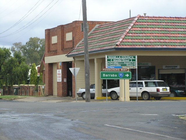
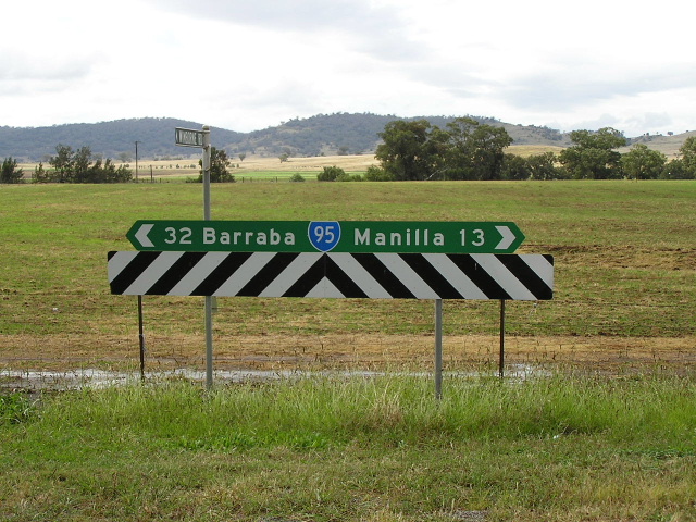
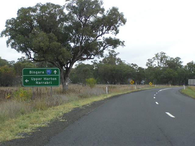
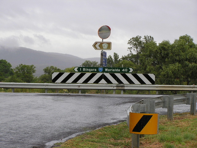
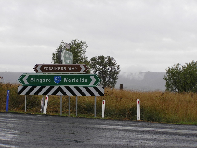
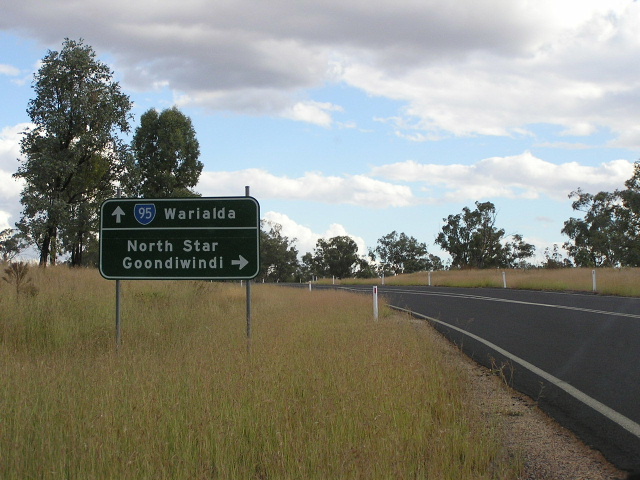
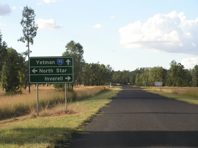
A much better-designed double-chevron ID sign at the junction with Gwydir Highway, including Yetman as the next focal point on SR95. All that is missing is recognition that the Fossickers Way name continues east along Gwydir Hwy. April 2006. |
 |
AD sign eastbound on Gwydir Hwy approaching SR95. Note the inclusion of the Fossickers Way name but no mention of SR95 straight ahead! April 2006. |
 |
AD sign westbound on Gwydir Highway approaching the western split of the NR38/SR95 duplex. April 2006. |
 |
Distance sign westbound on Gwydir Highway leaving Warialda. Note the inclusion of the Fossickers Way name but no mention of SR95. April 2006. |
 |
Gwydir Highway eastbound in Warialda approaching the junction with Stephen St (SR95). This is the eastern split of the NR38/SR95 duplex. April 2006. |
ID sign assembly facing southbound SR95 traffic at the junction of Gwydir Highway and Stephen St in Warialda. Note the colouring of the top sign, which is painted "standard green". This colour paint was used from the 1970s through to 1989 and fades to look very black after a number of years. April 2006. |
|
 |
Gwydir Highway westbound approaching Stephen St (SR95) in Warialda. Note the missing SR95 shield for straight. April 2006. |
 |
ID sign assembly facing westbound Gwydir Highway traffic at the junction with Stephen St in Warialda. April 2006. |
 |
AD sign southbound on Stephen St (SR95) approaching Gwydir Highway in Warialda. April 2006. |
 |
Looking north along Stephen St through Warialda's small commercial precinct. April 2006. |
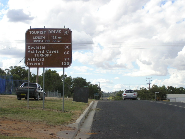 |
Tourist Drive 4 distance sign heading north along State Route 95 in Warialda. April 2006. |
 |
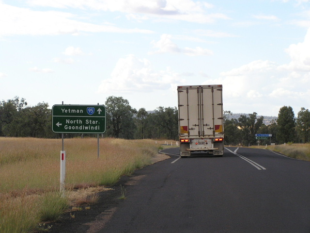
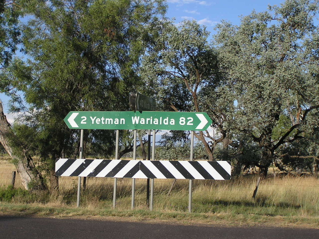
Black distance sign heading north from Warialda along State Route 95. There isn't much else you could put on the distance sign - Coolatai is so small you could blink and miss it. North Star and Goondiwindi are other possible candidates, accessed via Regional Road No. 7705 (Boggabilla Rd). In the distance you can make out some recent edge sealing that has been undertaken on State Route 95. April 2006. |
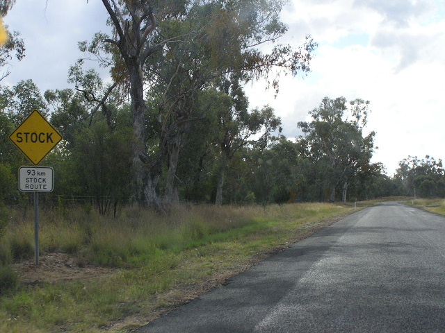 |
Unusual stock route signage northbound a few kms north of Warialda. I'm not sure whether this sign means that stock is allowed to be driven by foot along SR95? April 2006. |
 |
Looking north about 5km north of Warialda, showing recent seal widening. April 2006. |
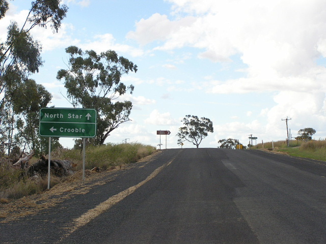 |
Non-standard AD sign northbound on SR95 approaching the Crooble turnoff, 6km north of Warialda. Note the missing SR95 shield and the focal point of "North Star" - should be "Yetman". April 2006. |
 |
Silly looking distance sign, heading north from the Crooble turnoff. April 2006. |
 |
Looking north to the 1950s bridge over Mosquito Creek at Boobah Camp. April 2006. |
 |
A closer view of the 1950s bridge over Mosquito Creek. Note one of the many surface quality changes. April 2006. |
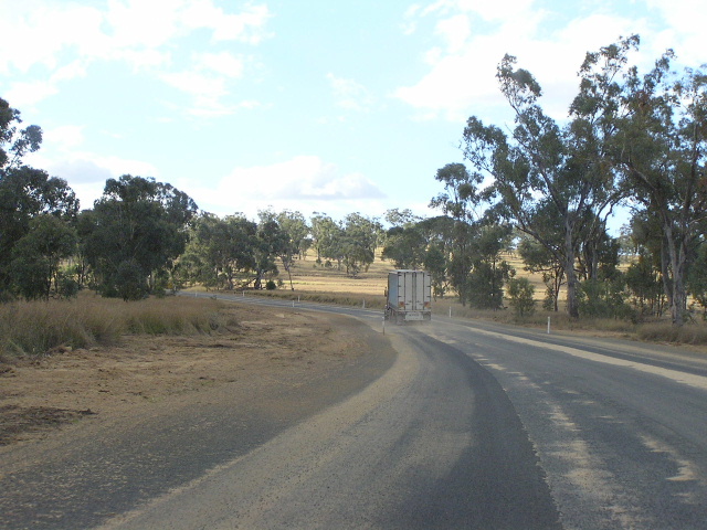 |
Looking north behind a semi-trailer about 16km north of Warialda, showing dodgy recent resealing. April 2006. |
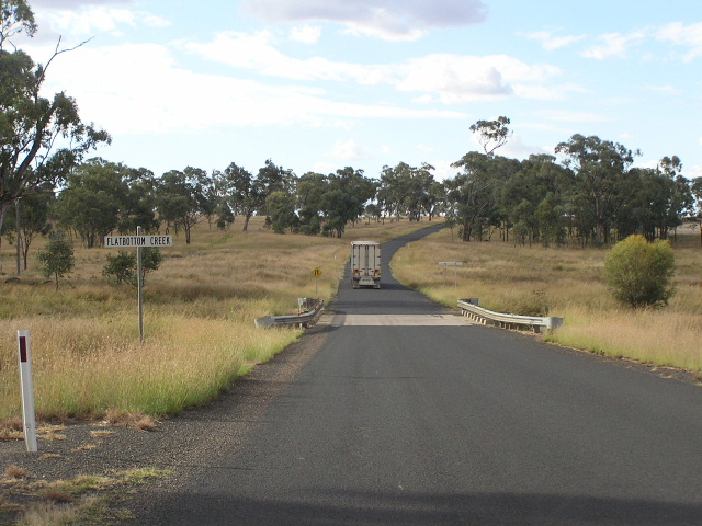 |
Looking north across Flatbottom Creek at Ironbark Dam Camp, 18km north of Warialda. The semi-trailer in the distance shows perfectly how narrow State Route 95 is. April 2006. |
 |
Typical mid-1990s RTA-designed AD sign northbound approaching the turnoff for North Star and Goondiwindi, 19km north of Warialda. April 2006. |
 |
Double-chevron ID sign acting as fingerboard at the above intersection. Note the later addition of Coolatai. April 2006. |
 |
Southbound AD sign approaching the turnoff for North Star and Goondiwindi. April 2006. |
 |
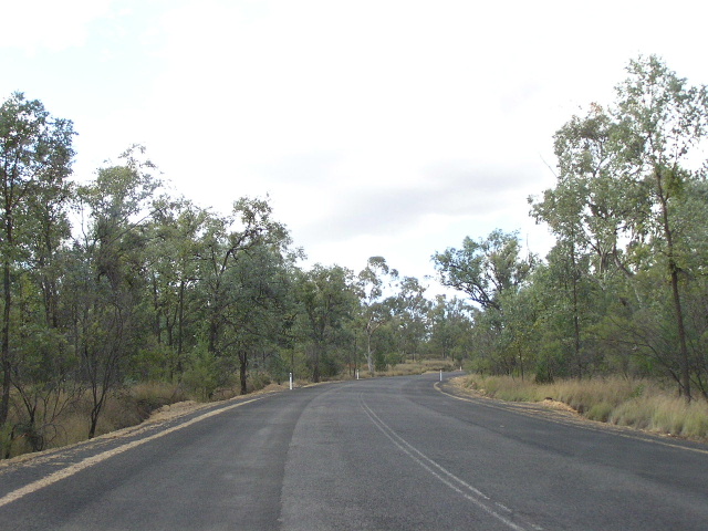
Looking north about 22km north of Warialda (there is a lack of kilometre plates on this road to tell you exactly where you are) showing patchy, narrow pavement. April 2006. |
 |
Looking north to the crossing of Stevenson Gully. April 2006. |
 |
Looking north along a recently resealed section devoid of linemarking, approaching a dip and floodway at Boundary Gully. There are several of these along State Route 95 between Warialda and Yetman, most of which are constructed in concrete. April 2006. |
 |
An example of a typical concrete floodway (that will probably one day be converted into a culvert) over an unnamed watercourse, about 7km south of Coolatai. April 2006. |
 |
Looking north along a section of badly patched, deteriorated and narrow pavement on the southern approach to Coolatai. April 2006. |
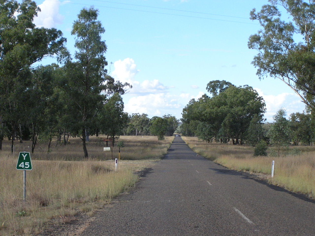 |
A "Y45" kilometre plate, heading north towards Coolatai. April 2006. |
 |
Looking north into the tiny settlement of Coolatai. April 2006. |
 |
And looking north, leaving Coolatai, less than 30 seconds after taking the previous photo. April 2006. |
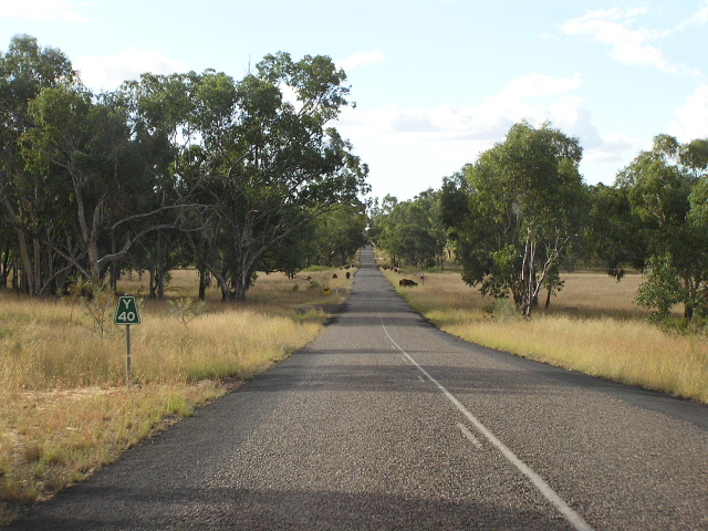 |
"Y40" kilometre plate, heading north from Collatai. In the distance, some cows are grazing along the side of the road unsupervised. April 2006. |
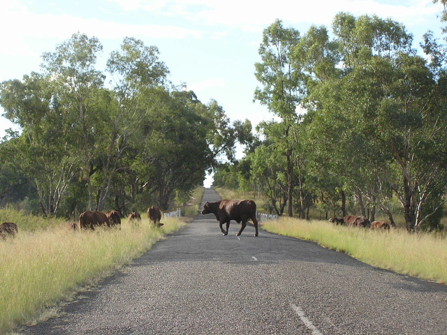 |
One friendly cow was kind enough to run across in front of us as we tried to pass by the grazing livestock. April 2006. |
 |
Looking north near Rocks Crossing showing a very old embankment and white-painted guard rail set-up. April 2006. |
 |
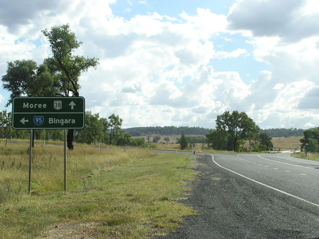
Distance sign heading south from Rocky Dam and the junction with Inverell-Rocky Dam road. Note no mention of any of the focal points south of Warialda - it is as if SR95 has been divided into 2 unrelated sections: north and south of Warialda. April 2006. |
 |
AD sign northbound approaching the junction with Inverell-Rocky Dam road. April 2006. |
 |
Black AD sign missing a SR95 shield, westbound on Inverell-Rocky Dam road approaching State Route 95 at Rocky Dam. April 2006. |
 |
Non-standard double chevron ID sign at the junction with Blue Nobby Rd at Rocky Dam. April 2006. |
 |
Looking north, 20km south of Yetman, showing deteriorating pavement. April 2006. |
 |
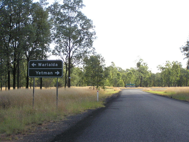
Fingerboard sign at the junction with the Yetman-North Star road, just south of State Route 95's northern terminus. Note the missing SR95 shield. April 2006. |
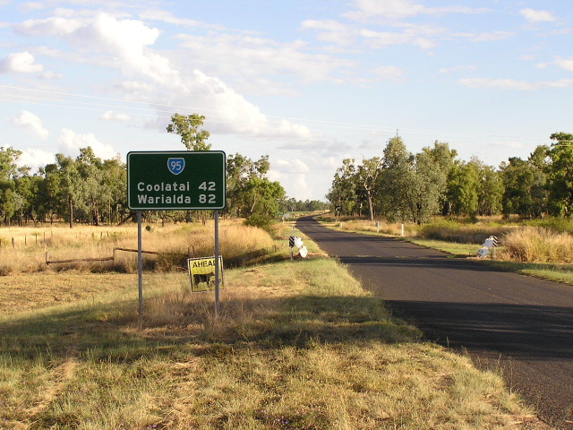 |
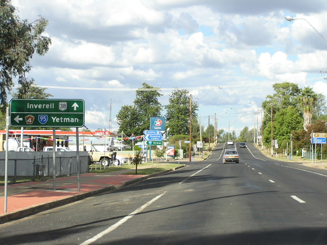
Distance sign heading south from State Route 95's northern terminus at the Bruxner Highway. This is the first southbound distance sign, yet no mention of any focal points beyond Warialda! April 2006. |
 |
Non-standard AD sign northbound on State Route 95 approaching Bruxner Highway. Note there is no mention of Yetman, which has been the focal point for the last 82km! Also note that the Bruxner Highway here does not have a route marker - it was slated to take the National Route 44 shield in 1974 but a 4.7km section that still remains unsealed has prevented that dream from ever coming true. So, for now, SR95 ends at an unnumbered road. April 2006. |
 |
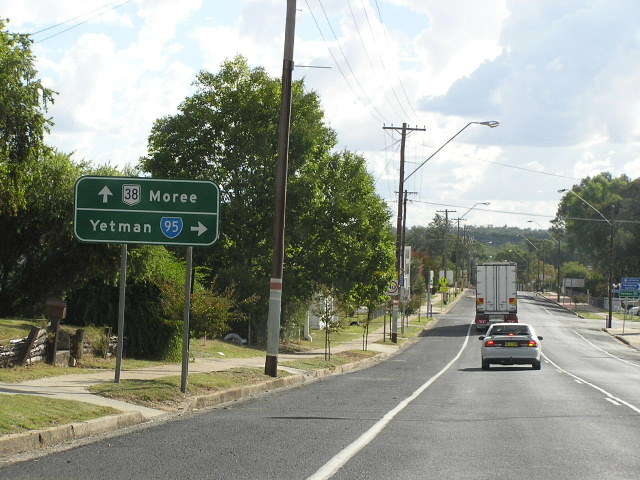
AD sign eastbound on Bruxner Highway approaching the junction with State Route 95 at Yetman. Note the incorrect NR95 shield. April 2006. |
 |
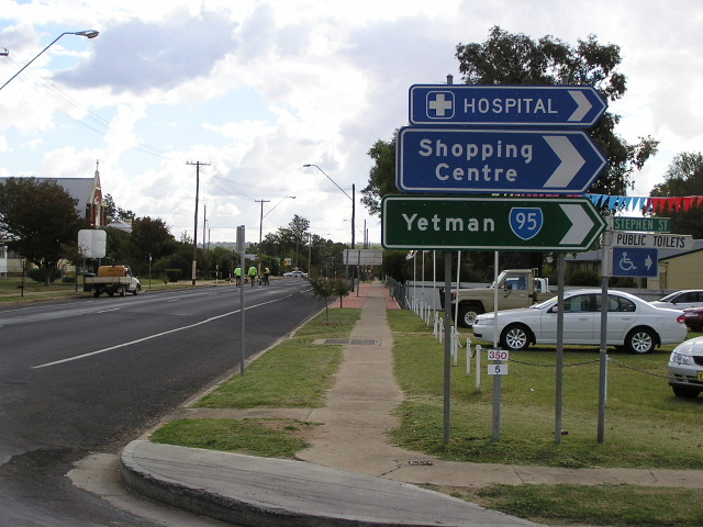
ID sign assembly at SR95's northern terminus with an incorrect shield. April 2006. |
Last updated 11 December 2012 © Ozroads 2003-2012. |