State Route 81 Yass - Cowra - Molong |
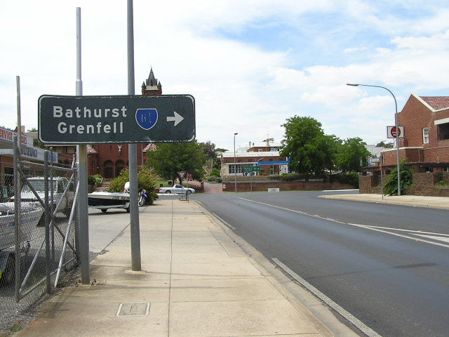
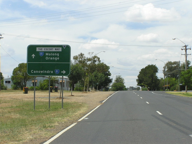
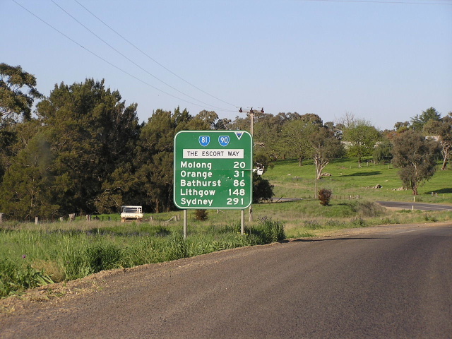
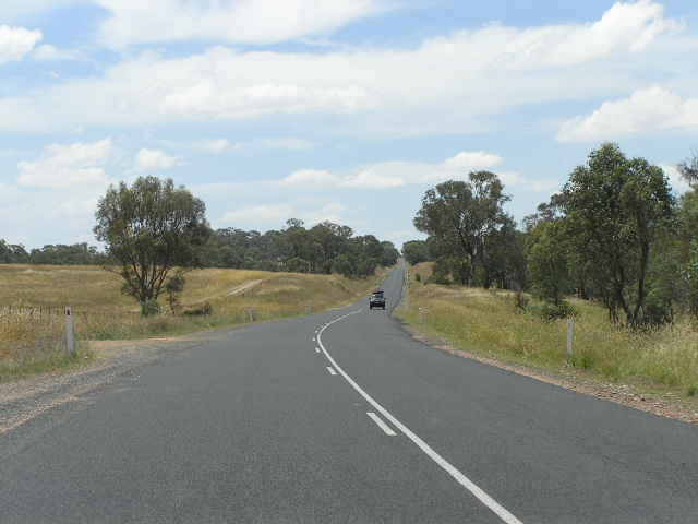
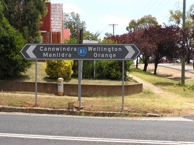
Distance sign heading north from Canowindra. Jan 2006.
In 2013, RMS will be implementing a new alpha-numeric route numbering system. For more information, visit the RMS Website. |
|
Forthcoming alpha-numeric route number: |
|
Length: 226km
Northern Terminus: Mitchell Hwy & Edwards St, Molong
Southern Terminus: Hume Hwy & Lachlan Valley Way, 7km northwest of Yass
Route taken: From the Hume Highway via Lachlan Valley Way, Mid Western Hwy, Lachlan St, Bridge St, Redfern St, Canowindra, Cudal, Escort Way, Peabody Rd, Wellington St & Edwards St to the Mitchell Hwy
Focal Points: Yass, Boorowa, Cowra, Canowindra, Molong
RTA Internal Classification: Main Road No. 56 (Lachlan Valley Way), State Highway No. 6 (Mid Western Hwy), Main Road No. 310 (Cowra-Cudal), Main Road No. 377 (Cudal-SR90), Main Road No. 61 (SR90 Duplex), Main Road No. 359 (SR90-Molong)
State Route 81 is a north-south route in mid-western New South Wales, linking the Hume Highway near Yass (and thus Canberra) with the Mid Western Hwy at Cowra and the Mitchell Highway at Molong. The route has pretty low traffic volumes along its length, with rural volumes not exceeding 3,000vpd at any location. A peak of just over 7,700vpd is found just north of the Mid Western Highway duplex in Cowra. The Lachlan Valley Way section, south of Cowra, is understandably the busiest section. Despite the low traffic volumes, the route is an essential link in the NSW rural state route system. The only major construction project on the route was the construction of a new high-level bridge carrying Mid Western Highway over the Lachlan River at Cowra during the mid-1980s.
Having only travelled on this route north of Cowra, I was under the impression that the route was of reasonable quality. However, it appears that the section south of Cowra to the Hume Highway is in much worse condition, with councils reduced to patching patches because of insufficient funding. The plight of the Lachlan Valley Way is covered in more detail in this article from the NSW Parliamentary Hansard.
 |
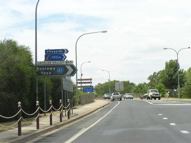
Eastbound AD sign on the Hume Highway approaching the beginning of the Lachlan Valley Way near Yass. Jan 2005. |
 |
Westbound AD sign on Hume Hwy approaching the beginning of Lachlan Valley Way near Yass. Feb 2006. |
 |
First distance sign on SR81 - heading north from Hume Highway. Feb 2006. |
 |
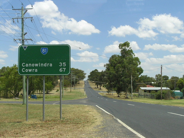
Great old black distance sign - surely dating from the 1970s - heading south on the Lachlan Valley Way from Cowra. Jan 2006. |
 |
Lachlan Valley Way northbound approaching the Mid Western Hwy in Cowra. Note there is no mention of SR81, which duplexes with NR24 across the Cowra Bridge before continuing north to Canowindra. Jan 2006. |
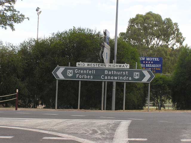 |
Black double-chevron ID sign at the junction with Mid Western Hwy. Note that again there is no mention of SR81, only its focal point "Canowindra". Jan 2006. |
 |
AD sign eastbound on Mid Western Hwy approaching its junction with Lachlan Valley Way, and thus SR81, in Cowra. Since the route markers are missing from the top left of the sign we can't tell whether SR81/NR24 duplex was signed although I fancy it wasn't. Jan 2006. |
 |
Black ID sign at the Mid Western Hwy/Lachlan Valley Way junction in Cowra. Jan 2006. |
 |
AD sign westbound on Mid Western Hwy approaching the junction with Lachlan Valley Way. This section of pavement is an unsigned duplex of SR81 and NR24. Jan 2006. |
 |
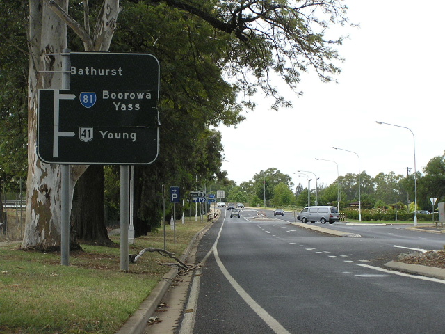
AD sign westbound on Mid Western Hwy approaching the junction with Lachlan St (SR81). Note two errors on the sign - SR24 should say National Route 24; and SR81 is not included straight ahead. Jan 2006. |
 |
Very old and peeling AD sign on Bridge St approaching Lachlan St in Cowra. Jan 2006. |
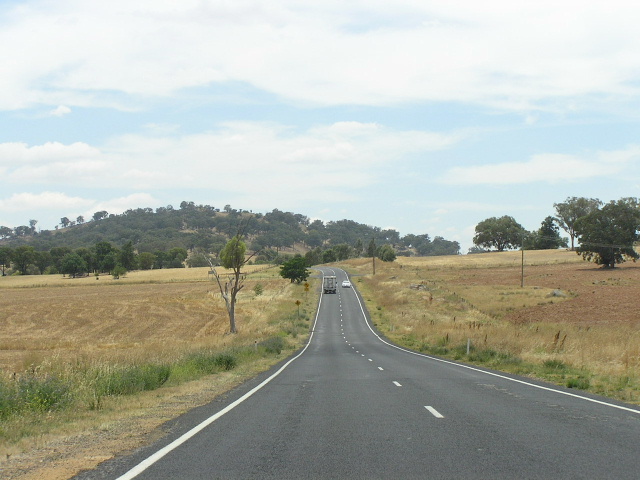 |
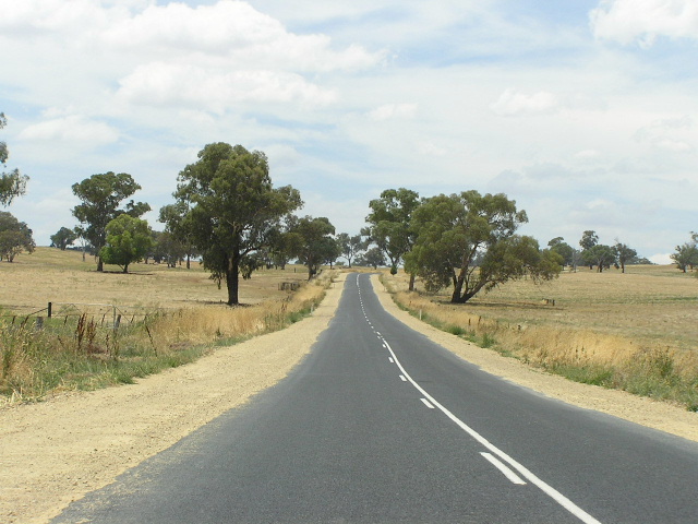
Typical view northbound between Cowra and Canowindra. Jan 2006. |
 |
Northbound AD sign on Tilga St approaching Ferguson St, Canowindra. Note the SR81 shield is on a coverplate over a B81 shield. Jan 2006. |
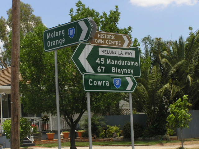 |
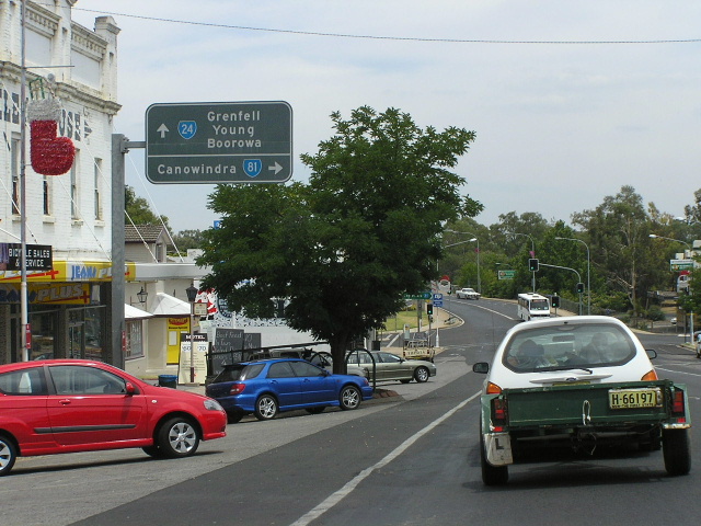
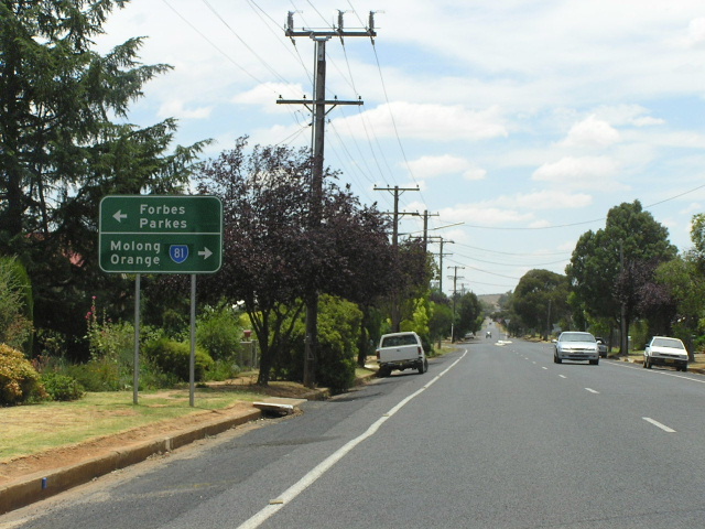
Conglomeration of ID signs at the Rodd St/Ferguson St/Belubula Way junction in Canowindra. Jan 2006. |
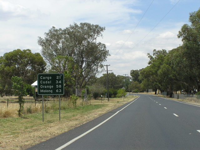 |
Distance sign heading north from Canowindra. Note there is no SR81 shield - another stupid RTA error. Jan 2006. |
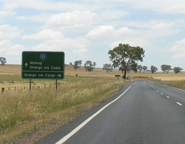 |
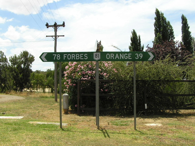
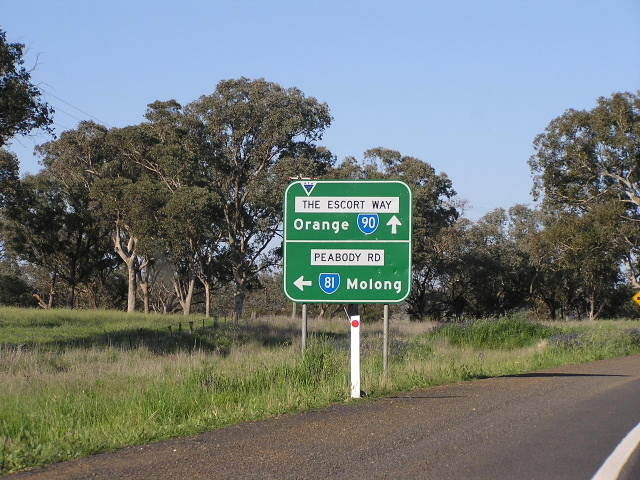
Northbound AD sign approaching the Orange-Canowindra road, 4km north of Canowindra. I find it interesting that Orange continues to be signed via SR81/SR90, a route which is 13km longer. Jan 2006. |
 |
Much lower standard section of SR81, looking north between Canowindra and Cudal. This road quality is probably "C" route standard but yet it will receive a B route under the alpha-numeric route numbering system. To be fair, the rest of the route is pretty decent quality. Jan 2006. |
 |
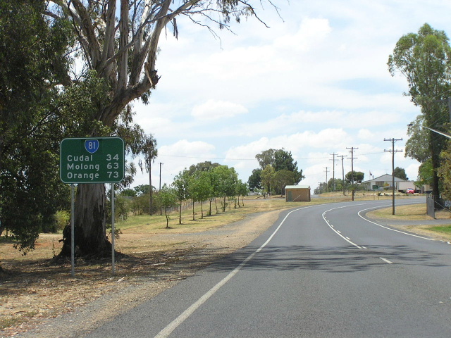
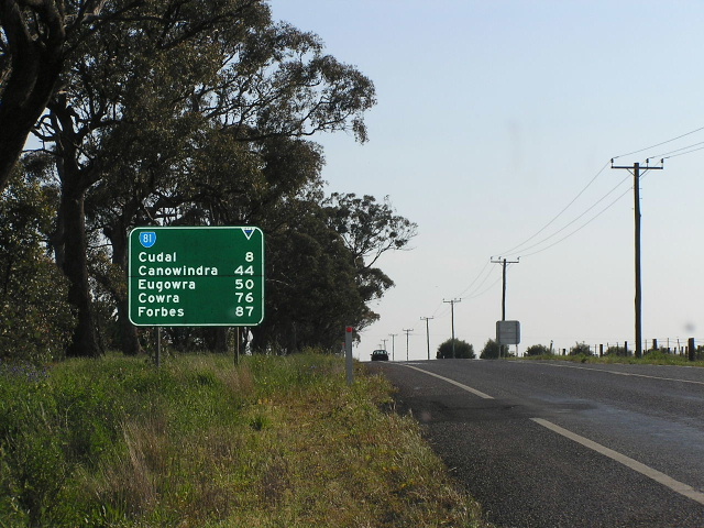
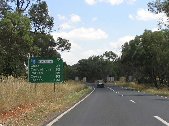
Distance sign heading south from Cudal. Note the the large blank space on the sign as if it is ready to accept a road name sometime in the future. Jan 2006. |
 |
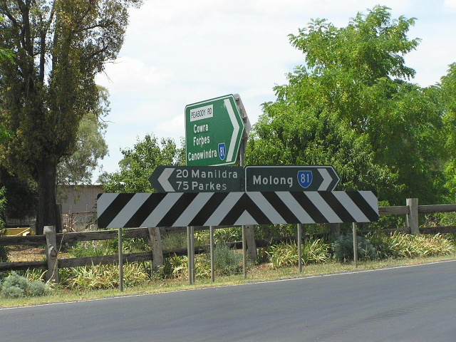
AD sign eastbound on Escort Way approaching SR81 at Cudal. Again note the large blank space on the lower panel. It is also interesting to note how the SR81 shield is aligned with "Molong", rather than being centred between Molong and Orange. This is not a practice seen often in NSW. Jan 2006. |
 |
Disgraceful use of National Route 81 shield + all capital letters on this fingerboard in Cudal. Furthermore, SR81 does not go to either Forbes or Orange, although Escort Way does (which is the road name at this point). Jan 2006. |
 |
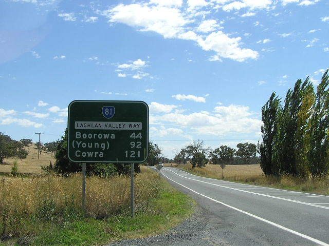
Distance sign on Escort Way heading southwest from State Route 90 at Boree. Note the large blank space next to the shield, seemingly reserved for an "Escort Way" name patch. Jan 2006. |
 |
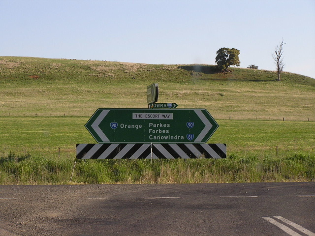
AD sign on Escort Way (SR90/81 duplex) heading west towards the split of SR81 and SR90 at Boree. Jan 2006. |
 |
Distance sign heading east from Boree along Escort Way (SR81/90 duplex). Jan 2006. |
 |
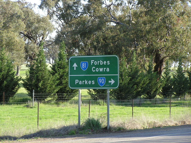
Eastbound AD sign approaching the eastern split of SR81/SR90 at Peabody Rd. Jan 2006. |
 |
Very ugly looking double-chevron ID sign at the Escort Way/Peabody Rd junction. Note the afterthought - a tiny fingerboard style sign that reads "Cowra/SR81". This was probably added by the Council. Jan 2006. |
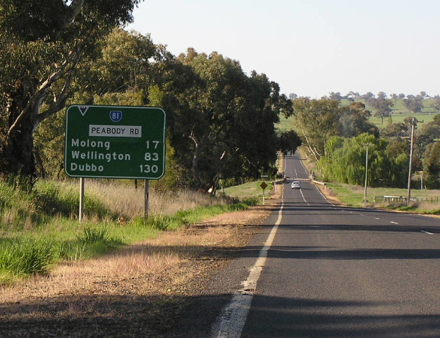 |
Distance sign on Peabody Rd heading north from Escort Way. Jan 2006. |
 |
Typical view of Peabody Rd with no edge lines, looking north between Escort Way and Molong. Jan 2006. |
 |
Distance sign heading south from Molong. Jan 2006. |
 |
Interesting comparison between old black and new green ID signs at the Peabody Rd/Wellington St junction in Molong. Jan 2006. |
 |
Looking east along Wellington St in Molong. State Route 81 signage disappears here, however we know that SR81 turns left onto Edwards St by the signage further up. Jan 2006. |
 |
Black double-chevron ID sign at the Edwards St/Bank St junction in Molong. This sign is located only one block from the northern terminus of SR81 at the Mitchell Hwy. Jan 2006. |
 |
Westbound AD sign for SR81 on Mitchell Hwy in Molong. Jan 2006. |
 |
Eastbound AD sign for SR81 on Mitchell Hwy in Molong. Jan 2006. |
Last updated 10 December 2012 © Ozroads 2003-2012. |