NSW State Route 78 Waterfall Way |
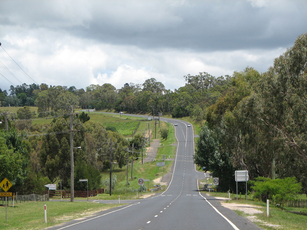
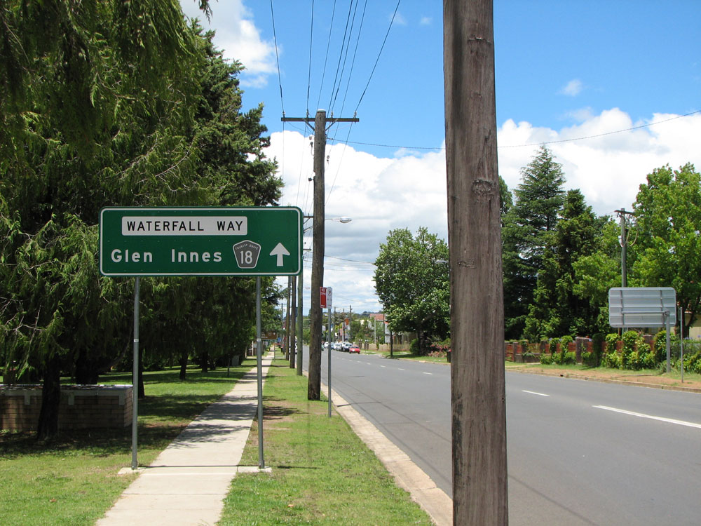
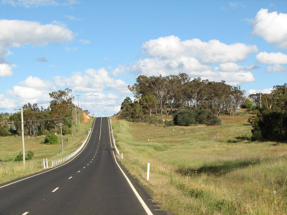
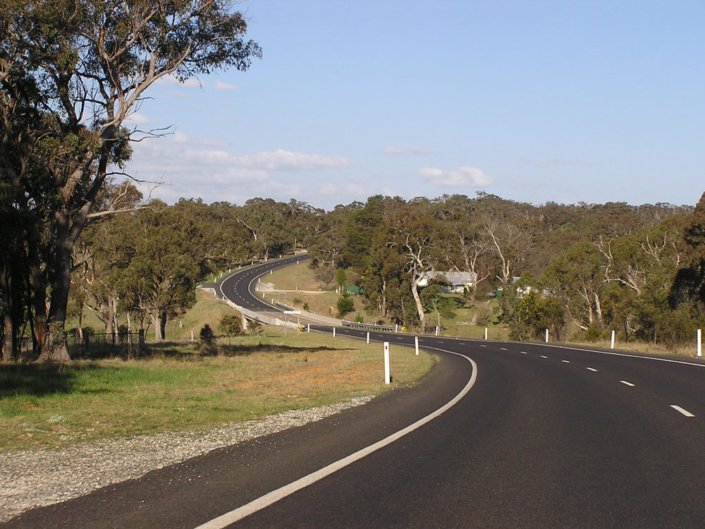
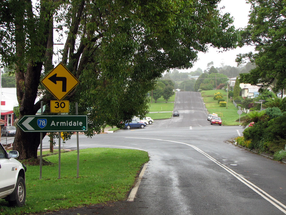
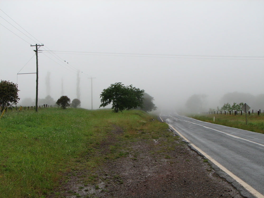
Waterfall Way looking east on the eastern outskirts of Armidale. Photo taken: December 2008.
In 2013, RMS will be implementing a new alpha-numeric route numbering system. For more information, visit the RMS Website. |
|
Forthcoming alpha-numeric route number: |
|
Length: 170km
Eastern Terminus: Pacific Hwy & Waterfall Way, Raleigh
Western Terminus: New England Hwy & Waterfall Way, 3km southwest of Armidale (southern end of Armidale bypass)
Route taken: Waterfall Way (Barney St, Dangar St, Kentucky St, Uralla Rd through Armidale)
Focal Points: Tamworth, Armidale, Coffs Harbour (Bellingen is also used for westbound traffic)
Roads ACt 1993 classification: Main Road No. 76
State Route 78 is the east-west route named Waterfall Way, connecting the New England Highway at Armidale with the Pacific Highway near Coffs Harbour. Passing through heavily timbered areas, including large sections of rainforest, the route carries a high volume of tourist traffic. Two waterfalls are actually adjacent to the road as it winds it way across the mountains between Dorrigo and Bellingen. For the easternmost 28km of its journey, State Route 78 meanders along the very beautiful Bellinger River valley.
Waterfall Way is sealed but relatively narrow and has steep, winding sections. In recent years storms and associated flash flooding have washed away sections of the roadway where it rises to the ranges, leading to traffic being limited to one lane until remedial work was completed.
The Waterfall Way developed not as a single through route but as conglomeration of smaller connecting routes through the early part of the 20th century. In conjunction with an extensive construction programme, the Department of Main Roads declared Trunk Road No. 74 (Grafton-Nymboida-Ebor-Armidale) and Trunk Road No. 76 (Ebor-Dorrigo-Bellingen-Raleigh) during the 1930s. As can be seen with these proclamations, the original focus was not an Armidale-Coffs Harbour route but one from Armidale to Grafton. The change of emphasis to a purely east-west route was finally reflected on 2 February 1996 when the Ebor-Armidale section of Waterfall Way was redeclared as part of Main Road No. 76 (Trunk Road classifications were abolished by the State Roads Act 1986 and incorporated into the ordinary Main Roads classification).
State Route 78 - the Waterfall Way's signed route marker, was introduced in 1974, running between the New England Hwy in Armidale and the Pacific Highway at Raleigh. In association with subsequent bypasses of Armidale (December 1994) and Raleigh (December 1997), State Route 78 has been extended west to meet the southern end of the Armidale Bypass and truncated about 50m to the west at the Pacific Highway (Raleigh Deviation).
The names of the two waterfalls adjacent to State Route 78 between Dorrigo and Bellingen reflect the effect that the Department of Main Roads has had on the development of the area - Newell Falls and Sherrard Falls are both named after former Commissioners for Main Roads.
Spotlight on: Raleigh
The construction of the deviation of Pacific Highway at Raleigh (opened December 1997) moved the junction of Waterfall Way and Pacific Highway approximately 100m to the west. This left a short section of State Route 78 to be decommissioned, between the current Pacific Highway junction and the Old Pacific Highway junction. The ID sign assembly dating from prior to these changes still remains.
Spotlight on: Armidale
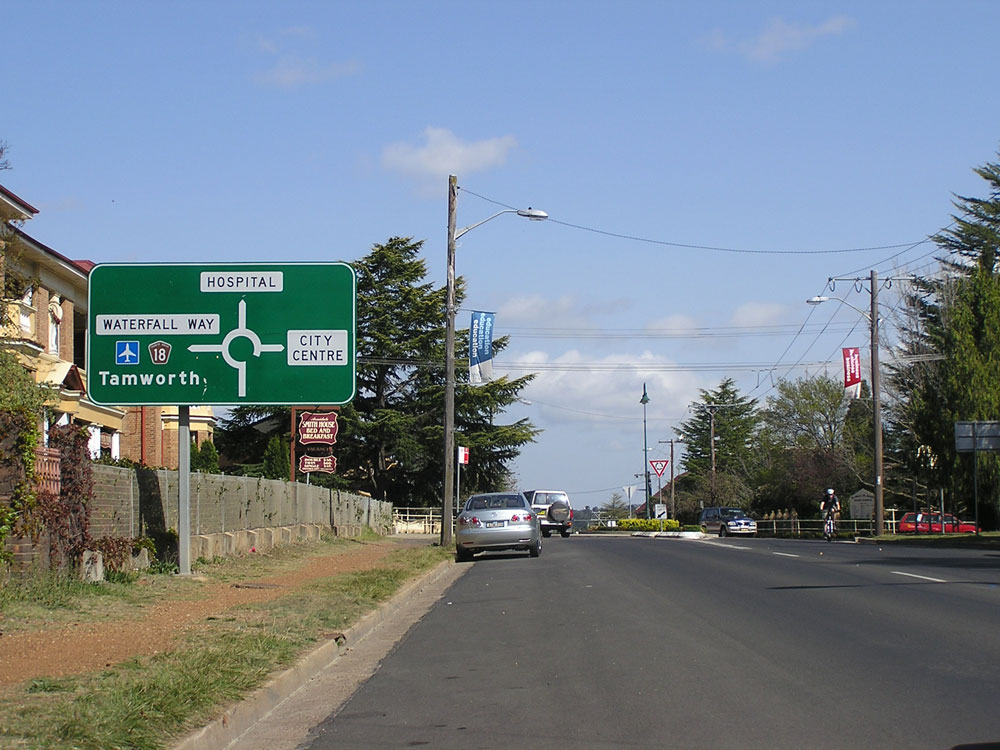
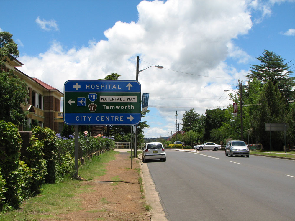
Upon opening of the New England Highway bypass of Armidale in 1994, National Highway 15 was re-routed around the town and State Route 78 was extended from the Barney Street/Marsh Street intersection along the former NH15 route to the southern end of the bypass. Unfortunately whoever designed the replacement signs did a terrible job and for many years signage was confusing and contradictory. Most signage along Barney, Dangar and Kentucky Streets did not show State Route 78 and State Route 78 was signed at both(!) ends of the Armidale bypass.
In the latter half of 2008, the RTA implemented a vastly improved signposting scheme along State Route 78 through Armidale, properly signposting SR78 and rationalising focal point signage. Signage is now very clear that SR78 extends to the southern end of the bypass - only 14 years late! Also, for some strange reason, none of the new signs have provision for alpha-numeric route markers which is strange given the RTA's work across the state and, perhaps more importantly, gives the RTA another chance to screw up the signage again when the signs are replaced to cater for an alpha-numeric route marker.
Photos of State Route 78 |
|
 |
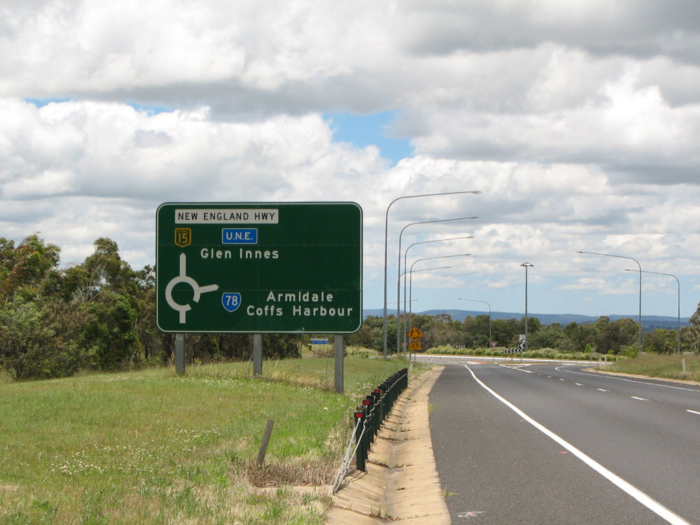
AD sign southbound on New England Highway at Hoys Road, 2km north of the northern end of the Armidale bypass, showing that the New England Highway bypasses Armidale and SR78 can be reached by either town entrance. Photo taken: December 2008. |
 |
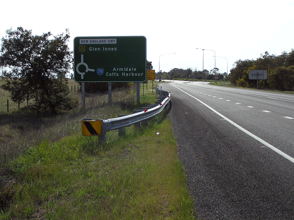
AD sign southbound on New England Highway approaching the roundabout at the northern end of the Armidale bypass. Until comprehensive signage changes in 2008, signage at this intersection incorrectly showed SR78 along Glen Innes Road. Photo taken: October 2007. |
 |
RD sign incorrectly showing SR78, southbound on Glen Innes Rd at the junction with New England Highway, 3km north of Armidale City Centre. Photo taken: October 2007. |
 |
AD sign northbound on New England Highway approaching the junction with Glen Innes Road at the northern end of the Armidale bypass. Photo taken: October 2007. |
 |
AD sign northbound on New England Highway at Saumarez, 2km south of the junction with Waterfall Way (Uralla Road) at the southern end of the Armidale bypass, showing the town bypass and directions to follow SR78. Photo taken: December 2008. |
 |
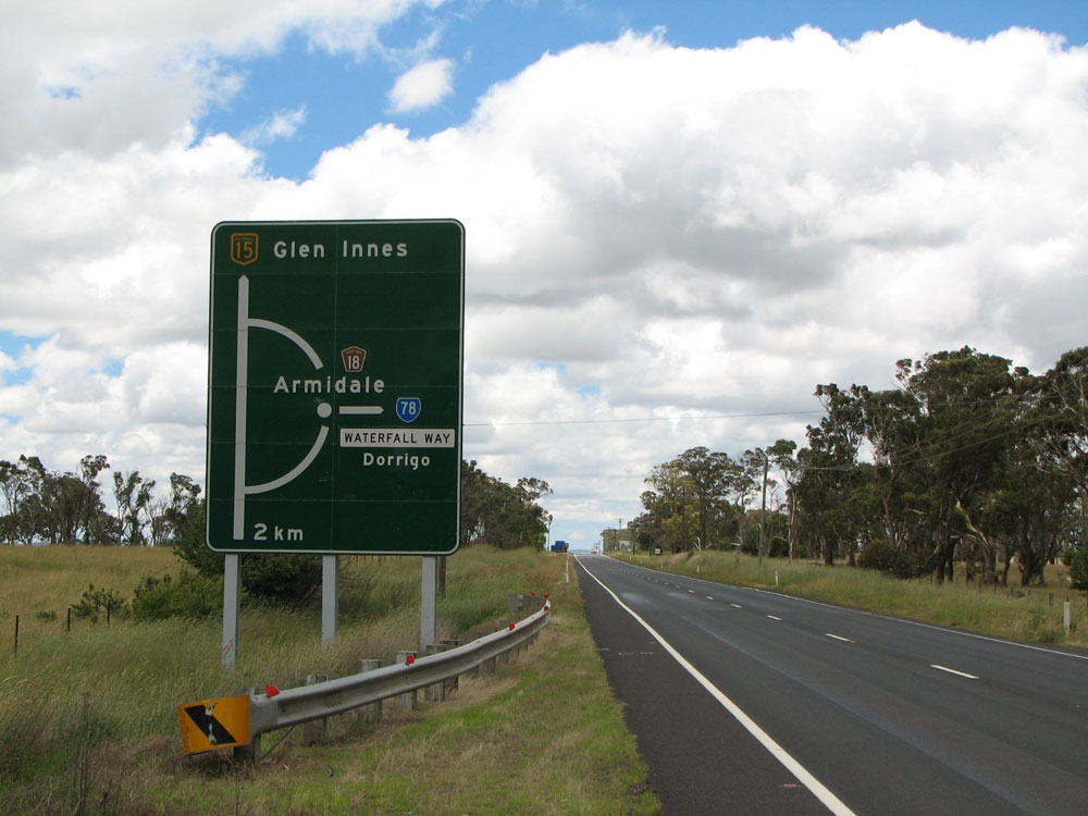
AD sign northbound on New England Highway approaching the junction with Waterfall Way at the southern end of the Armidale bypass, showing SR78 branching off to the right. Photo taken: October 2007. |
  |
Two views of the AD sign southbound on New England Highway approaching the junction with Waterfall Way at the southern end of the Armidale bypass. The first photo shows the sign as installed upon opening of the bypass in 1994; the 2nd photo showing subsequent coverplating which was done during comprehensive signposting improvements in 2008. Top photo: January 2005. Bottom photo: December 2008. |
  |
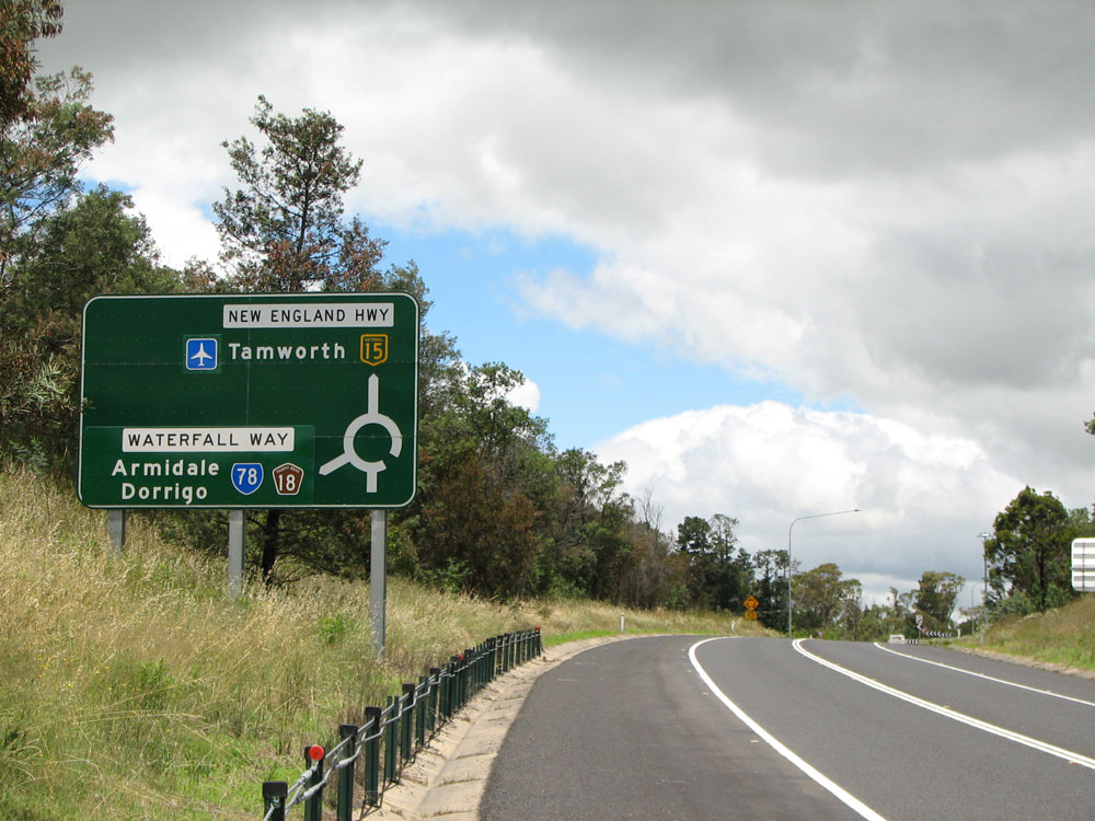
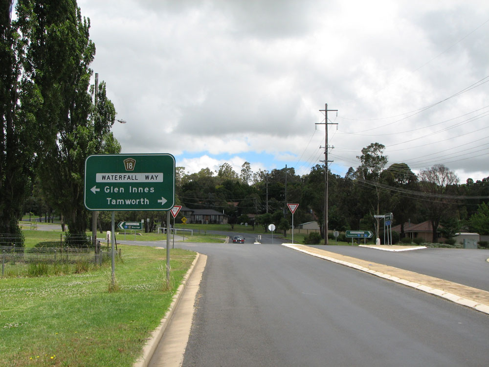
Old and new RD signs eastbound on Waterfall Way at the junction with New England Highway, 5km southwest of Armidale City Centre. The new sign was installed in 2008 and is certainly an improvement. Top photo: October 2007. Bottom photo: December 2008. |
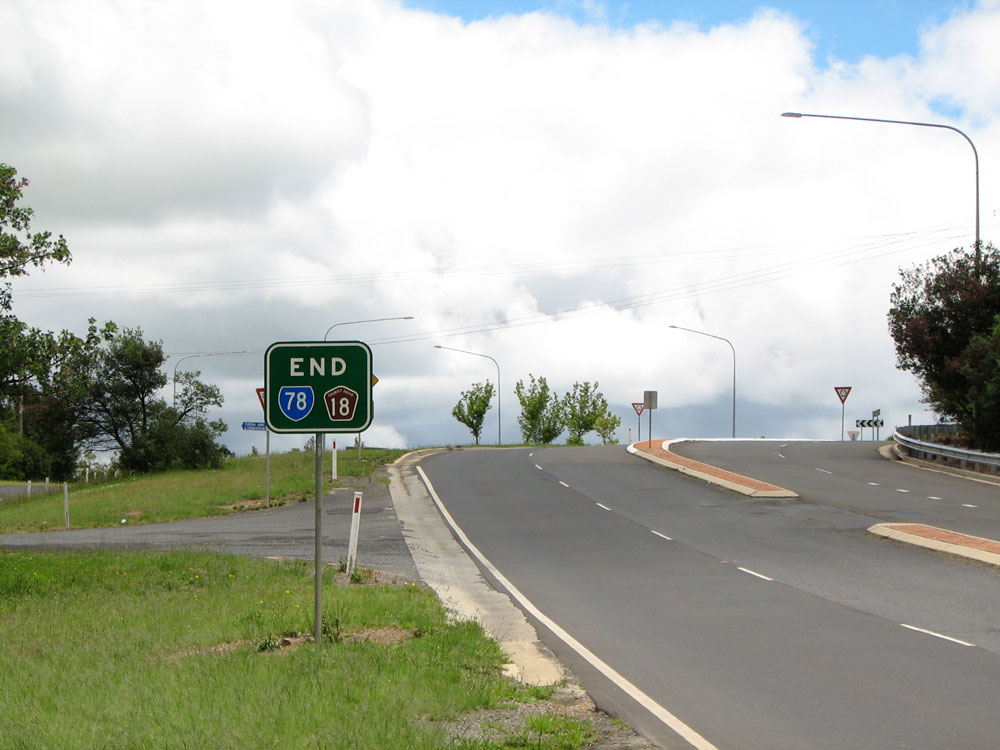 |
Rare 'END' sign eastbound on Waterfall Way at the junction with New England Highway, 5km southwest of Armidale City Centre. Photo taken: December 2008. |
 |
Waterfall Way (Uralla Road) looking west across Manns Gully, showing the ascent towards the junction with New England Highway. You can just make out the AD sign for the junction in the distance. |
 |
Remote focal point reinforcement sign, eastbound on Waterfall Way (Uralla Road) outside New England Girls School. These signs are used to assist navigation through complicated road layouts where the remote focal point might not always be shown on signs. Photo taken: December 2008. |
  |
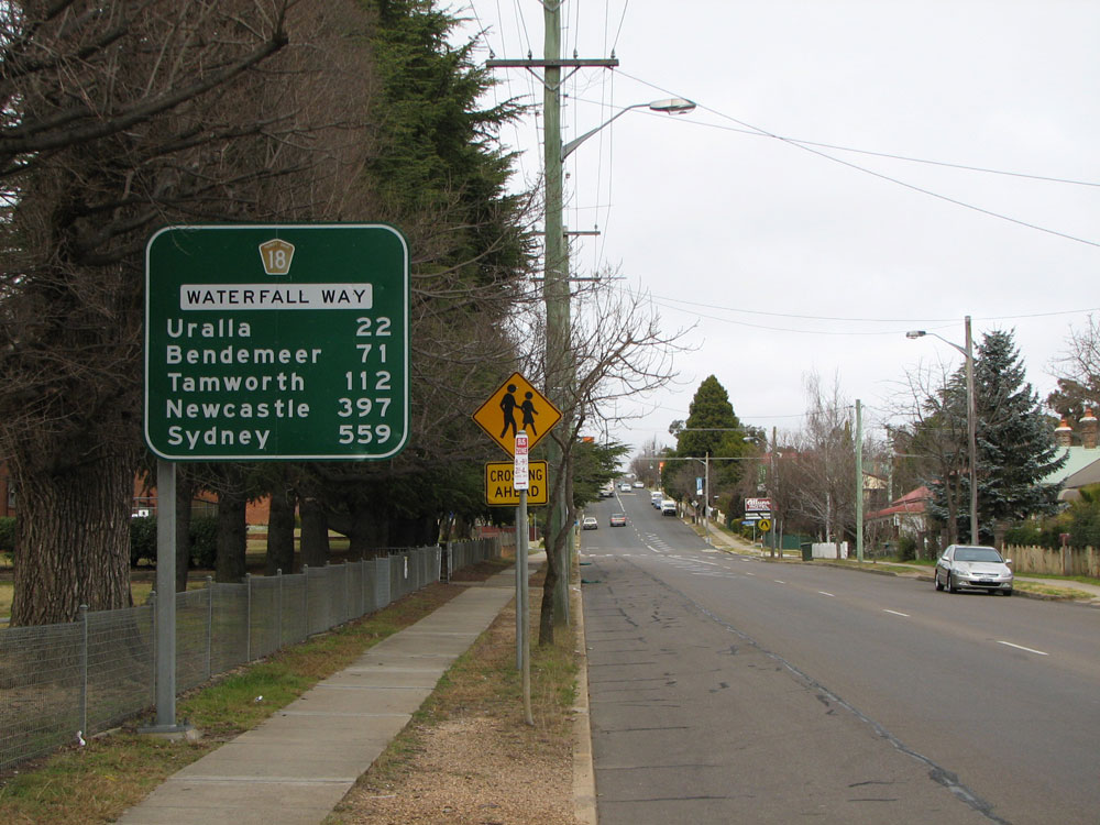
Old and new RD signs westbound on Waterfall Way (Uralla Road) near Miller Street, 3km west of Armidale City Centre. Note how the old sign incorrectly omits SR78! The old sign also retained the remote focal points of Newcastle and Sydney, harking back to when this section of road was part of the New England Highway. Top photo: July 2008. Bottom photo: December 2008. |
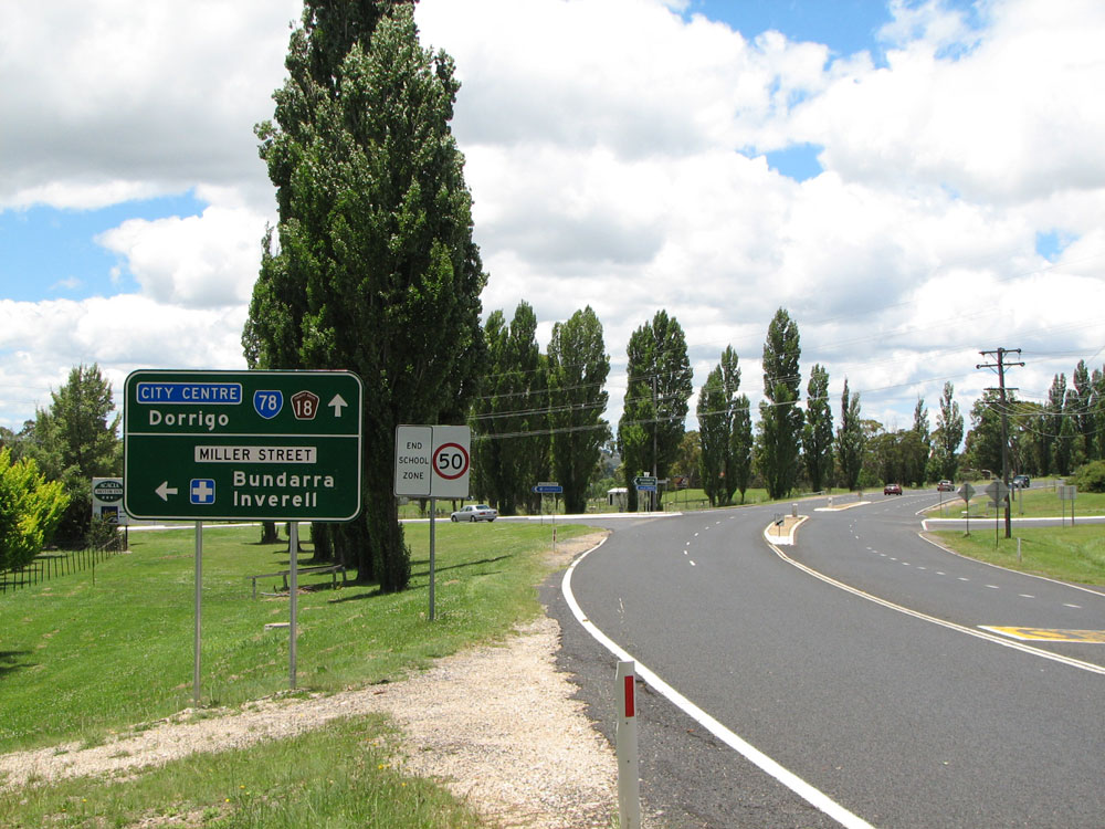 |
AD sign eastbound on Waterfall Way (Uralla Road) approaching the junction with Miller Street (Main Road No. 124), 3km west of Armidale City Centre. Photo taken: December 2008. |
 |
AD sign southbound on Miller Street approaching Waterfall Way. This sign was not updated during 2008 unlike most others and still omits SR78 and retains the former New England Highway focal point of Glen Innes. Photo taken: December 2008. |
 |
Waterfall Way (Kentucky Street) looking east towards Markham Street. Photo taken: December 2008. |
  |
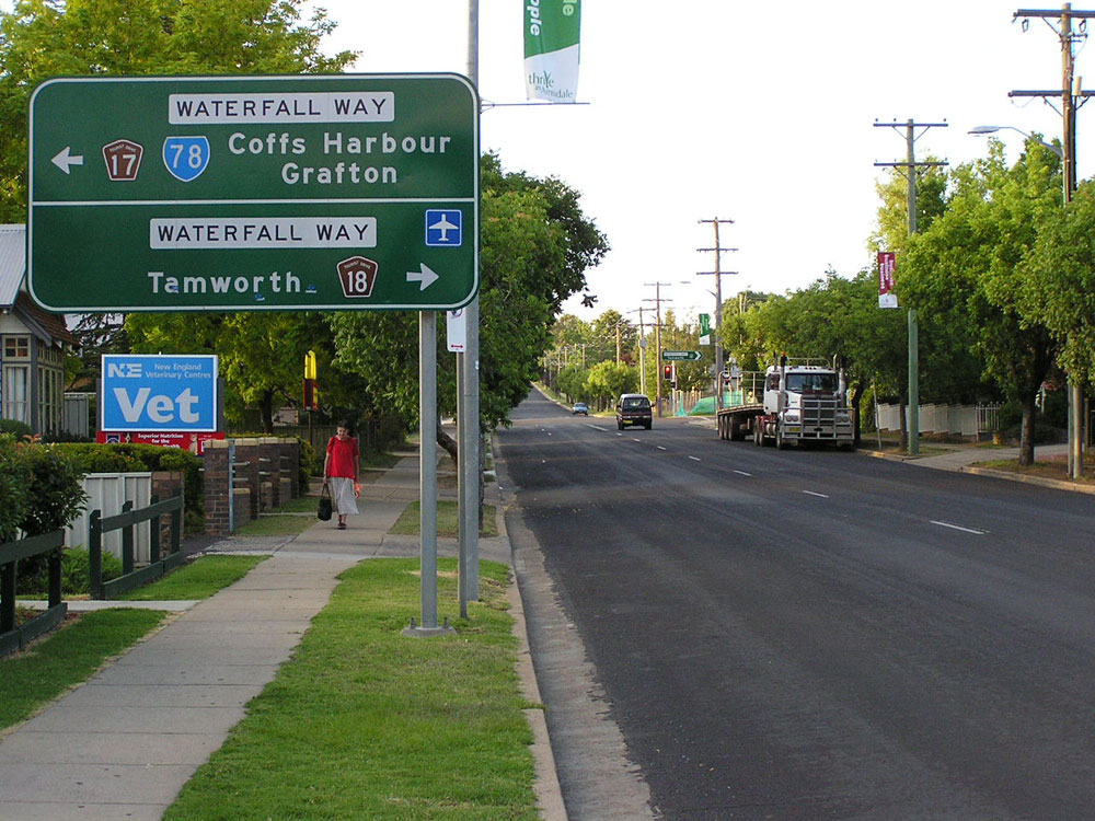
Old and new AD signs eastbound on Waterfall Way (Kentucky Street) approaching the junction with Memorial Avenue & O'Connor Road. Waterfall Way turns left here onto Dangar Street. Top photo: July 2008. Bottom photo: December 2008. |
 |
ID sign facing northbound traffic at the intersection of Waterfall Way, Memorial Avenue & O'Connor Road. Note the empty posts awaiting installation of a new sign. Also note how the old sign has the wrong focal point and no mention of either SR78 or TD18. Photo taken: July 2008. |
 |
RD sign southbound on Waterfall Way (Dangar Street) outside Armidale City Public School. This sign was removed and not replaced as part of the 2008 signposting improvement works. Note how it incorrectly omits SR78. Photo taken: July 2008. |
 |
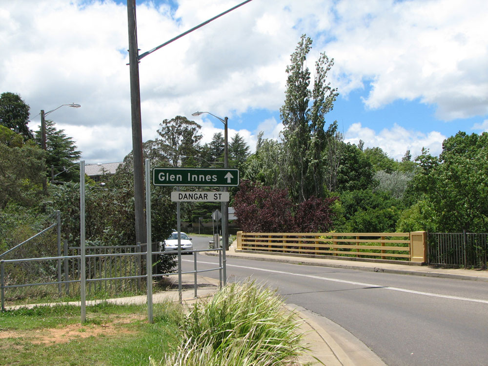
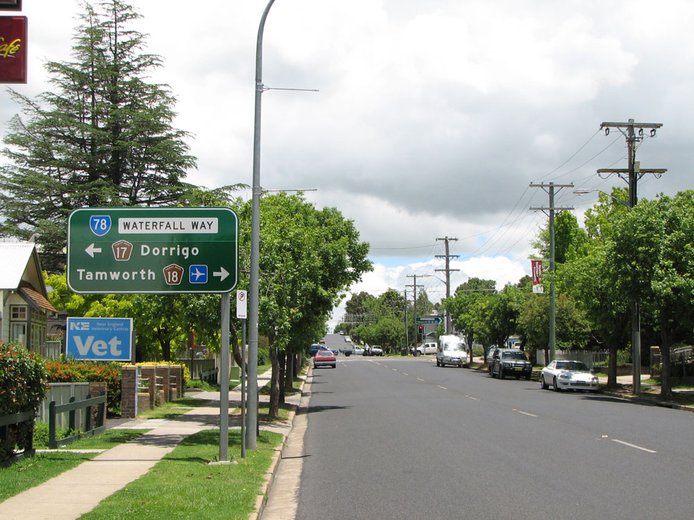
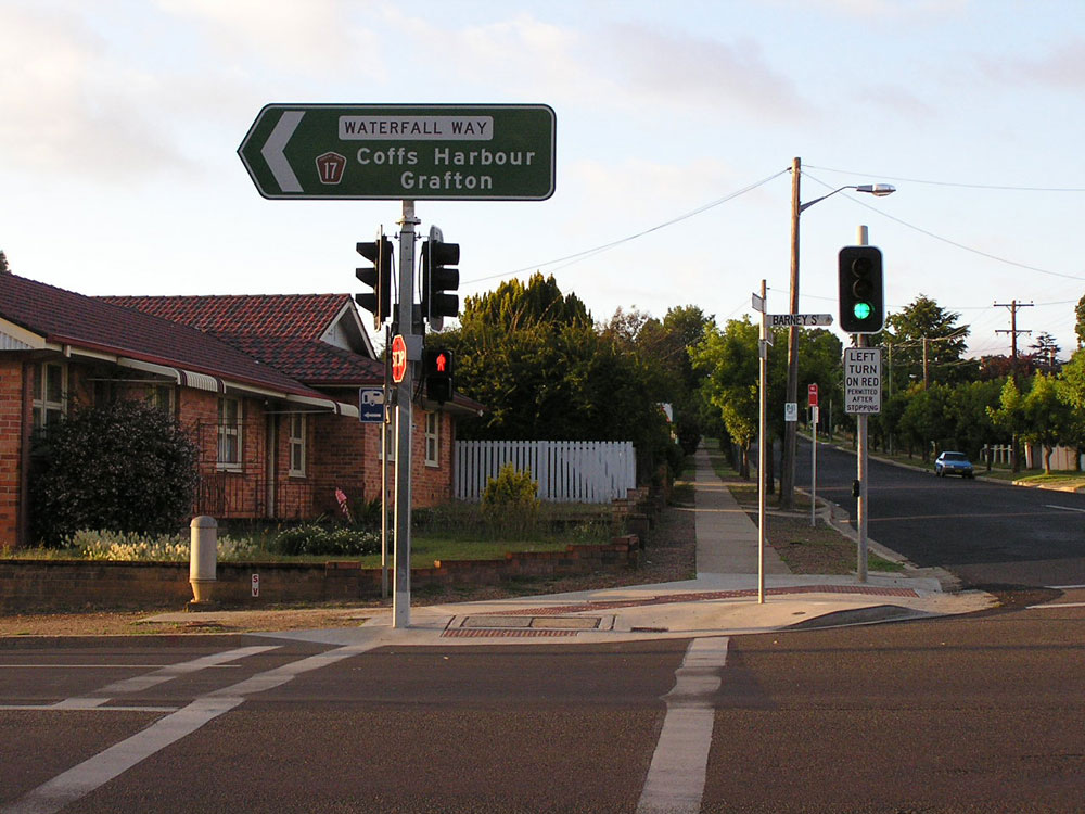
AD sign northbound on Waterfall Way approaching the intersection of Barney and Dangar Streets. Waterfall Way turns right here onto Barney Street. Photo taken: December 2008. |
 |
ID sign facing eastbound traffic at the intersection of Barney Street & Dangar Street, Armidale. This sign was replaced in 2008 - note how it omits reference to SR78. Photo taken: December 2008. |
  |
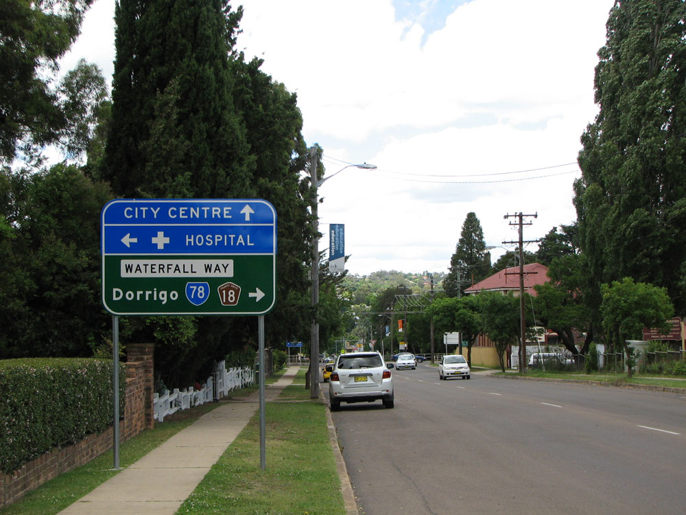
Old and new AD signs westbound on Waterfall Way (Barney Street) approaching the junction with Dangar Street, Armidale. Note how the old omits reference to SR78 and has the wrong colour patches for the hospital and city centre. Top photo: July 2008. Bottom photo: December 2008. |
  |
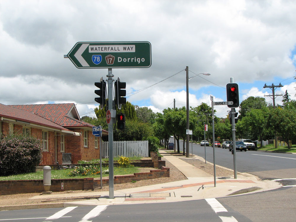
Old and new AD signs eastbound on Waterfall Way (Barney Street), approaching the junction with Marsh Street, Armidale. Note the change of focal points for SR78. Top photo: January 2005. Bottom photo: December 2008. |
  |
Old and new AD signs southbound on Marsh Street, approaching the junction with Waterfall Way (Barney Street), Armidale. Note how the old AD sign incorrectly omitted SR78 from the right turn panel. Top photo: January 2005. Bottom photo: December 2008. |
  |
Old and new ID signs at the intersection of Waterfall Way (Barney Street) & Marsh Street, Armidale. Note how the old sign incorrectly omitted reference to SR78. Top photo: January 2005. Bottom photo: December 2008. |
  |
Old and new ID signs at the intersection of Waterfall Way (Barney Street) & Marsh Street, Armidale. Note the change in focal points and how the old ID sign omitted SR78, despite the old AD sign showing it! Also note the dodgy placement of the road name patch on the new ID sign. Top photo: January 2005. Bottom photo: December 2008. |
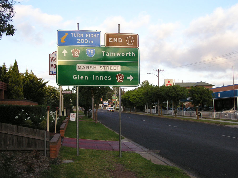  |
Old and new AD signs westbound on Waterfall Way (Barney Street) approaching Marsh Street, Armidale. The old AD sign correctly showed SR78 continuing straight ahead, and was prepared for changeover to alpha-numeric route marking. One wonders why it was replaced, with a sign that is not prepared for the changeover! Also note removal of the 'END TD17' sign. Top photo: January 2005. Bottom photo: December 2008. |
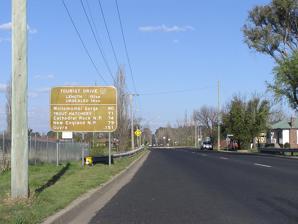 |
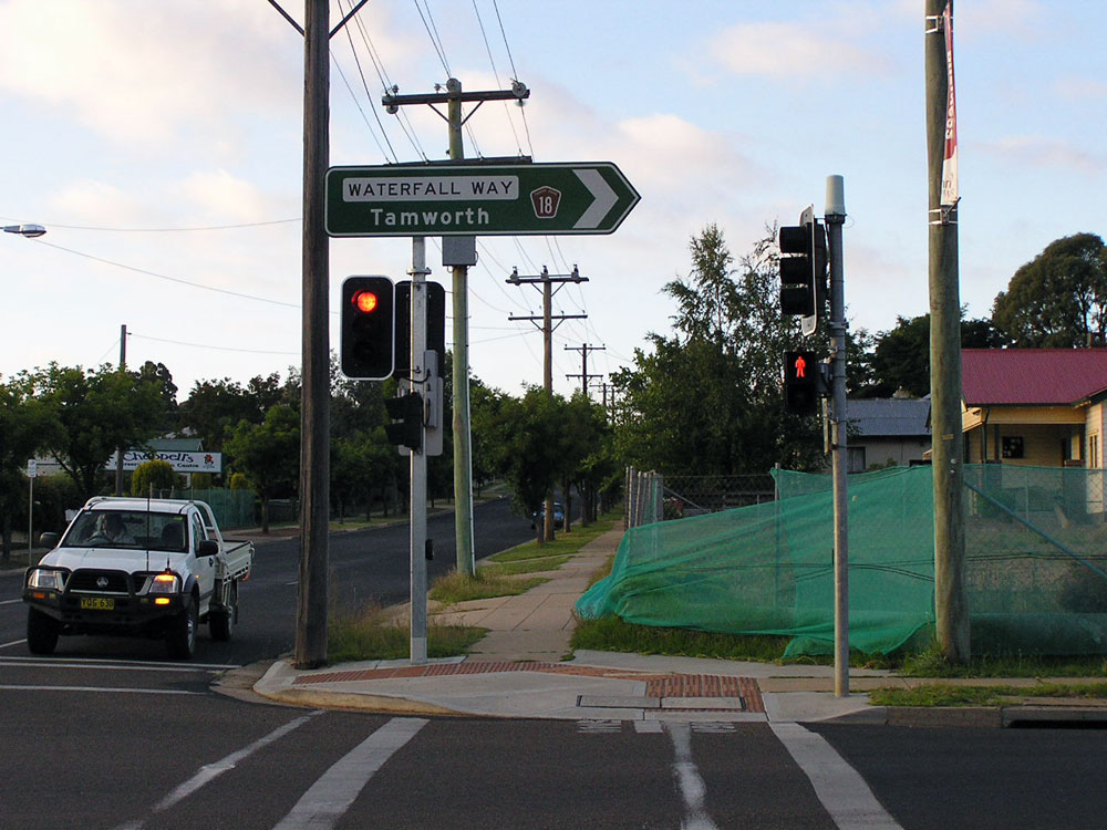
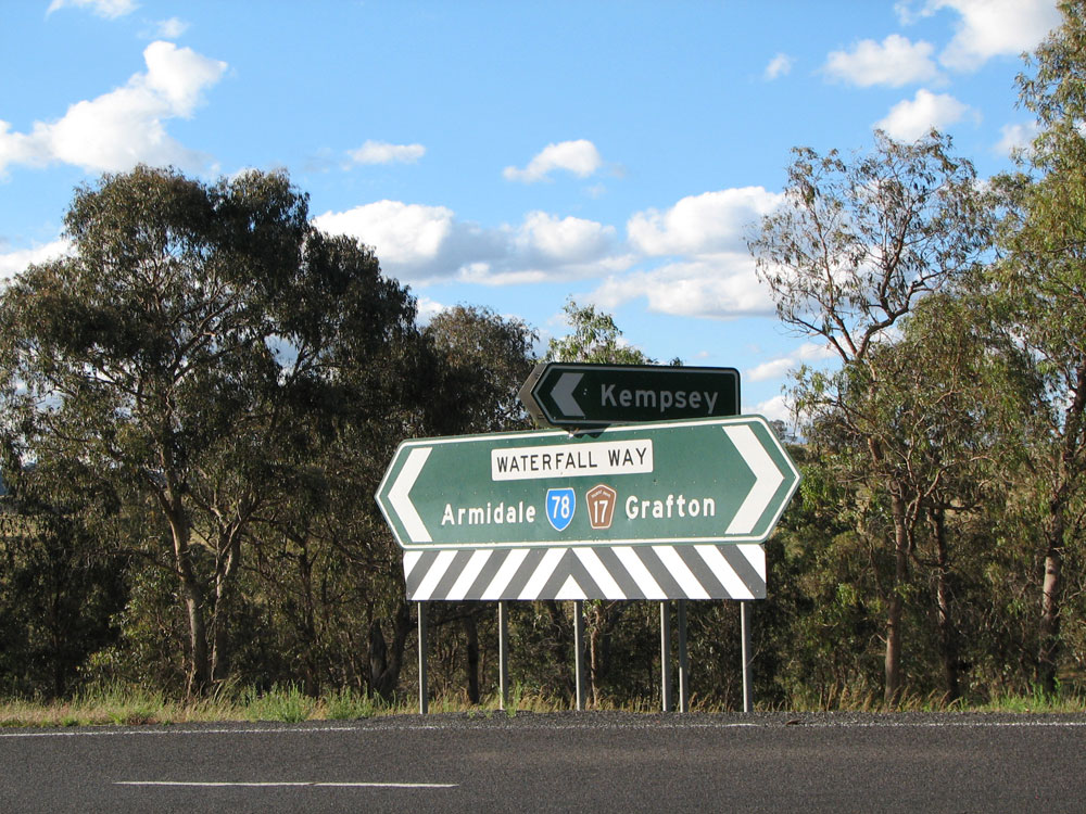
Waterfall Way (Barney Street) looking east towards the Canambe Street intersection, Armidale, showing the RD sign for Tourist Drive 17. This route follows SR78 to near Ebor, before heading west to Guyra. Photo taken: October 2007. |
 |
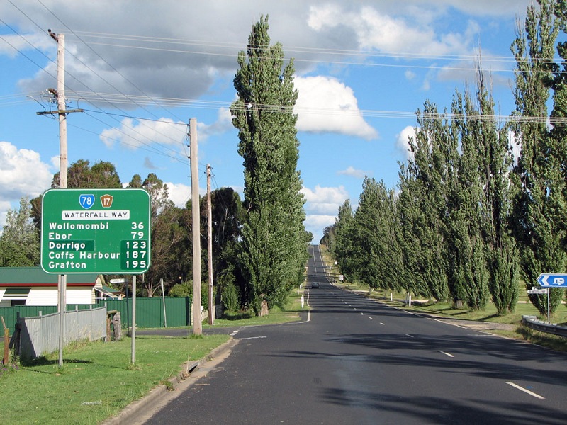
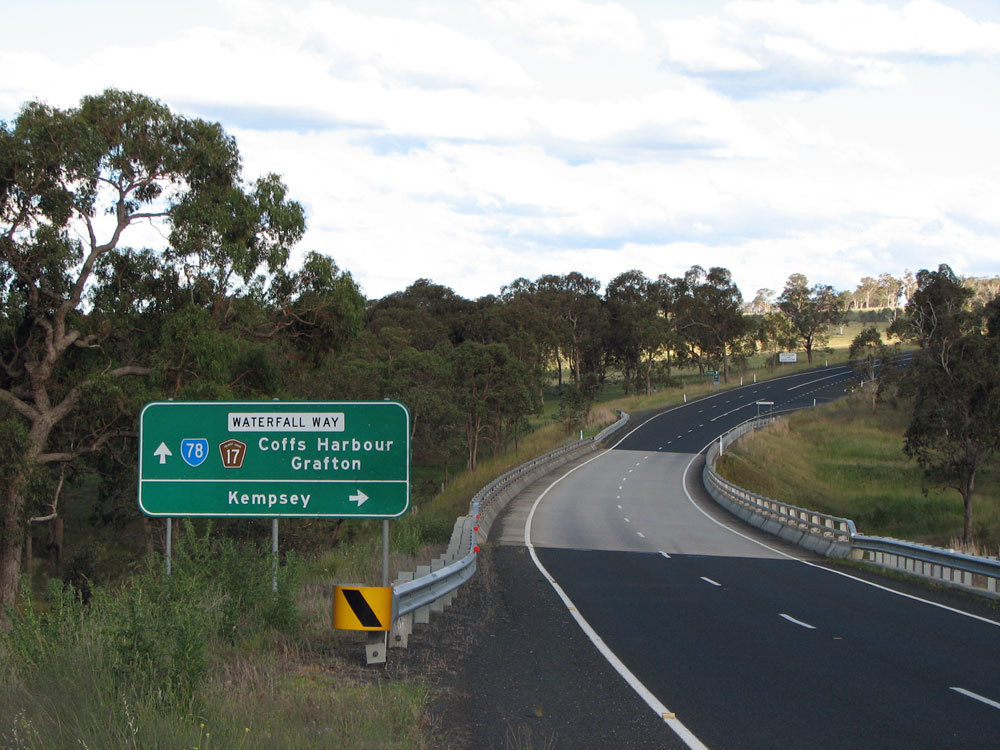
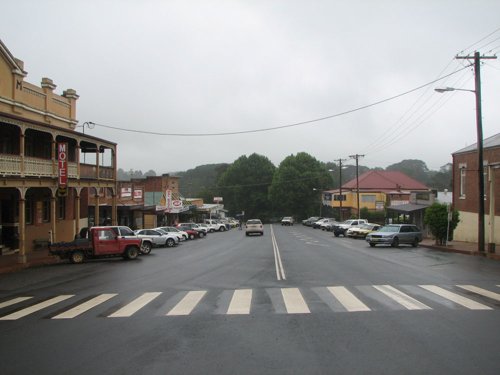
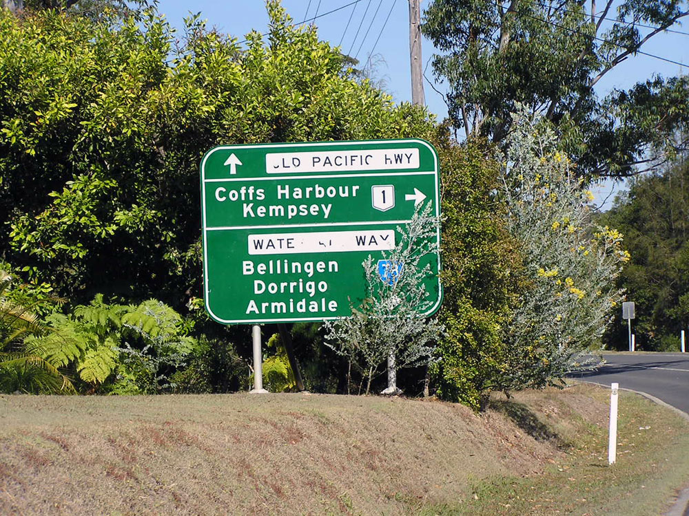
Waterfall Way looking east on the eastern outskirts of Armidale. Note the coverplates - Dorrigo covers Kempsey, which was covered in anticipation of the decommissioning of Main Road No. 75 between Wollomombi and Bellbrook. Photo taken: December 2008. |
 |
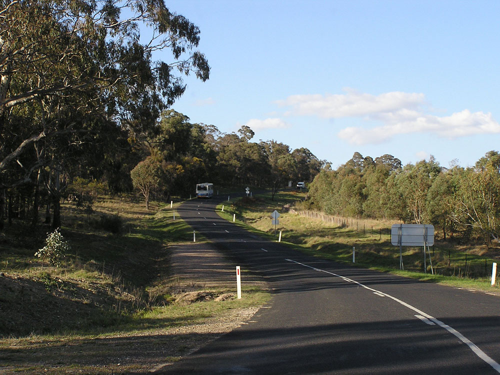
Waterfall Way looking east, 4km east of Armidale. Note the original route of the road which is visible skirting the southern side of the hill. Photo taken: December 2008. |
 |
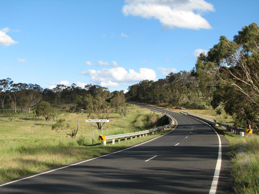
Old black kilometre plate, looking east on Waterfall Way at the start of the Commissioners Waters deviation, 6km east of Armidale. Photo taken: October 2007. |
 |
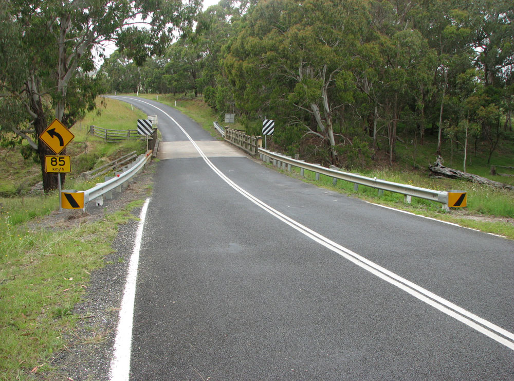
Waterfall Way looking east across the bridge over Commissioners Waters, 6.5km east of Armidale. Photo taken: December 2008. |
 |
Waterfall Way looking east towards the junction with Gara Road as you ascend after crossing Commissioners Waters, 7km east of Armidale. Photo taken: October 2007. |
 |
Waterfall Way looking east across Burying Ground Creek, 9km east of Armidale. Photo taken: October 2007. |
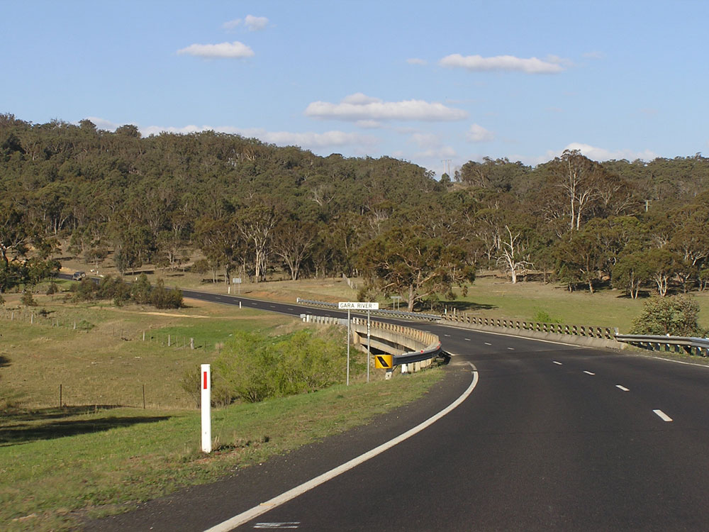 |
Waterfall Way looking east towards the bridge over Gara River, 14km east of Armidale. Photo taken: October 2007. |
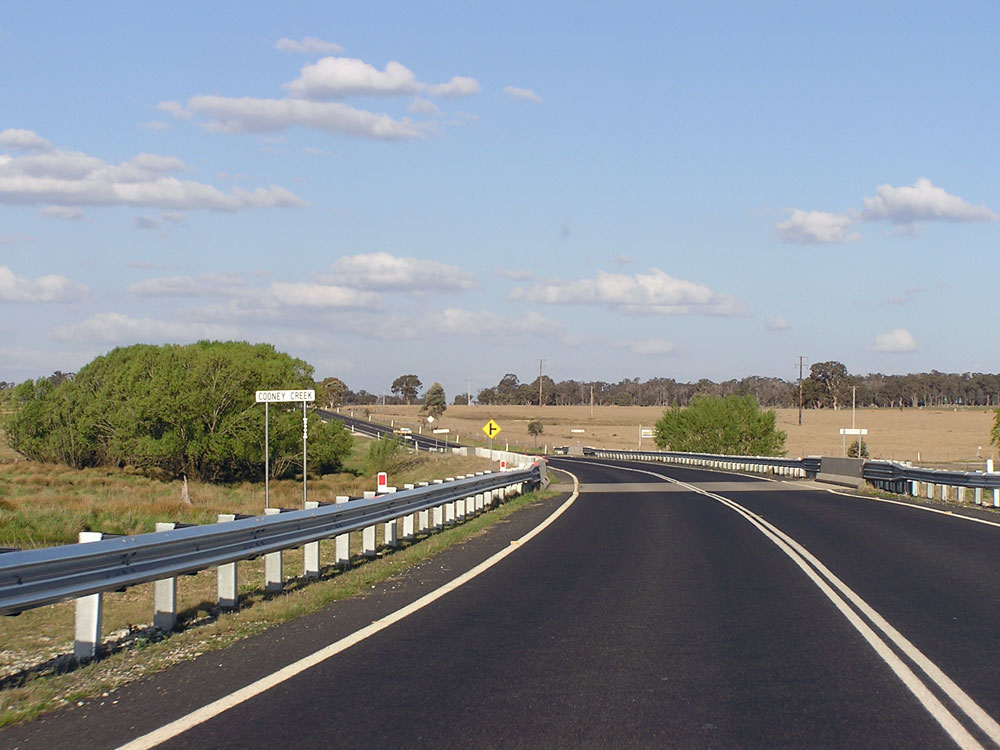 |
Waterfall Way looking east across Cooney Creek, near the junction with Metz Road, 19km east of Armidale. Photo taken: October 2007. |
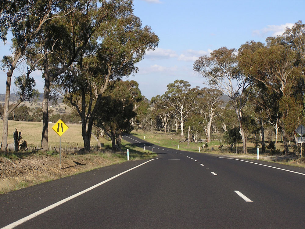 |
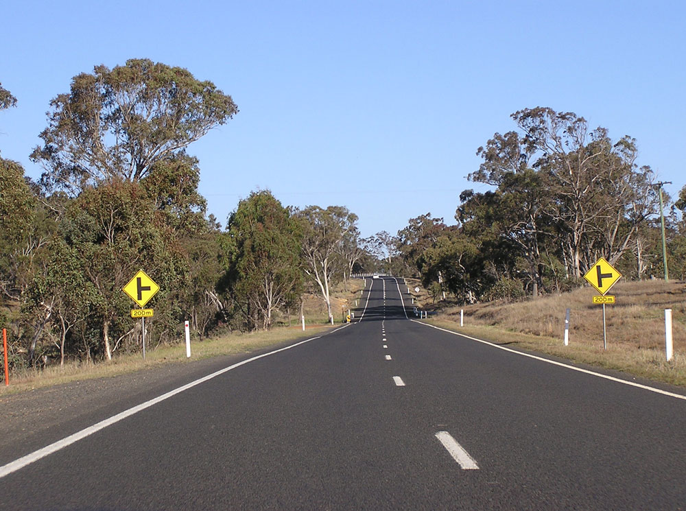
Waterfall Way looking east as the road narrows, showing the typical 'Main Road' road standard in NSW, 22km east of Armidale. Photo taken: October 2007. |
 |
Fingerboard sign assembly at the intersection of Waterfall Way & Old Hillgrove Road, 22km east of Armidale. Photo taken: October 2007. |
 |
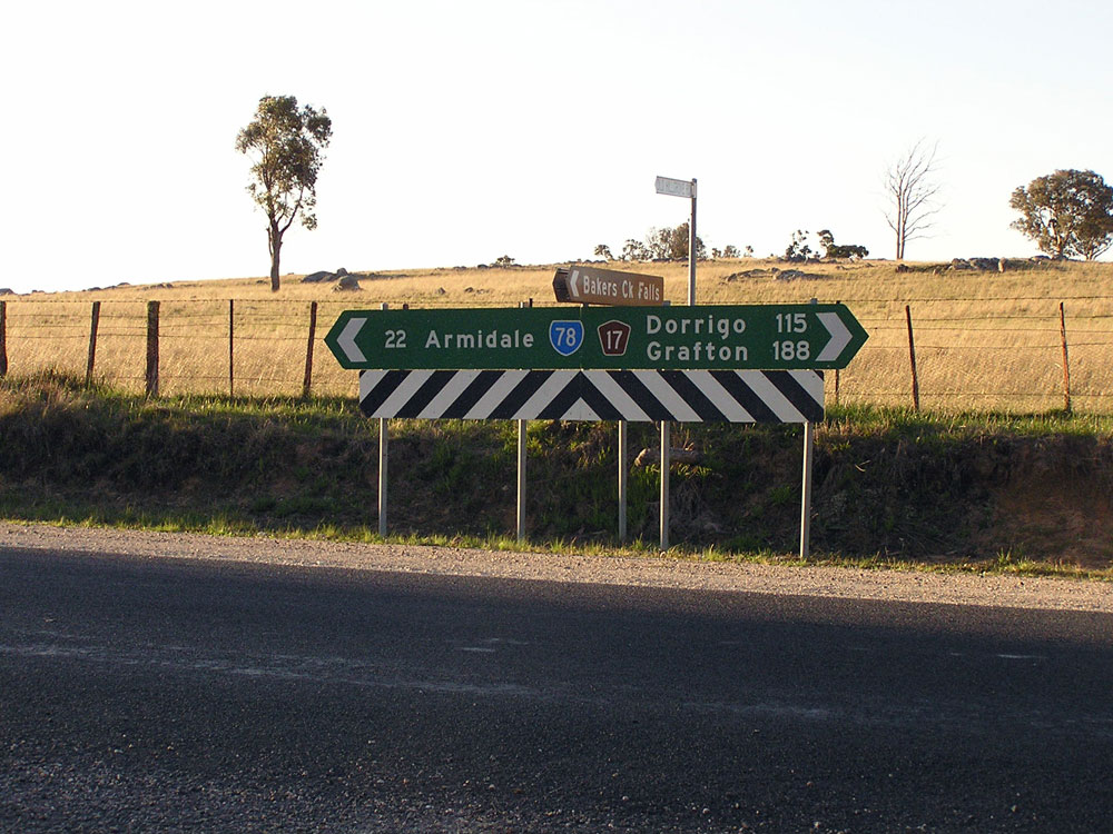
Waterfall Way looking east towards the bridge over Bakers Creek, 25km east of Armidale. Photo taken: December 2008. |
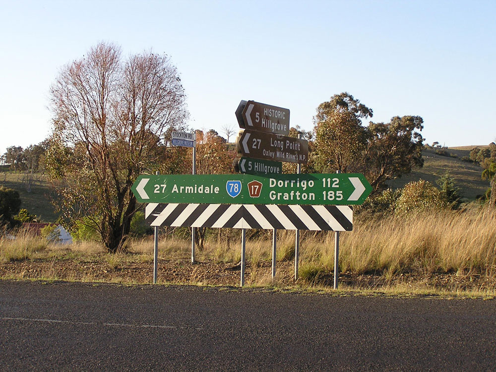 |
Fingerboard sign assembly at the intersection of Waterfall Way & Stockton Road, 27km east of Armidale. Photo taken: October 2007. |
 |
Waterfall Way looking east at the beginning of the descent to the bridge over Four Mile Creek, 30km east of Armidale. Photo taken: October 2007. |
 |
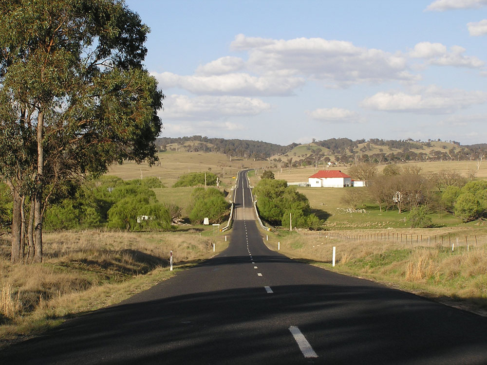
Waterfall Way looking east across the bridge over Four Mile Creek, 31km east of Armidale. This bridge was replaced in 2010. Photo taken: December 2008. |
 |
Waterfall Way looking east as you ascend from the bridge over Four Mile Creek, 31km east of Armidale. Photo taken: December 2008. |
 |
Waterfall Way looking east across the bridge over St Helena Creek, 34km east of Armidale. Photo taken: December 2008. |
 |
Waterfall Way looking east towards the crossing of Green Gully, 36km east of Armidale. Photo taken: December 2008. |
 |
Waterfall Way looking east the junction with Wollomombi Falls Road, 38km east of Armidale. Note the old alignment branching off to the left here, leading to the old bridge over the Wollomombi River. Photo taken: December 2008. |
 |
Waterfall Way looking east towards the bridge over the Wollomombi River at Wollomombi, 39km east of Armidale. Photo taken: October 2007. |
 |
Dodgy service signage eastbound on Waterfall Way approaching the junction with the original alignment of Waterfall Way at Wollomombi. Photo taken: October 2007. |
 |
Non-standard ID sign at the junction of Waterfall Way & its old alignment at Wollomombi. Photo taken: October 2007. |
 |
Waterfall Way looking east across the bridge over Chandler River at Wollomombi with the junction with Armidale-Kempsey Road in the background. Note how the focal points on this sign have not been updated to reflect the new signage through Armidale. Photo taken: December 2008. |
 |
ID sign assembly at the intersection of Waterfall Way & Armidale-Kempsey Road at Wollomombi. Following the recent road classification review, Armidale-Kempsey Road was decommissioned and is now only a local road. It still provides an interesting drive through sparsely populated country into the Maclaey River valley. Photo taken: December 2008. |
 |
RD sign eastbound on Waterfall Way after the junction with Armidale-Kempsey Road at Wollomombi. Note no reference to Dorrigo! Photo taken: December 2008. |
 |
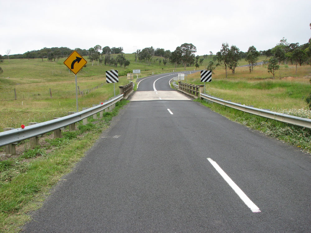
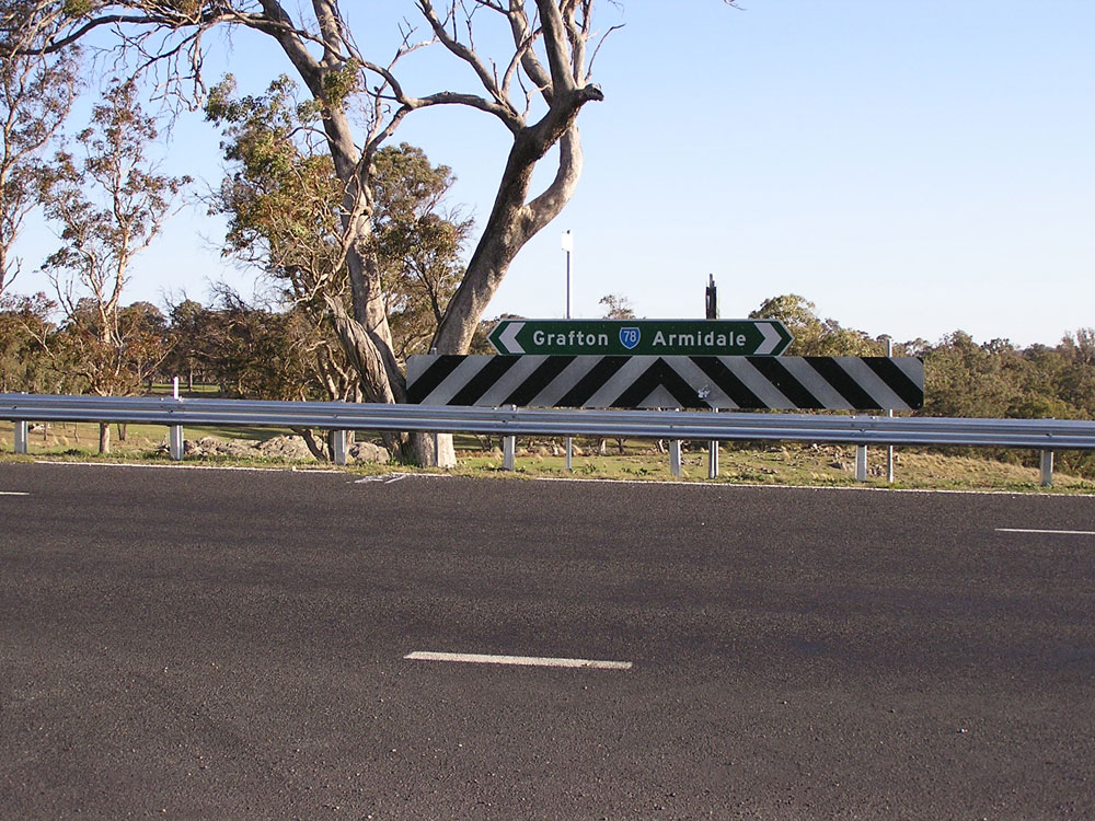
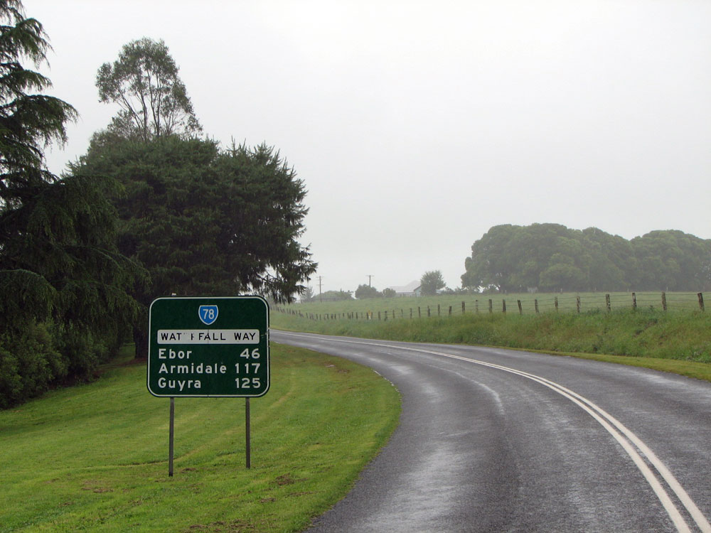
ID sign assembly at the junction of Waterfall Way & Armidale Road (Main Road No. 74), 9km northeast of Ebor. Waterfall Way turns to the east here. Photo taken: December 2008. |
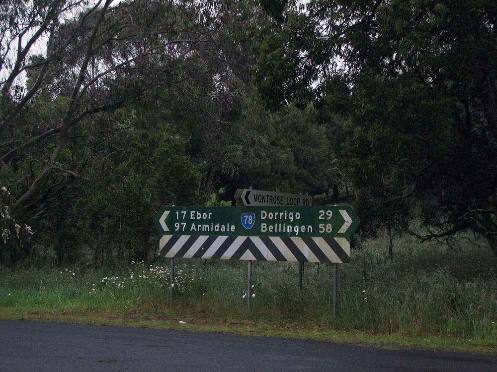 |
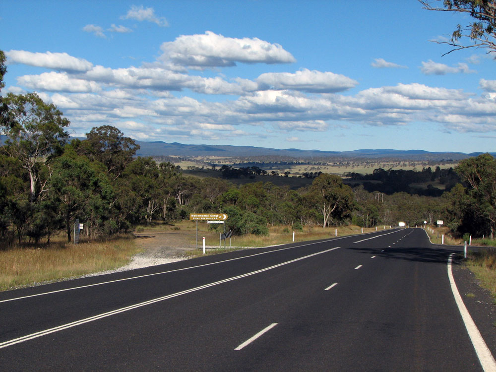
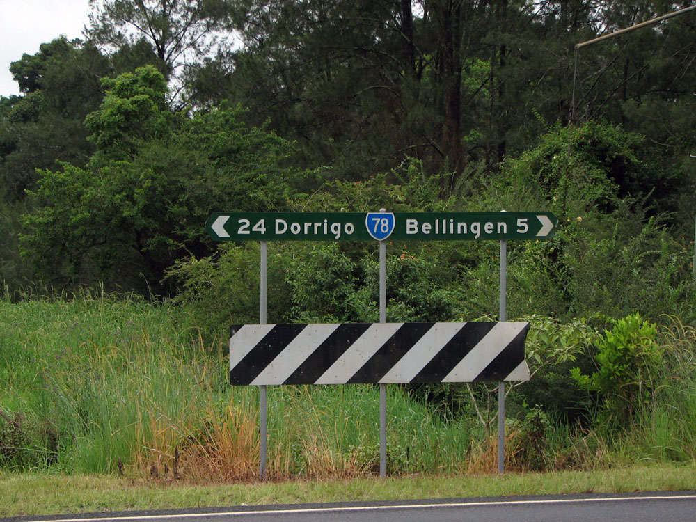
Fingerboard sign at the intersection of Waterfall Way & Montrose Loop Road, 33km west of Dorrigo. Take special note of the distance shown on the sign - they are one of several which are incorrect in this area. Photo taken: December 2008. |
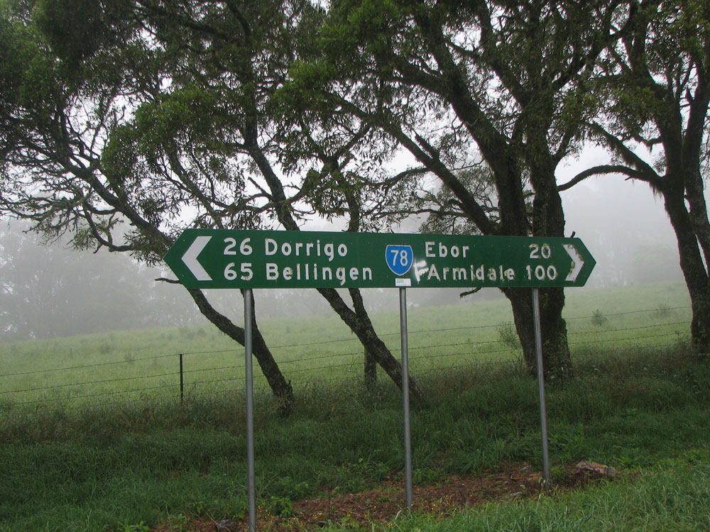 |
Fingerboard sign strangely located on a curve, not an intersection, 26km west of Dorrigo. Note that, despite travelling east since the last sign, Bellingen has gotten further away! Photo taken: December 2008. |
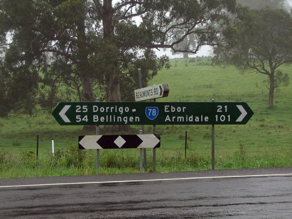 |
Fingerboard sign at the intersection of Waterfall Way & Beaumonts Road, 25km west of Dorrigo. Surprisingly the distance to Dorrigo is correct, but notice how Bellingen was 65km on the previous sign and now it is 54km! Photo taken: December 2008. |
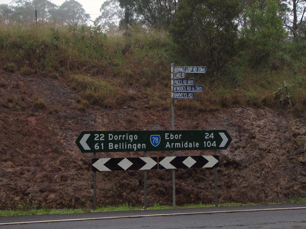 |
Fingerboard sign at the intersection of Waterfall Way & the western end of Deer Vale Road, 22km west of Dorrigo. Note that Bellingen is again apparently further away than on the previous sign - facepalm! Photo taken: December 2008. |
 |
Fingerboard sign at the intersection of Waterfall Way & the eastern end of Deer Vale Road, 5km west of Dorrigo. Note the fog! Photo taken: December 2008. |
 |
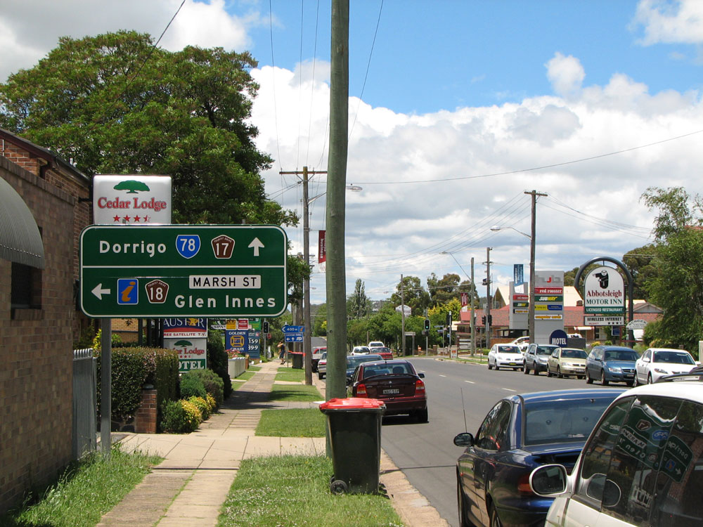
RD sign with the road name patch peeling off, heading west from Dorrigo. Photo taken: December 2008. |
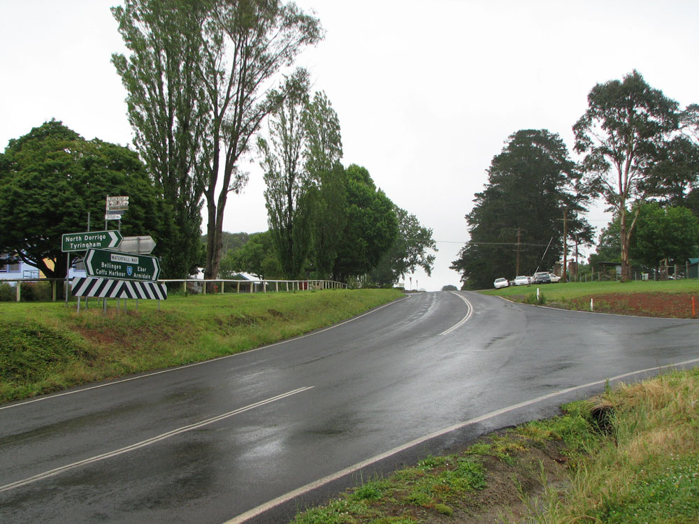 |
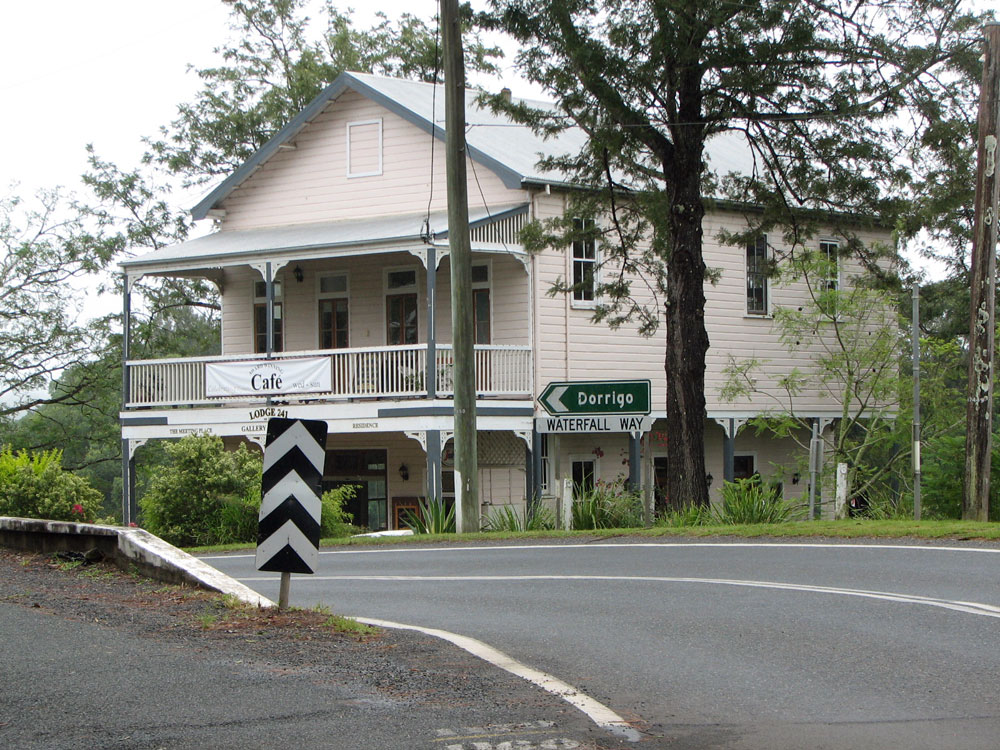
Waterfall Way looking west through the intersection with Rosewood Street at Dorrigo. Photo taken: December 2008. |
 |
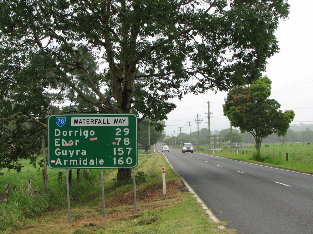
AD sign westbound on Waterfall Way approaching the bridge over Bielsdown River and the junction with Rosewood Street at Dorrigo. Note the incorrect route numbers! Photo taken: December 2008. |
 |
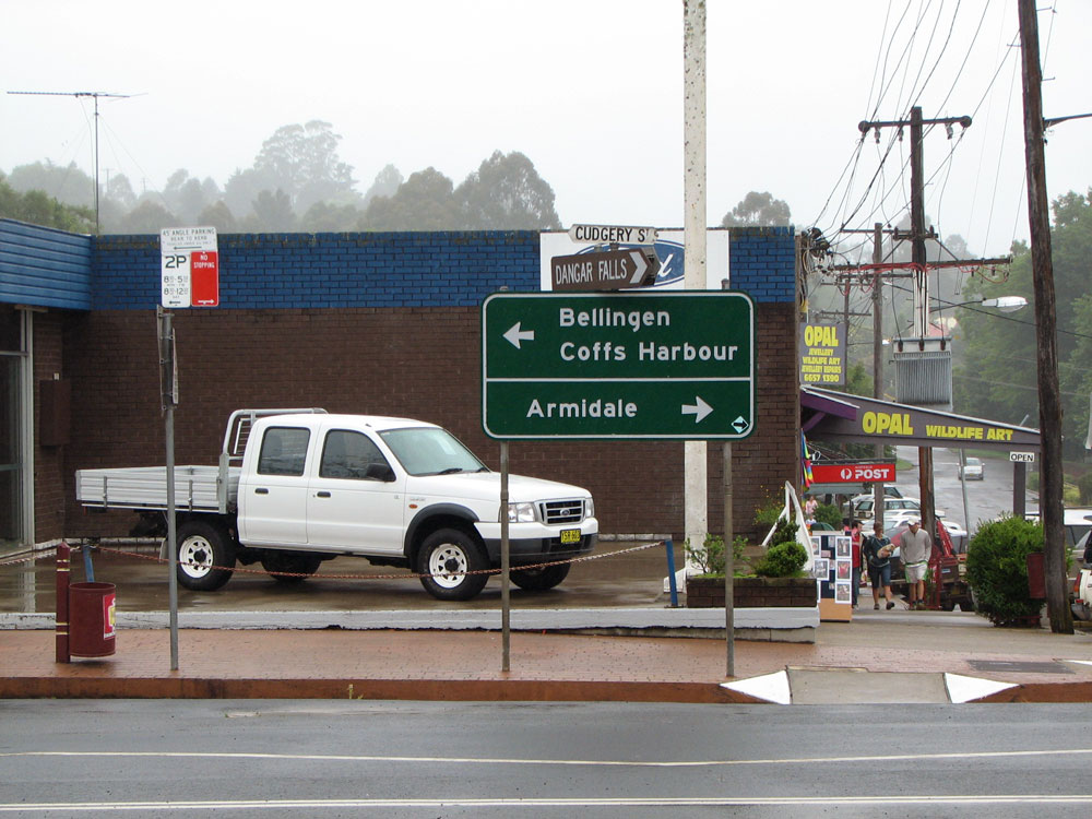
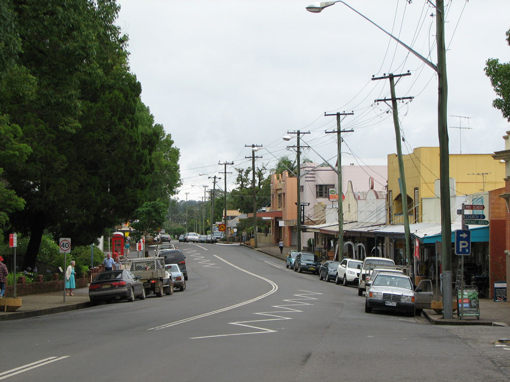
Waterfall Way (Cudgery Street) looking west through Dorrigo town centre from the junction with Hickory Street. Photo taken: December 2008. |
 |
Dodgy AD sign acting as an ID sign at the intersection of Waterfall Way (Cudgery Street) & Hickory Street, Dorrigo. Note the absence of route markers. Photo taken: December 2008. |
 |
Waterfall Way (Cudgery Street) looking west towards the junction with Hickory Street at Dorrigo. Photo taken: December 2008. |
 |
Waterfall Way (Cudgery Street) looking east towards Myrtle Street, Dorrigo. Waterfall Way makes a right turn here. Photo taken: December 2008. |
 |
ID sign northbound on Waterfall Way (Myrtle Street) approaching Cudgery Street, Dorrigo. Photo taken: December 2008. |
 |
RD sign southeastbound on Waterfall Way (Karabin Street) as you leave Dorrigo. Photo taken: December 2008. |
 |
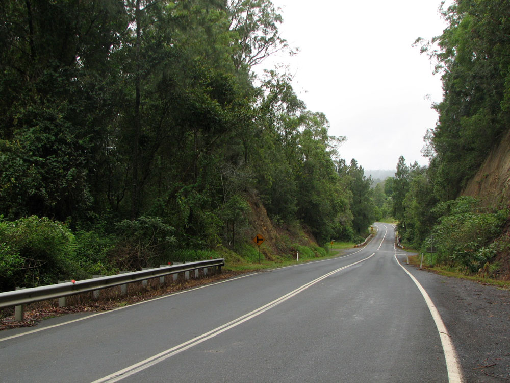
Waterfall Way looking west from the junction with Dome Road, 2km east of Dorrigo. Photo taken: December 2008. |
 |
Dodgy fingerboard sign assembly at the intersection of Waterfall Way & Dome Road, 2km east of Dorrigo. Photo taken: December 2008. |
 |
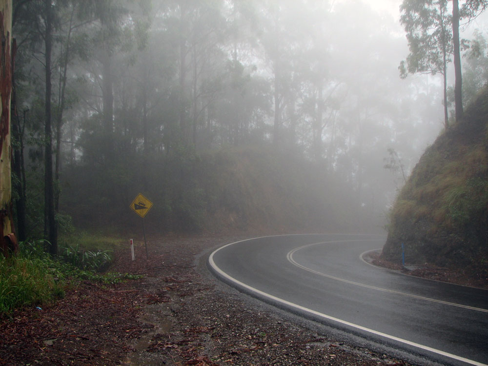
Waterfall Way looking east into thick fog on approach to Dorrigo Mountain, 4km east of Dorrigo. Photo taken: December 2008. |
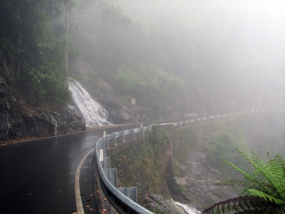 |
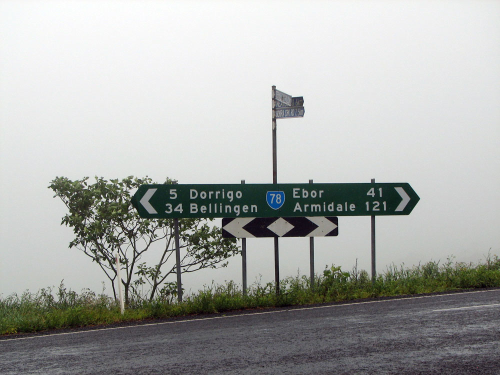
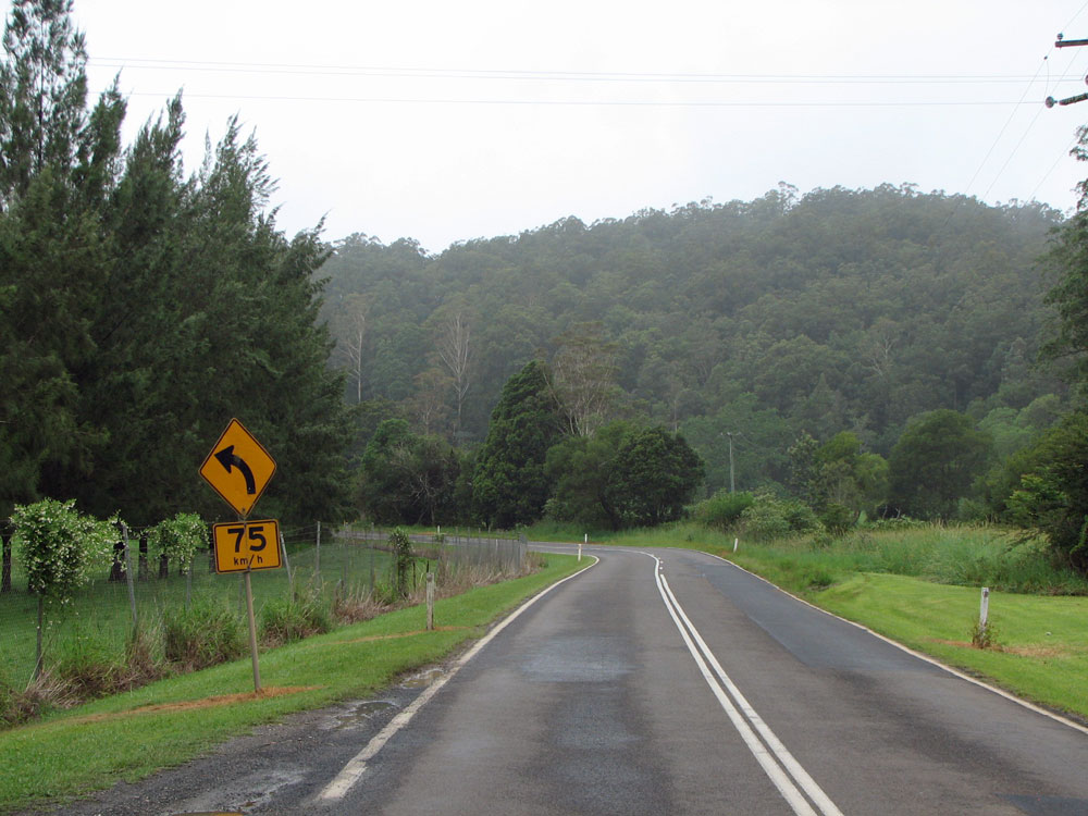
Waterfall Way looking north across the single-lane section at Newell Falls on the way down Dorrigo Mountain, 8.5km east of Dorrigo. Photo taken: December 2008. |
 |
Waterfall Way looking south through the thick fog as you descend Dorrigo Mountain, 9km east of Dorrigo. Note the old road alignment branching off to the left whilst the current alignment cuts through the mountain to ease the curve. Photo taken: December 2008. |
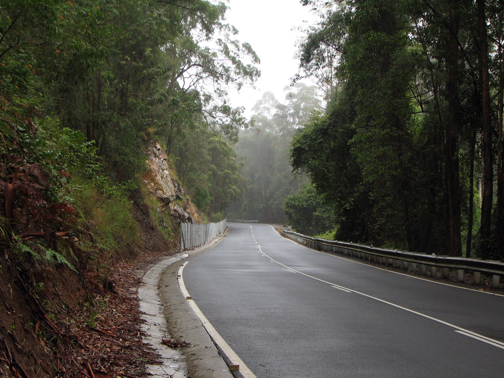 |
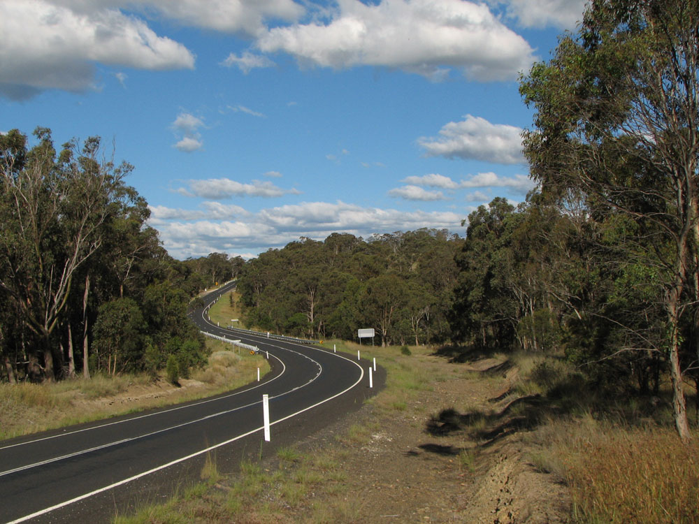
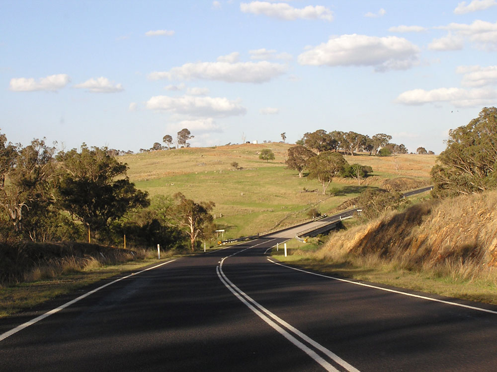
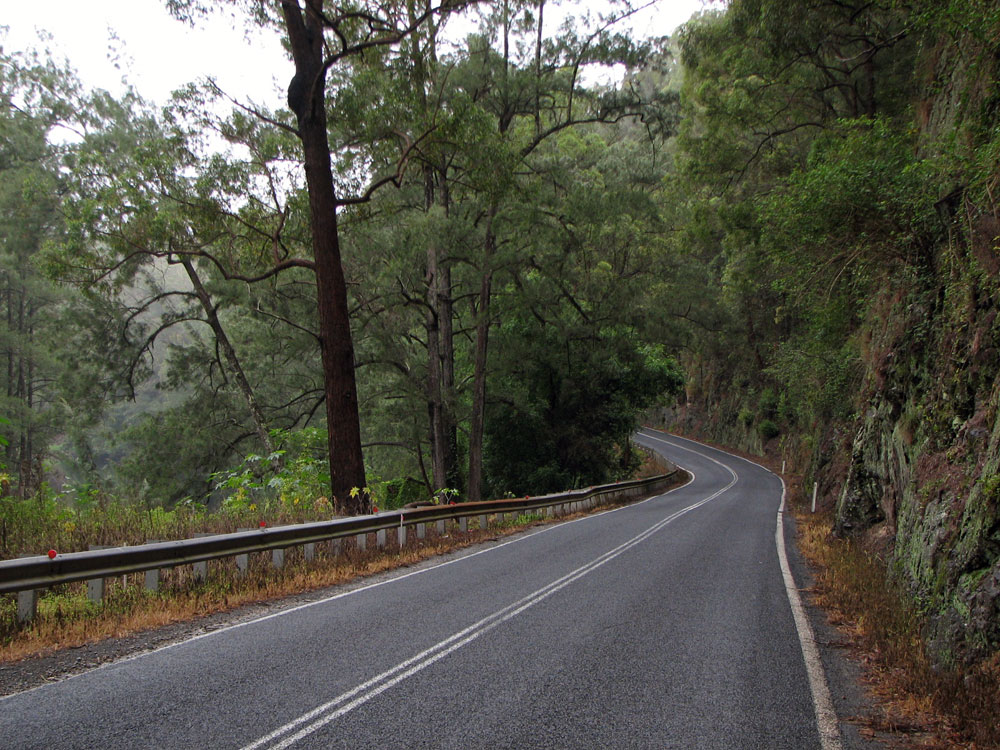
Waterfall Way looking east near the bottom of Dorrigo Mountain, 12km east of Dorrigo. This section was recently reconstructed following a landslide in 2007. Photo taken: December 2008. |
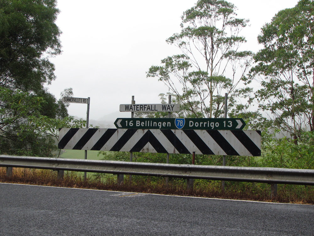 |
Well-designed fingerboard sign at the intersection of Waterfall Way & Summervilles Road, 13km east of Dorrigo. Photo taken: December 2008. |
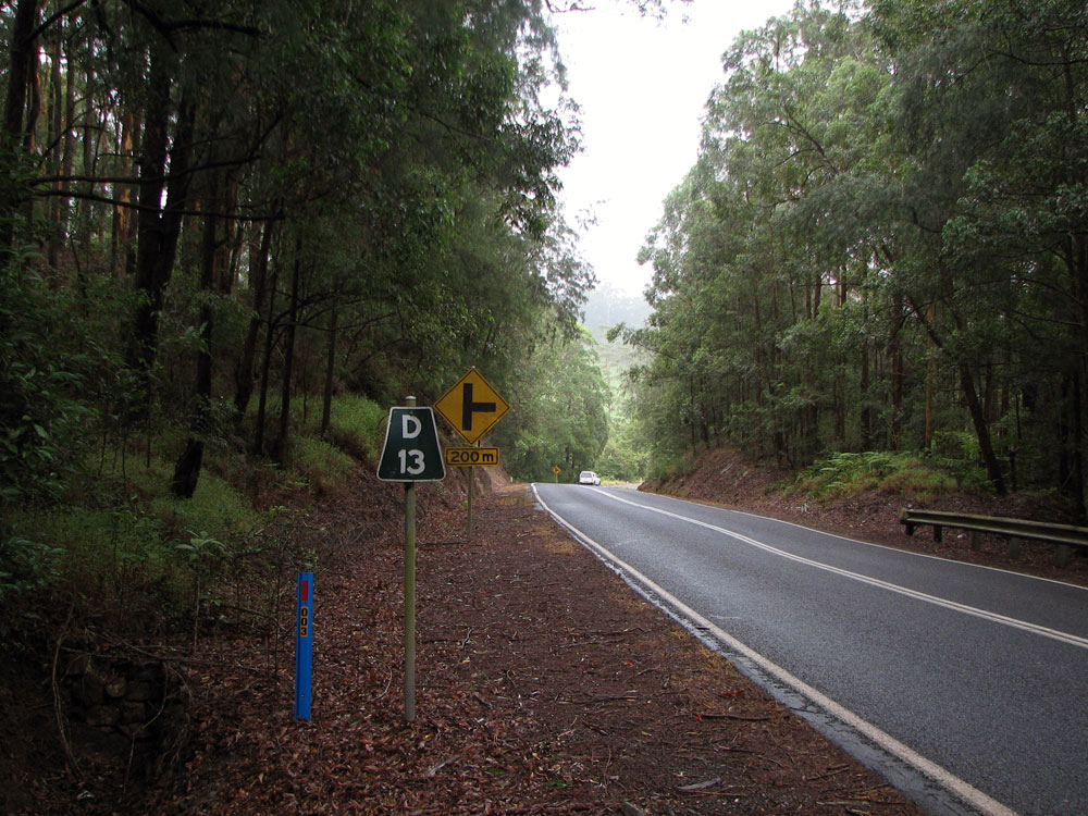 |
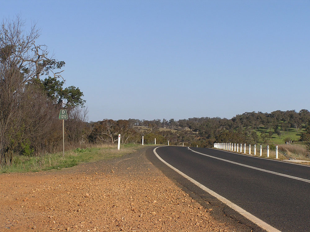
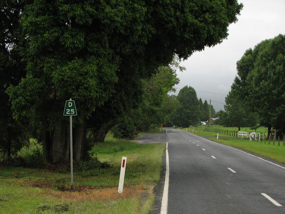
'D13' kilometre plate westbound on Waterfall Way approaching the junction with Summervilles Road. This section of Waterfall Way up Dorrigo Mountain has kilometre plates every kilometre rather than the typical 5km spacing. Photo taken: December 2008. |
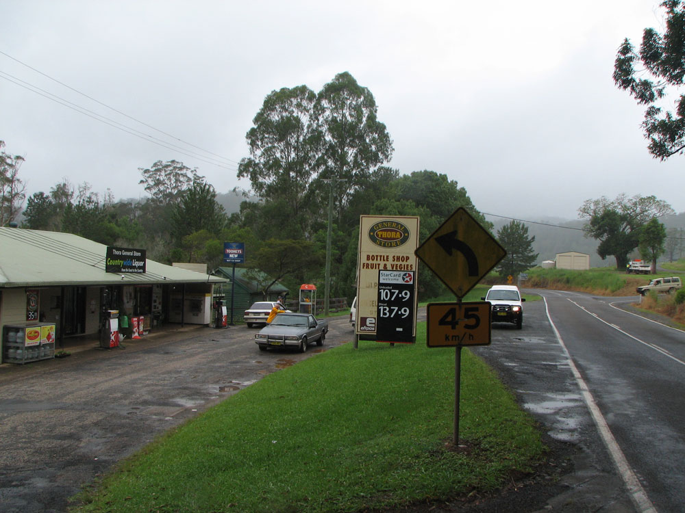 |
Waterfall Way looking east at the Thora General Store, on approach to the high-level bridge over the Bellinger River at Thora. Photo taken: December 2008. |
 |
Waterfall Way looking west towards the high-level bridge over the Bellinger River at Thora, 15km east of Dorrigo. Photo taken: December 2008. |
 |
Waterfall Way looking west through the Bellinger River valley, 18km east of Dorrigo. Photo taken: December 2008. |
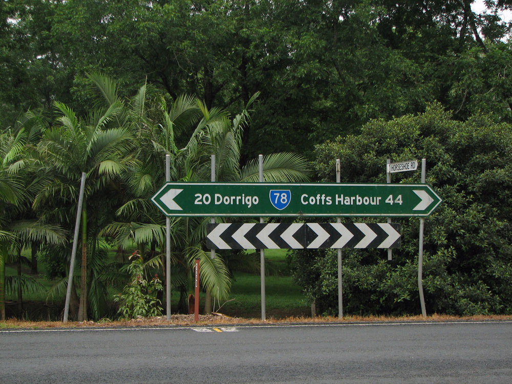 |
Dodgy fingerboard sign at the intersection of Waterfall Way & Horseshoe Road, 20km east of Dorrigo. Note the reference to Coffs Harbour rather than Bellingen, which is shown on all other signs. Photo taken: December 2008. |
 |
Waterfall Way looking east through the Gordonville Cutting where the road squeezes between Wattle Hill and the Bellinger River. Photo taken: December 2008. |
 |
Waterfall Way looking south towards the bridge over Boggy Creek, 24km east of Dorrigo. Photo taken: December 2008. |
 |
Perfectly designed fingerboard sign at the junction of Waterfall Way & Mahers Road, Boggy Creek, 24km east of Dorrigo. Photo taken: December 2008. |
 |
Waterfall Way looking west through the Bellinger River valley between Bellingen and Boggy Creek, 25km east of Dorrigo. Photo taken: December 2008. |
 |
Dodgy RD sign westbound on Waterfall Way at the western edge of Bellingen. Note how Guyra is shown as 3km closer than Armidale, yet on the RD sign leaving Dorrigo, Guyra is shown as 8km further! Photo taken: December 2008. |
 |
Dodgy ID sign missing the SR78 route marker at the junction of Waterfall Way & Coronation Street, Bellingen. Photo taken: December 2008. |
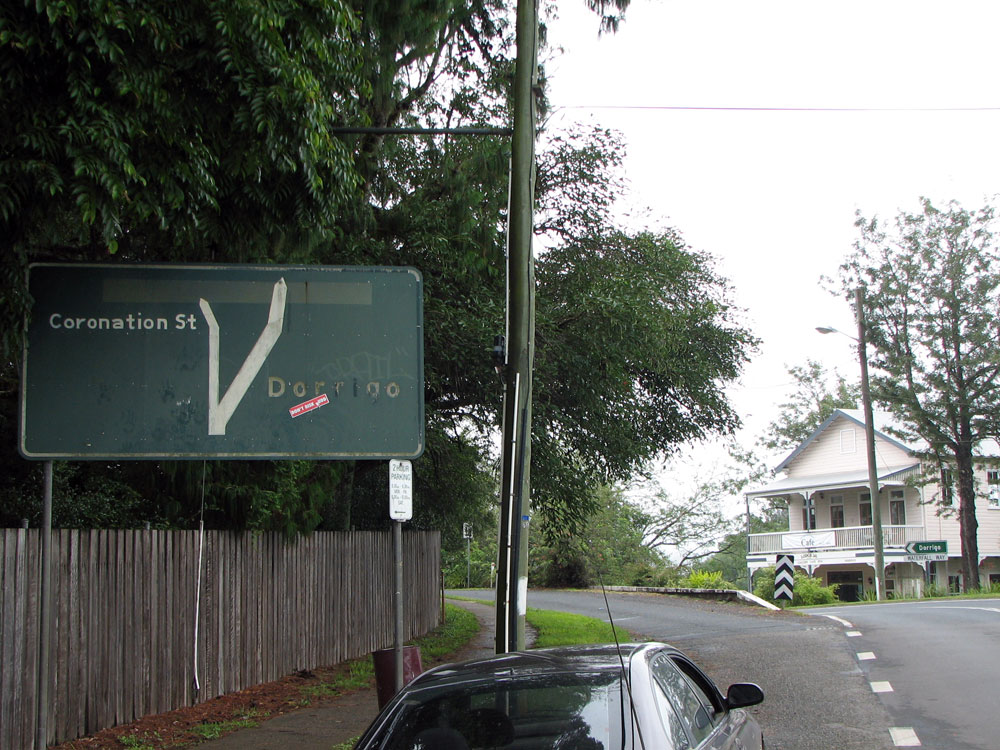 |
Dodgy black AD sign westbound on Waterfall Way, approaching the junction with Coronation Street at Bellingen. Note how the sign originally showed Coronation Street across the top and some dodgy changes have been made to make the sign a little less confusing. Also note the absence of a SR78 shield. Photo taken: December 2008. |
 |
Waterfall Way (Hyde Street) looking east near Oak Street, Bellingen. Photo taken: December 2008. |
 |
Waterfall Way (Hyde Street) looking east towards the junction with Church Street (former Main Road No. 118), Bellingen. M.R. No. 118 lead to Macksville via Bowraville and a tortuous route through the hills south of Bellingen. Photo taken: December 2008. |
 |
Black fingerboard sign at the intersection of Waterfall Way (Hyde Street) & Bridge Street, Bellingen. This sign would have been one of the earliest SR78 signs and was covered with a blank coverplate until signposting of the route was completed. Unfortunately somebody forgot to remove the coverplate and it is still there, 30+ years later! Photo taken: December 2008. |
 |
Waterfall Way (Hyde Street) looking east from Bridge Street, Bellingen. Photo taken: December 2008. |
 |
Waterfall Way looking west on the eastern outskirts of Bellingen. Photo taken: December 2008. |
 |
Dodgy fingerboard sign at the intersection of Waterfall Way & Crown Street on the eastern edge of Bellingen. Photo taken: December 2008. |
 |
Waterfall Way looking east across the Bellinger River flats near Crown Street, Bellingen. There is no RD sign for eastbound traffic leaving Bellingen. Photo taken: December 2008. |
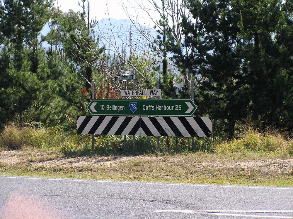 |
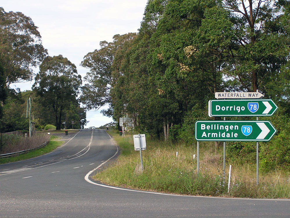
Dodgy fingerboard sign at the intersection of Waterfall Way & Short Cut Road, 2km west of Pacific Highway. Short Cut Road provides a shorter route to Urunga via the industrial area. Photo taken: August 2004. |
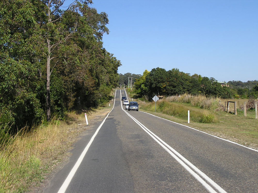 |
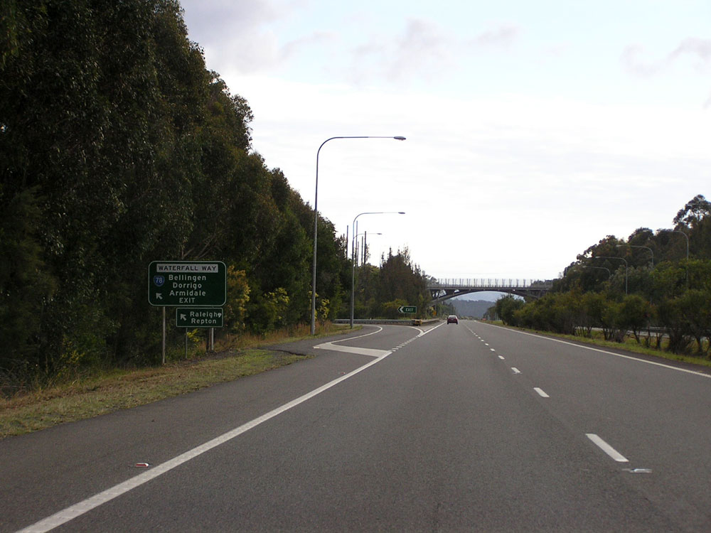
Waterfall Way looking west between Short Cut Road and Pacific Highway. Photo taken: August 2004. |
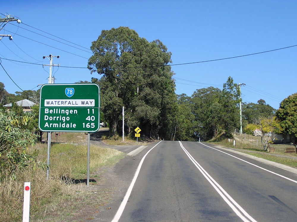 |
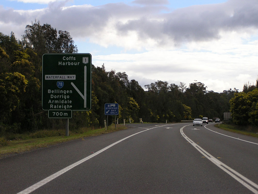
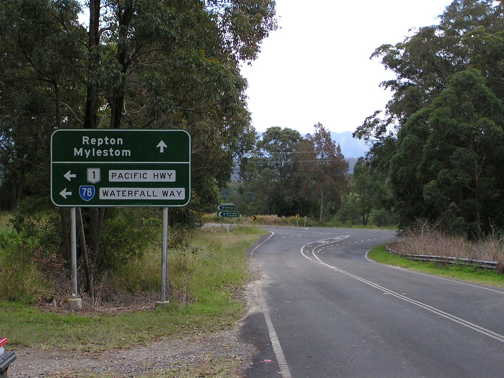
RD sign westbound on Waterfall Way near the junction with Pacific Highway at Raleigh. Photo taken: August 2004. |
 |
AD sign on the northbound off-ramp from Pacific Highway to Waterfall Way at Raleigh. Photo taken: July 2008. |
 |
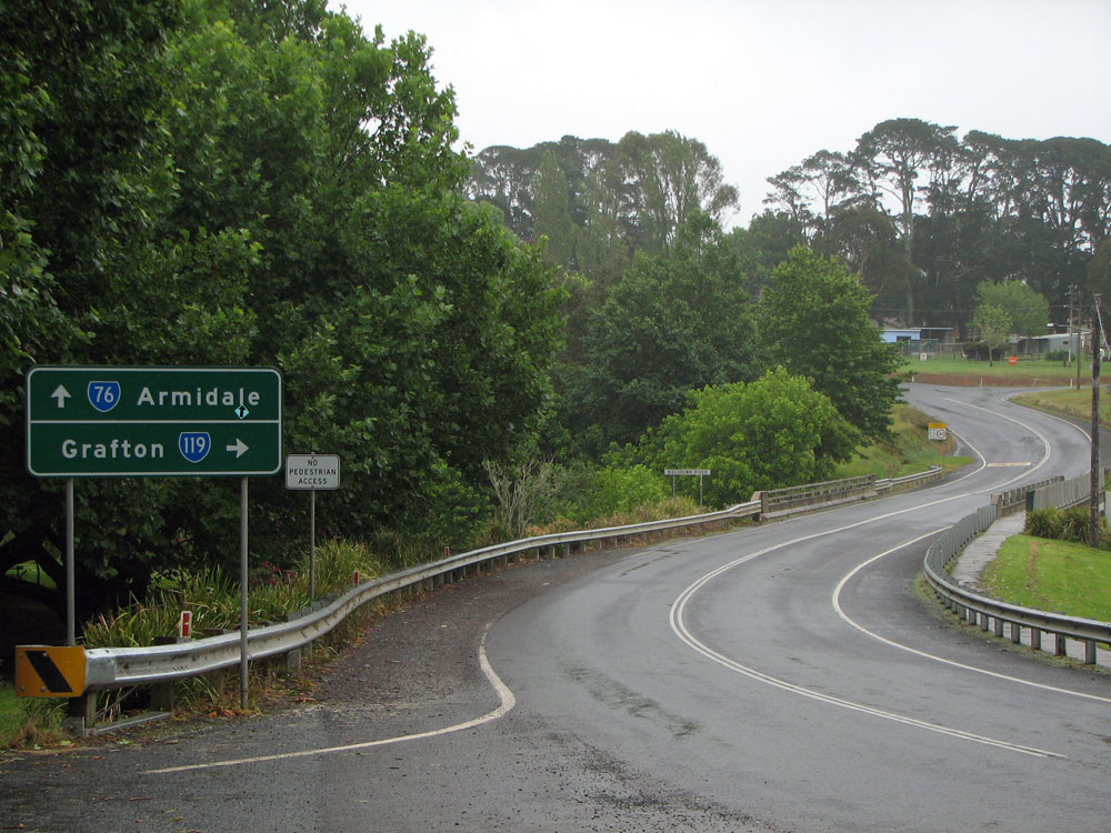
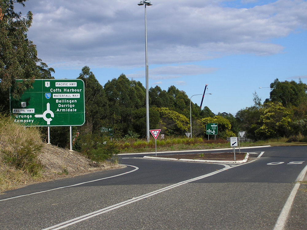
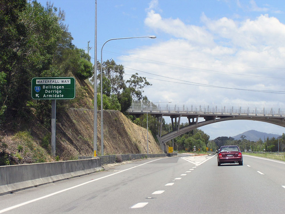
AD sign westbound on Waterfall Way approaching the northbound ramps to/from Pacific Highway at Raleigh. The bridge in the middle ground carries Waterfall Way over the Pacific Highway. Photo taken: July 2008. |
 |
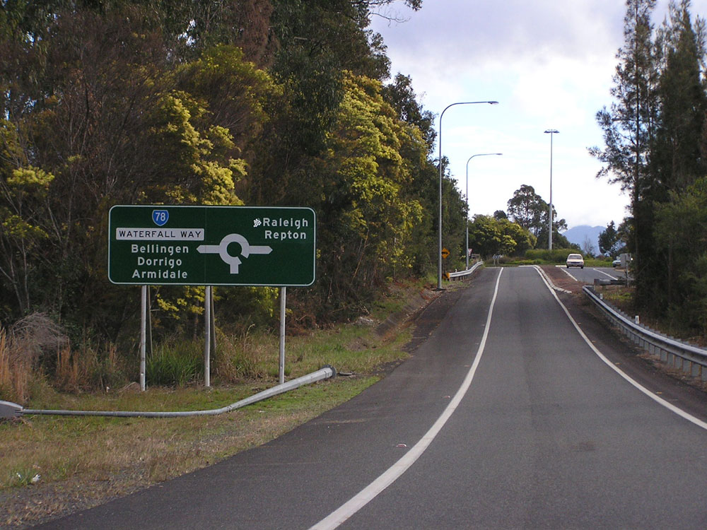
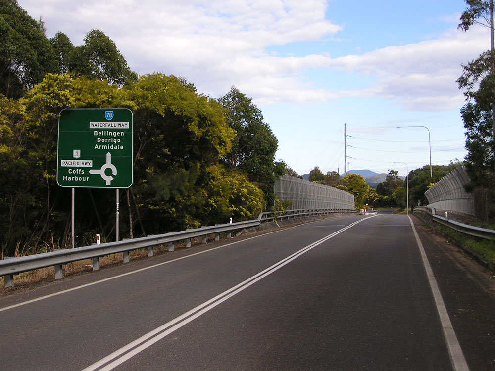
AD sign westbound on the former section of Waterfall Way approaching the junction with Pacific Highway at Raleigh. The junction is a folded diamond with roundabout junctions located either side of the bridge carrying Waterfall Way across the highway. Photo taken: July 2008. |
  |
Northbound signage on Pacific Highway approaching the junction with Waterfall Way at Raleigh. Photos taken: July 2008. |
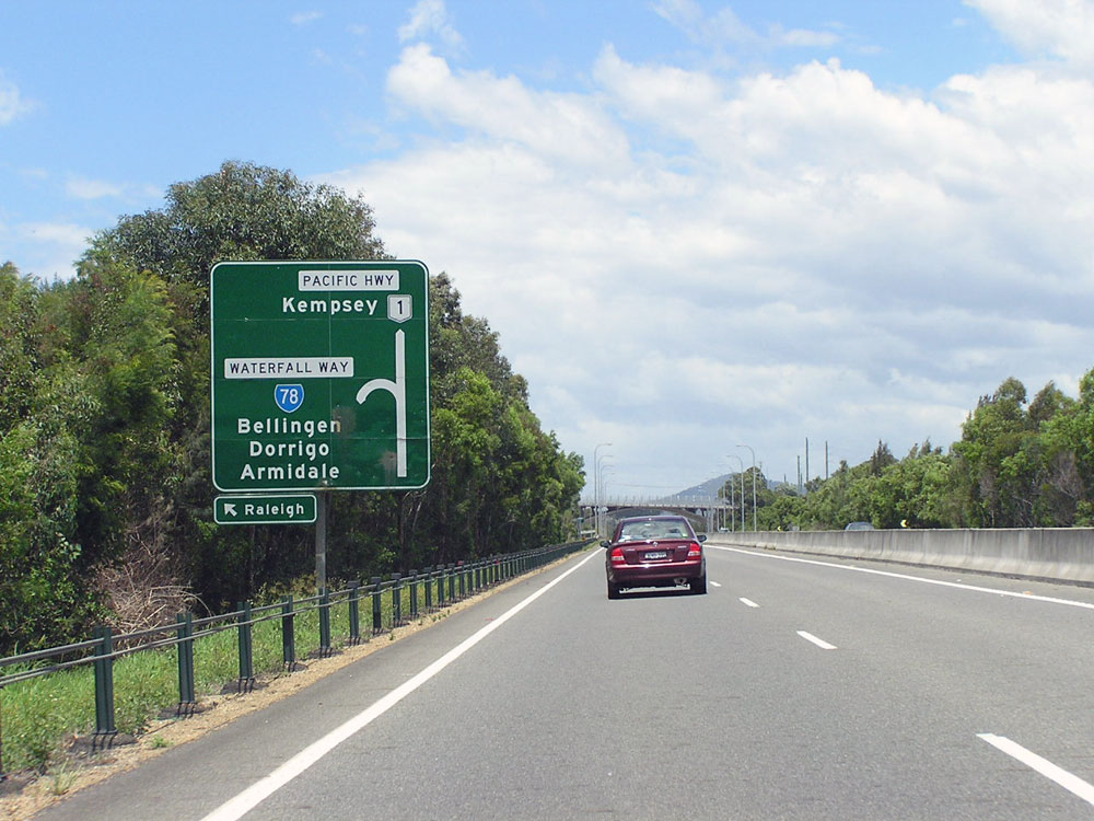  |
Southbound signage on Pacific Highway approaching the junction with Waterfall Way at Raleigh. Note the attractive arch bridge which carries Waterfall Way across the highway. Photos taken: November 2005. |
Photos of the old alignment of Waterfall Way between Pacific Highway & Old Pacific Highway, Raleigh |
|
 |
ID sign assembly at the intersection of Old Pacific Highway & the former section of Waterfall Way at Raleigh. These signs date from when this intersection was still the junction with Pacific Highway, prior to construction of the Raleigh deviation. Photo taken: July 2008. |
 |
AD sign northbound on Old Pacific Highway approaching the junction with the former section of Waterfall Way at Raleigh. This sign was installed after opening of the Raleigh deviation. Photo taken: July 2008. |
 |
AD sign southbound on Old Pacific Highway approaching the junction with the former section of Waterfall Way at Raleigh. This dodgy sign was installed after opening of the Raleigh deviation. Photo taken: July 2008. |
Last updated 10 December 2012 © Ozroads 2003-2012. |