Dee Why to North Ryde via Frenchs Forest & Chatswood |
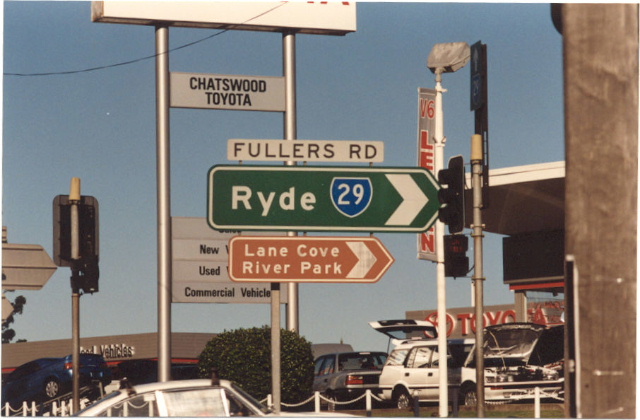
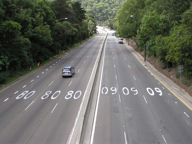
1990 photo of non-reflective ID signs at the intersection of Pacific Hwy & Fullers Rd, Chatswood.
In 2013, RMS will be implementing a new alpha-numeric route numbering system. For more information, visit the RMS Website. |
|
Forthcoming alpha-numeric route number: |
|
Length: 19km
Eastern Terminus: Pittwater Rd & Warringah Rd & Harbord Rd, Dee Why
Western Terminus: Lane Cove Rd & Epping Rd, North Ryde
Route names: Warringah Rd, Babbage Rd, Boundary St, Pacific Hwy, Fullers Rd, Millwood Ave, Dehli Rd, Epping Rd
Focal Points: North Ryde, Chatswood, Frenchs Forest, Dee Why
RTA Internal Classification: Main Road 373 (Epping Rd), Main Road 191 (Dehli/Millwood/Fullers), State Highway 10 (Pacific Hwy), Main Road 329 (Boundary/Babbage/Warringah)
Route overview:
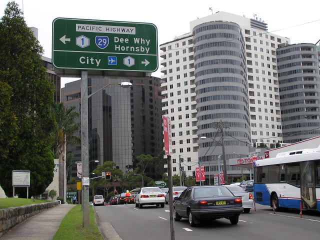
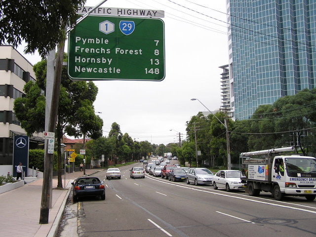
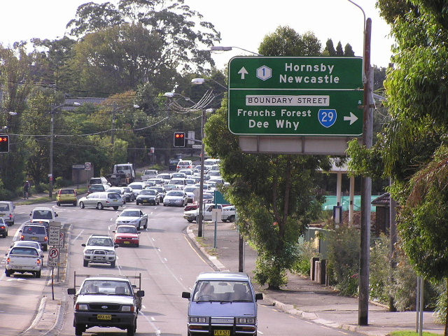
State Route 29 is a circumferential state route across Sydney's northern suburbs, connecting the major commercial and hi-tech centres of North Ryde, Chatswood and Frenchs Forest with the Pacific Hwy, Metroad 3 and the northern beaches. The quality of the road varies, from 6-lane freeway standard across the Roseville Bridge to two-lane winding sections between North Ryde and Chatswood. This route includes a 1km duplex with Metroad 1 (Pacific Highway) at Chatswood.
The route was first signposted in 1974, between Epping Rd (then SR28) at North Ryde and Pittwater Rd (then SR14), Dee Why. The only alignment change was made in May 1997 when the M2 Motorway opened to traffic and SR29 was extended west along the former alignment of Metroad 2 (Epping Rd) to meet Metroad 3 at North Ryde. To this day this section is poorly signposted, but does have a rare "END SR29" sign.
The route between North Ryde and Chatswood was first opened up in 1918, with the construction of Fullers Bridge over the Lane Cove River. Willoughby, Ku-ring-gai and Warringah Councils then joint-funded construction of a bridge over Middle Harbour at Roseville Chase which was completed in 1924. The Department of Main Roads then recognised the importance of this route in the 1950's and proposed several upgrades to significantly improve its quality. The widening of Boundary St, Babbage Rd and Warringah Rd to 6 lanes was completed in 1968, following the construction of a new Roseville Bridge, which opened to traffic in April 1966. The bridge was constructed on a new freeway standard alignment and the approaches are 80km/h standard, bypassing the narrow and winding apporaches to the old low-level bridge.
Notable events in the history of SR29:
1918 - Fullers Bridge
1924 - Original Roseville Bridge
April 1966 - new Roseville Bridge
1968 - Boundary St, Babbage Rd & Warringah Rd widening completed
1974 - Signposted between Epping Rd and Dee Why
May 1997 - Extended west to Lane Cove Rd
Photos of State Route 29 |
|
 |
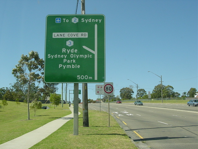
Lane Cove Rd northbound approaching Epping Rd, the beginning of SR29. This section is signed as "To Metroad 2" however, as it used to be Metroad 2. Photo taken Feb 2006. |
 |
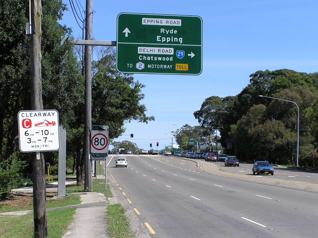
Epping Road eastbound as it approaches the beginning of SR29. Note that it is signed as "to Metroad 2" rather than SR29. Photo taken March 2004. |
 |
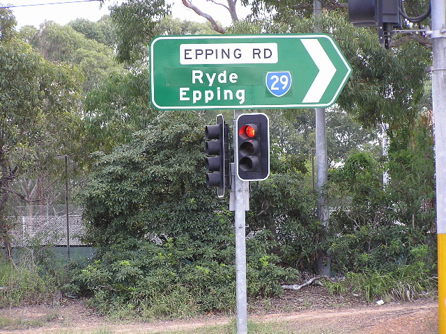
Epping Rd eastbound at the beginning of SR29. Photo taken March 2004. |
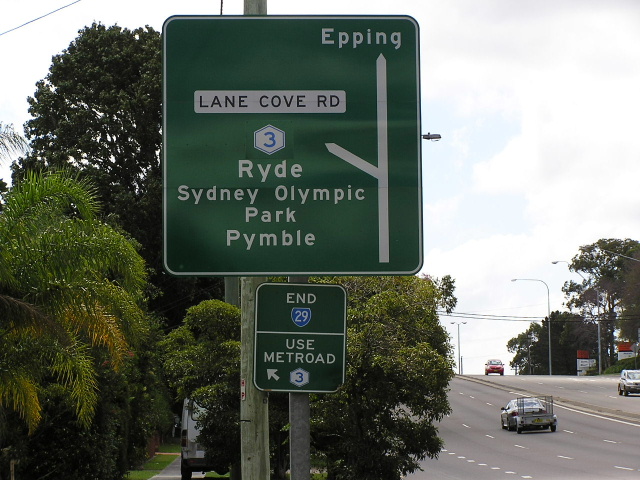 |
"END 29" sign westbound on Epping Rd at Lane Cove Rd. Note the unusual "use Metroad 3" sign. Photo taken February 2005. |
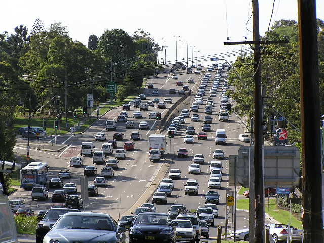 |
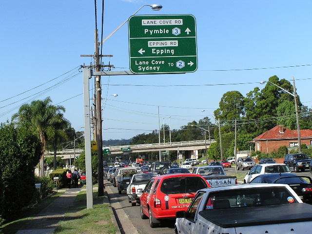
Typical afternoon peak view of Epping Rd westbound towards Wicks Rd, North Ryde. This was taken about 5pm in November 2003. |
 |
Epping Rd AD sign for Dehli Rd showing a couple of coverplate jobs since the opening of the M2 Motorway. There is a blank coverplate over Metroad 2, a "Ryde" coverplate over Nth Ryde and a "To Metroad 2 Mwy TOLL" coverplate over Dee Why. Nov 2005. |
 |
ID sign showing SR29 on a coverplate over Metroad 2 at Epping & Dehli Rds, North Ryde. Photo taken 2004. |
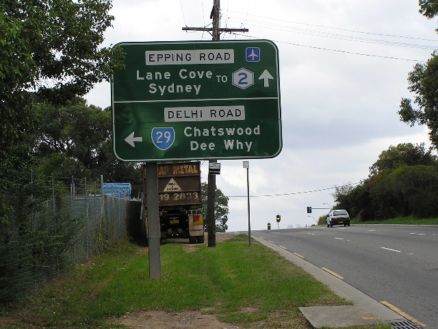 |
Epping Rd eastbound approaching the former western terminus of SR29, at Dehli Rd, North Ryde. Photo taken 2004. |
 |
Looking east along Dehli Rd through North Ryde, showing widening works in November 2003. |
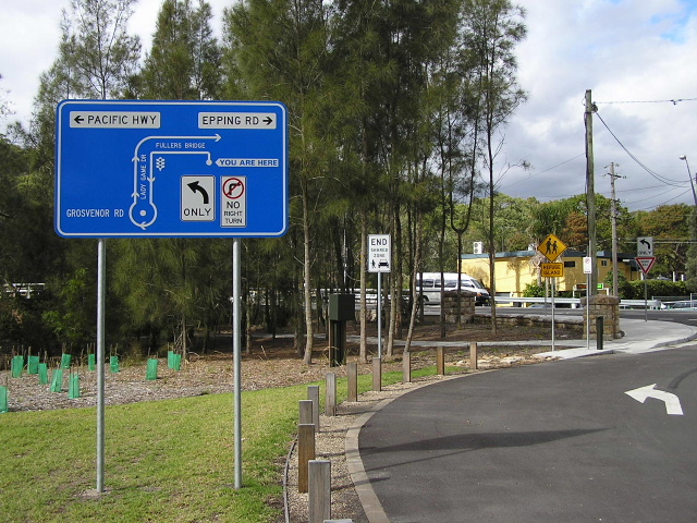 |
Very unusual diagrammatic sign at the entrance to Lane Cove National Park, Chatswood West. June 2006. |
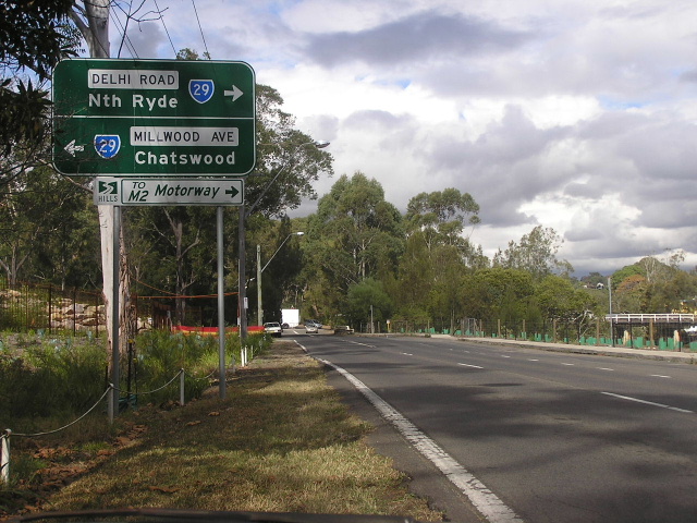 |
AD sign southbound on Lady Game Drive approaching Dehli Rd & Millwood Ave at Chatswood West. Fullers Bridge, which carries SR29 across the Lane Cove River, can be seen in the distance. June 2006. |
 |
Looking west along Fullers Rd towards Greville St at Chatswood West. April 2004. |
Reasonably new RD sign omitting the SR29 shield on Fullers Rd, Chatwsood West. Photo taken Feb 2006. |
|
 |
Fullers Rd eastbound approaching Pacific Hwy, Chatswood. Photo taken Feb 2006. |
 |
Pacific Hwy northbound from Fullers Rd, Chatswood. Photo taken Feb 2006. |
 |
Newly-installed (late 2005) lane allocation sign warning southbound Pacific Highway traffic that the right lane must turn right at Fullers Rd. It is interesting that such a small (and thus inconspicuous) sign was chosen and the route markers are omitted. Feb 2006. |
 |
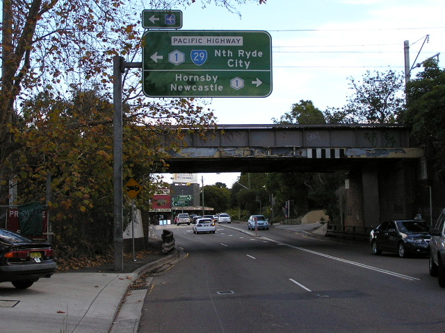
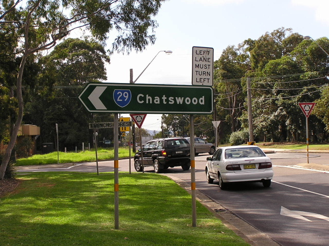
Pacific Hwy northbound approaching Boundary St, Roseville. This is where SR29 splits from Metroad 1 and heads east to the coast. Photo taken April 2004. |
 |
Pacific Hwy southbound approaching the duplex at Roseville. Photo taken March 2006. |
 |
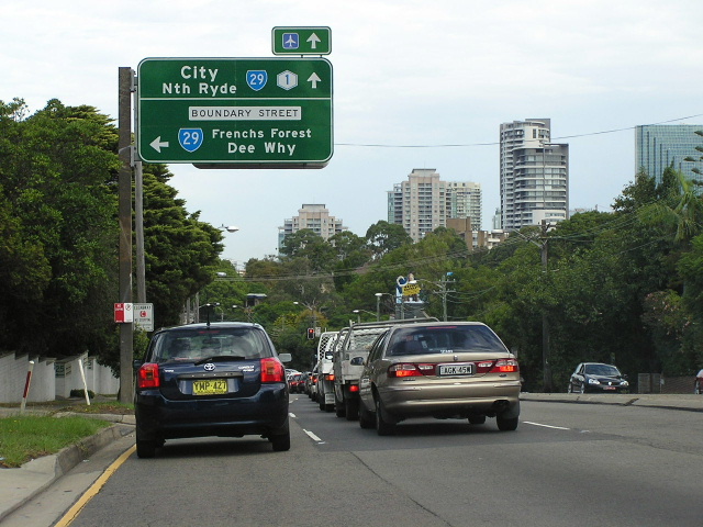
Boundary St westbound approaching Pacific Hwy, Roseville. Photo taken June 2006. |
A similar view of Boundary Street, this time showing the railway overpass which was replaced in early 2012. Note the provision for future road widening on the right. Photo taken: Daniel Thornton, October 2012. |
|
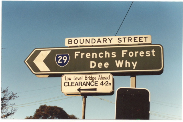 |
1990 photo of non-reflective ID sign at Pacific Hwy & Boundary St, Roseville. |
 |
Pacific Hwy southbound from Boundary St, Roseville. Photo taken April 2004. |
 |
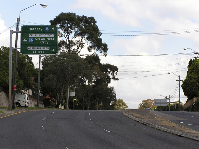
Boundary St westbound through Roseville. Photo taken March 2006. |
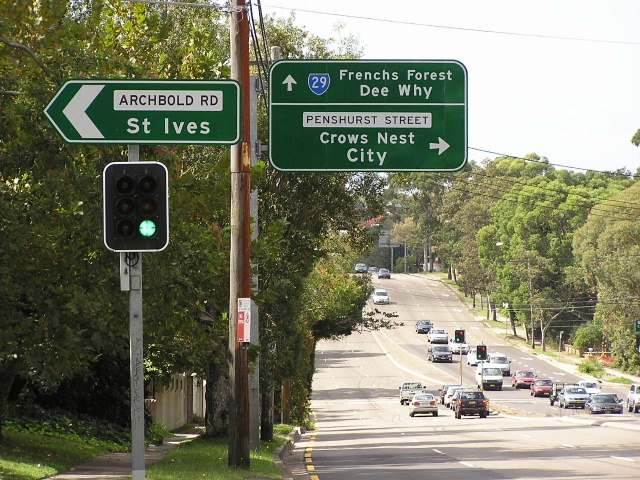 |
Boundary St westbound at Archbold Rd, Roseville. Photo taken April 2004. |
 |
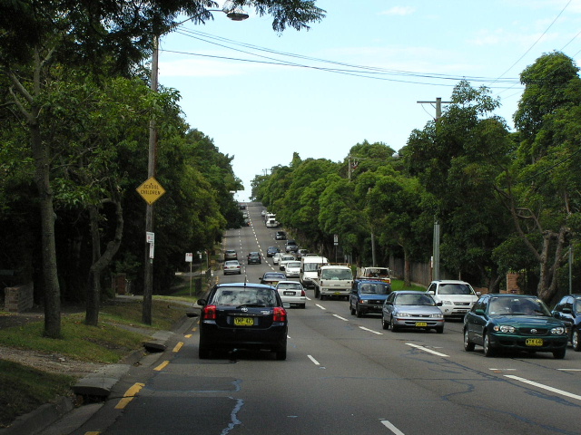
Boundary St eastbound approaching Penshurst St, Roseville. Photo taken April 2004. |
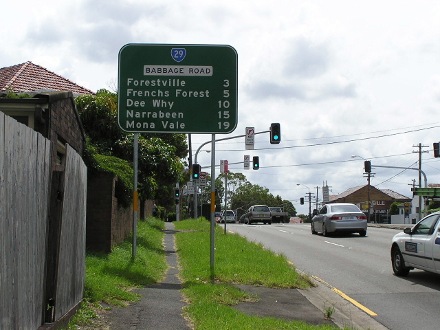 |
Babbage Rd northbound from Eastern Valley Way, Roseville Chase. Photo taken March 2006. |
 |
Warringah Rd heading west from Roseville Bridge, Roseville Chase. Photo taken April 2004. |
 |
Warringah Rd looking east from Malga Ave towards Roseville Bridge. Photo taken April 2004. |
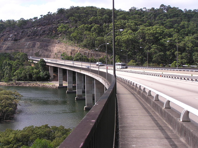 |
Looking east across Roseville Bridge, completed in 1966. Photo taken April 2004. |
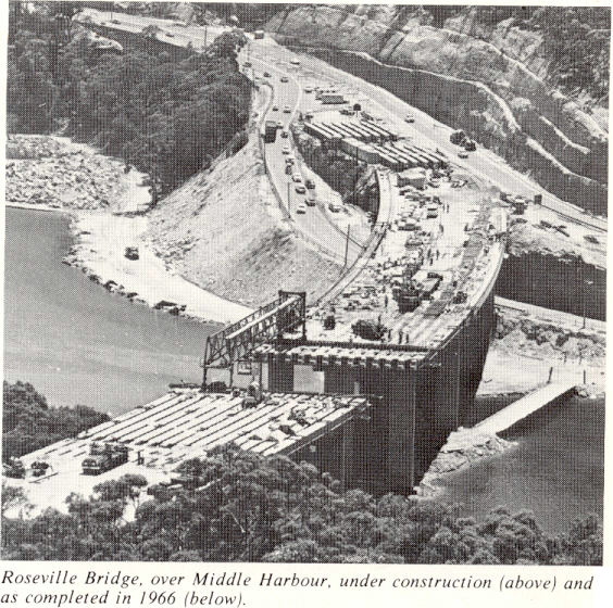 |
Roseville Bridge under construction in 1965. Photo scanned from 'The Roadmakers'. |
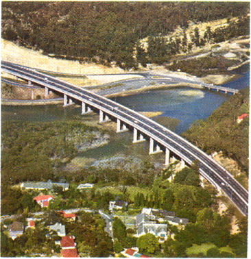
Roseville Bridge just after opening in 1966. Scanned from 'The Roadmakers'. |
|
 |
The new and the old Roseville Bridges in 1970. Scanned from DMR Journal. |
 |
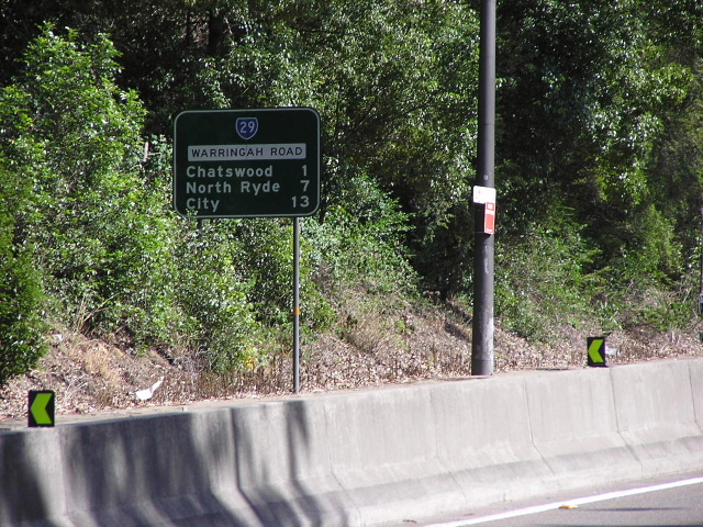
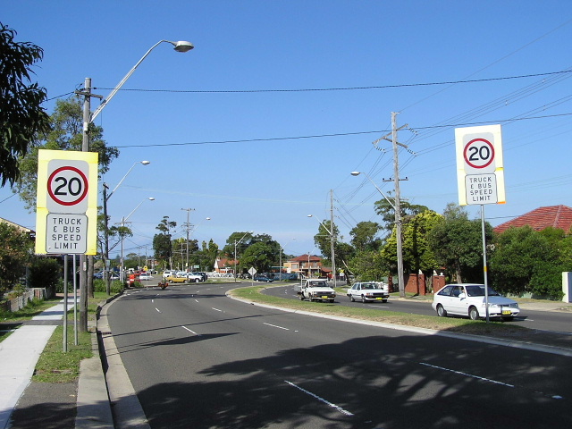
Distance sign heading west from Forest Way. Nov 2005. |
 |
1991 photo of Warringah Rd eastbound before Forest Way, Frenchs Forest. |
 |
April 2004 photo of Forest Way approaching Warringah Rd, Frenchs Forest. |
 |
1991 photo of the same sign as the the above photo. |
 |
Old black AD sign, probably installed in 1974, southbound on Wakehurst Parkway approaching Warringah Rd. 1991.
|
 |
This sign replaced the one in the above photo. April 2004.
|
 |
Another old black AD sign, this time westbound on Warringah Rd. 1991. |
 |
This sign replaced the sign in the above photo. April 2004. |
 |
Another old black AD sign, this time northbound on Wakehurst Pkwy approaching Warringah Rd. 1991. |
 |
More black AD signs, this eastbound on Warringah Rd. 1991. |
 |
Warringah Rd eastbound approaching Wakehurst Pkwy. April 2004. |
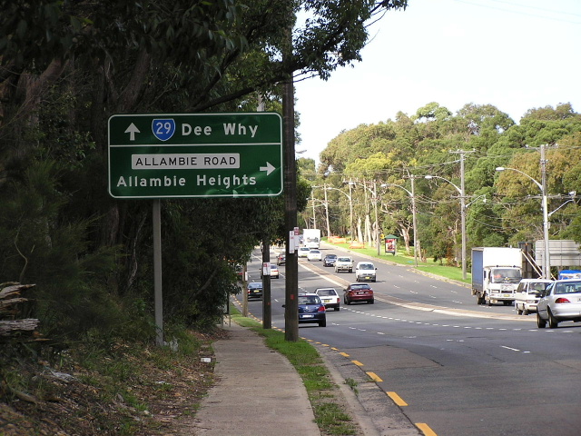 |
Warringah Rd eastbound approaching Allambie Rd, Frenchs Forest. Photo taken April 2004. |
 |
SR29 ID sign at the corner of Roxborough Rd and Allambie Rd, Frenchs Forest. Photo taken April 2004. |
 |
Warringah Rd eastbound through Beacon Hill. Photo taken April 2004. |
 |
Nice old black fingerboard sign pointing Oxford Falls Rd traffic towards Warringah Rd at the junction with Iris St, Beacon Hill. March 2006. |
 |
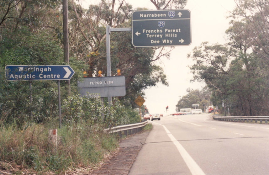
Looking east towards Dee Why from Beacon Hill. Photo taken April 2004. |
 |
Eastbound approach to the steep descent to Pittwater Rd. Photo taken April 2004. |
 |
First RD sign heading west from Pittwater Rd. April 2004. |
 |
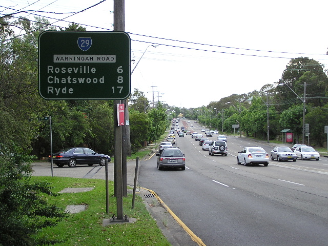
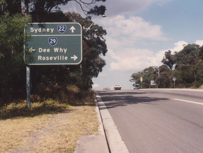
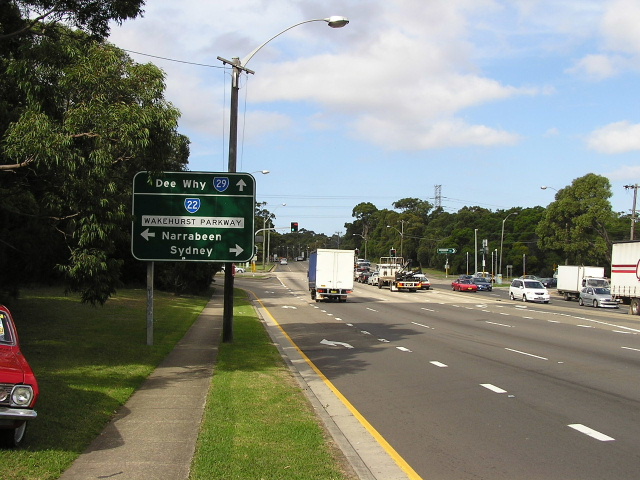
AD sign on Harbord RD approaching the beginning of SR29 at Dee Why. April 2004. |
 |
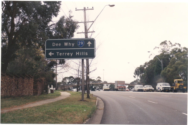
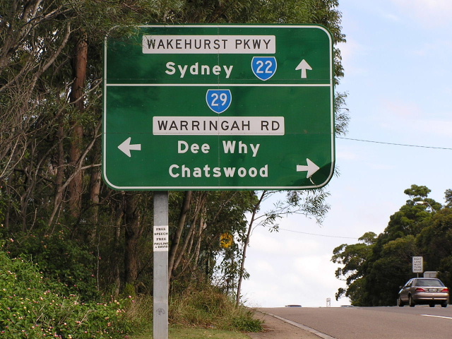
Metroad 10 heading south approaching SR29 at Dee Why. April 2004. |
Last updated 10 December 2012 © Ozroads 2003-2012. |