State Route 135 |
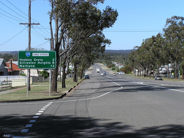
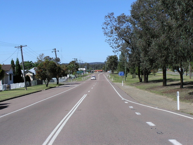
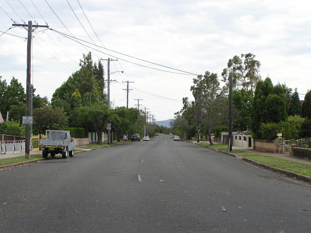
Looking north on Lang St, Kurri Kurri. Oct 2004.
In 2013, RMS will be implementing a new alpha-numeric route numbering system. For more information, visit the RMS Website. |
RMS have advised that this route will be decommissioned and not replaced by an alpha-numeric route number. |
Length: 20km
Northern Terminus: New England Highway & Cessnock Rd & Walker St & Church St, Maitland
Southern Terminus: Leggetts Dr & Lake Rd, Mulbring
Route taken: Leggetts Dr (formerly Leggetts Lane & Kurri Kurri-Mulbring Rd), Stanford St, Railway St, Victoria St, Lang St, Main Rd, Cessnock Rd
Focal Points: Toronto/Sydney, Kurri Kurri, Maitland
RTA Internal Classification: Main Road 195
Route Overview:
State Route 135 is a relatively important north-south route through the Lower Hunter Valley coalfields districts, connecting Kurri Kurri and Maitland to SR82 and areas further south. The role of the route has been lessened in the last 10 years, the opening of the F3 Freeway through to Minmi taking over the role as the major southern highway access to the Maitland area. However, it remains an important artery for the former coal ming district it serves.
The route was introduced in 1974, originally beginning at SR82 in Mulbring, the intersection of Mt Vincent Rd and Child St. From here it headed north along Mt Vincent Rd, Maitland Rd and White Bridge Rd to join the current alignment on the northern outskirts of Mulbring. From here it followed the current alignment to just south of Maitland, where it used Regent St, bridged the railway and terminated at High St (New England Hwy).
The first inkling of change came in July 1980 when the Department of Main Roads proclaimed a new route (Parallel St) Main Road No. 607 - the interim Maitland Bypass. SR135's Regent St became a part of this but retained the SR135 shield with NH15 still passing through Maitland town centre. When the Maitland Bypass proper was completed in Spetember 1988, SR135 was re-aligned at its northern end onto a new link road that joined Cessnock Rd to the bypass at Church St & Walker St roundabout. The old alignment is still largely intact, especially on the north side of the railway, however the railway overpass has been removed. A local road, Mt Dee Rd, now makes use of the old Regent St alignment on the south side of the railway to connect with Cessnock Rd.
The fist major change south of Kurri happened in August 1984 when the Mulbring Deviation of SR82 was opened to traffic and SR135 was extended for 1km along Child and Palmer Streets in Mulbring to meet the new deviation. SR135 now took a rather circuitous route through Mulbring, a rather obvious shorter route via Leggetts Lane not being used. This was rectified in March 1988 when an upgraded and widened Leggetts Lane was given the SR135 and NH1 shields as part of the interim National Highway route between the F3 Freeway and New England Highway. The NH1 duplex, from SR135's new southern terminus at Lake Rd, Mulbring, to Kurri Kurri, lasted until December 1993 when NH1 was re-routed onto the new section of freeway from Palmers Rd to Minmi. This also spelled the end of interim National Highway status for the route between Mulbring and Kurri Kurri.
Until 2004 a large number of original 1974 signs existed at the intersection of Victoria St & Lang St, Kurri Kurri, including a distance sign with a "km" plate on it. Following the removal of these, there is still one forgotten 1974 sign on the old alignment at Mulbring, intersection of Maitland Rd & White Bridge Rd & Richmond Vale Rd to be precise. Other relics are located at the intersection of Mt Vincent Rd & Child St in Mulbring, where SR135 black ID signs dating from 1984 remain.
Unfortunately it seems that SR135 will lose its number under the alpha-numeric route marking system that will be introduced in NSW. UBD has already omitted SR135 from its maps, despite signage on the ground clearly stating that the route remains, and a new AD sign in Kurri Kurri with the alpha-numeric routes on it has no provision for a route along the current SR135. It will be a very sad day when the Hunter loses this historic route.
Notable events in the history of SR135:
1974 - Route introduced; extending from High St (New England Hwy) & Regent St, Maitland to Mt Vincent Rd (Sr82) & Child St (SR82), Mulbring
Jul 1980 - Northern 2km of route becomes part of the interim Maitland Bypass - signed as "Shopping Centre By-Pass" not as NH15
Aug 1984 - Mulbring Deviation opened to traffic, SR135 extended 1km to meet the new deviation via Child and Palmer Streets
Mar 1988 - SR135 re-routed onto Leggetts Lane (now Leggetts Dr) which was upgraded as part of the interim National Highway link & NH1 duplex comissioned
Sep 1988 - SR135 re-aligned at its northern end to meet the New England Hwy at the Walker St & Church St roundabout, Maitland
Dec 1993 - NH1 duplex decomissioned
Photos of State Route 135 |
|
 |
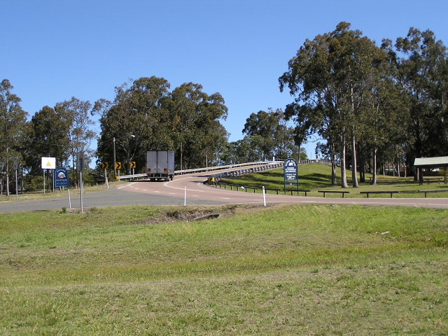
Northbound on SR82 approaching the start of SR135 at Mulbring. Dec 2003. |
 |
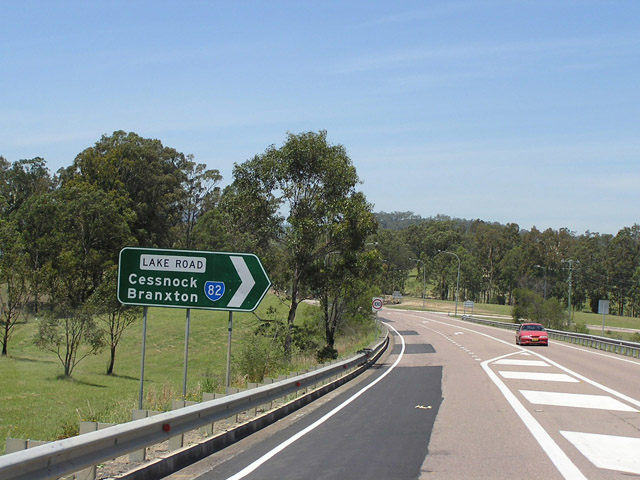
Approaching the start of SR135 from SR82 eastbound (Lake Rd). Oct 2004. |
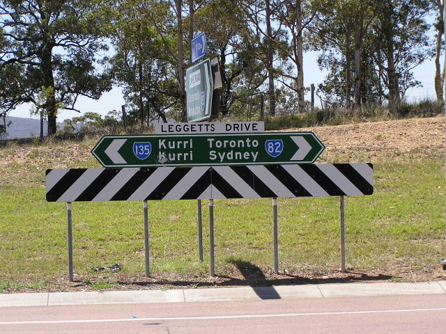 |
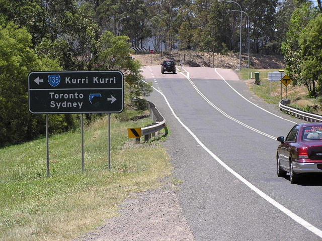
Double-chevron ID sign with new (2004) "Leggetts Dr" nameplate. Oct 2004. |
 |
Heading south approaching SR135's terminus this is the only warning you get, no mention that SR135 ends or that SR82 goes straight until you reach the RD sign on the other side of the intersection. Oct 2004. |
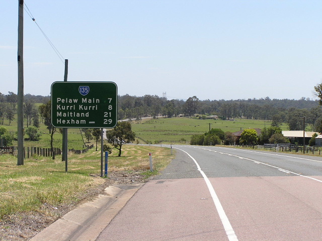 |
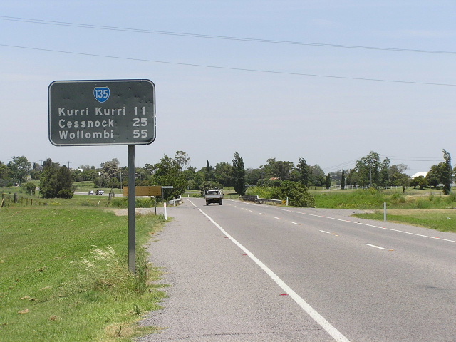
First distance sign northbound on SR135. Oct 2004. |
 |
Looking south to the bridge that takes SR135 across and old railway alignment into Pelaw Main. The railway tracks disappeared about 15 years ago so the bridge is only a reminder of the days when the railway was so busy that not even a level crossing would suffice. Oct 2004. |
 |
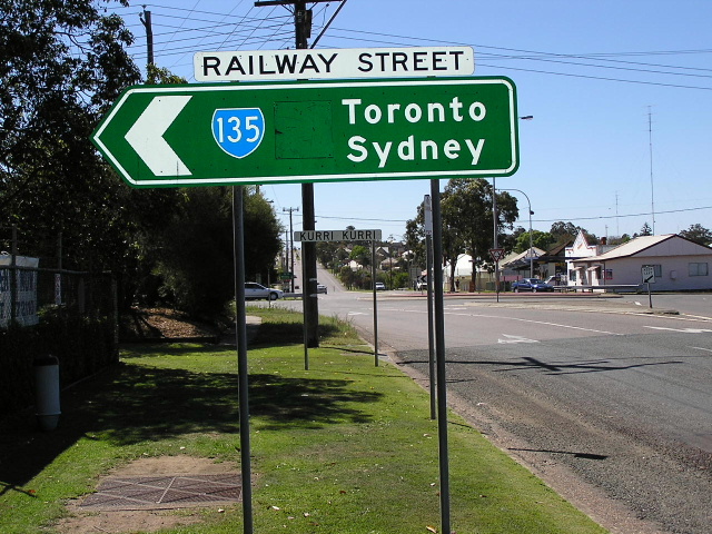
Looking north along Railway Street, Kurri Kurri. The vacant land on the right is an old railway alignment that connected the Pelaw Main Colliery and Richmond Vale Railway with the Stanford Merthyr Colliery. Oct 2004. |
 |
Northbound on Railway St approaching the SR132 duplex along Victoria St, Kurri Kurri. Oct 2004. |
 |
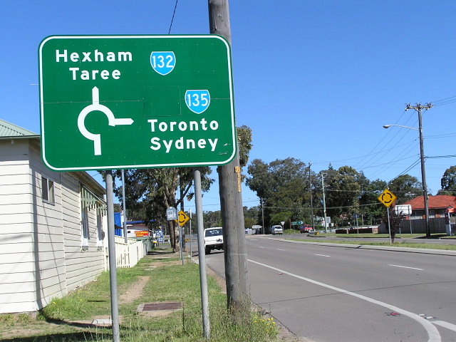
Westbound on SR132 approaching SR135. The coverplate covers a NH1 shield, which duplexed with the southern portion of SR135 from March 1988 till Dec 1993. Oct 2004. |
 |
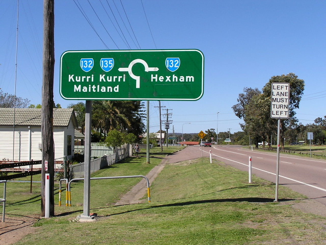
Approaching the eastern split of SR132/135 (Victoria/Tarro/Railway Streets intersection) in Kurri Kurri. Oct 2004. |
 |
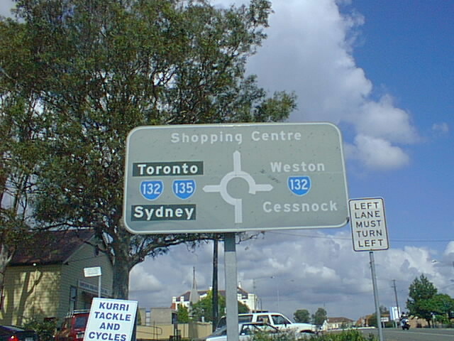
RD sign showing the 132/135 dupleex along Victoria St, Kurri Kurri. Oct 2004. |
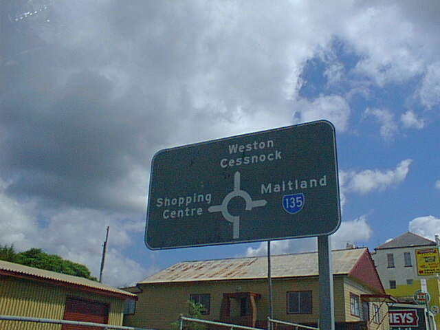 |
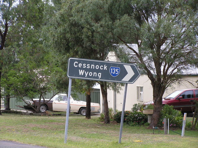
Great old 1970's original AD sign at the Victoria St/Mitchell Ave/Lang St intersection in the middle of Kurri Kurri. This intersection used to be full of them but they have sadly been replaced in 2004. Note the missing SR132 shield for the "Weston/Cessnock" destination. Dec 2003. |
 |
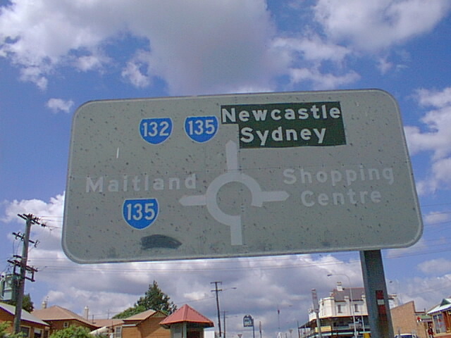
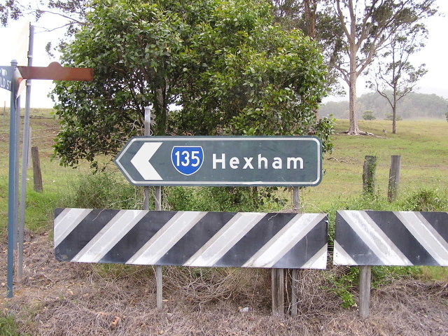
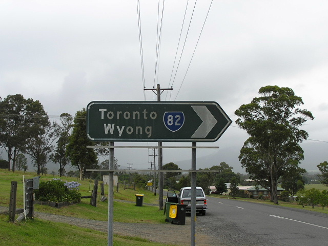
Another extremely faded 1970's AD sign, this time southbound on SR135. Note "Newcastle/Sydney" is on coverplates, the old focal points were Hexham/Wyong before NH1 was routed through Kurri Kurri in 1988 and these routes gained a more long distance focus. Dec 2003. |
 |
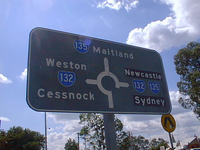
Eastbound on Mitchell Ave (SR132) this time. Dec 2003. |
 |
Northbound on Lang St, this one was in the best condition of them all. Dec 2003. |
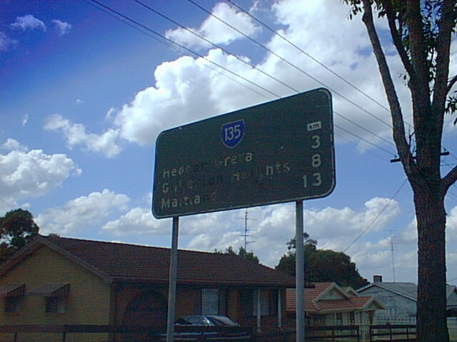 |
Poor photo of a faded RD sign in very poor condition, heading north on SR135. Note the "km" plate which places the age of this sign at 1974. DEc 2003. |
 |
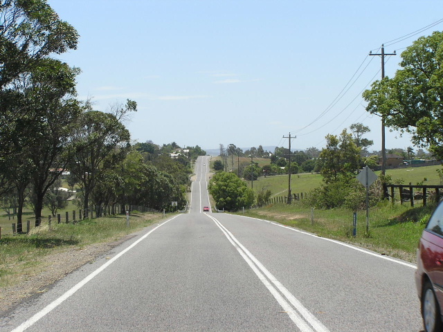
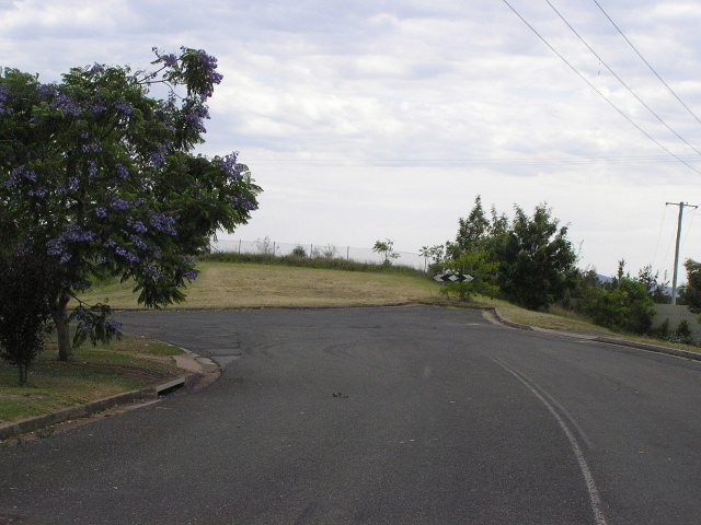
Looking north across Testers Hollow. Oct 2004. |
 |
Looking north to Gilleston Heights. Oct 2004. |
 |
1987 black fingerboard sign at the intersection with Mt Dee Rd, Maitland. Oct 2004. |
 |
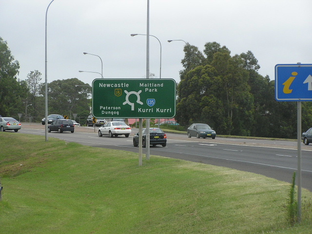
First RD sign southbound from the New England Highway. Oct 2004. |
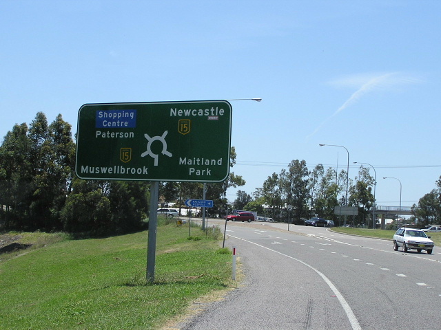 |
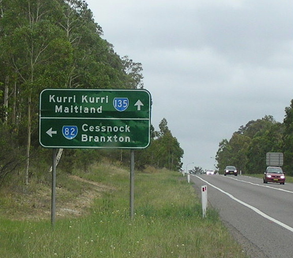
AD sign northbound on SR135 for its northern terminus at NH15. No "END" sign :-( Oct 2004. |
 |
Approaching the start of SR135 from the west on NH15. Dec 2003. |
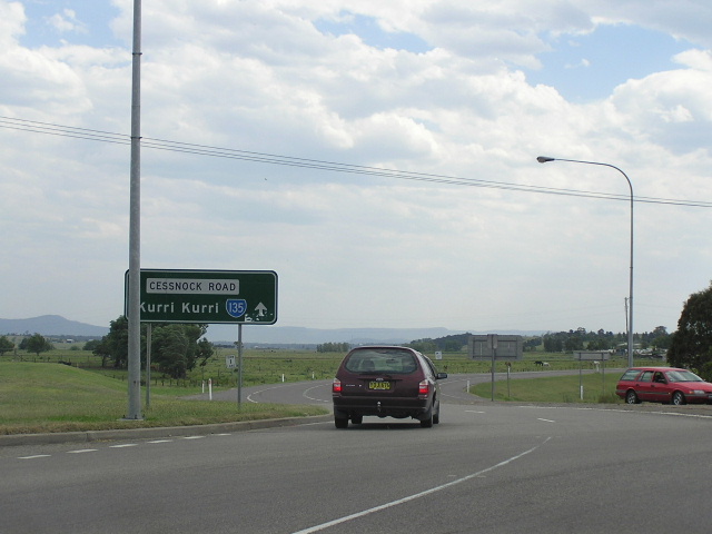 |
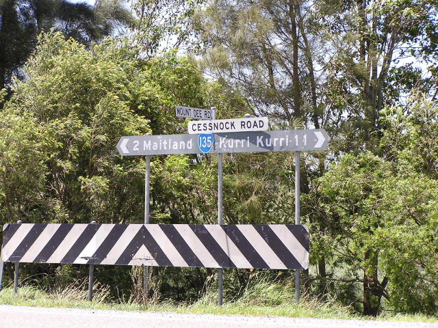
The lone ID sign that points the way to SR135 - Cessnock Rd. Oct 2004. |
Photos of SR135 former alignment - White Bridge Rd, Maitland Rd & Mt Vincent Rd, Mulbring (1974-1988) |
|
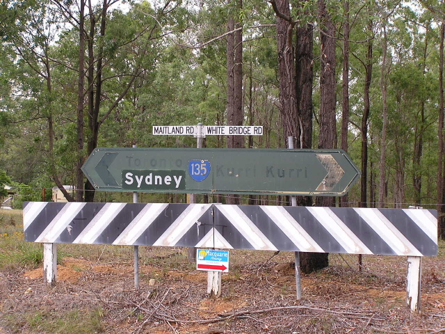 |
Very old, faded 1974 relic at the intersection of Maitland Rd, White Bridge Rd & Richmond Vale Rd, Mulbring. Dec 2003. |
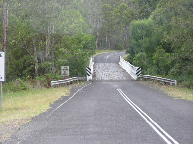 |
The white bridge that White Bridge Rd its name, across Wallis Creek north of Mulbring. Dec 2003. |
 |
ID sign, installed in 1984, at the intersection of Mt Vincent RD & Child St, Mulbring. This intersection was the southern terminus of SR135 from 1974 until August 1984 when it was extended about 1km to meet the new alignment of SR82 which bypassed Mulbring. Dec 2003. |
 |
Another 1984 ID sign at the same intersection. Dec 2003. |
 |
This sign shows that the 1km extension of SR135 leads directly to SR82 and does not mention SR135 at all. There used to be another sign on the same structure that pointed right to "Cessnock/SR82" but this was in particularly poor condition and removed during 2003, possibly illegally :p although Cessnock Council now owns this road and its signs. Dec 2003. |
Photos of SR135 former alignment - Regent Street, Maitland (1974-1988) |
|
These two maps show the former alignment of SR135 near Maitland. The top is the DMR's map of the Maitland Bypass project, the old route being shown in light blue (thanks to Viseth Uch for that). The bottom map is scanned from the 1984 UBD Newcastle Street Directory, showing the area before the bypass construction was commenced. |
|
 |
Looking south on Regent St at the northern abutment of the old railway overpass. This bridge was removed when the bypass was completed and Regent St was returned to being a residential street. Oct 2004. |
 |
Looking north along Regent St on the north side of the railway. Oct 2004. |
Last updated 12 December 2012 © Ozroads 2003-2012. |