State Route 132 |

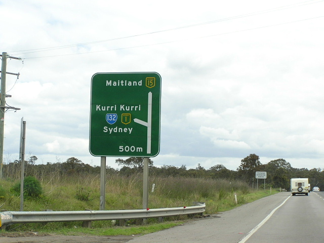
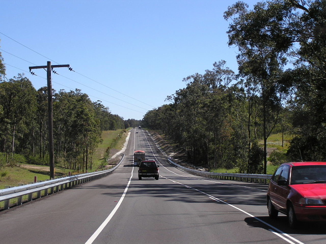
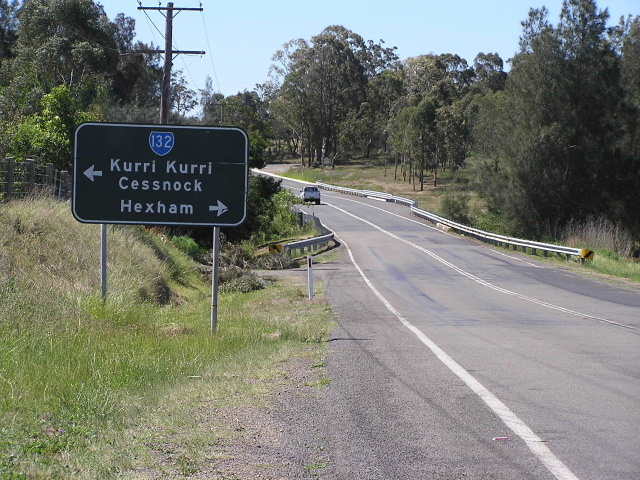
Heading east out of Kurri Kurri. Oct 2004.
In 2013, RMS will be implementing a new alpha-numeric route numbering system. For more information, visit the RMS Website. |
|
Forthcoming alpha-numeric route number: |
|
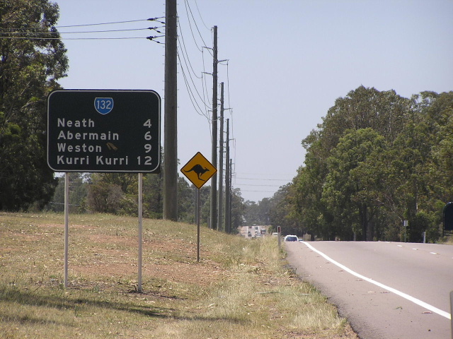
Length: 30km
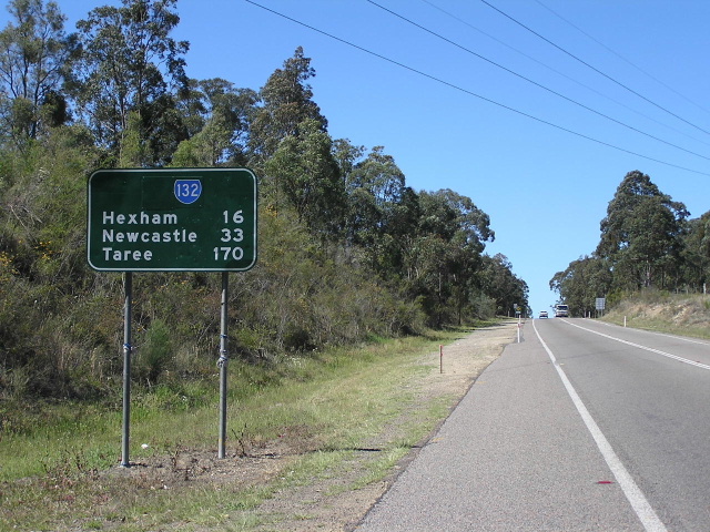
Eastern Terminus: John Renshaw Dr & Sydney-Newcastle Fwy & Weakleys Dr, Beresfield
Western Terminus: Maitland Rd & Vincent St, Cessnock
Route taken: John Renshaw Dr, Mulbring St, Tarro St, Victoria St, Mitchell Ave, Northcote St, First St, Station St, Cessnock Rd, Maitland Rd
Focal Points: Hexham, Kurri Kurri, Cessnock
RTA Internal Classification: Main Road 588
Route Overview:
State Route 132 is a major Hunter Region east-west route, connecting the Pacific and New England Highways with the coal mining and tourist areas of Kurri Kurri and Cessnock. The route is heavily trafficked east of Kurri Kurri where most mine activity is now centred.
John Renshaw Drive was constructed between Buchanan and Minmi-Thornton Rd during 1960-61 to replace the existing poor-quality connection between Newcastle and the coalfields via West Wallsend. In April 1964, JRD was extended easterly from its former terminus at Minmi-Thornton Rd (now the F3/Weakleys Drive) to meet the New England Highway at Tarro Railway bridge. Upon completion of the Beresfield Bypass in October 1970, John Renshaw Drive was truncated at the New England Hwy intersection at Beresfield.
State Route 132 was introduced in 1974, extending from the New England Highway at Beresfield to Vincent St, Cessnock. Included was a duplex with SR135 along Victoria St, Kurri Kurri and for a brief period (Mar 1988-Dec 1993) a duplex with NH1 between the New England Highway and Railway St, Kurri Kurri. In December 1993, when NH1 was routed onto the new freeway and Lenaghans Dr, SR132 was truncated about 1km east, at the intersection with Lenaghans Dr & Weakleys Dr.
The John Renshaw Drive portion of the route was named after Sir John Renshaw who was Deputy Premier and Minister for Highways during the 1950s and 60s. Renshaw was the first to push for a federally-funded National Highway system in 1956, a concept which came to fruition in November 1974 when the National Roads Act was assented to.
Notable events in the history of SR132:
Dec 1961 - John Renshaw Drive completed between Buchanan and Minmi-Thornton Rd (commenced Aug 1959)
Sep 1964 - John Renshaw Drive constructed east to New England Hwy at Tarro Railway Station; previously had terminated at Minmi-Thornton Rd (now F3)
1974 - Route introduced; extended about 500m further eat to meet the New England Highway at Beresfield
Mar 1988 - NH1 duplex introduced between Kurri Kurri and Beresfield
Dec 1993 - NH1 duplex removed and SR132 truncated at Lenaghans Dr/Weakleys Dr roundabout
Photos of State Route 132 |
|
 |
Heading west on the New England Highway approaching the start of SR132. This interchange is the southern terminus of NH15, however, SR132 now starts about 1km down John Renshaw Dd at the roundabout with the F3. Oct 2004. |
 |
ID signs signalling the start of the offramp for John Renshaw Dr. Oct 2004. |
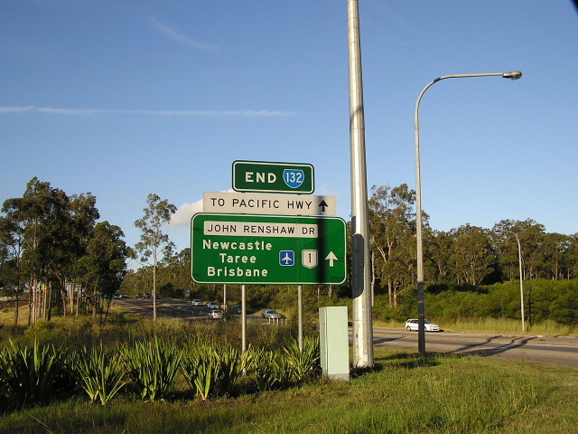 |
Rare "END" sign at the F3/Weakleys Dr roundabout. I was quite surprised to find this here considering the terminus has only been at this location since Dec 1993. April 2004. |
 |
First RD sign on SR132 heading west from the F3/Weakleys Dr roundabout at Beresfield. Oct 2004. |
 |
Looking west on a recently upgraded section of John Renshaw Drive through Black Hill. Oct 2004. |
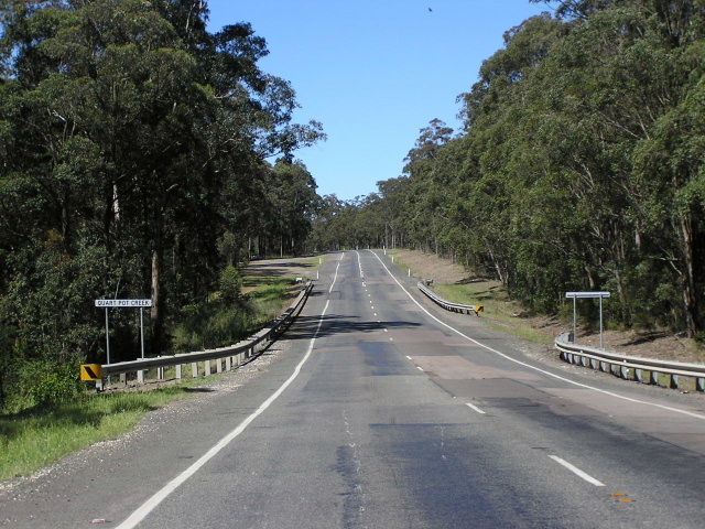 |
Looking east at Quort Pot Creek with some less than desirable pavement quality. Oct 2004. |
 |
Looking east from Buchanan-East Maitland Rd near the SR128 junction, Buchanan. Oct 2004. |
 |
AD sign eastbound approaching George Booth Drive, the start of SR128. Dec 2003. |
 |
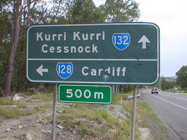
Black AD sign on SR128 approaching SR132 at Buchanan. Oct 2004. |
 |
Eastbound AD sign approaching George Booth Drive, Buchanan. Dec 2003. |
 |
Heading west from George Booth Dr across the Wallis Creek floodplain. Oct 2004. |
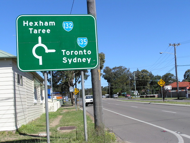 |
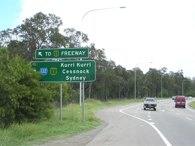
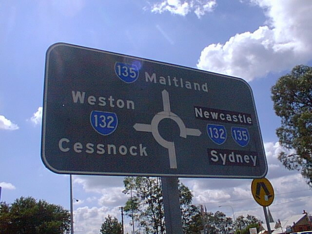
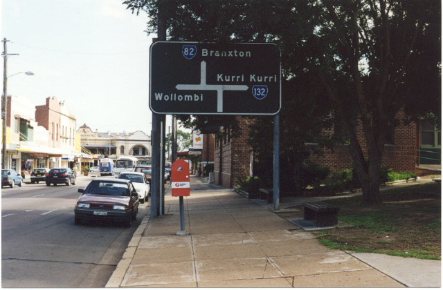
Approaching the eastern split of SR132/135 (Victoria/Tarro/Railway Streets intersection) in Kurri Kurri. Oct 2004. |
 |
RD sign showing the 132/135 dupleex along Victoria St, Kurri Kurri. Oct 2004. |
 |
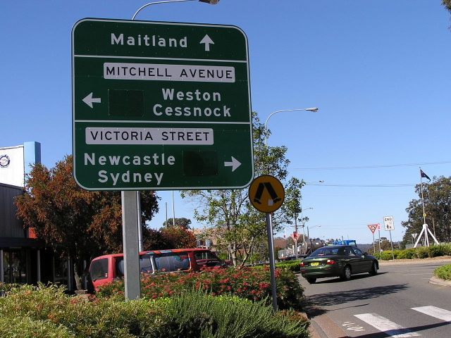
Great old 1970's original AD sign at the Victoria St/Mitchell Ave/Lang St intersection in the middle of Kurri Kurri. This intersection used to be full of them but they have sadly been replaced in 2004. Note the missing SR132 shield for the "Weston/Cessnock" destination. Dec 2003. |
 |
Another extremely faded 1970's AD sign, this time southbound on SR135. Note "Newcastle/Sydney" is on coverplates, the old focal points were Hexham/Wyong before NH1 was routed through Kurri Kurri in 1988 and these routes gained a more long distance focus. Dec 2003. |
 |
Eastbound on Mitchell Ave (SR132) this time. Dec 2003. |
 |
Northbound on Lang St, this one was in the best condition of them all. Dec 2003. |
 |
Faded, probably 1980's judging by the street name in capitals on black background, ID sign. Dec 2003. |
 |
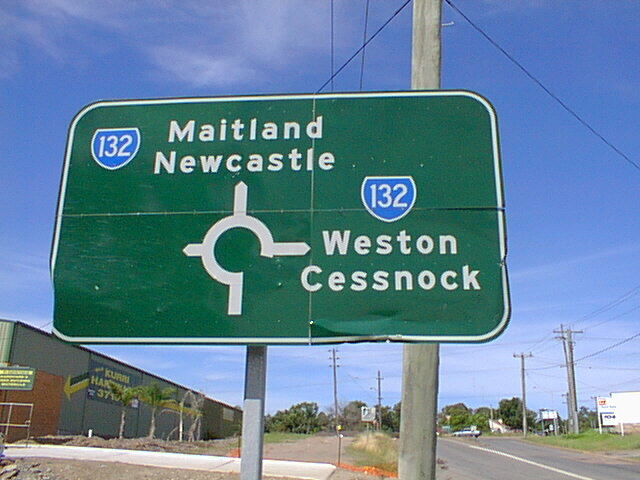
Since I showed you all those old ones I thought I would include one of the signs that replaced them. This one is northbound on Lang St. Note the large coverplates that are covering alpha-numeric route markers. It puzzles me why this sign doesnt include the present route markers and also why SR135 wont get an alpha-numeric route marker. Oct 2004. |
 |
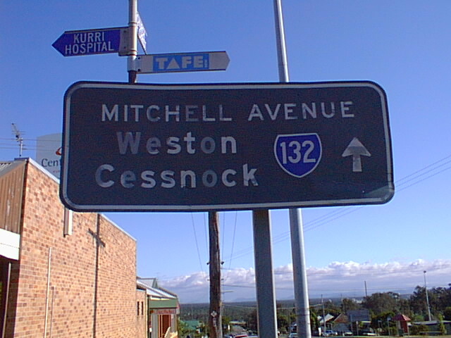
Further north-west, SR132 turns west onto Northcote St with Mitchell Ave continuing towards Loxford and Swayers Gully. This pic is taken on Mitchell Ave, heading south-east, approaching the SR132 junction. Dec 2003. |
 |
Shieldless RD sign heading west from the above intersection. Dec 2003. |
 |
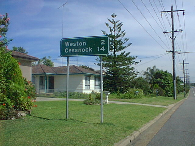
Heading east on First St through Weston. I love the section of SR132 between Cessnock and Kurri Kurri for its great old concrete pavment, probably surviving from the 1930's or 40's as seen in this photo. Oct 2004. |
 |
Eastbound approaching the dog-leg in Weston on Cessnock Rd. Oct 2004. |
 |
Looking east in Abermain, a small former mining community between Weston and Cessnock. Oct 2004. |
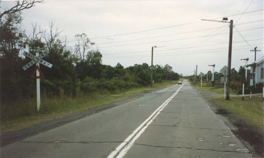 |
Looking west at the Neath railway crossing in 1990. This type of pavement was extremely common along this road. |
 |
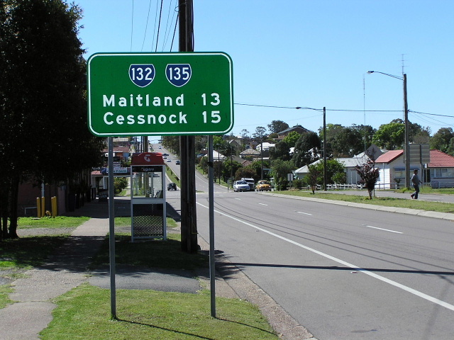
Heading east from Cessnock. Oct 2004. |
 |
Northbound on SR82 (Vincent St) approaching the start of SR132 in Cessnock. There is no warning from the Wollombi Rd direction. This sign has since been replaced. Dec 1998. |
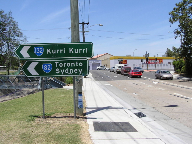 |
Southbound on SR82 (Allandale Rd) warning of the dog-leg and start of SR132 in Cessnock. Oct 2004. |
Last updated 12 December 2012 © Ozroads 2003-2012. |