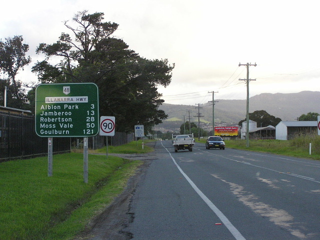
National Route 48 |
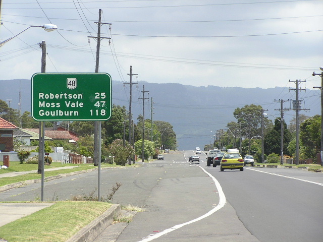
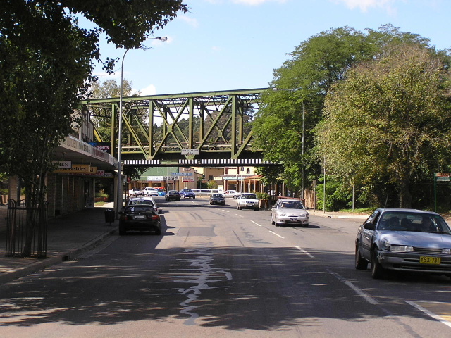
Illawarra Highway heading west through Robertson. Mar 2005.
In 2013, RMS will be implementing a new alpha-numeric route numbering system. For more information, visit the RMS Website. |
|
Forthcoming alpha-numeric route number: |
|
Length: 65km
Eastern Terminus: Princes Hwy & Illawarra Hwy, Albion Park Rail
Western Terminus: Hume Hwy & Illawarra Hwy, Hoddles Cross Roads
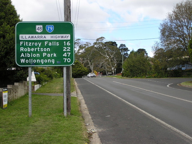
Focal Points: Wollongong, Moss Vale, Goulburn
RTA Internal Classification: State Highway No. 25
Proclaimed a State Highway: 3 August 1962
Named: 3 August 1962
NR48 Introduced: 1974
Route Overview:
The Illawarra Highway is an east-west highway connecting the Illawarra coastal plain with the Hume Highway and Southern Highlands. Its most well-known feature is Macquarie Pass, opened in 1898, which is a narrow, steep and winding road ascending the Illawarra Escarpment. The highway has been experiencing a steady increase in heavy vehicle traffic due to the expansion of port facilities at Port Kembla.
The Illawarra Highway began classified life in 1928 as a conglomeration of a number of Main Roads. In the 1950s the importance of the Moss Vale-Albion Park route was recognised and its status was duly upgraded to that of a trunk route. On 3 August 1962 the Department of Main Roads declared this route as State Highway No. 25 and named it Illawarra Highway.
Originally omitted from the National Route marking scheme, the Illawarra Highway was given the National Route 48 shield in 1974.
Notable Events:
1898 - Road through Macquarie Pass opened, providing the first direct road inland from the coast between Bulli and Batemans Bay
1948 - Reconstructed between Macquarie Pass and Albion Park
3 Aug 1962 - Proclaimed State Highway No. 25 and named Illawarra Highway
1974 - National Route 48 introduced
Sep 1987 - Grade separated interchange completed at Hoddles Cross Roads (Hume Hwy junction)
Dec 1990 - Deviation 4km W of Robertson
2003 - Bridge widening between Macquarie Pass and Albion Park
 |
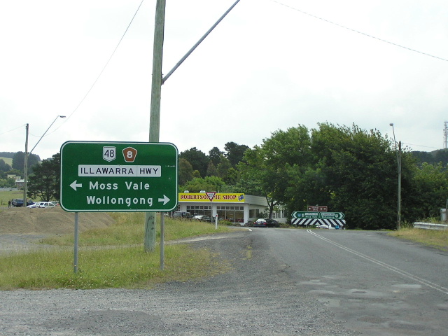
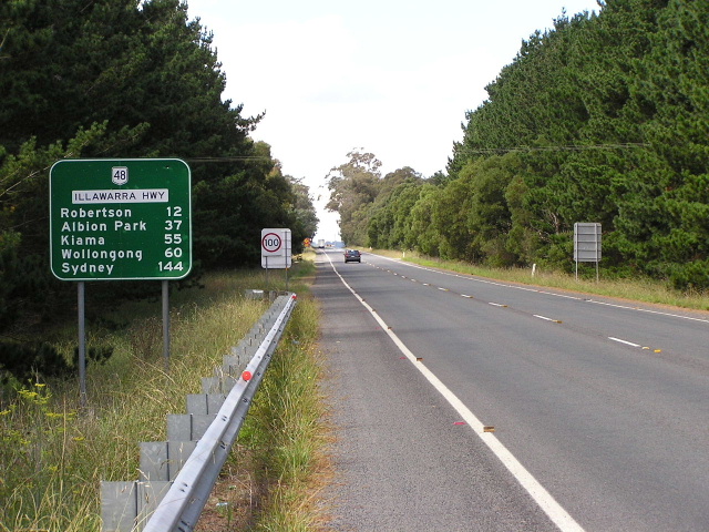
Southbound on Princes Highway (NR1) at Albion Park Rail approaching the start of the Illawarra Highway and NR48. Dec 2004. |
 |
Northbound on the Illawarra Hwy approaching its terminus at Princes Hwy. Dec 2004. |
 |
Looking south on Illawarra Highway from Princes Hwy. Mar 2005. |
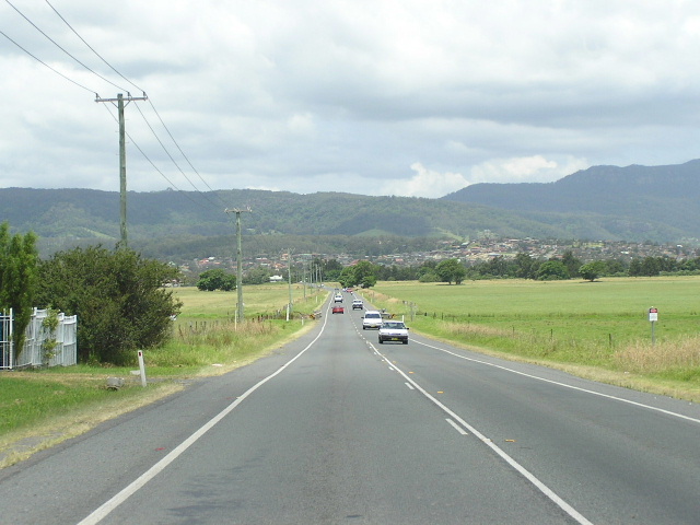 |
Looking south across the floodplain country towards Albion Park. Dec 2004. |
 |
Heading north from Albion Park. Dec 2004. |
 |
Incorrect NH48 shield and missing SR157 shield at Tongarra Rd & Terry St, Albion Park. Dec 2004. |
 |
Another incorrect NH48 shield at Russell St in Albion Park. Dec 2004. |
 |
Heading west from Albion Park. Dec 2004. |
 |
Heading east through Tullimbar. Dec 2004. |
 |
The bottom of Macquarie Pass - the first direct road inland to be constructed between Bulli and Batemans Bay. Dec 2004. |
 |
Heading east from Jamberoo Mtn Rd. Dec 2004. |
 |
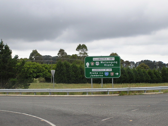
Heading west approaching the SR80 duplex. Dec 2004. |
 |
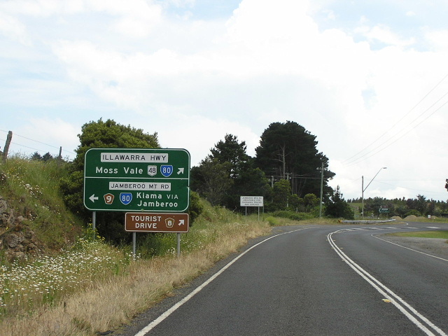
Approaching the Illawarra Hwy from Jamberoo Mtn Rd. Dec 2004. |
 |
Unusual straight arrow on this eastbound AD sign approaching Jamberoo Mtn Rd. Dec 2004. |
 |
Section of old highway on the east side of Robertson, looking east. Dec 2004. |
 |
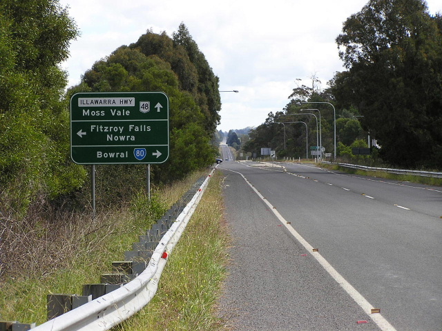
Heading west through Robertson. Dec 2004. |
 |
Looking south on Kangaloon Rd (old SR80) approaching Illawarra Highway. Dec 2004. |
 |
Heading east from Pearsons Lane. Dec 2004. |
 |
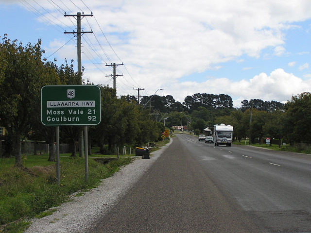
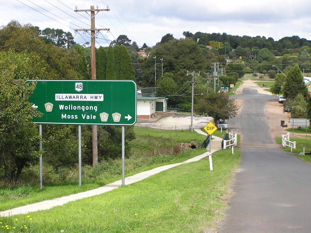
Looking east through fertile countryside near Burrawang. Mar 2005. |
 |
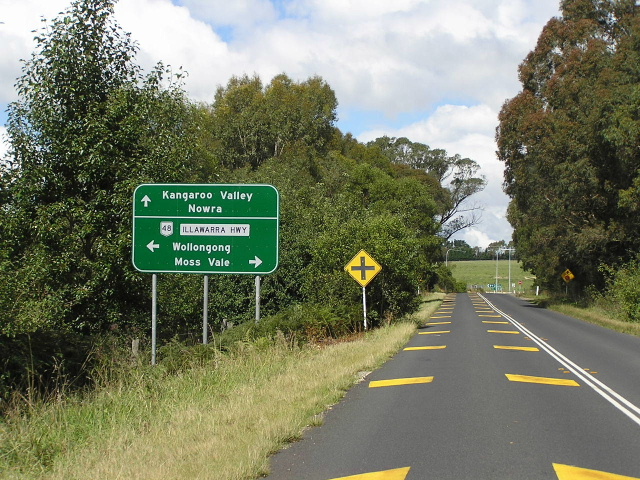
Looking west from Burrawang. Mar 2005. |
 |
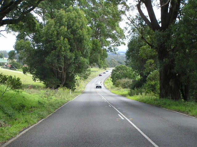
Heading east from Sheepwash Rd. Mar 2005. |
 |
Approaching Sheepwash Rd - the end of the SR80 duplex. Mar 2005. |
 |
Horrible font on this sign approaching the highway from Sheepwash Road. Mar 2005. |
 |
One of the very few directional signs acknowledging the SR80 duplex. Mar 2005. |
 |
Heading west from Sheepwash Rd. Mar 2005. |
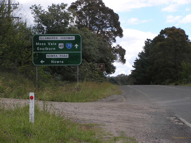 |
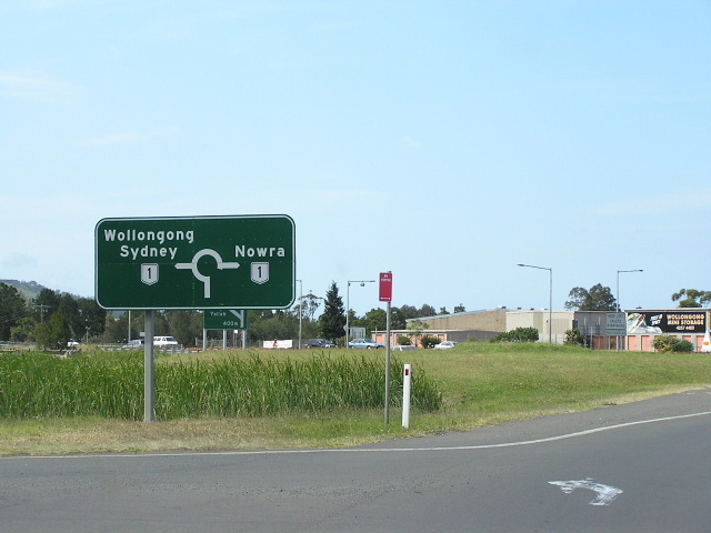
Westbound approaching Nowra Rd (SR79). Note that SR79 is shown straight (correct) but not left (Incorrect). Mar 2005. |
 |
Heading west from Nowra Rd along the SR79 duplex. Mar 2005. |
 |
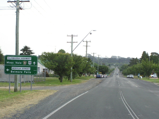
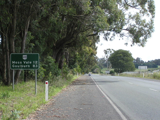
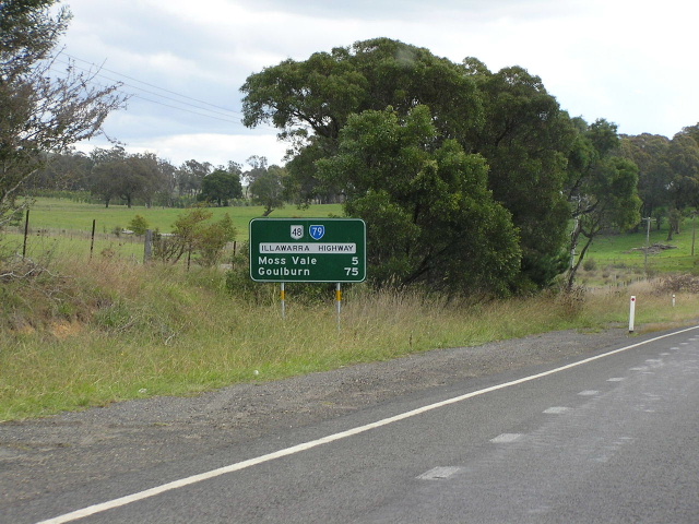
Heading east from Moss Vale. Mar 2005. |
 |
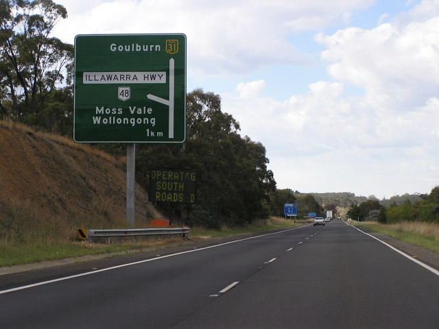
Heading northeast through Moss Vale approaching SR79. Mar 2005. |
 |
Looking east to the Main Southern Railway in Moss Vale. Mar 2005. |
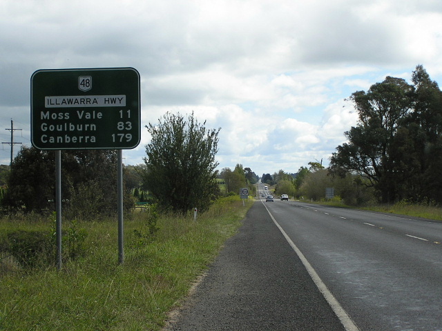
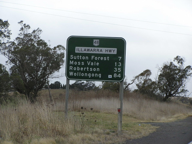
Heading east from Sutton Forest. Mar 2005. |
|
 |
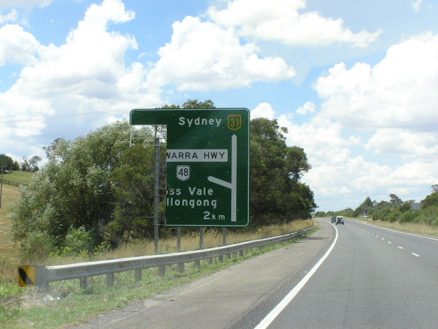
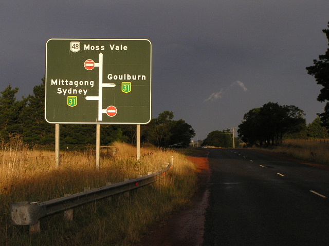
The end of NR48 - approaching the Hume Highway at Hoddles Cross Roads. July 2004. |
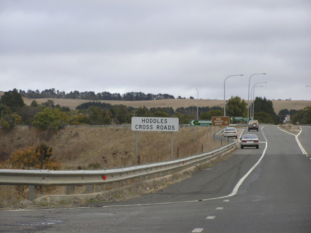 |
Confirmation this junction is indeed called Hoddles Cross Roads :p July 2004. |
 |
Heading east from the Hume Highway. July 2004. |
 |
Heading south on Hume Hwy approaching Illawarra Highway. Feb 2006. |
 |
Looking north on Hume Hwy approaching Illawarra Highway. I wonder what caused a large chunk of this sign to go missing. The sign has since been replaced. Jan 2004. |
 |
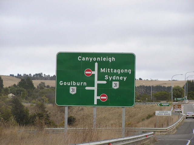
Approaching Illawarra Highway/Hume Hwy interchange from Canyonleigh Road. This sign dates from the opening of the interchange in the 1980s. Feb 2006. |
Last updated 13 December 2012 © Ozroads 2003-2012. |