National Route 41 |
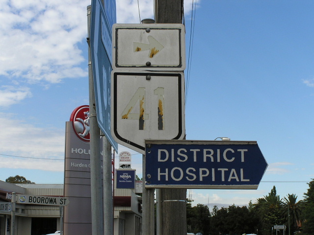
Badly fading and peeling National Route 41 trailblazer at the corner of Zouch St & Boorowa St in Young. Feb 2006.
In 2013, RMS will be implementing a new alpha-numeric route numbering system. For more information, visit the RMS Website. |
|
Forthcoming alpha-numeric route number: |
|
Length: 316km
Northern Terminus: Mid Western Highway, Cowra
Southern Terminus: Hume Hwy, 6km north of Table Top
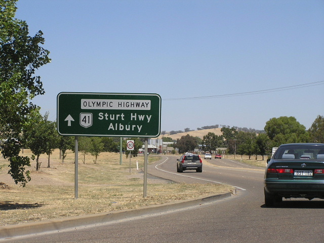
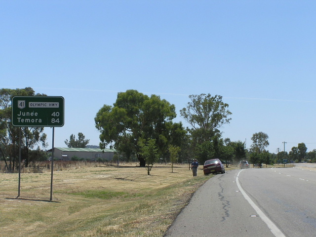
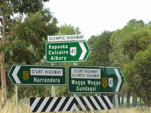
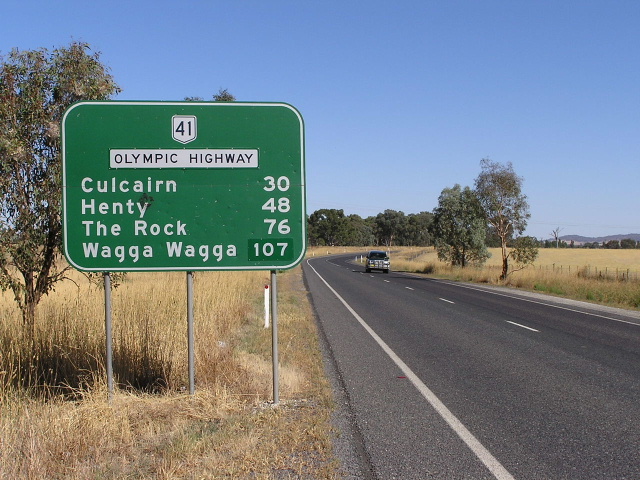
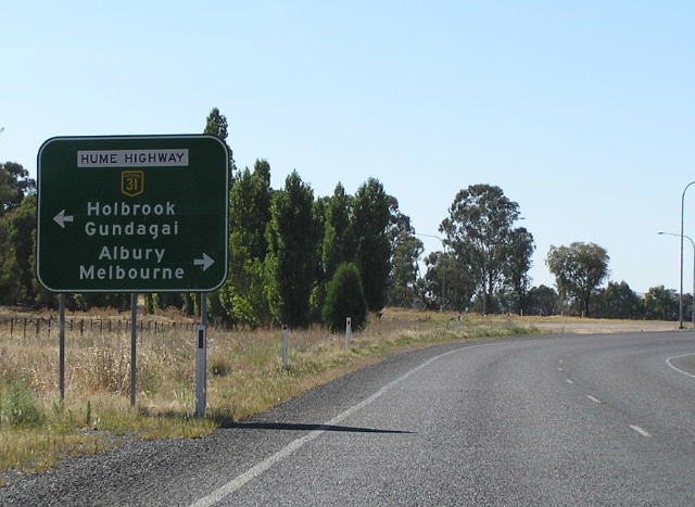
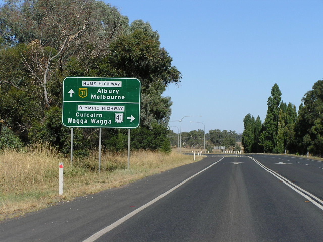
Route taken: From the Hume Highway via Culcairn, Henty, Uranquinty, Sturt Hwy, Gobbagombalin Deviation, Junee, Cootamundra and Young to the Mid Western Highway, that portion of the route south and north of the Sturt Highway being known as "Olympic Highway"
Note: National Route 41 is continuous along the duplex with Sturt Highway, whilst the name Olympic Highway is not.
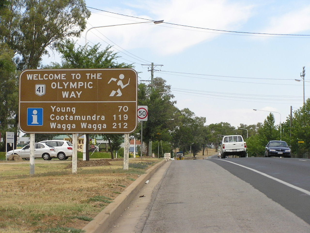
Focal points: Albury, Wagga Wagga, Junee, Cootamundra, Young, Cowra
RTA Internal Classification: Main Road No. 78 (north and south of the Sturt Hwy duplex), State Highway No. 14 (Sturt Highway section)
Named Olympic Highway: 1996 (previously named Olympic Way)
National Route 41 is a north-south route following the Olympic Highway through south-western New South Wales. It is a useful alternative route from Albury to Sydney (via Cowra and Bathurst), as well as serving Wagga Wagga which is the region's largest city. National Route 41 was not included in the original NAASRA plan for the National Route marking system in the 1950s and this explains its out-of-sequence number (i.e. 41 should be located west of 39). It was instead introduced by the Department of Main Roads (NSW) in 1974, along with several other additions to the National Route system (37,44,48, 52 and 58). It appears that these routes were not considered important enough to be included as National Routes in the 1950s but, by the early 1970s, thier importance had grown sufficiently to warrant a higher status that just a State Route.
The Olympic Highway, contrary to common belief is only a highway by name. According to its proclamation under the Roads Act 1993, the Olympic Highway is only a Main Road - No. 78 to be precise. Until 1986 it was Trunk Road No. 78 - the second highest legal road classification in New South Wales - however the enactment of the State Roads Act 1986 abolished Trunk Roads and incorporated them into the ordinary Main Roads classification. The fact the Olympic Highway is only a name is reflected in the quality of the road which, whilst it has improved considerably over the last 10-15 years, is still below par for a highway. Numerous level crossings of the Sydney-Melbourne railway line on poor alignments along the length of the highway add to its lower quality and there was one very high profile fatality at the level crossing near Gerogery in January 2001 which has led to calls for an upgrade or elimination programme. While I would normally champion that the level crossing was not to blame, and that driver error/incompetence/law-breaking caused the accident, the level crossing at Gerogery was complicated by a number of things:
-
firstly, the road has an intersection at the level crossing.
-
secondly, the important road does sharp left and right bends.
-
thirdly, the dog leg is roughly east-west and may have put the sun in the driver's eyes.
-
fourthly, the red flashing lights cannot properly point at both the main road and minor road approaches.1
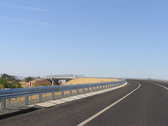
The NSW Government responded with funding enabling the Roads and Traffic Authority to construct a 1.6km deviation and new steel-and-concrete bridge over the railway line at Gerogery. Construction commenced in November 2003 and the new bridge and deviation was opened to traffic on 16 December 2005.
Interestingly, the Gerogery railway crossing was not originally part of the Olympic Way. A change of route on 1 July 1988 sent Olympic Way down what was formerly known as Bells Road, to reach the Hume Highway 10km south of Gerogery. The original route (23km long) was located a few kilometres inland and joined the Hume Highway at Ettamogh, 11km south of the current Olympic/Hume Highways junction. Presumably the reasoning behind the change was that a shorter connection ot the Hume Highway would save the RTA maintenance and construction costs of having a duplicate route a few kilometres west of the Hume Hwy (the old route of Olympic Highway is now under local government control) and that the new route is on a much straighter and flatter alignment.
The other significant recent construction project on the Olympic Highway was the 7km Gobbagombalin Deviation at Wagga Wagga, which bypassed the town centre to the west. The partially dual carriageway deviation included a lengthy viaduct across the Murrumbidgee River between Moorong St and Old Narrandera Rd and a grade-separated interchange for access to/from Charles Sturt University. Also included in the project was a the Wiradjuri Bridge over the Murrumbidgee River on the old alignment of Olympic Highway, replacing the steel truss Hampden Bridge which had been in service since 1895. The Gobbagombalin Deviation was opened to traffic in July 1997. The former route of the Olympic Highway was via Hampden Ave, Fitzmaurice St and Baylis St, although traffic frequently used Gurwood and Docker Streets to bypass most of the CBD.
The Olympic Highway was named in 1996. Previously, it had been known as "Olympic Way" since 5 July 1963. The name originates from the Olympic Torch having taken this route from Cowra to Albury on its way to the 1956 Olympics in Melbourne. The upgrading of the name from "Way" to "Highway" may have been associated with the coming of the Olympics to Sydney in 2000.
1. http://en.wikipedia.org/wiki/Gerogery_level_crossing_accident Accessed: 16 January 2006
|
Photos of National Route 41 - Olympic Highway |
|
 |
Mid Western Hwy westbound approaching the beginning of National Route 41 in Cowra. Jan 2006. |
 |
Mid Western Hwy eastbound approaching the beginning of National Route 41 in Cowra. Jan 2006. |
 |
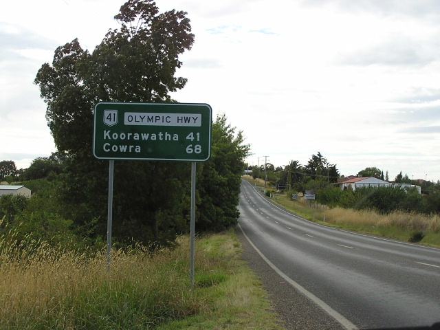
Looking north along Olympic Highway to its terminus at Mid Western Hwy, Cowra. Jan 2006. |
 |
Distance sign marking the beginning of the Olympic Highway in Cowra (although the sign still says "Olympic Way"!) Jan 2006. |
 |
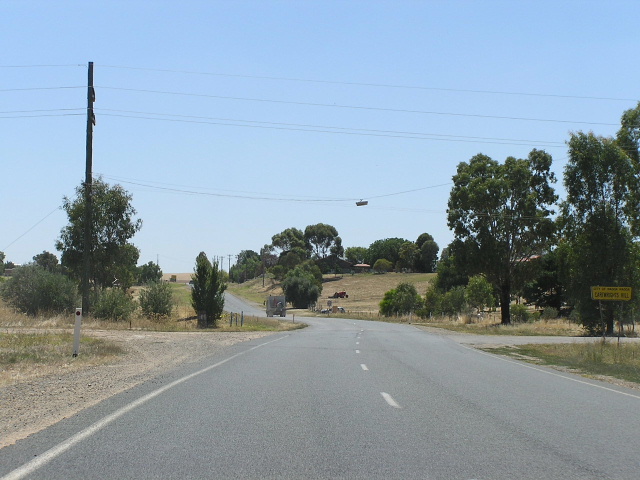
Black fingerboard signage at Noonbinna, 7km south of Cowra. Feb 2006. |
 |
Another black fingerboard, this time at Wattamondara, 15km south of Cowra. Feb 2006. |
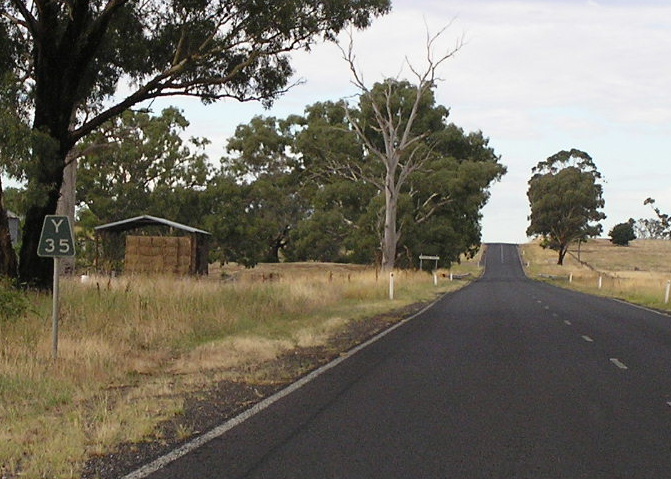 |
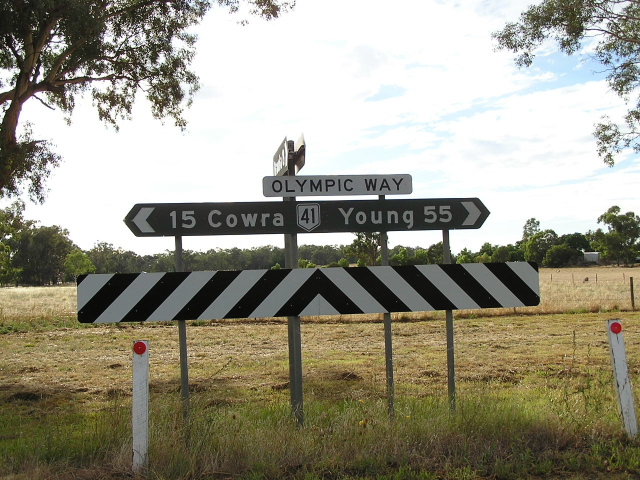
Black Y35 kilometre plate southbound near Crowther. Feb 2006. |
 |
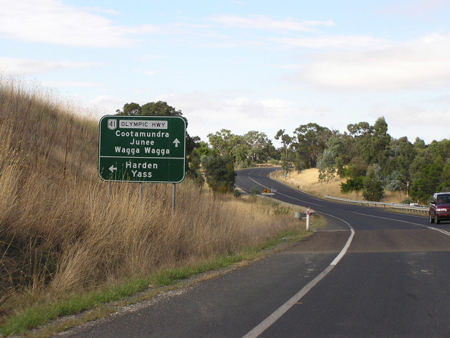
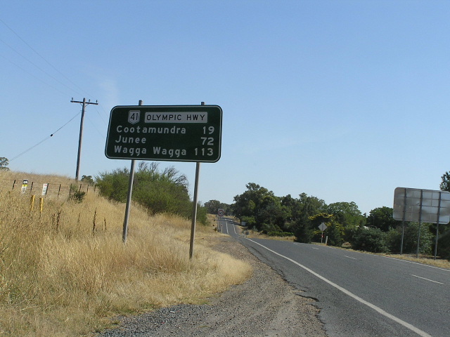
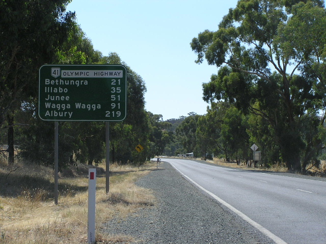
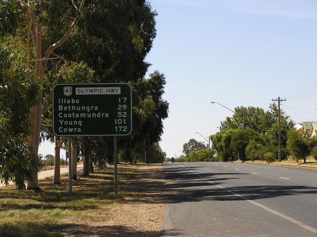
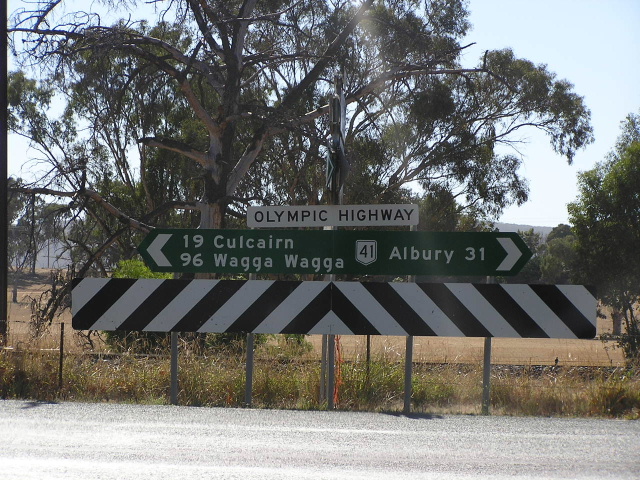
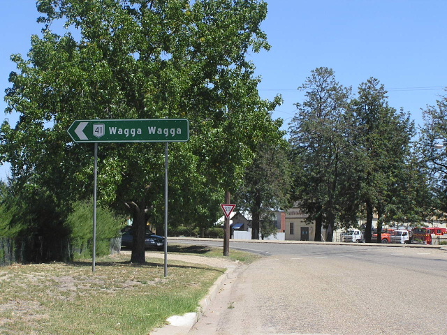
Distance sign heading north from Young. Feb 2006. |
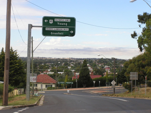 |
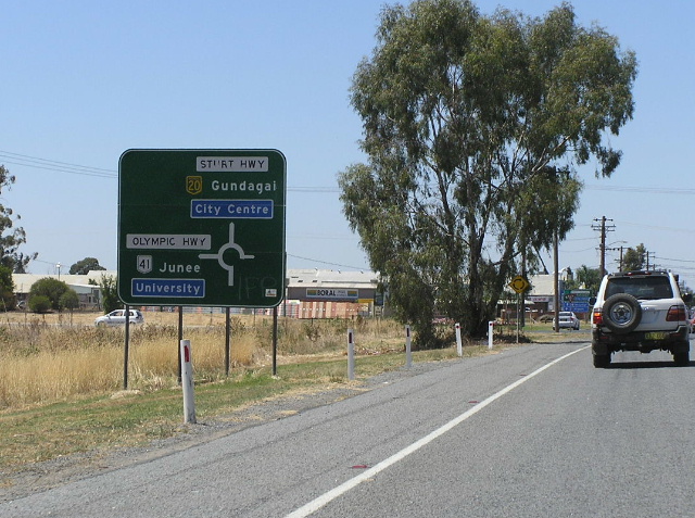
Southbound on Olympic Highway (Elizabeth St) approaching Henry Lawson Way (William St) in Young. Feb 2006. |
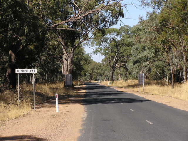
Extremely rare National Route 41 trailblazer at the corner of Zouch St & Boorowa St in Young. I am extremely surprised to find this, particularly because the use of trailblazers in NSW was generally discontinued prior to the introduction of NR41 in 1974. Also note the clearly visible coverplate on the direction sign not facing the camera. The coverplate reads "Olympic Highway" and is covering "Olympic Way". Feb 2006. |
|
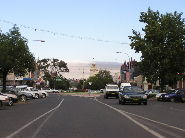 |
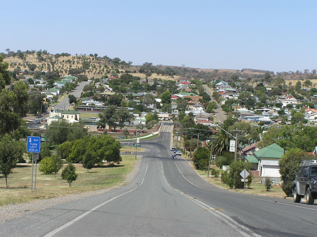
Looking west through Young town centre along Boorowa Street. Feb 2006. |
 |
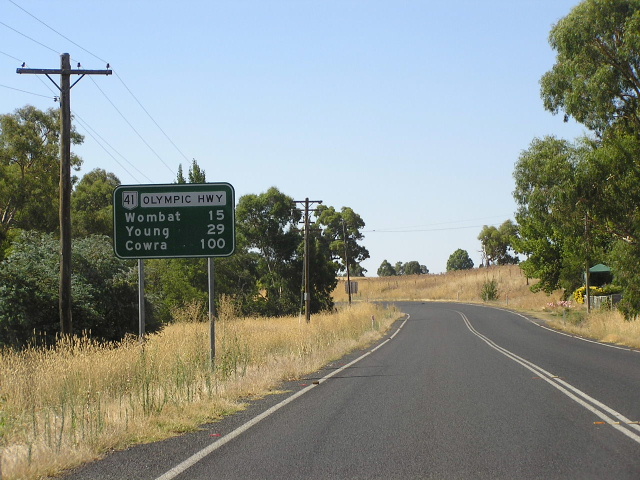
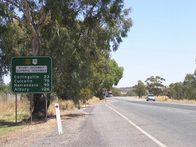
Distance sign heading south from Young. Feb 2006. |
 |
Southbound AD sign for the junction with Wombat Rd at Wombat. Feb 2006. |
 |
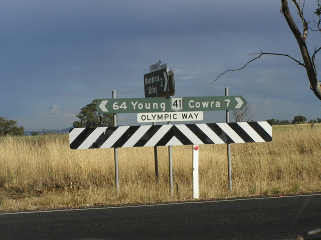
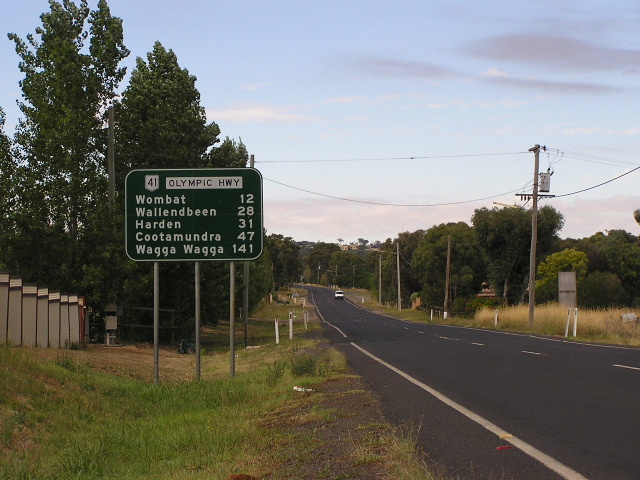
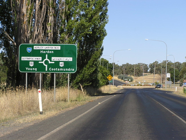
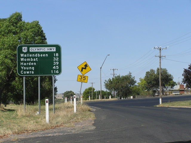
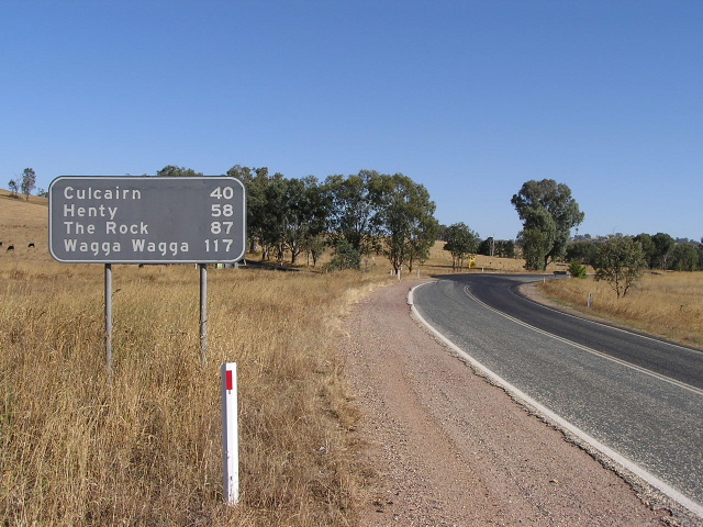
Distance sign heading north from Wallendbeen. Feb 2006. |
 |
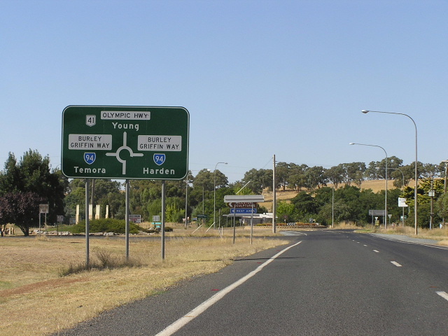
Eastbound AD sign on Burley Griffin Way approaching Olympic Hwy at Wallendbeen. Feb 2006. |
 |
Northbound AD sign on Olympic Hwy approaching Burley Griffin Way at Wallendbeen. Feb 2006. |
 |
Distance sign heading south from Wallendbeen. Feb 2006. |
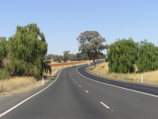 |
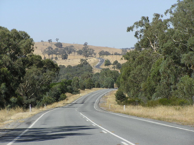
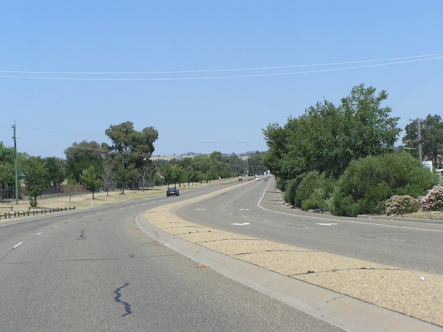
Looking north on one of the better sections of the Olympic Highway, near Jindalee. Feb 2006. |
 |
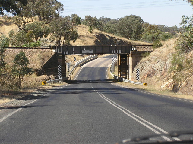
Looking south to the railway overpass on the northern outskirts of Cootamundra. Its the numerous railway crossings on right angles, like these, that prevent the Olympic Highway from being a truly high standard road. Feb 2006. |
 |
Distance sign heading north in Cootamundra approaching the railway overpass. Feb 2006. |
 |
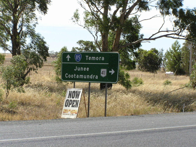
AD sign southbound approaching Temora Street in Cootamundra. Feb 2006. |
 |
Interesting style of AD sign with a very elaborate structure for a country town, eastbound on Temora St approaching Olympic Highway. Feb 2006. |
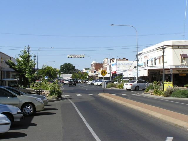 |
Looking north along Parker St, the main street of Cootamundra. Feb 2006. |
 |
Looking south along Parker St, the main street of Cootamundra. Feb 2006. |
 |
AD sign northbound on Olympic Hwy approaching Mackay St in Cootamundra. Feb 2006. |
 |
Distance sign heading south from Cootamundra. Feb 2006. |
 |
Looking north beneath the Main Southern Railway line and across Cootamundry Creek, just south of Cootamundra. This section of the highway is very substandard. Feb 2006. |
 |
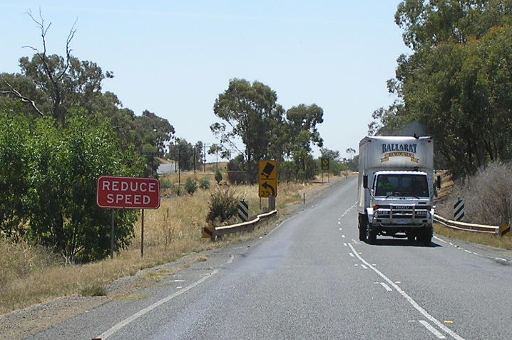
Looking north at Bethungra Hill. Feb 2006. |
 |
Unusual diagrammatic AD sign (with incorrect SR41 shield) at the dog-leg in Bethungra. The Olympic Highway crosses the railway line again via two right-angle bends. Note the rectangular coverplate on the right-hand side of the sign, it probably covers the legend: "Ironbung Street". Feb 2006. |
 |
Dual fingerboards at Warren's Lane, adjacent to another railway level crossing, 3km north of Illabo. Feb 2006. |
 |
Looking north alongside the Main Southern Railway line, between Junee and Illabo. Feb 2006. |
 |
Reconstruction underway between Junee and Illabo. Feb 2006. |
 |
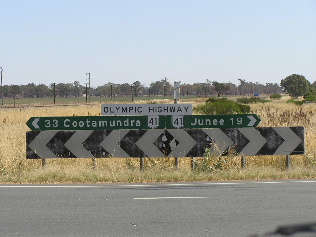
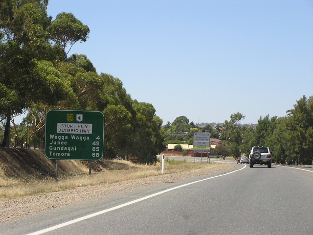
One of two distance signs heading north from Junee. Feb 2006. |
 |
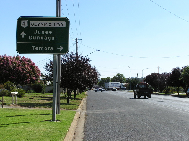
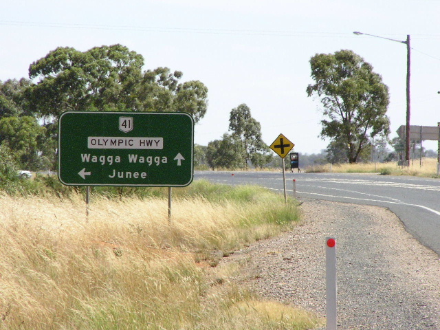
AD sign northbound on Main Street, approaching Olympic Hwy in Junee. Feb 2006. |
 |
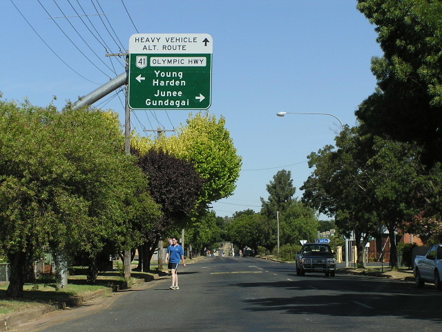
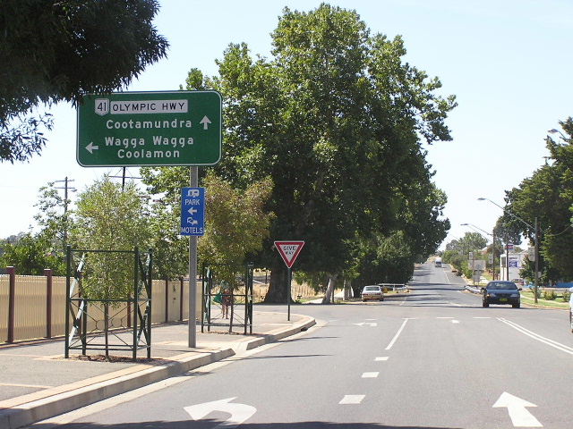
Looking east along Olympic Highway into Junee. Feb 2006. |
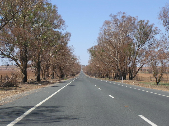 |
Looking east between Junee and State Route 85. A recent fire appears to have destroyed what once was a lovely tree-lined boulevard. Feb 2006. |
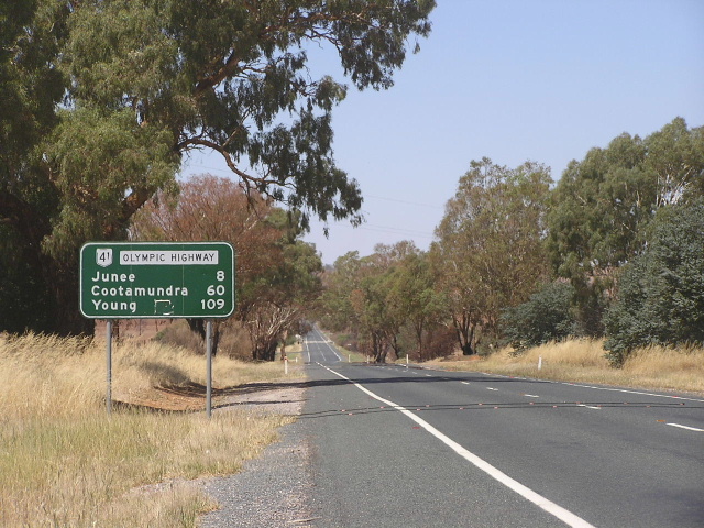 |
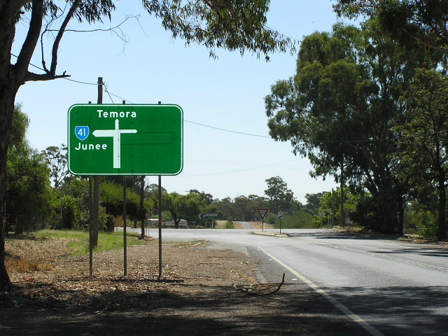
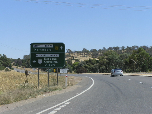
Distance sign heading east from the junction with State Route 85, 8km west of Junee. Feb 2006. |
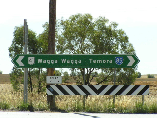 |
Double-chevron ID sign at the State Route 85 junction. Jan 2004. |
 |
Southbound on State Route 85 approaching Olympic Highway. Jan 2004. |
 |
Northbound AD sign for State Route 85 junction. Note that Olympic Hwy traffic must turn here to remain on the highway. Jan 2004. |
 |
Distance sign heading south from State Route 85. Jan 2004. |
 |
Very old black, borderless "J15" kilometre plate, northbound 15km south of Junee. Feb 2006. |
 |
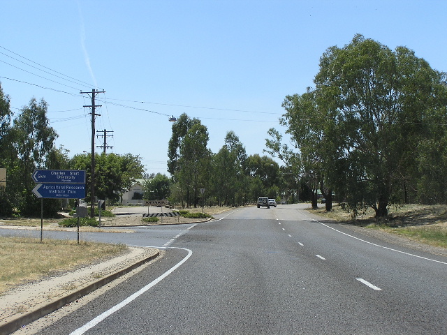
Northbound on the Gobbagombalin Deviation approaching the junction with Coolamon Road. Feb 2006. |
 |
Looking north at the lone grade-separated interchange on the Deviation, at Boorooma Street - the main access to Charles Sturt University. The interchange only has south-facing ramps, traffic to and from the north uses Coolamon Rd. Feb 2006. |
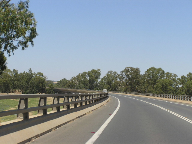 |
Looking south across the Murrumbidgee River and floodplain on Gobbagombalin Bridge, one of the longest road bridges in New South Wales. Feb 2006. |
 |
Looking south along the Gobbagombalin Deviation from Travers St. Feb 2006. |
 |
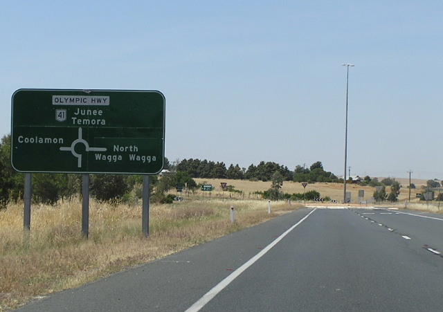
Interesting use of "Sturt Hwy" as focal point at Kincaid Street. Feb 2006. |
 |
Distance sign heading north from Sturt Highway. Feb 2006. |
 |
Eastbound AD sign on Sturt Hwy approaching Olympic Hwy in Wagga Wagga. Feb 2006. |
 |
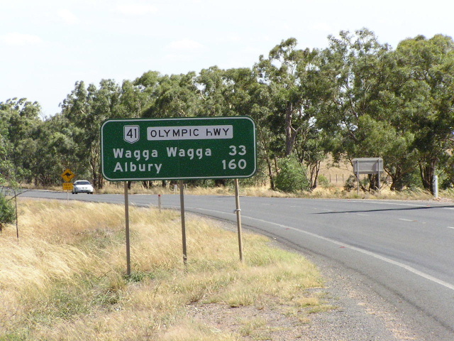
Distance sign heading east on Sturt Hwy from Olympic Hwy at Wagga Wagga. Note the unusual use of dual highway names - quite useful for navigational purposes although rarely used. Feb 2006. |
 |
Distance sign with dual highway names, heading east from Olympic Hwy along Sturt Hwy towards Wagga Wagga. Feb 2006. |
 |
Westbound Sturt Hwy approaching the western junction with Olympic Hwy. Feb 2006. |
 |
ID sign assembly at the Sturt Hwy/Olympic Hwy western junction. Jan 2004. |
 |
Distance sign heading south from Sturt Highway. Jan 2005. |
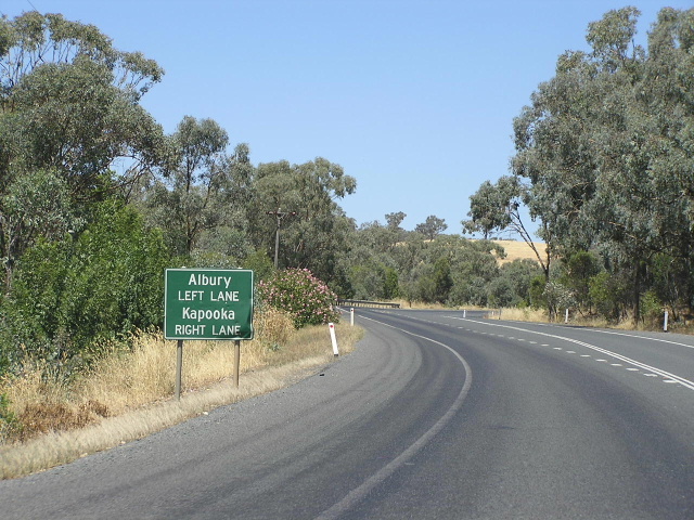 |
Unusual AD sign southbound approaching the railway overpass at Kapooka, 4km south of Sturt Hwy. This is yet another location where the Olympic Hwy crosses the Main Southern Railway line at right-angle bends. Feb 2006. |
 |
Looking north approaching the railway overpass at Kapooka. Feb 2006. |
 |
Fingerboard sign at the junction with the old alignment of Olympic Way, Gerogery. Feb 2006. |
 |
Looking south to the railway overpass at Gerogery. Feb 2006. |
 |
The first northbound distance sign on Olympic Highway, heading north from Hume Highway. Feb 2006. |
 |
AD sign southbound on Olympic Highway approaching its southern terminus at Hume Hwy. Feb 2006. |
 |
Hume Hwy westbound approaching the beginning of Olympic Hwy. Feb 2006. |
Former alignment of Olympic Highway: Wagga Wagga (bypassed June 1997) |
|
 |
Looking north along Hampden Ave into Cartwrights Hill. Feb 2006. |
 |
Remnant NR41 ID sign at the corner of Hampden Ave & Mill St in North Wagga Wagga. Feb 2006. |
 |
Looking north along Hampden Ave through North Wagga Wagga. Feb 2006. |
Really dodgy attempt at an ID sign assembly, at the corner of Tarvers St and Fitzmaurice St. Feb 2006. |
|
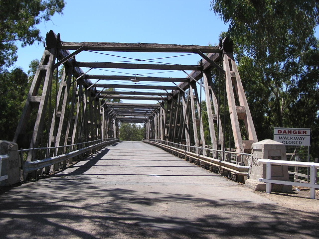 |
Looking east across Wiradjuri Bridge, which carried traffic from 1892 until 1995. It is now to be preserved as a heritage item - the best example of an Allan Truss bridge in New South Wales. Feb 2006. |
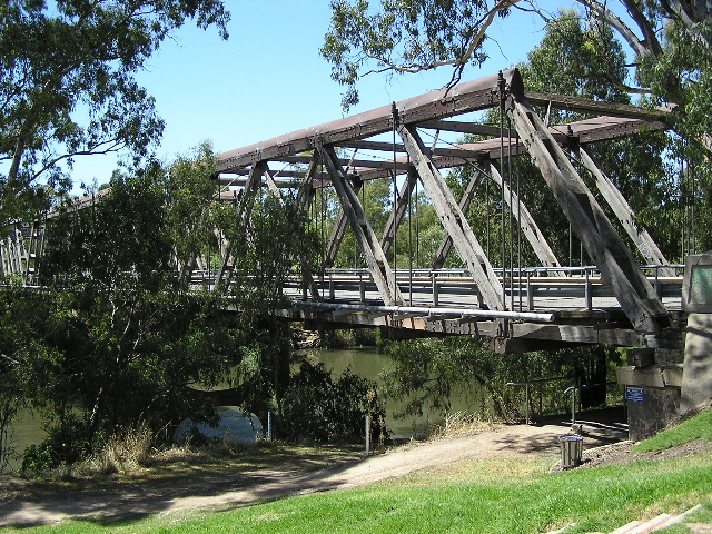 |
A side-on view of the Wiradjuri Bridge, spanning the Murrumbidgee River. Feb 2006. |
 |
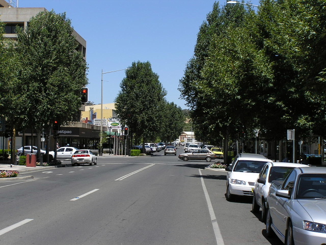
Looking north along Fitzmaurice Street through the northern end of Wagga Wagga CBD. Feb 2006. |
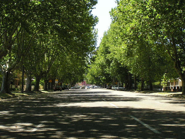 |
Looking east along the tree-lined Gurwood Street. This was frequently used, along with Docker St, as a bypass of the Wagga Wagga CBD, although the gazetted route of Olympic Way remained Baylis Street. Feb 2006. |
 |
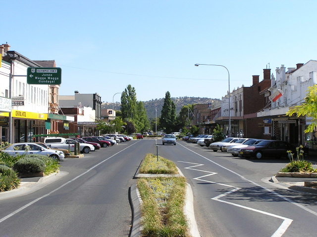
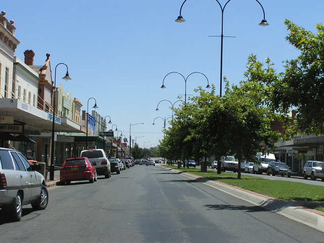
Looking south along Baylis Street through Wagga Wagga CBD. The exensive landscaping and traffic calming measures have been installed following opening of the Gobbagombalin Deviation. Feb 2006. |
Former alignment of Olympic Way: Gerogery to Table Top (decommisioned 1 July 1988) |
|
 |
Remnant "Olympic Way" sign, heading south from Gerogery. Feb 2006. |
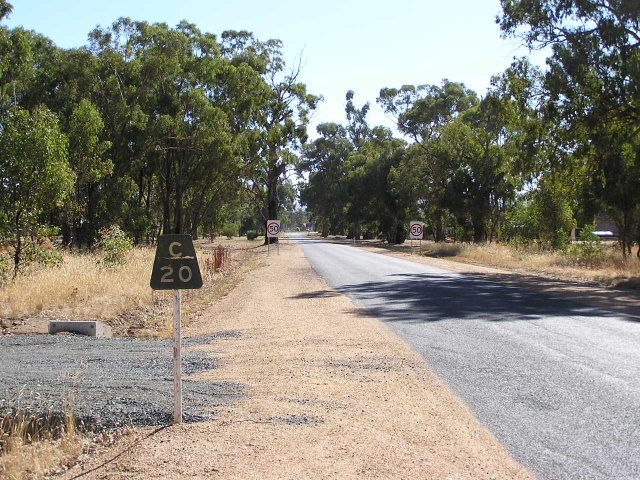 |
Very old, black borderless "C20" kilometre plate, northbound approaching Gerogery. Feb 2006. |
 |
Looking north along a typical section of the old Olympic Way, south of Gerogery West. Feb 2006. |
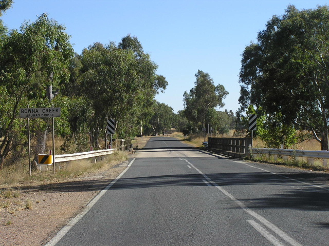 |
Looking north at a narrow bridge (Spurs Bridge) over Bowna Creek. Feb 2006. |
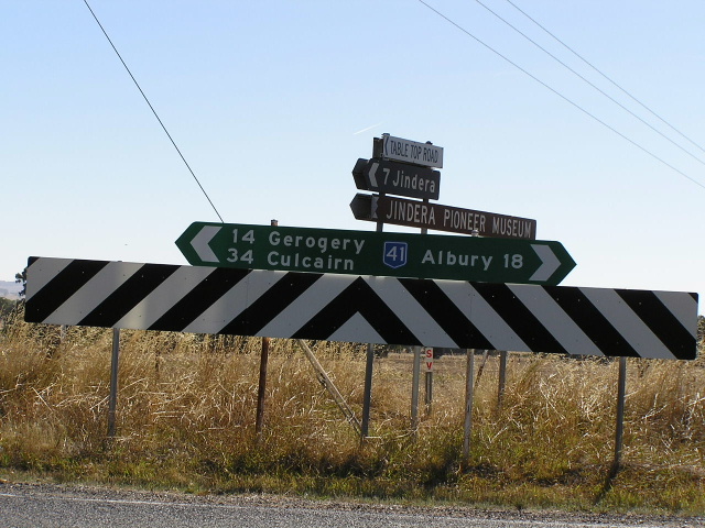 |
A signposting travesty! This completely wrongly coloured NR41 shield at Table Top Rd indicates that this was once the Olympic Way. Feb 2006. |
 |
A fair dinkum relic! This black fingerboard probably dates from 1974, located at Tynan Rd. Feb 2006. |
 |
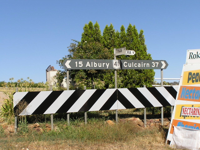
Black distance sign heading north from the junction with Hume Highway at Table Top. This sign reflects the road's days as part of the Olympic Way (through the focal points) but was probably installed following the re-gazettal in 1988, hence no shield. Feb 2006. |
Last updated 13 December 2012 © Ozroads 2003-2012. |