National Route 16 Murray Valley Highway |
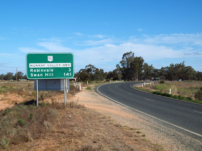
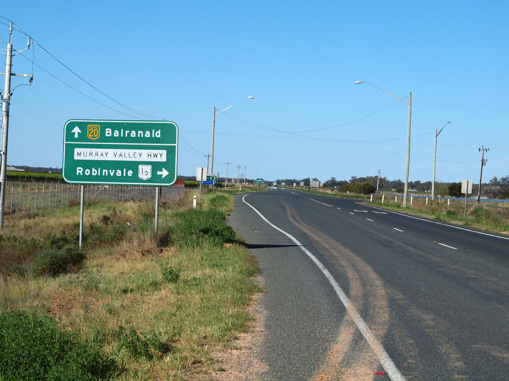
RD sign southbound on Murray Valley Highway at the junction with Sturt Highway, 3km north of Robinvale. Source: Peter Renshaw, October 2011.
In 2013, RMS will be implementing a new alpha-numeric route numbering system in NSW. For more information, visit the RMS Website. |
RMS have advised that this route will be decommissioned and not replaced by an alpha-numeric route number. |
Length: 2km
Route Names: Murray Valley Highway
Northern Terminus: Sturt Hwy, 2km west of Euston NSW
Southern Terminus: Euston Robinvale Bridge across the Murray River, Robinvale
Focal Points: Robinvale, Mildura
RTA Internal Classification: Main Road No. 503
National Route 16 is now only 2km long, stretching from the Sturt Hwy near Euston to the Robinvale Bridge across the Murray. However, National Route 16 once travelled over half the length of the Murray River between Corryong and Robinvale, mostly following the current B400 alignment.
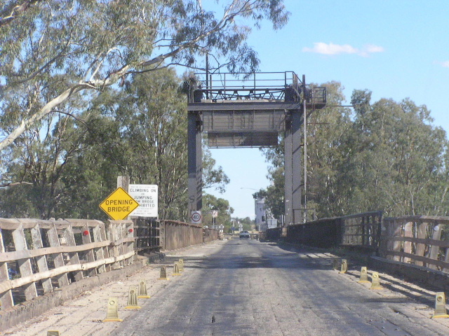
Current Alignment: The route traverses the Murray River on the one-lane Robinvale Bridge. This bridge was built in 1924 and, like most other Murray River bridges, has a now unused opening span. The remainder of the route, all 2km of it, is 100km/h two-lane rural highway.
National Route 16 was proclaimed in 1955, at the dawn of the National Route system. Its initial alignment is somewhat of an unkown at the Robinvale end, as many maps show it extending west to meet the Calder Highway at Hattah. However, it is implied on NAASRA's 1982 map of National Route signposting that the NR16 designation always continued through Robinvale to meet the Sturt Hwy in NSW. It is quite possible that the Murray Valley Hwy designation, which preceeded the route number a number of years, in fact did terminate in Hattah but was later re-routed to match the numerical designation. Despite these conclusions, its original western terminus is somewhat of a mystery.
East of Robinvale, National Route 16 followed the line of today's B400 through Swan Hill and Echuca. A short, 12km, duplex with National Route (later National Highway now NHA) 39 through Strathmeton followed. After passing through Cobram, Yarrawonga and Rutherglen, another duplex was encountered with National Highway (earlier National Route, now NHM) 31 between Barnawartha North and Wodonga for 13km. Prior to the upgrade of this section to freeway standards in 1987, NR16 used what is now Old Barnawartha Rd, parallelling the Old Hume Hwy on the north side of the railway for up to 5km before crossing the railway at a level crossing. Through Wodonga NR16 followed Melbourne Rd (the original Hume Hwy route), Elgin St, High St and Thomas Mitchell Drive. East of Wodonga, NR16 passed through Bonegila and Tallangatta before turning north and passing through Granya, Walwa, Tintaldra and Towong en route to its terminus in Corryong. During the 1980's both NR16 and the Murray Valley Hwy were re-routed through the mountains to Corryong, before proceeding east to the NSW Border.
In 1997, Victoria's Statewide Route Numbering System began replacing all the routes in rural Victoria. One of the first of these to go was NR16 within the North East Region as part of the trial of the new system in late 1996. By the end of 1998 all of the route had been superseded with the new B400 designation, relegating NR16 to its position of the shortest National Route in Australia, at 2km entirely within NSW.
Click HERE to see photos of National Route 16 remnants, and photos from prior to its decomissioning in Victoria.
National Route 16 Photos |
|
 |
Assortment of signs on the Victorian approach to the Robinvale Bridge. Note the NH20 shield, acknowledging that if you cross the bridge you ahve no choice but to join NH20. Photo taken Jan 2004. |
 |
Old style 'Welcome to NSW' sign with the Waratah flower symbol. Photo taken Jan 2004. |
 |
Looking north across the single-lane bridge. Clearly visible is the now unused opening span. Photo taken Jan 2004. |
 |
Looking north again, this time past the opening span. Photo taken Jan 2004. |
 |
The southbound approach to the bridge, showing the traffic signals that control the traffic flow. Photo taken Jan 2004. |
 |
Looking south across the bridge. Photo taken Jan 2004. |
 |
Off the south end of the bridge now and the B400 begins. Photo taken Jan 2004. |
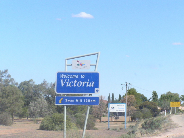 |
And of course, the 'Welcome to Victoria' sign. Photo taken Jan 2004. |
 |
Murray Valley Highway looking south at the northern end of the Euston Robinvale Bridge over the Murray River. The border between NSW/Victoria is the high water mark on the southern bank - i.e. the other end of this bridge. Source: Peter Renshaw, October 2011. |
 |
Victorian RD sign which has crept into NSW, northbound on Murray Valley Highway just before the bridge over the Murray River floodplain. The sign should, of course, show NR16 and be in the NSW design style. Source: Peter Renshaw, October 2011. |
 |
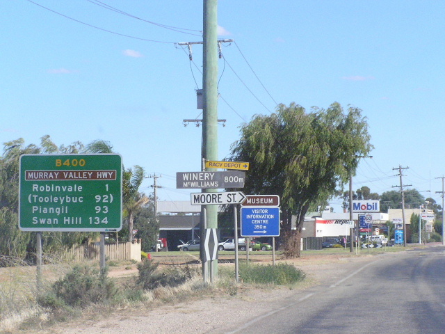
Typical late-1990s style RD sign southbound on Murray Valley Highway near the junction with Sturt Highway, 3km north of Robinvale. Source: Peter Renshaw, October 2011. |
 |
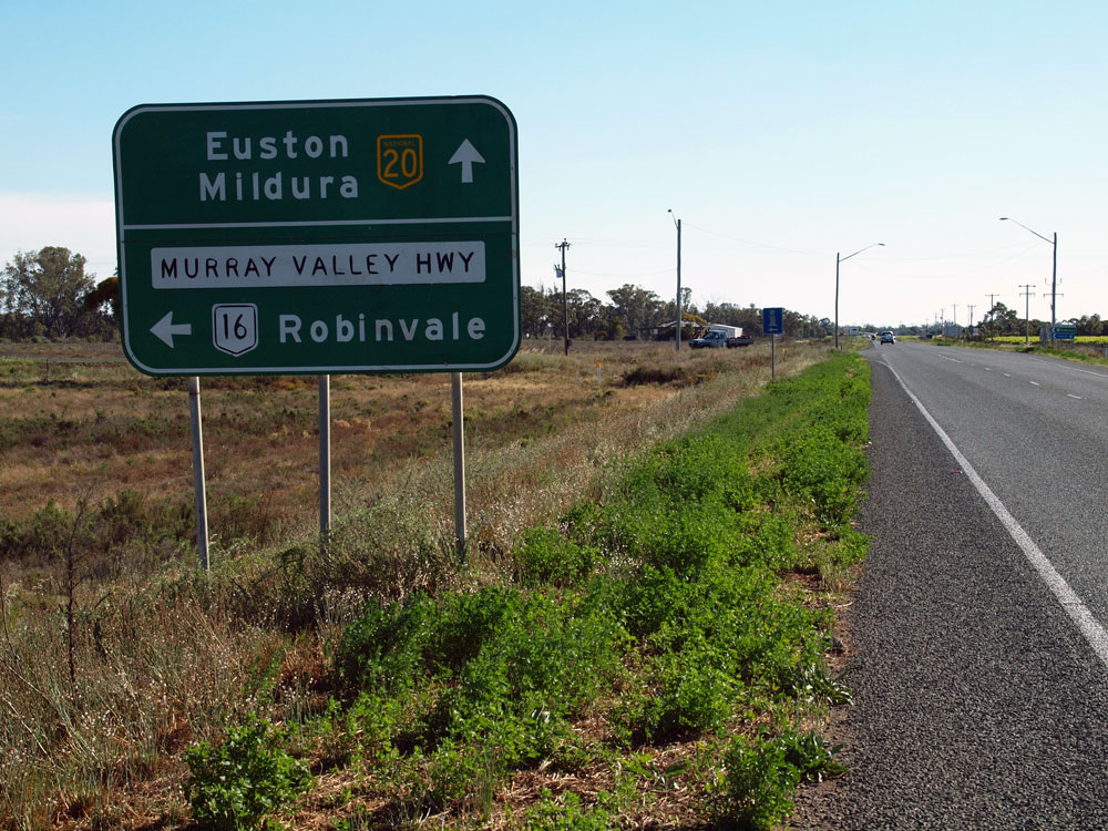
Northbound NR16 approaching the Sturt Hwy intersection. Photo taken Jan 2004. |
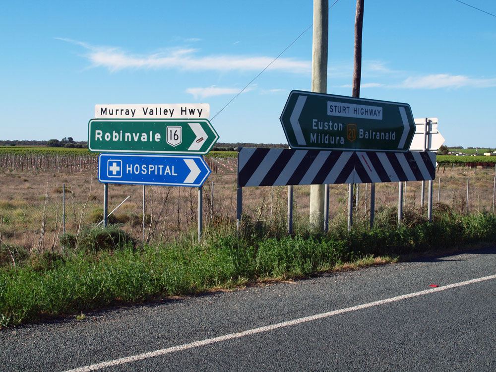 |
ID sign assembly at the junction of Sturt & Murray Valley Highways. Note the incorrect lower case lettering on the Murray Valley Highway name plate. Source: Peter Renshaw, October 2011. |
 |
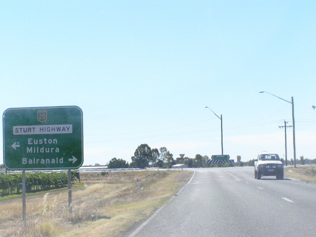
AD sign westbound on Sturt Highway approaching the junction with Murray Valley Highway. Source: Peter Renshaw, October 2011. |
 |
AD sign eastbound on Sturt Highway approaching the junction with Murray Valley Highway. Note the peeling black lettering, typical of signs of this era in southwestern NSW. Source: Peter Renshaw, October 2011. |
Last updated 12 December 2012 © Ozroads 2003-2012. |