NSW STATE ROUTE 77
Decomissioned
Lifespan: 1988-1993 (5 years)
Length: 35km
Northern Terminus: Pacific Highway & Pennant Hills Rd, Pearces Corner
Southern Terminus: Hume Hwy & Cumberland Hwy, Liverpool
Route taken: Cumberland Hwy (Pennant Hills Rd/James Ruse Dr/Briens Rd/Hart Dr/Freame St/Emert St/Jersey Rd/Betts Rd/Warren Rd/Smithfield Rd/Palmerston Rd/New Cambridge St/Cambridge St/Joseph St/Orange Grove Rd)
Focal Points: Hornsby, Parramatta, Liverpool
RTA Internal Classification: State Highway 13
Route Overview:
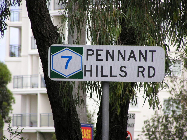
State Route 77 was the Cumberland Highway's original designation, commissioned on completion and proclamation of the highway in August 1988. SR77 usurped part of SR55 which previously had extended north from Parramatta along Pennant Hills Rd but only lasted a few years, being replaced by Metroad 7 in 1993. There are only a two remnants of SR77 remaining, both on side-streets in Pennant Hills. The signs, pictured below, were part of an experimental advance street name signage program that was trialed on the Pennant Hills Rd section of the newly-named Cumberland Hwy in 1989. More detailed assessment of the route, and of State Highway 13's history can be viewed on the Cumberland Highway page.
Notable events in the history of SR77:
1967 - Pennant Hills Rd 4-laned from Murray Farm Rd to Thompsons Cnr
1978 - Thompsons Cnr Channelised
September 1979 - Parramatta Bypass Stage 2 (Pennant Hills Rd to Windsor Rd)
September 1980 - Parramatta Bypass Stage 3 (Windsor Rd interchange & extension to Kleins Rd)
December 1981 - Parramatta Bypass Stage 4 (Kleins Rd to Hammers Rd & spur to Harris Rd)
Early 1980's - Cumberland Hwy route approved and devlopment begun
August 1988 - Cumberland Hwy named & proclaimed, replacing former SH13 route via Woodville Rd
December 1990 - Pennant Hills Rd 6-laned from Boundary Rd to Pearces Corner
1993 - SR77 replaced by Metroad 7
1993 - Polding St/Smithfield Rd interchange, Fairfield West
July 1995 - Pennant Hills Rd 6-laned from Copeland Rd to Boundary Rd
July 1995 - Thompsons Corner underpass
July 1995 - Bridge widening from Fairfield West to Liverpool
June 2002 - The Horsley Dr to Merrylands Dr 6-laning
Photos of State Route 77 |
|
 |
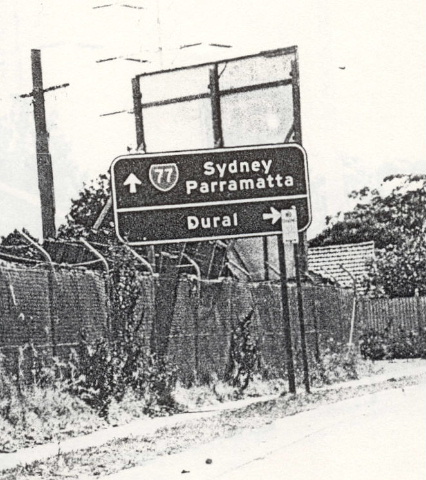
Pennant Hills RD AD sign southbound on the F3 at Wahroonga. Photo taken April 1993, only months before SR77 was decomissioned. |
 |
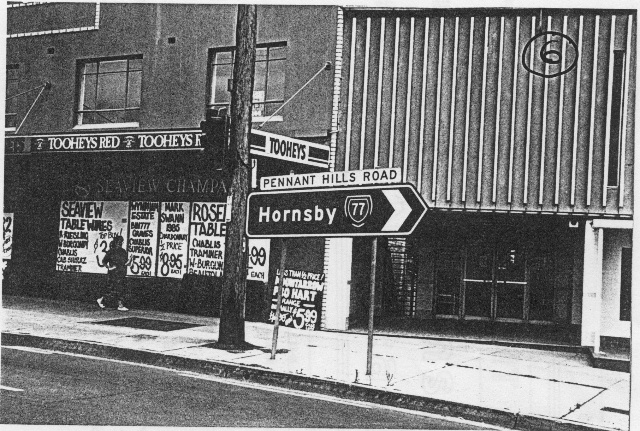
Pennant Hills Rd ID sign at the F3 intersection, Wahroonga. Photo taken April 1993. |
 |
Pennant Hills Rd RD sign, southbound from the F3 at Wahroonga. Note SR77 is on a coverplate over SR55 which once ventured this far north. Photo taken April 1993. |
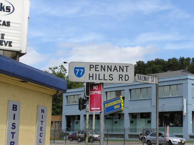 |
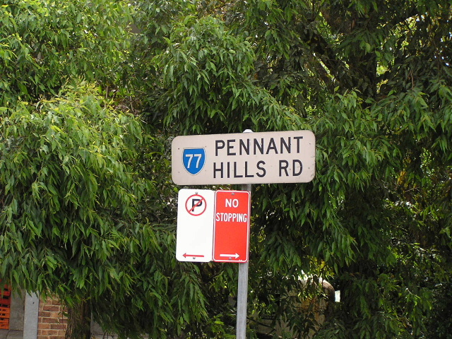
SR77 remnant in Railway St, Pennant Hills. These signs were part of a trail of better street name signage, piloted on Pennant Hills Rd in the late 1980's. Photo taken December 2003. |
 |
Similar type of sign to the above photo, this one in Trebor Rd, Pennant Hills, was coverplated. Photo taken December 2003. |
 |
Same style of sign, this one was forgotten, City View Rd, Pennant Hills. Photo taken December 2003. |
 |
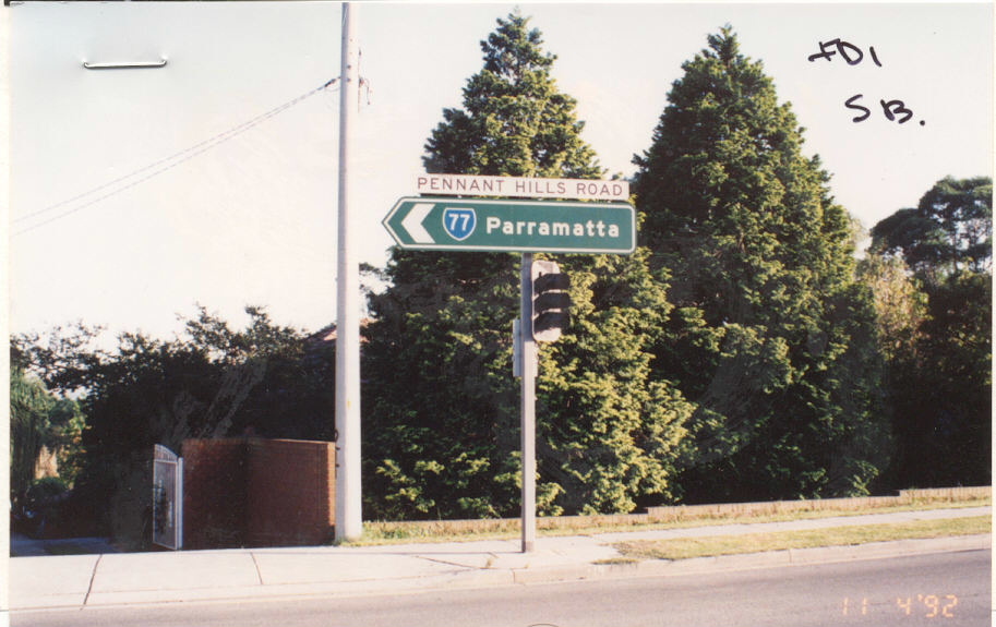
Photocopy of Pennant Hills Rd AD sign southbound at Boundary Rd, Pennant Hills. Photo taken c.1989. |
 |
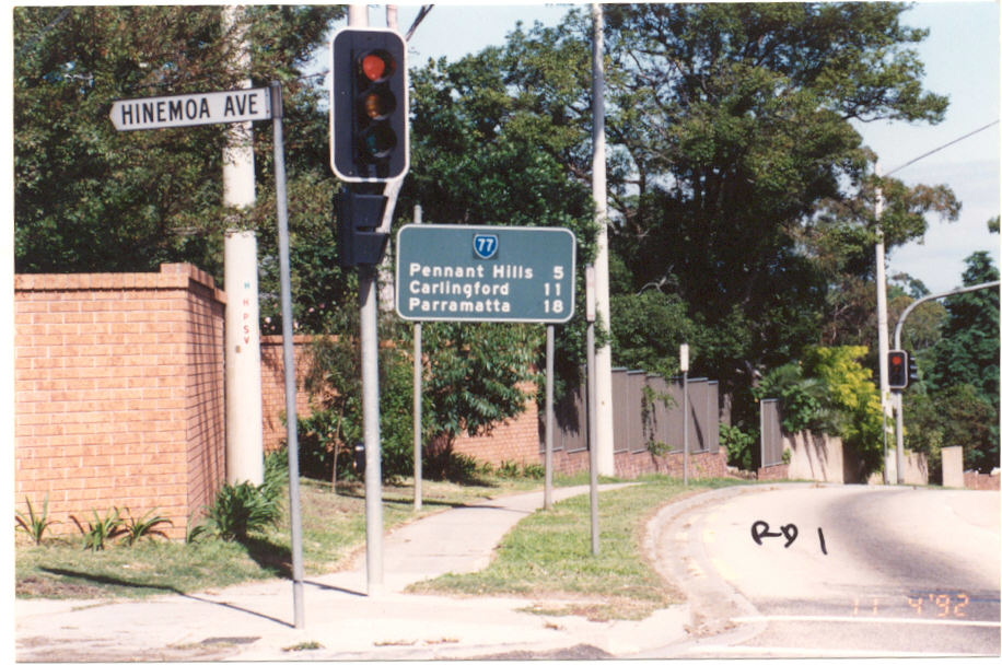
Photocopy of ID sign at Marsden Rd, Carlingford. Photo taken c.1990. |
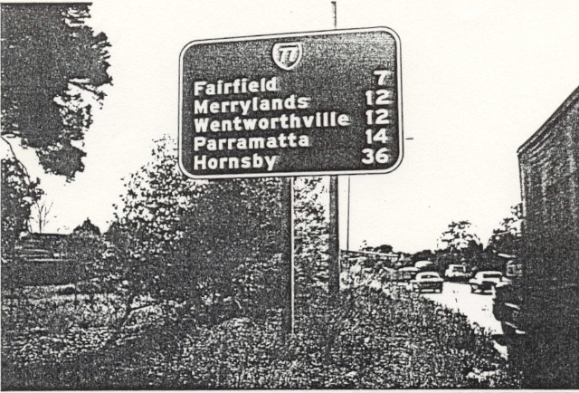 |
SR77 distance sign northbound from Cabramatta Rd, Cabramatta. Photo taken c.1990. |
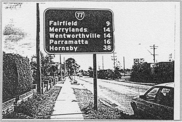 |
SR77 distance sign northbound from Hume Hwy, Liverpool. Photo taken c.1990. |