NSW STATE ROUTE 66
Decommissioned

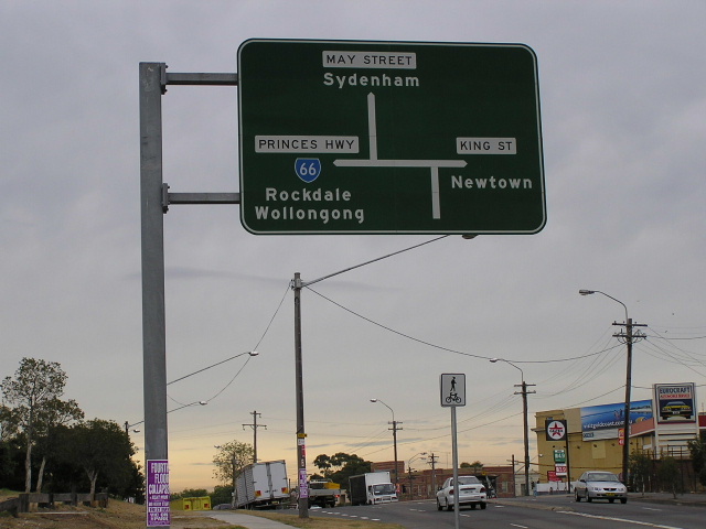
Looking south on Princes Hwy at May St, St Peters. April 2004.
Lifespan: 1991-2004 (13 years)
Length: 13km
Northern Terminus: Broadway & Harris St & Regent St, Ultimo
Southern Terminus: Princes Hwy & President Ave, Kogarah
Route taken: Princes Hwy, Sydney Park Rd, Euston Rd, McEvoy St, Botany Rd, Regent St (Henderson Rd/Wyndham St/Gibbons St Northbound)
Focal Points: Wollongong, Rockdale, Sydenham, Redfern, City
RTA Internal Classification: State Highway No. 1 (Princes Hwy), Main Road No. 528 (Sydney Pk Rd/Euston Rd/McEvoy St), Main Road No. 170 (Remainder of Route)
Route Overview:
State Route 66 replaced National Route 1 in the inner south of Sydney following its major alignment shift in April 1991. The original route was simply the Princes Highway (including King St & City Rd) from Kogarah to Broadway. In June 1993 SR66 was moved onto a new route between St Peters and Broadway - utilising Sydney Park Rd, Euston Rd, McEvoy St, Botany Rd and Regent St through Redfern. This was the designated heavy vehicle route to the Harbour Bridge and had been upgraded for the purpose. The route was finally decommissioned in June 2004 along with most other Sydney region state routes.
As part of the Roads 2000 plan a new (upgraded) route for trucks between the Western Distributor and St Peters was announced via Micthell Rd, Euston Rd, McEvoy St, Botany Rd and Regent St. Construction commenced in April 1987 and the major improvements were opened to traffic in June 1992 - the Mitchell Rd to Euston Rd connection (now named Sydney Park Road) and the Regent St to Gibbons St in Redfern which facilitated the one-way street system. The whole project was completed in June 1996 - having already taken the SR66 in June 1993.
Notable events:
April 1991 - Route introduced via City Rd and King St
June 1993 - SR66 re-routed through Redfern
June 2004 - SR66 decommissioned
Photos of the former State Route 66 |
|
 |
Princes Hwy northbound approaching the start of SR66 at Kogarah. Feb 2000. |
 |
President Ave westbound approaching the start of SR66 at Kogarah. Feb 2000. |
 |
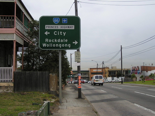
Princes Hwy northbound at Regent St, Kogarah. May 2004. |
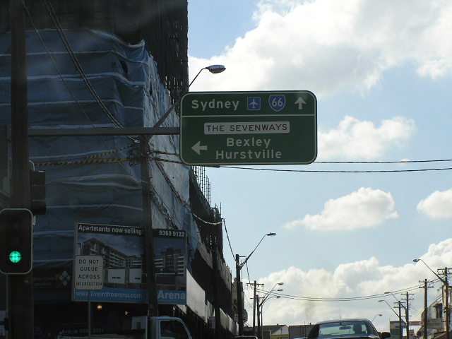 |
Princes Hwy northbound at The Sevenways, Rockdale. May 2004. |
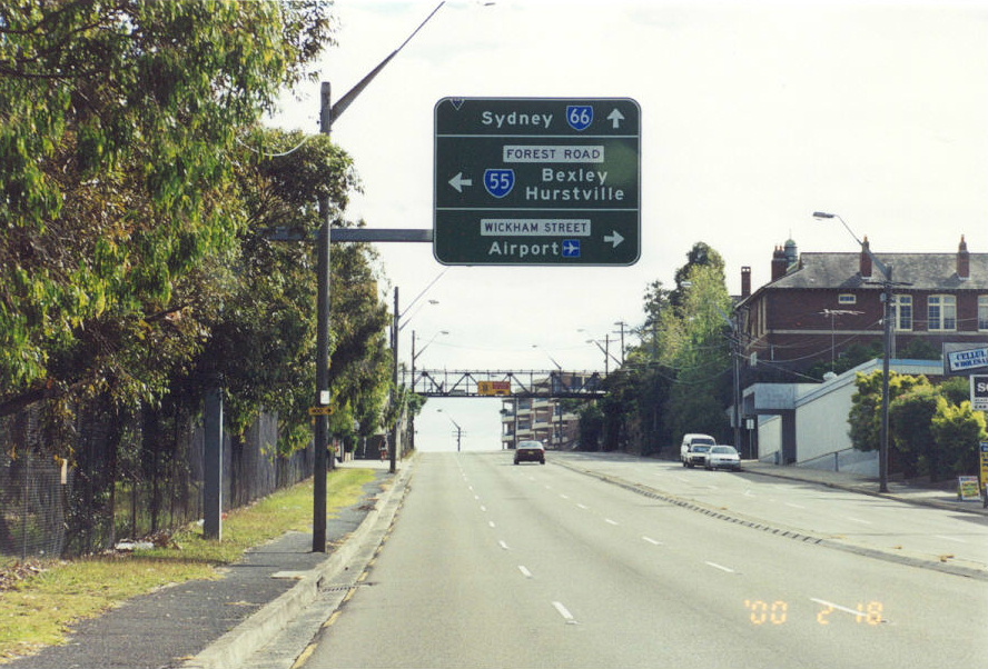 |
Princes Hwy northbound at Forest Rd, Arncliffe. Feb 2000. |
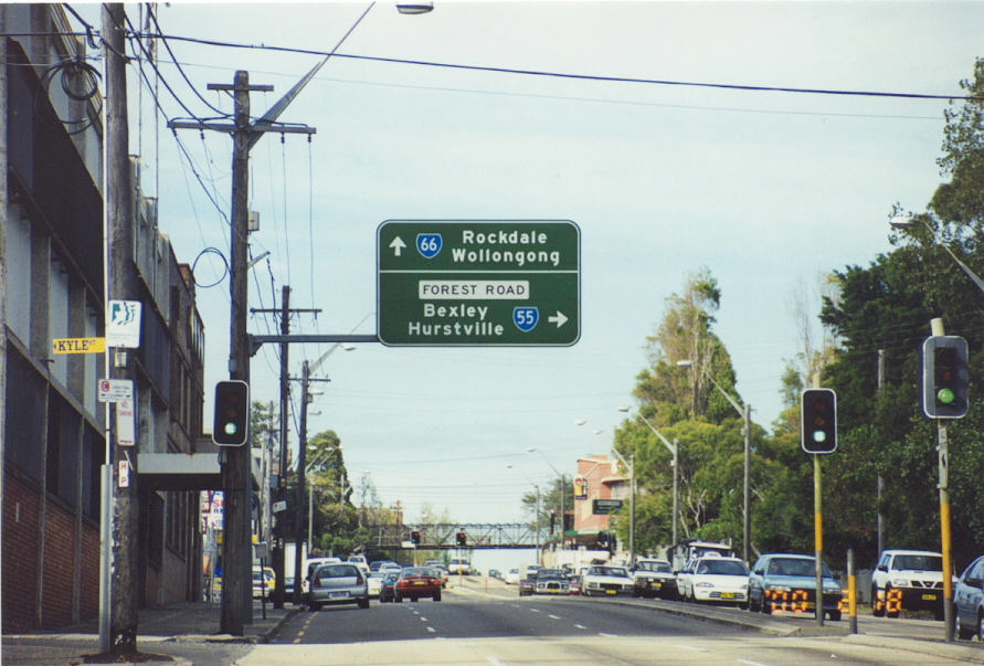 |
Princes Hwy southbound at Forest Rd, Arncliffe. Feb 2000. |
 |
Wickham St westbound approaching Princes Hwy, Arncliffe. Feb 2000. |
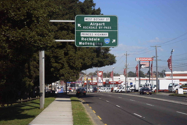 |
Princes Hwy southbound at West Botany St, Arncliffe. April 2004. |
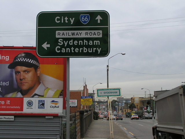 |
Princes Hwy northbound approaching Railway Rd, Sydenham. April 2004. |
 |
Railway Rd eastbound approaching Princes Hwy. April 2004. |
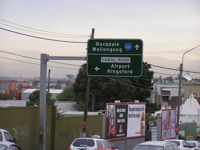 |
Princes Hwy southbound at Canal Rd (former SR17) at St Peters. April 2004. |
 |
Princes Hwy northbound where SR66 turns onto Sydney Park Rd. April 2004. |
1994 photo showing Mitchell Rd - Sydney Park Rd's old name. |
|
 |
Sydney Park Rd heading west to Princes Hwy at St Peters. April 2004. |
 |
Heading east on Sydney Park Rd to Euston Rd. Note the blank coverplates that have amended the rounabout diagram since the closure of one leg of the roundabout. April 2004. |
 |
Euston Rd southbound at Sydney Park Rd. April 2004. |
 |
McEvoy St northbound at Fountain St, Alexandria. April 2004. |
 |
Fountain St eastbound approaching McEvoy St, Alexandria. April 2004. |
 |
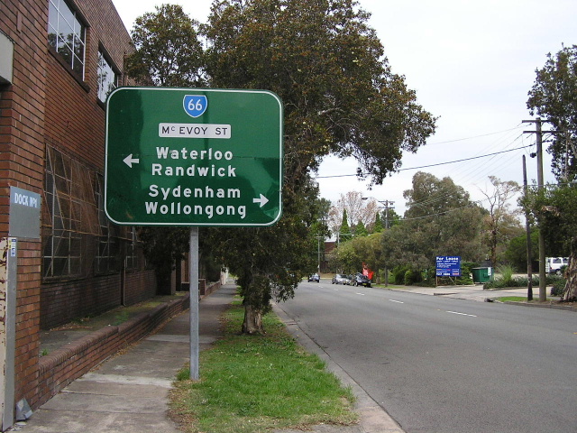
McEvoy St eastbound approaching Botany Rd, Waterloo. April 2004. |
 |
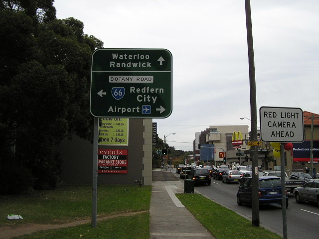
Botany Rd southbound at McEvoy St. April 2004. |
 |
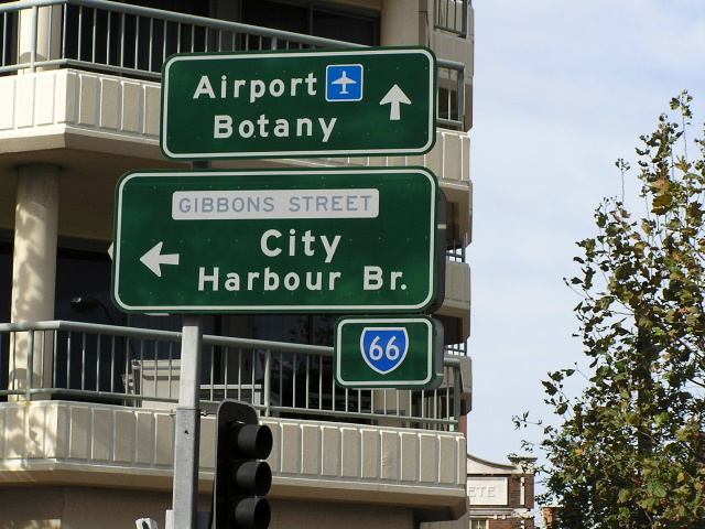
Henderson Rd & Wyndham St, Redfern. Note SR66 is on a separate sub-sign. This is because the majority of signs in this area were installed before the decision was made to route SR66 through Redfern. April 2004. |
 |
Another sign assembly with separate SR66 shield. April 2004. |
 |
Gibbons St northbound approaching Cleveland St at St Pauls Terrace. April 2004. |
 |
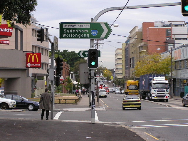
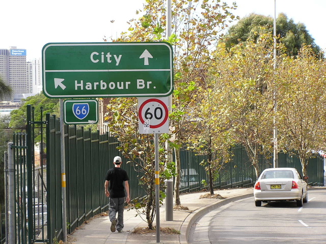
Regent St southbound at Cleveland St. April 2004. |
 |
Regent St at Lee St, Chippendale. April 2004. |
 |
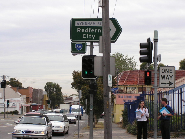
Harris St southbound approaching Broadway. April 2004. |
1994 photo showing SR66 along Broadway and then down City Rd (the original route) - note the SR66 shield is covering a NR1 shield. |
|
 |
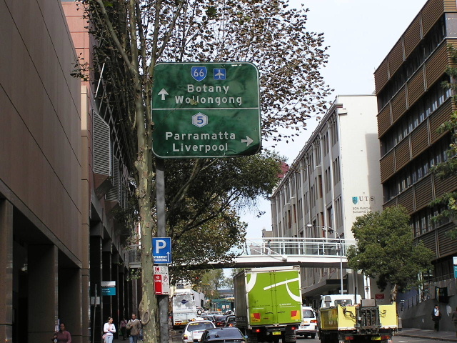
Blank coverplate over SR66 shield on King St (Princes Hwy), Newtown. April 2004. |
 |
Another blank coverplate over SR66 shield on King St (Princes Hwy), Newtown. April 2004. |