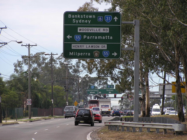
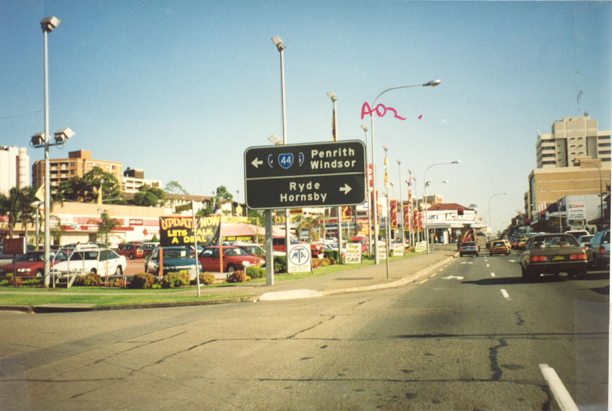
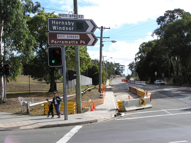
Former State Route 55 Hornsby - Parramatta - Hurstville - Arncliffe |
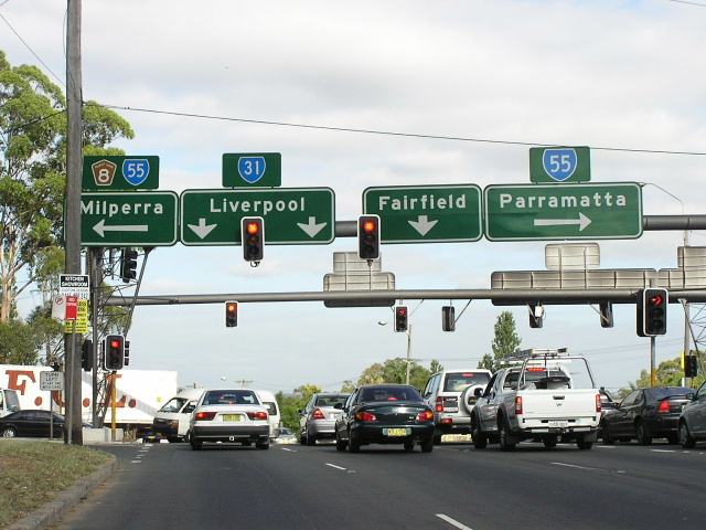
Heading north from Newbridge Rd & Milperra Rd, Milperra. May 2004.
Lifespan: 1974-2004 (30 years)
Length (2004): 47km
Northern Terminus (2004): Cumberland Hwy & James Ruse Drive & Pennant Hills Rd, North Parramatta
Southern Terminus: Princes Hwy & Forest Rd & Wickham St, Arncliffe
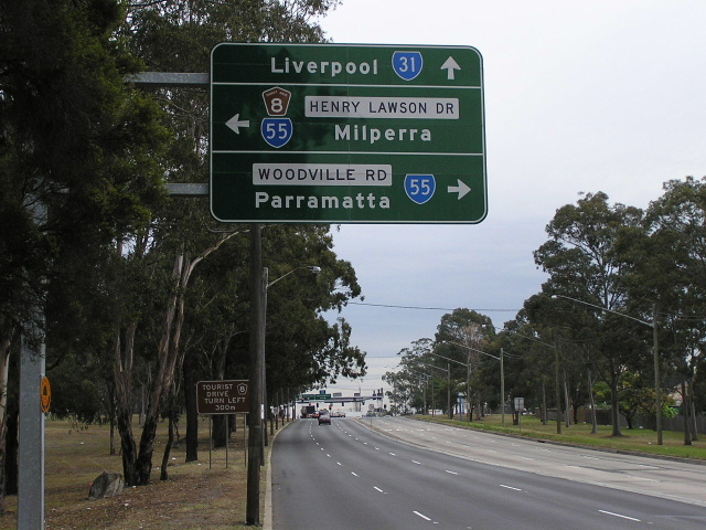
Route taken (2004): James Ruse Dr, Parramatta Rd, Woodville Rd, Henry Lawson Dr, Forest Rd, Queens Rd, Croydon Rd, Forest Rd
Focal Points: Hornsby/Windsor, Granville, Parramatta, Milperra, Hurtsville, Rockdale, Arncliffe
RTA Internal Classification (current): Main Road No. 168 (Arncliffe-Peakhurst), Main Road No. 508 (Henry Lawson Dr), Main Road No. 640 (Woodville Rd), State Highway No. 5 (Parramatta Rd), Main Road No. 309 (James Ruse Dr)
Route Overview:
State Route 55 was a circumferential State Route in Sydney’s metropolitan area, connecting the Pacific, Hume and Princes Highways with Parramatta, Milperra, Hurstville and, of course, each other.
It was first introduced in 1974, along with most of the other NSW State Routes, extending from Pacific Highway at Pearces Corner to the Princes Highway at Arncliffe, via Pennant Hills Road, Church Street, Woodville Road, Henry Lawson Drive and Forest Road. It was introduced as a direct replacement for Ring Road 5, which is where the number 55 was derived from, as the Ring Roads were decommissioned in favour of a comprehensive State Route marking scheme.
The Department of Main Roads’ Schedule of Descriptions of State Routes from 1st July 1982 provides the following description of State Route 55:
“From the junction of State Highway Nos. 10 (Pacific Highway) and 13 (Cumberland Highway) at Wahroonga, then via State Highway No. 13 (Pennant Hills Rd, Church St, Woodville Rd) and Main Road Nos. 508 (Henry Lawson Drive) and 168 (Forest Road) to the junction with State Highway No. 1 (Princes Highway) at Arncliffe. (Incorporating previous Ring Road No. 5)”
This description of the route pretty much sums up its main roles within the network - firstly to connect the Pacific and Hume Highways via Parramatta and secondly to provide a circumferential route between Hornsby, Parramatta, Milperra, Hurstville and Arncliffe.
With the development of Parramatta as Sydney’s supposed second CBD during the late 1980s and the construction of a new route for the Cumberland Highway, State Route 55 was faced with major changes. The first came in 1987 with the closure of Church Street in Parramatta to create a pedestrian mall. State Route 55 was relocated from its original Church Street route onto Albert, O’Connell, Macquarie and Pitt Streets (a one-way operation was implemented south of Macquarie Street which saw northbound traffic using Pitt and Macquarie Streets, southbound traffic used O’Connell Street) and then the Great Western Highway to rejoin Church Street at Parkes Street.
This realignment, however, was only a temporary measure. The completion of the new Cumberland Highway route in 1988 meant a re-jigging of the State Route in this area. The new highway route was re-badged as State Route 77 from Wahroonga to Liverpool, replacing State Route 55 along Pennant Hills Road. State Route 55 itself was decommissioned along Pennant Hills Road and relocated again at Parramatta, this time via Parramatta Road and James Ruse Drive around the eastern side of Parramatta to meet Pennant Hills Road at North Parramatta. The section of the route along James Ruse Drive replaced the former State Route 53.
Thus, in 1989, State Route 55 began at the intersection of Pennant Hills Road and James Ruse Drive in North Parramatta, following James Ruse Drive, Parramatta Road and thence its original route via Milperra and Hurstville to Princes Highway at Arncliffe.
The only other change to the route came in 1993, with the creation of a bypass route around Hurstville via Queens Road and Croydon Road. State Route 55 was shifted onto this new route as Forest Road through Hurstville CBD was closed to through traffic and pedestrianised. This is how State Route 55 stayed until its decommissioning in 2004. The route was decommissioned as part of a large programme of route deletions in Sydney in preparation for the introduction of alpha-numeric route marking.
Notable events in the history of State Route 55:
1974 - State Route 55 introduced to replace Ring Road 5, extending from Hornsby to Arncliffe via Parramatta, Milperra and Hurstville
1987 - State Route 55 relocated from Church St onto O'Connell/Pitt Streets at Parramatta to allow construction of Church Street Mall
1988 - State Route 55 relocated James Ruse Dr, bypassing Parramatta to the east, and truncated at the intersection of Pennant Hills Rd & James Ruse Dr
1993 - State Route 55 relocated from Forest Road onto Queens Rd & Croydon Rd, bypassing Hurstville CBD
2004 - State Route 55 completely decommissioned.
Photos of the former State Route 55 (final alignment) |
|
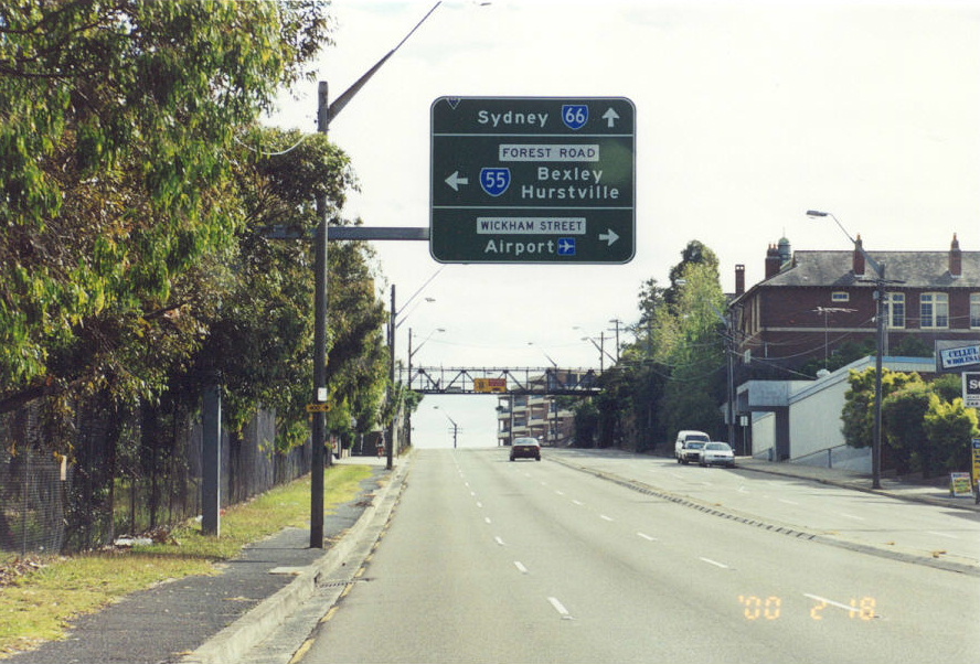 |
Starting from the Arncliffe end of SR55 - northbound on the Princes Hwy approaching Forest Rd. Feb 2000. |
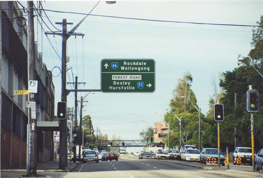 |
Southbound on Princes Hwy approaching Forest Rd. Feb 2000. |
 |
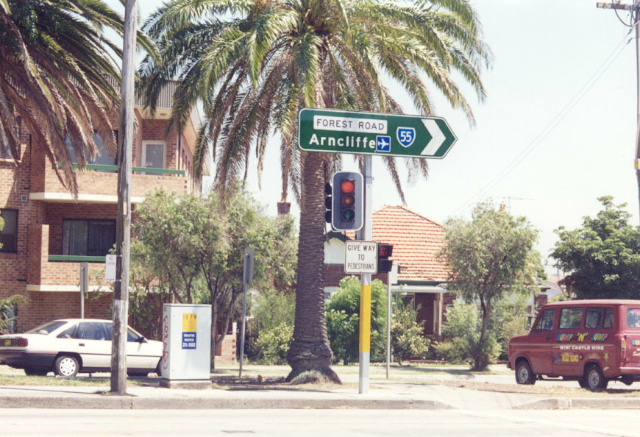
Westbound on Wickham St approaching the start of SR55. Feb 2000. |
 |
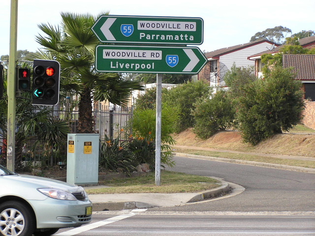
ID sign at the intersection of Forest Rd & Stoney Creek Rd, Bexley. 1997. |
 |
ID sign at Willison Rd, Bexley. 1997. |
 |
Westbound on Forest Rd approaching Croydon Rd, Hurstville. 1997. |
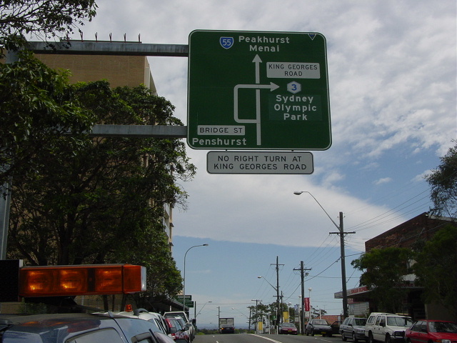 |
Westbound on Forest Rd approaching Bridge St, Hurstville. Jan 2004. |
 |
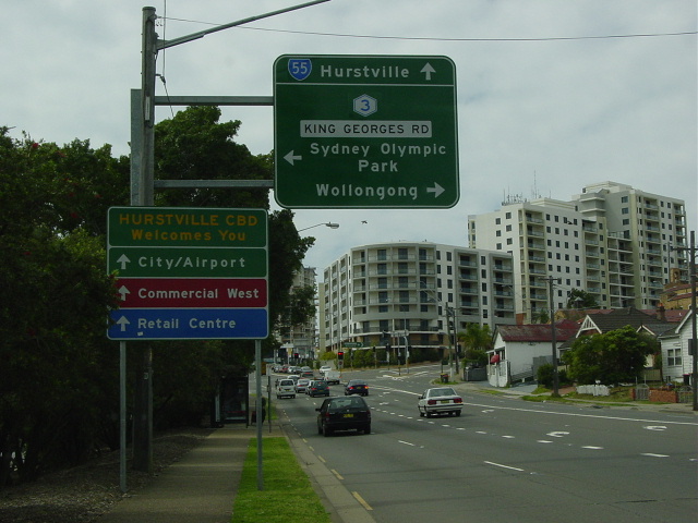
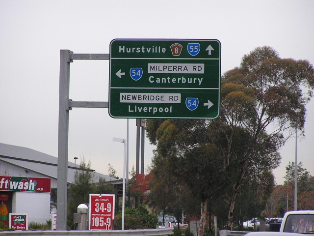
Southbound on King Georges Rd approaching Forest Rd, Hurstville. April 2004. |
 |
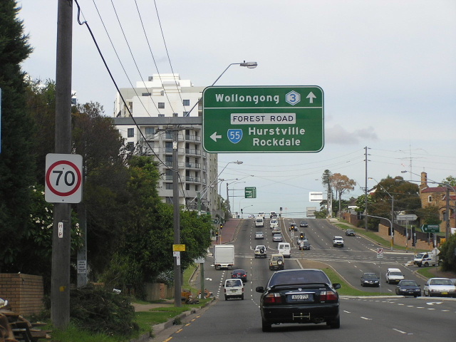
Eastbound on Forest Rd approaching King Georges Rd, Hurstville. Jan 2004. |
 |
Heading east on Forest Rd approaching Bonds Rd & Boundary Rd, Peakhurst. 1997. |
 |
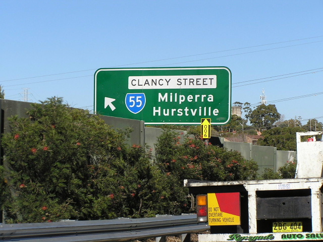
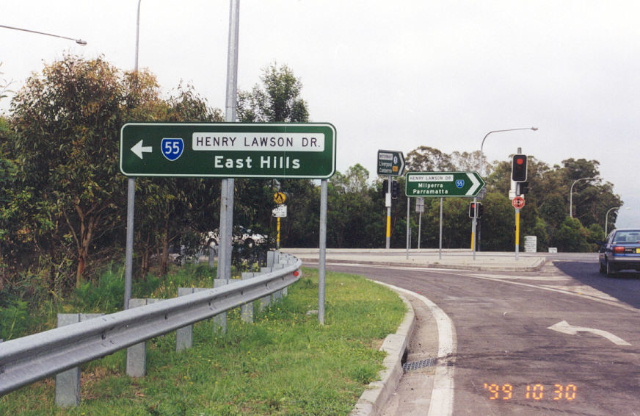
Painted black AD sign westbound on Henry Lawson Dr approaching Clancy St at Padstow Heights. June 1992. |
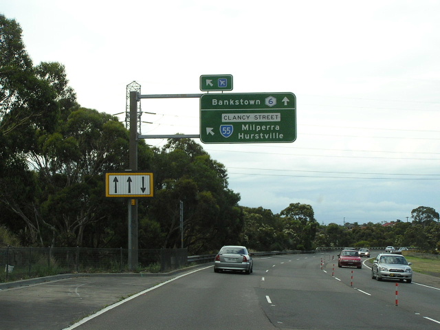 |
Heading north on Metroad 6 approaching Clancy St exit - still showing a SR55 shield as at Feb 2005. |
 |
Still northbound on Metroad 6 at Clancy St exit. Feb 2005. |
 |
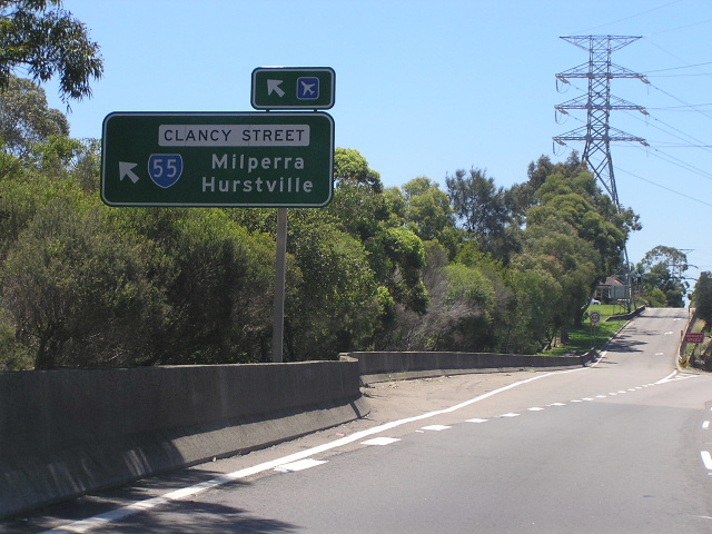
At the top of the Clancy St off-ramp facing northbound traffic. Feb 2005. |
 |
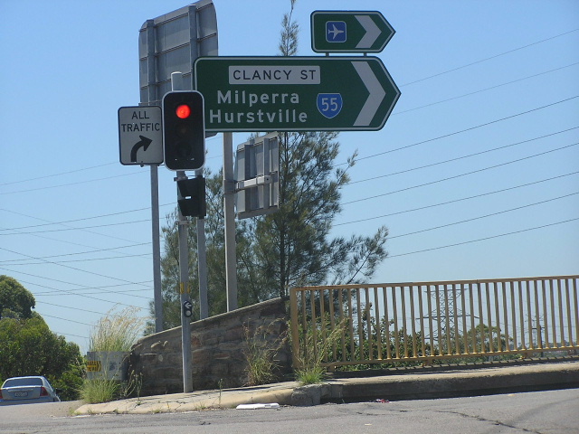
At the top of the Clancy St ramp - facing southbound traffic. July 2004. |
 |
Southbound on Metroad 6 approaching the Clancy St ramp. July 2004. |
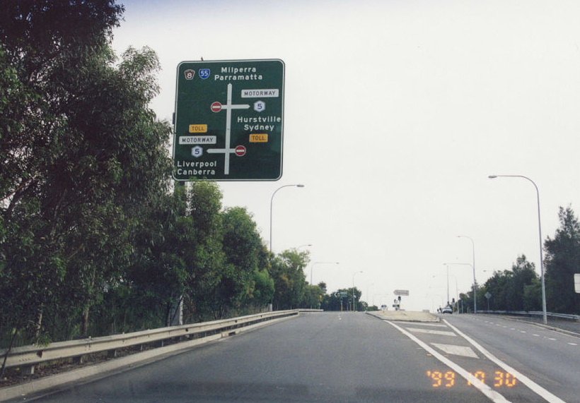 |
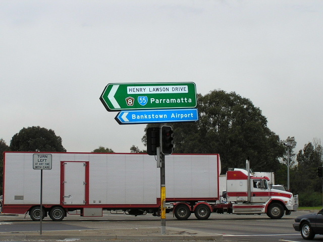
Northbound on Henry Lawson Dr approaching the M5 at Milperra. Oct 1999. |
 |
Westbound on the M5 approaching Henry Lawson Drive. Jan 2004. |
 |
Westbound on the M5 at Henry Lawson Drive. Jan 2004. |
 |
Eastbound on the M5 approaching Henry Lawson Drive. Jan 2004. |
 |
AD and ID signs with State Route 55 shields at the junction of Henry Lawson Dr and the M5 Motorway, Milperra. Oct 1999. |
 |
Southbound on Henry Lawson Dr approaching the M5. Oct 1999. |
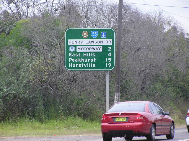 |
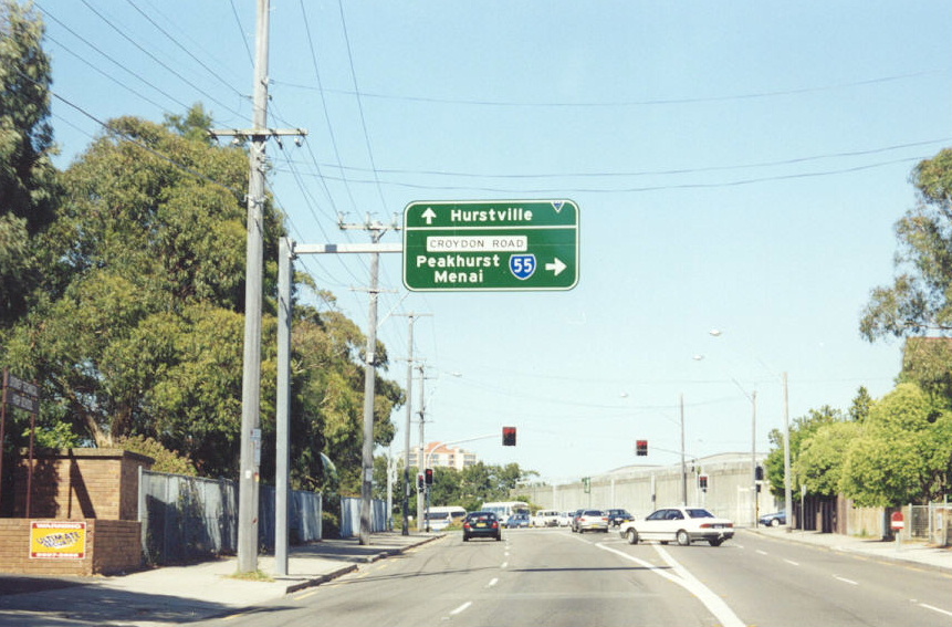
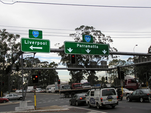
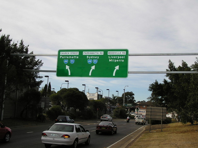
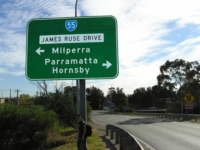
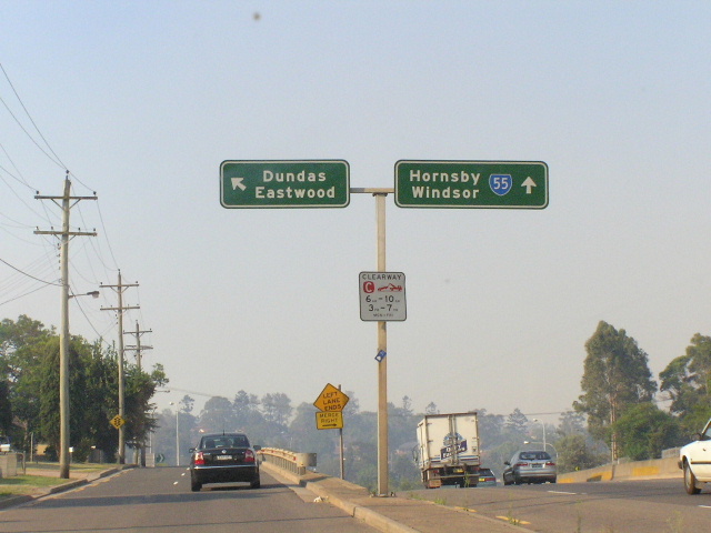
Southbound on Henry Lawson Dr after Newbridge Rd/Milperra Rd. May 2004. |
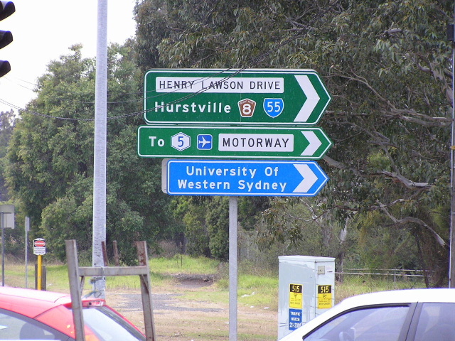 |
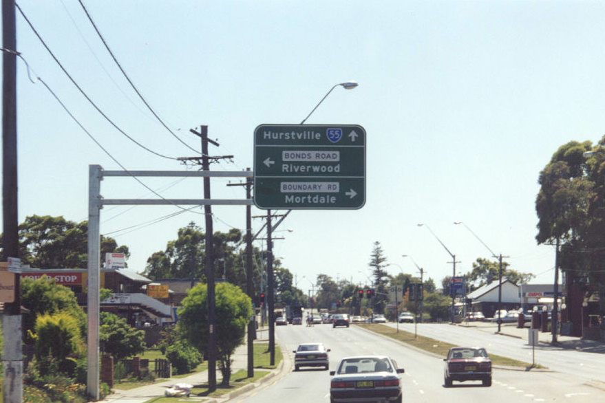
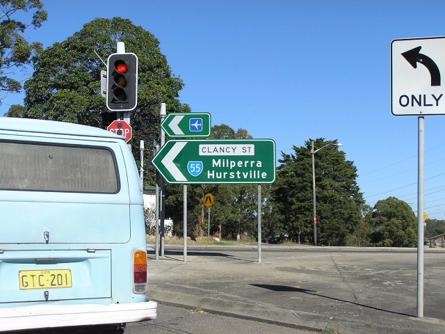
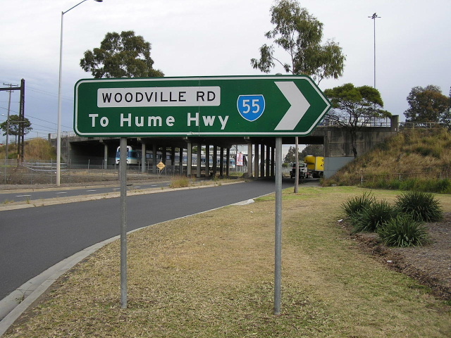
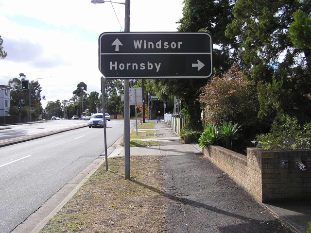
ID sign assembly with State Route 55 shield at the intersection of Henry Lawson Dr, Newbridge Rd & Milperra Rd, Milperra. May 2004. |
 |
ID sign assembly with State Route 55 shield at the intersection of Henry Lawson Dr, Newbridge Rd & Milperra Rd, Milperra. May 2004. |
 |
Southbound on Henry Lawson Dr approaching Newbridge Rd/Milperra Rd. May 2004. |
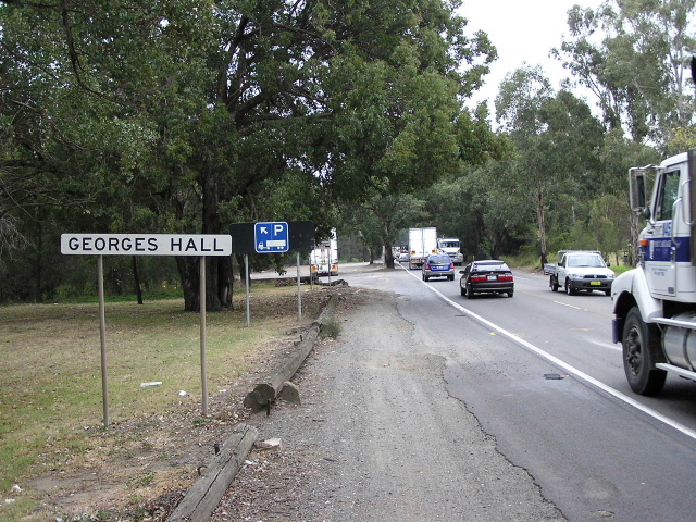 |
Northbound entering Georges Hall. I included this pic because i found it odd to see a truck parking area in the middle of Sydney and on Henry Lawson Drive which surprisingly is used by a lot of truck traffic considering its rural road design. May 2004. |
 |
These used to be fairly common on Henry Lawson Drive, however, I only managed to snap this one before they were removed in June 2004. Jan 2004. |
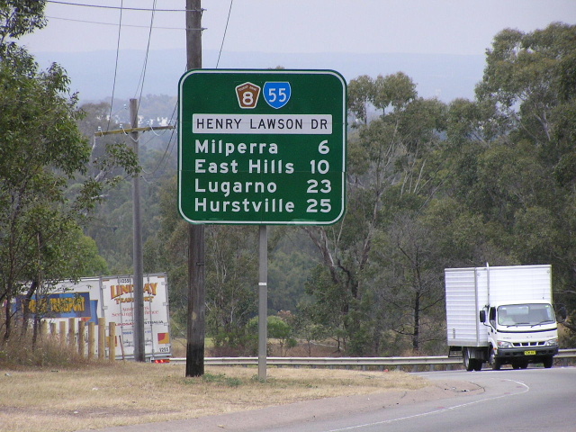 |
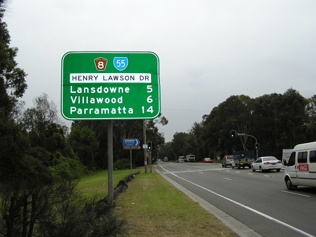
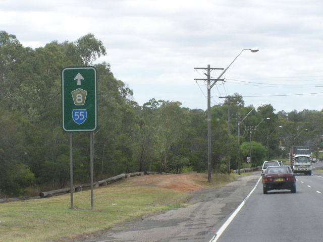
Distance sign heading south on Henry Lawson Drive from Hume Highway at Lansdowne. May 2004. |
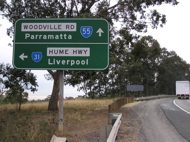 |
AD sign northbound on Henry Lawson Drive approaching Hume Highway at Lansdowne. May 2004. |
 |
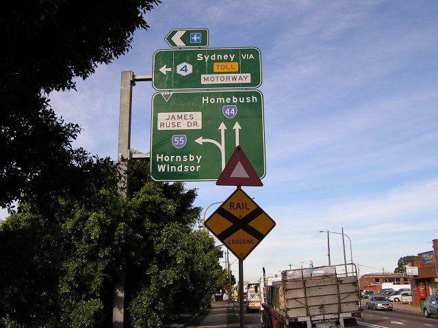
Overhead signs facing northbound traffic at the intersection of Hume Highway, Henry Lawson Dr & Woodville Rd. This unique overhead signage set-up earnt this intersection the title 'Meccano Set'. May 2004. |
 |
AD sign eastbound on Hume Highway approaching Henry Lawson Drive & Woodville Rd at Lansdowne. May 2004. |
 |
Overhead signs facing eastbound traffic at the intersection of Hume Highway, Henry Lawson Dr & Woodville Rd. These State Route 55 shields were still remaining in July 2006 despite most of the other State Route 55 shields having been removed from this intersection. Feb 2005. |
 |
AD sign westbound on Hume Highway approaching Henry Lawson Drive & Woodville Rd at Lansdowne. May 2004. |
 |
Overhead signs facing westbound traffic at the intersection of Hume Highway, Henry Lawson Dr & Woodville Rd. Dec 2005. |
 |
Overhead signs facing southbound traffic at the intersection of Hume Highway, Henry Lawson Dr & Woodville Rd. June 2006. |
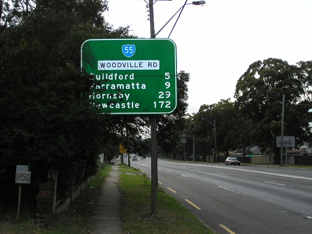 |
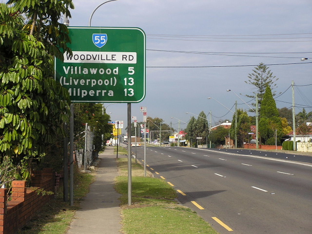
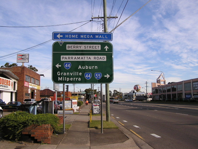
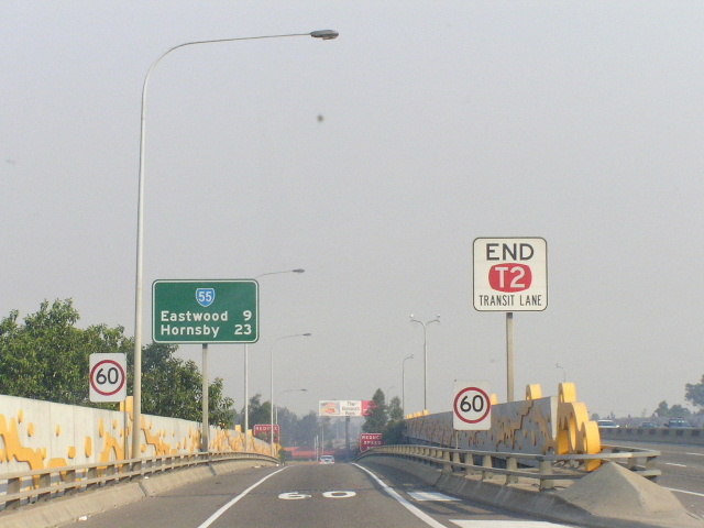
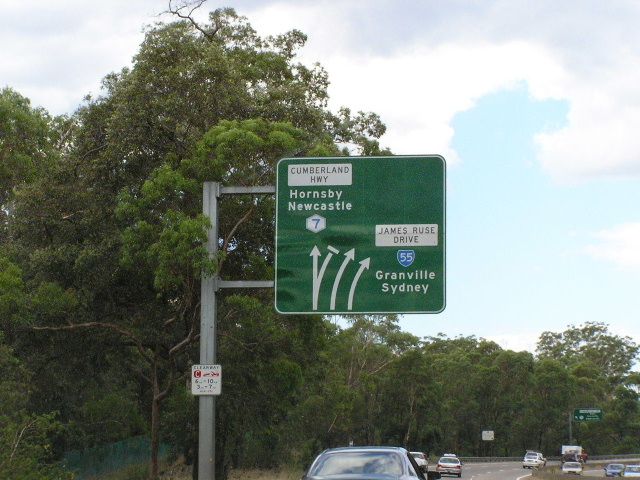
Distance sign northbound on Woodville Rd in Villawood. Note the inclusion of Hornsby and Newcastle as focal points - reflecting State Route 55's former role as a link between the Hume and Pacific Highways. May 2004. |
 |
Southbound AD sign at the Villawood railway overpass, opened in January 1970. May 2004. |
 |
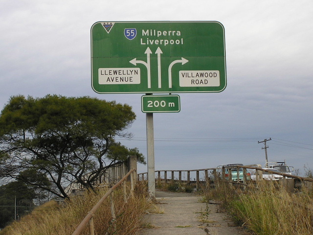
ID sign on Llewellyn Ave at Woodville Rd, Villawood. May 2004. |
 |
AD sign eastbound on Christina Rd, approaching Woodville Rd at Villawood. May 2004. |
 |
Interesting focal point for this sign. Christina Rd & Woodville Rd. May 2004. |
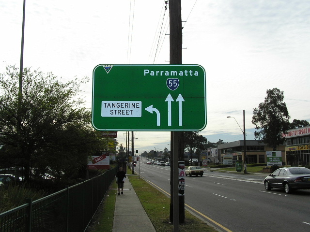 |
Northbound approaching Tangerine St. May 2004. |
 |
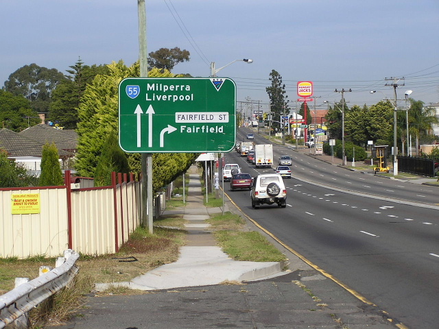
ID signs at Fairfield St. May 2004. |
 |
Southbound approaching Fairfield St. May 2004. |
 |
Heading south from Merrylands Rd. May 2004. |
 |
Northbound approaching the Gt Western Hwy at Granville. This subway replaced the level crossing known as 'Dog Trap Gates'. May 2004. |
 |
Odd style lane allocation signs on the M4 overpass. Is it just me or are the signs way too small for the arrows? May 2004. |
 |
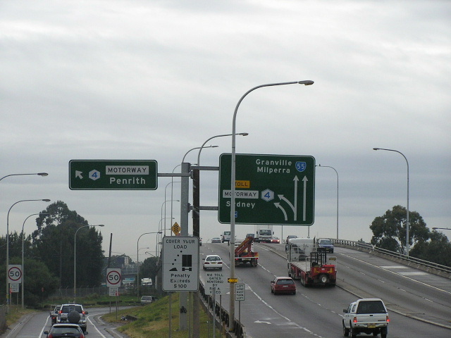
SR44/55 duplex sign at the M4 off-ramp. May 2004. |
 |
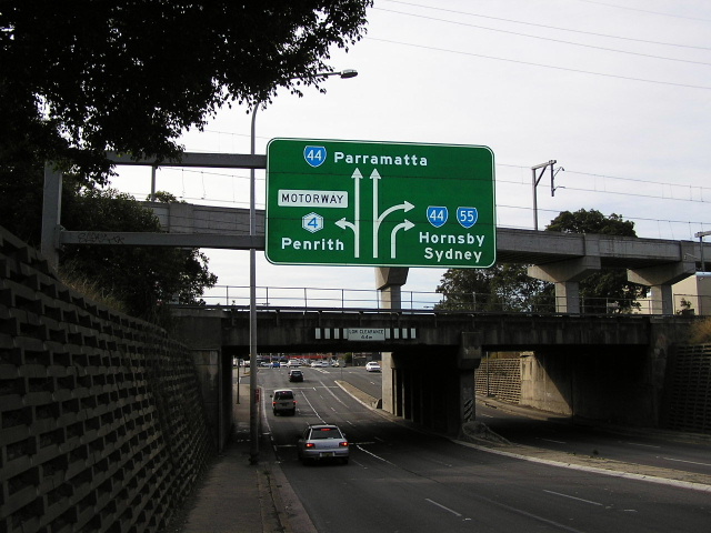
AD sign eastbound on the Western Motorway approaching the Church Street interchange at Parramatta, showing State Route 55 shield. Jan 2004. |
 |
AD sign installed during the early part of 2004 incorrectly showing SR55 going left (which it used to do). May 2004. |
 |
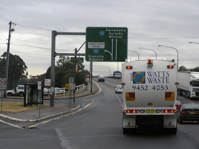
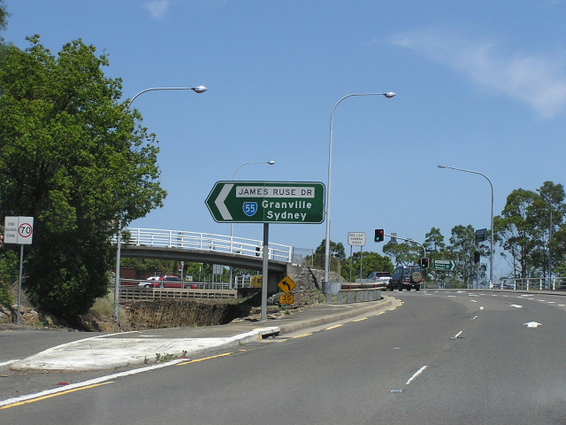
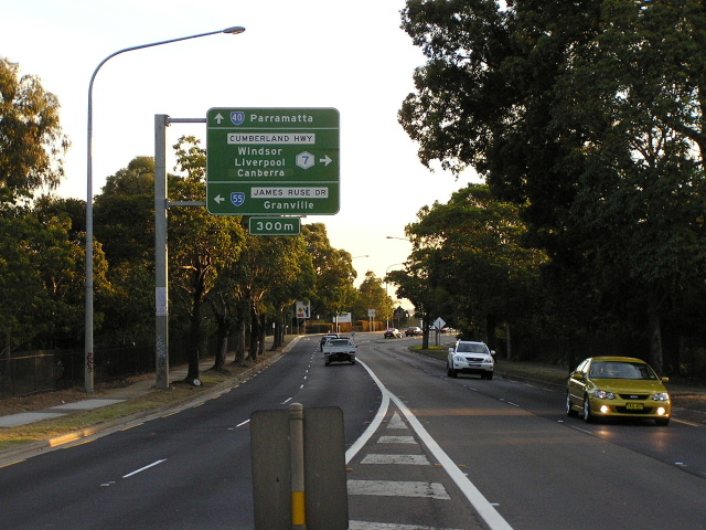
AD sign eastbound on Parramatta Rd approaching James Ruse Drive at Granville. June 2004. |
 |
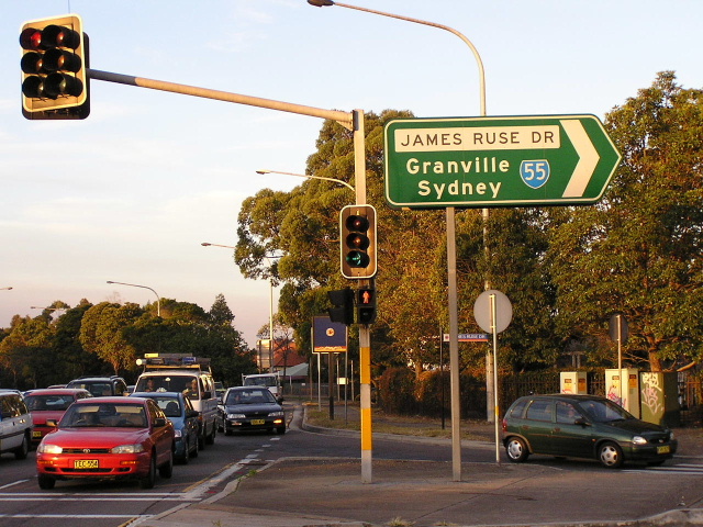
AD sign southbound on James Ruse Dr approaching Parramatta Rd at Granville. June 2004. |
 |
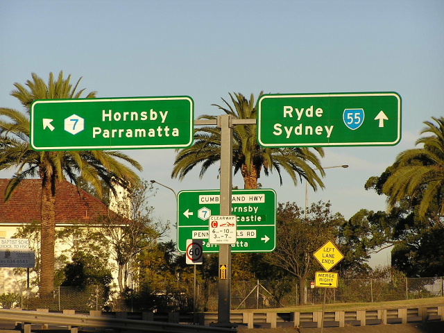
Overhead signs northbound on James Ruse Drive at the junction with Western (M4) Motorway, Granville. June 2004. |
 |
AD sign on the westbound off-ramp from Western Motorway to James Ruse Dr at Granville. June 2004. |
 |
Unusual State Route 55 RD sign on the eastbound off-ramp from Western Motorway to James Ruse Dr at Granville. Unusual because of its location (there is another RD sign just around the corner on the main carriageway of James Ruse Dr) and unusual because it includes Eastwood as a focal point, despite Eastwood not being shown on any subsequent signs. Jan 2004. |
 |
Distance sign northbound on James Ruse Drive near Prospect St, Rosehill. This is the other distance sign I was referring to in the caption for the previous photo. June 2004. |
 |
A collection of southbound signs on James Ruse Drive at the junction with Western Motorway. May 2004. |
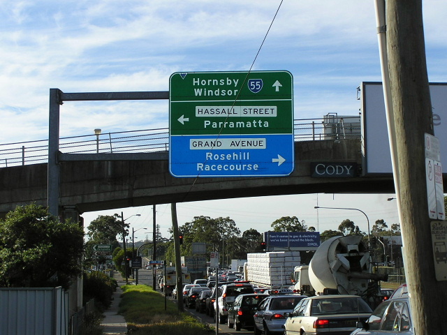 |
AD sign northbound on James Ruse Dr approaching Hassall St & Grand Ave at Rosehill. June 2004. |
 |
ID sign facing eastbound traffic at the intersection of James Ruse Dr, Hassall St & Grand Ave. June 2004. |
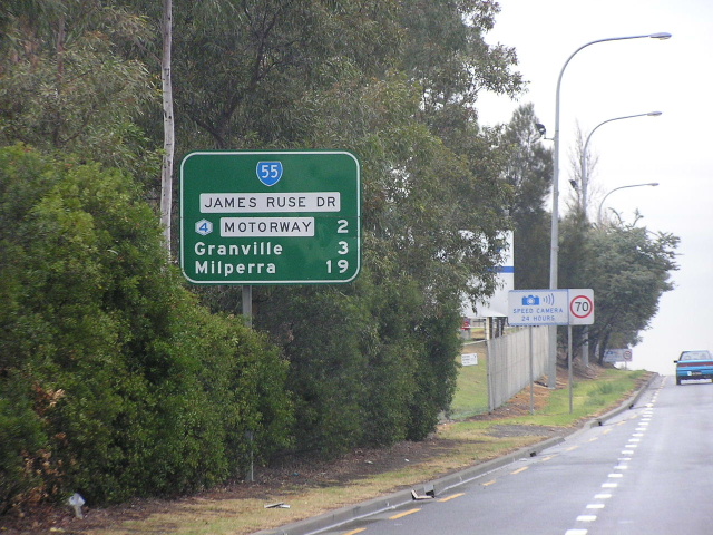 |
Distance sign southbound on James Ruse Drive approaching the Parramatta River, Rydalmere. May 2004. |
 |
AD sign westbound on Victoria Road approaching James Ruse Dr at Rydalmere. May 2004. |
 |
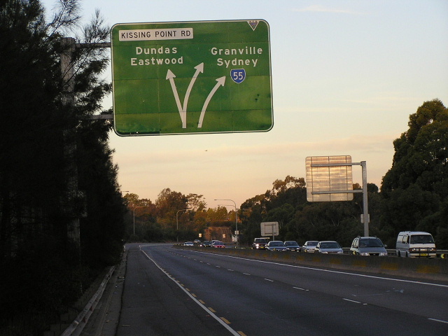
Butterfly signage set-up northbound on James Ruse Dr at the Kissing Point Rd interchange, North Parramatta. Jan 2004. |
 |
ID sign facing westbound traffic on Kissing Pt Rd at the interchange with James Ruse Dr, North Parramatta. Jan 2004. |
 |
AD sign facing eastbound traffic on Pennant St approaching the interchange with James Ruse Dr, North Parramatta. June 2004. |
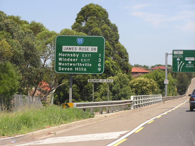 |
Unusual distance sign northbound on James Ruse Drive at Belmore Street East, North Parramatta. Note the use of 'xx EXIT' as a focal point rather than the destinations themselves. Jan 2004. |
 |
Diagrammatic lane allocation AD sign southbound on James Ruse Drive approaching the Kissing Pt Rd interchange at North Parramatta. June 2004. |
 |
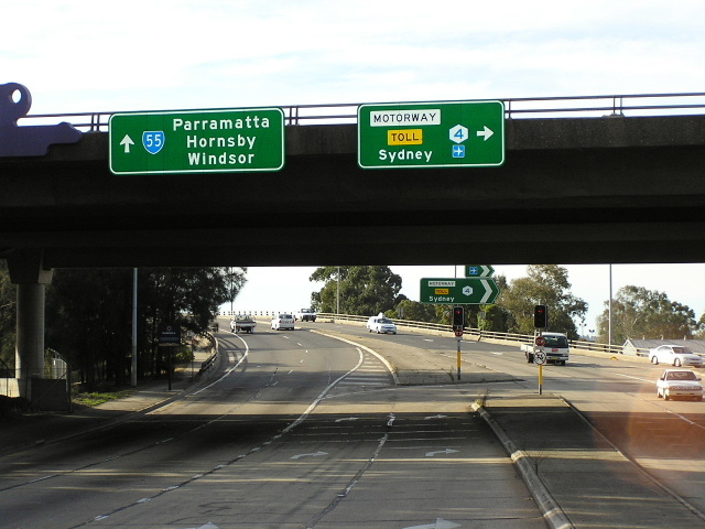
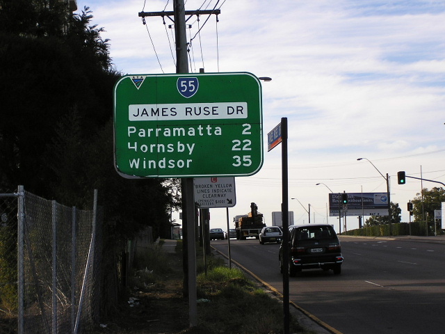
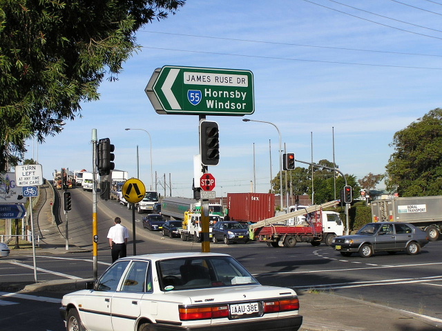
This is the first southbound distance sign on State Route 55 at the time of its decommissioning - located on the southbound on-ramp from Pennant Hills Rd to James Ruse Dr, North Parramatta. June 2004. |
 |
State Route 55 shield on an AD sign, located north-eastbound on Pennant Hills Rd approaching James Ruse Dr. June 2004. |
 |
AD sign showing State Route 55 (and an incorrect State Route 40 shield) south-westbound on Pennant Hills Rd approaching James Ruse Dr. June 2004. |
 |
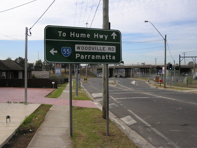
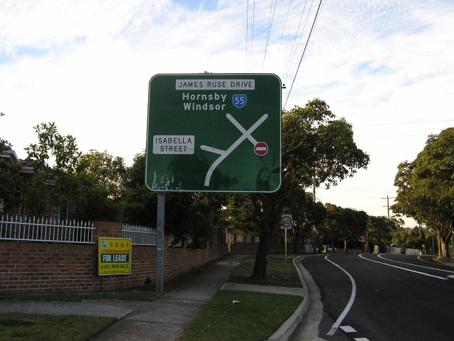
ID sign marking the entry to State Route 55 from Pennant Hills Rd, North Parramatta. June 2004. |
 |
Butterfly sign set-up for the southbound off-ramp from James Ruse Dr to Pennant Hills Rd. This was the beginning of State Route 55 from 1988 until its decommissioning in 2004. June 2004. |
 |
Diagrammatic lane allocation AD sign south-eastbound on James Ruse Dr approaching Pennant Hills Rd and the beginning of the former State Route 55 at North Parramatta. Jan 2004. |
Photos of former State Route 55 - interim alignment through Parramatta (1987-88) |
|
 |
Black AD sign with a horribly inadequate coverplate northbound on Great Western Hwy (Church St) approaching the intersection with Parkes St & Church St, Parramatta in 1993. State Route 55 was routed around the CBD of Parramatta during the late 1980s to allow the construction of Church Street Mall. |
 |
Black AD sign westbound on Parkes Street approaching the Great Western Highway at Parramatta, showing SR55 southbound along Great Western Highway (Church St). I have a feeling that the National Route 32 shield may also be covering a State Route 55 shield. Dec 1993. |
 |
Black ID sign facing westbound traffic at the intersection of Pitt & Argyle Streets, Parramatta. The blank coverplate hides a State Route 55 shield. State Route 55 was routed around Parramatta CBD onto Pitt and O'Connell Streets during the late 1980s to bypass Church Street. June 2006. |
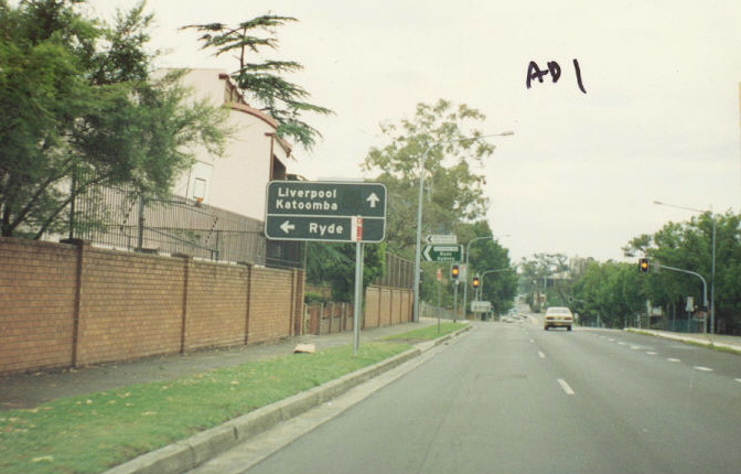 |
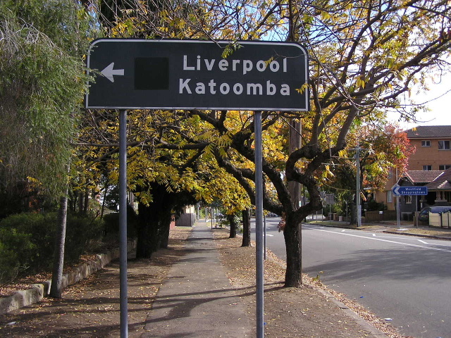
Black AD sign southbound on O'Connell St approaching Victoria Rd, Parramatta. Note the blank coverplate covering a State Route 55 shield and the long-distance focal points of Liverpool (for SR55) and Katoomba (for NR32) reflecting the route's role as a bypass of Parramatta CBD. Dec 1993. |
 |
Due to the infavourable lighting it is a bit hard to see this blank coverplate covering a SR55 shield on the lower panel of the sign. O'Connell St & Albert St, North Parramatta. June 2006. |
 |
Half an AD sign (not sure what happened to the lower panel) on Albert Street westbound approaching O'Connell St at North Parramatta. Again note the blank coverplate and the long distance focal points that seem out of place in this residential street. June 2006. |
 |
Black AD sign eastbound on Albert St, approaching Church St & Pennant Hills Rd at North Parramatta. Note the black coverplate that covers a State Route 55 shield. |
Photos of the former route of State Route 55 - former alignment from Parramatta to Hornsby (1974-1988) |
|
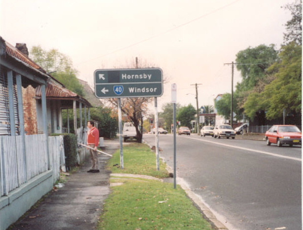
State Route 55 shield on a butterfly sign set-up at the northbound off-ramp from James Ruse Dr to Pennant Hills Rd, North Parramatta. Source: Main Roads, Vol. 45 (Department of Main Roads, 1981) |
|
Poor photo of the former "END SR55" sign at Pearces Corner. c. 1987 |
|