NSW STATE ROUTE 28
Decomissioned
Lifespan: 1974-1993 (19 years)
Length: 22km
Eastern Terminus: Bradfield Hwy & Cahill Expressway, Sydney
Western Terminus: Pennant Hills Rd (Cumberland Highway) & Carlingford Rd, Carlingford
Route taken: Bradfield Hwy, Warringah Fwy, Gore Hill Fwy, Longueville Rd, Epping Rd, Beecroft Rd, Carlingford Rd
Focal Points: Sydney, Epping, Carlingford
RTA Internal Classification: Main Road 632 (Bradfield Hwy) Main Road 651 (Freeways), Main Road 373 (Longueville Rd/Epping Rd/Carlingford Rd), Main Road 139 (Beecroft Rd)
Replaced By: Metroad 2 (except Carlingford Rd)
Route Overview:
State Route 28 was a radial state route to Sydney's north-west suburbs, beginning initially at the Pacific Hwy, Artarmon (later the southern toll booths of the Harbour Bridge) and following Epping and Carlingford Roads to meet Pennant Hills Rd at Carlingford. The route is a mix between 6-lane and 4-lane arterial road (80km/h limit on most of Epping Rd) with a large chunk of freeway in there too.
SR28 was proclaimed in 1974, between the Pacific Hwy at Artarmon and Pennant Hills Rd at Carlingford. In August 1992, when the Gore Hill Freeway was opened to traffic, the route was extended south/east along the Gore Hill & Warringah Fwys as well as the Harbour Bridge to the southern toll booths. This extension was short lived, most of SR28 being replaced by Metroad 2 in October 1993.
Spotlight on: Epping Road
Epping Rd is one of Sydney's busiest arteries, especially through Lane Cove. The road was purpose built during the late 1930's along what was a potential heavy rail corridor, opening to traffic in February 1940. Most of the route has no direct property access, allowing for an 80km/h limit between Lane Cove West and Epping. A widening and reconstruction program was begun in the mid-1960's as the North Ryde and Marsfield areas were subdivided, the first section between Lane Cove and Dehli Rd completed in 1967. Through Marsfield, from Shrimptons Ck & Terreys Ck was widened to 6-lanes in 1971 and the missing link through North Ryde, between Dehli Rd and Shrimptons Ck was completed in conjunction with the Lane Cove Rd overpass, which was completed in September 1978.
Notable events in the history of SR28:
March 1932 - Sydney Harbour Bridge opened to traffic
February 1940 - Epping Road opened to traffic
1967 - Epping Rd widened to 6-lanes between Lane Cove and Dehli Rd
June 1968 - Warringah Fwy opened to traffic from Bradfield Hwy to Miller St
1971 - Epping Rd widened to 6-lanes between Shrimptons Creek and Terreys Creek
1974 - State Route 28 proclaimed from Artarmon to Carlingford
September 1978 - Warringah Fwy opened to traffic from Miller St to Willoughby Rd
July 1978 - Epping Rd widened to 6-lanes between Dehli Rd & Shrimptons Ck including Lane Cove Rd overpass
March 1990 - Epping Rd tidal flow introduced through Lane Cove
August 1992 - Gore Hill Freeway opened to traffic & SR28 extended south/east to Harbour Bridge toll booths
October 1993 - SR28 decomissioned
Photos of State Route 28 |
|
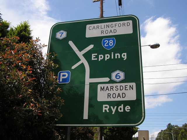 |
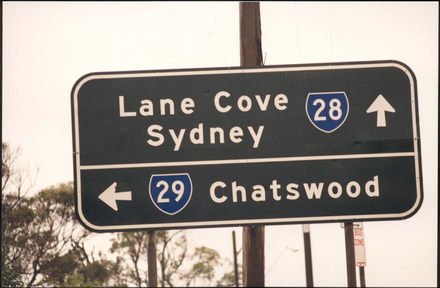
Pennant Hills Rd northbound in Carlingford, this sign is still in existence (as of September 2004). I find it amusing that this sign has been coverplated 3 different times, but not once did they correct the obsolete SR28 shield. Photo taken December 2003. |
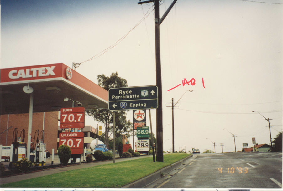 |
Very old black AD sign southbound on Pennant Hills Rd at Carlingford. This sign would date from the days when Pennant Hills Rd was SR55, prior to 1988. Photo taken 1993. |
 |
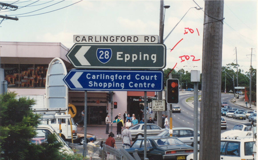
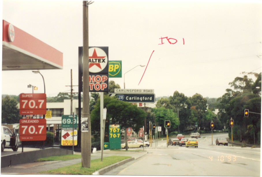
Carlingford Rd black ID signs at Pennant Hills Rd. Photo taken 1993. |
 |
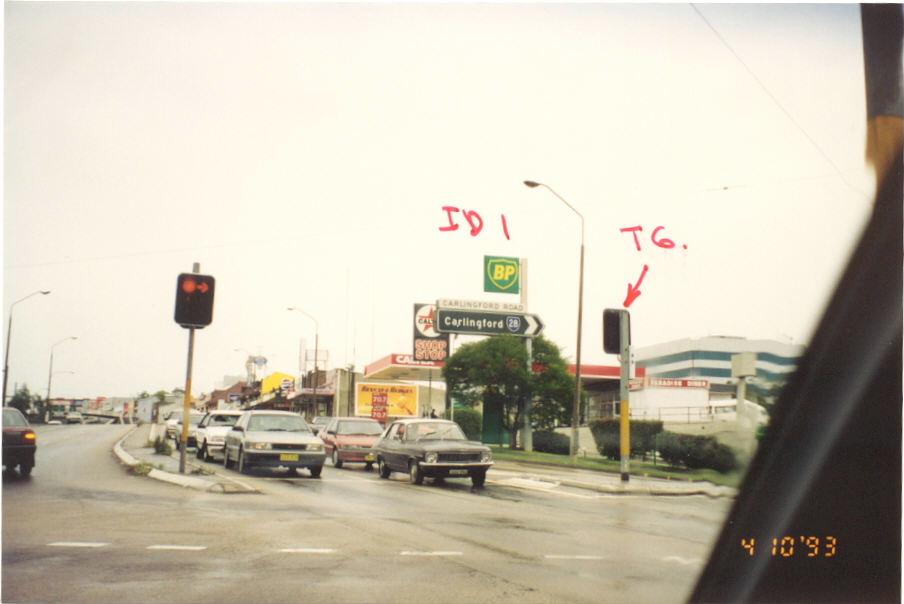
Another black ID sign at Carlingford. Photo taken 1993. |
 |
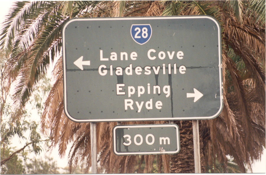
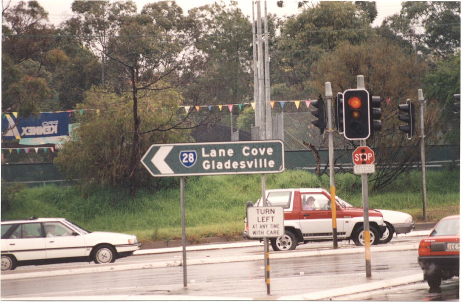
Carlingford Rd ID sign at Beecroft Rd, Epping. Photo taken 1993. |
 |
Carlingford Rd ID sign at Beecroft Rd, Epping. Photo taken 1993. |
 |
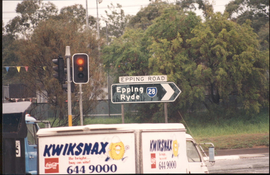
This sign no longer exists on Beecroft Rd, southbound outside Epping Station. You can see that 'Lane Cove' is on a coverplate over 'SR28 Lane Cove/Sydney' and later 'Metroad 2 Lane Cove/Sydney'. Photo taken August 2004. |
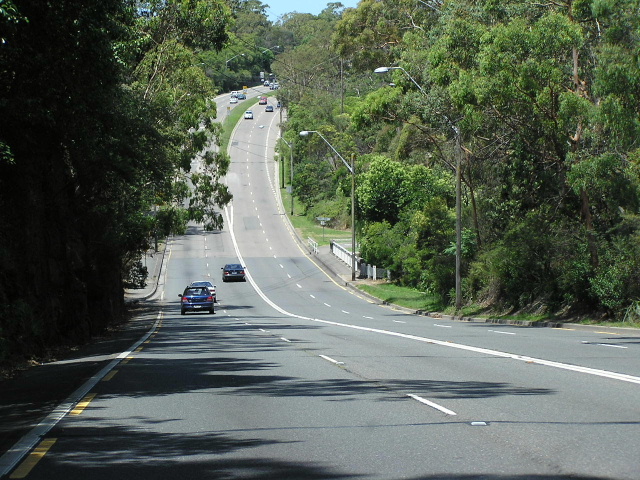 |
Epping Rd looking east across Terreys Creek showing the transition from 4-lane road to 6-lane road. Photo taken May 2004. |
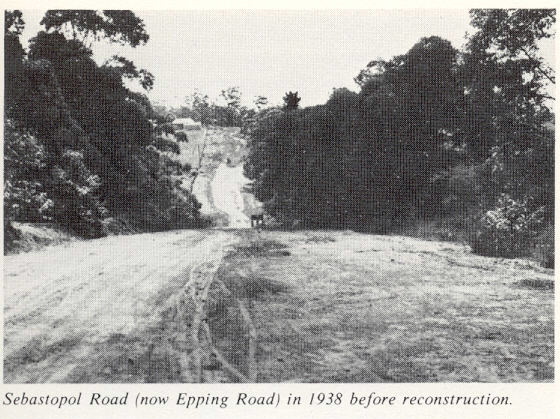 |
Epping Road (then Sebastopol Rd) at Marsfield in 1938 before reconstruction. |
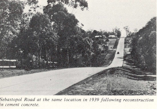 |
Same location following reconstruction in cement concrete in 1939. |
Stringybark Creek bridge in 1940. This bridge was widened to 6-lanes by building an almost identical bridge next to it in 1971. |
|
 |
Typical 1980's black AD sign on Epping Rd approaching Dehli Rd at North Ryde. Photo taken c.1991. |
 |
SR28 AD sign on Dehli Rd approaching Epping Rd, North Ryde. Photo taken c.1991. |
 |
Another AD sign, same intersection. Note the very old Ryde Council sign in the background. Photo taken c.1991. |
 |
Black ID sign, same intersection. Photo taken c.1991. |
 |
Black ID sign, same intersection. Photo taken c.1991. |
SR28 shield on Gore Hill Fwy overhead sign. This sign was coverplated with a Metroad 2 shield in late 1993. Photo taken August 1992. |
|
 |
The only other remaining SR28 shield is on this changable messgae sign at Ernest St & Warringah Fwy, Cammeray. The SR28 shield appears in the morning peak between 6-10am. This particular sign is so old that the SR28 shield is on a coverplate over a 'F1' shield! Photo taken April 2004. |