NSW STATE ROUTE 27
Decomissioned
Lifespan: 1992-2004 (12 years)
Length: 10km
Northern Terminus: Concord Rd & Homebush Bay Dr, Rhodes
Southern Terminus: Punchbowl Rd & Wiley Ave & King Georges Rd, Wiley Park
Route taken: Concord Rd, Leicester Ave, Raw Square, Redmyre Rd, The Boulevard, Coronation Pde, Punchbowl Rd
Focal Points: Ryde, Strathfield, Punchbowl, Hurstville
RTA Internal Classification: Main Road 549 (Punchbowl Rd), Main Road 668 (remainder of route)
Route Overview:
State Route 27 is a rather historic route, following the path of Ring Road 3 then State Route 33 before it. State Route 27 was proclaimed in December 1992, when SR33 was moved onto the Strathfield Bypass corridor (Homebush Bay Dr/Centenary Dr/Roberts Rd). However, this historic route only lasted 12 years, being decomissioned in June 2004. All trace of the route, bar dozens of blank coverplates, has been removed.
Since SR27 was proclaimed, there has not been a notable event along this route, so for this reason, all development of the route will be discussed under the SR33 page.
Notable events in the history of SR27:
1964 - Route proclaimed part of Ring Road 3
March 1972 - Strathfield Square bypass (Raw Square Extension)
1974 - Ring Road 3 designation replaced by State Route 33 designation
December 1982 - One-way system introduced between railway and Paterson St
December 1985 - One-way system removed, entry to Strathfield changed to Leicester Ave (formerly Swan Ave)
December 1992 - SR33 moved onto new Homebush Bay/Centenary Dr corridor; SR27 proclaimed
June 2004 - SR27 decomissioned
Further Reading (on-site):
M4 interchange/Parramatta Rd intersection, North Strathfield
State Route 33 (decomissioned)
Ring Road 3 (decomissioned)
Photos of State Route 27 |
|
 |
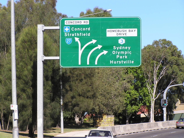
Homebush Bay Drive northbound approaching Concord Rd, SR27's former northern terminus. Photo taken April 2004. |
 |
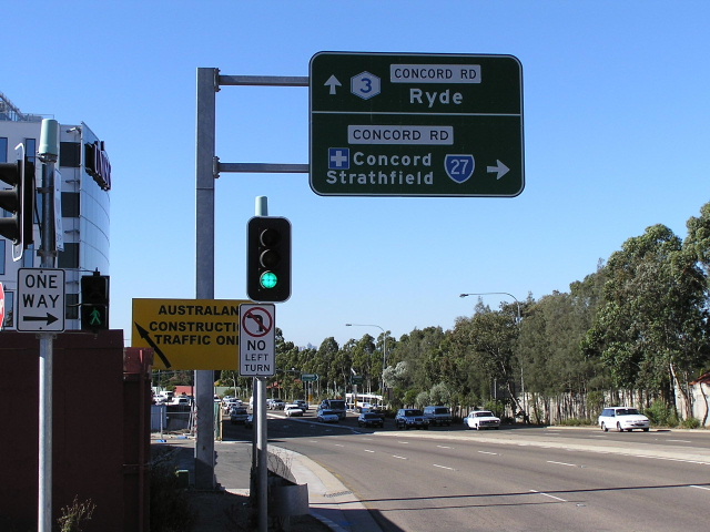
Concord Rd southbound approachign Homebush Bay Drive. Photo taken April 2004. |
 |
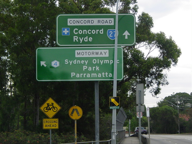
Cantilevered ID signs southbound on Concord Rd. Photo taken April 2004. |
 |
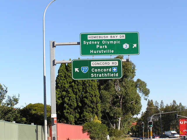
Northbound ID sign, same intersection. Photo taken April 2004. |
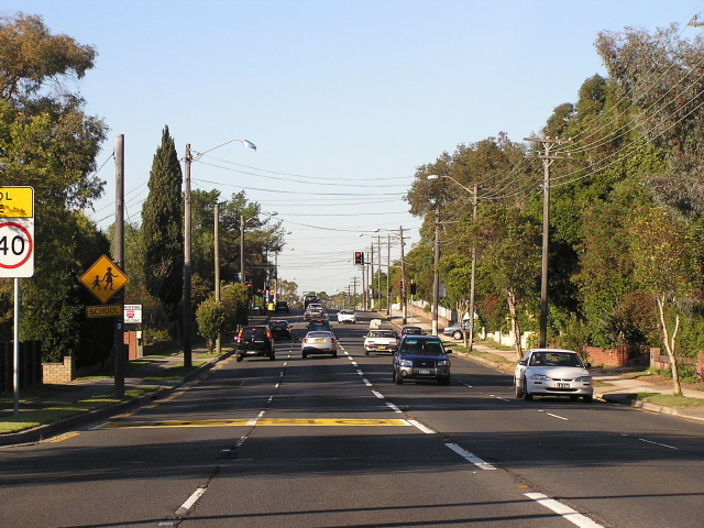 |
Looking south on Concord Rd in Concord West. 80% of the route looks exactly like this, four-lanes with no median. Photo taken January 2004. |
 |
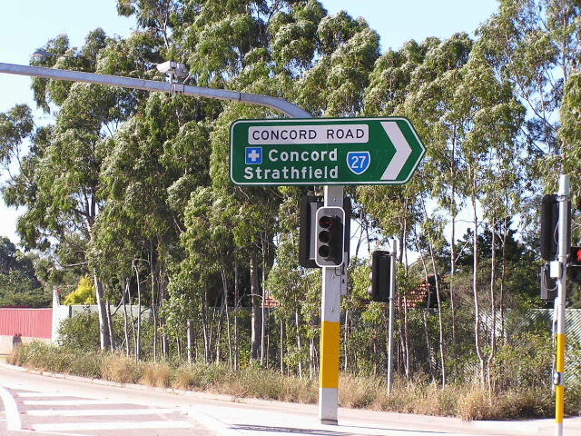
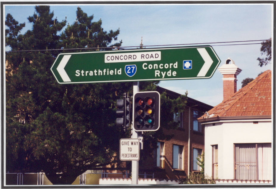
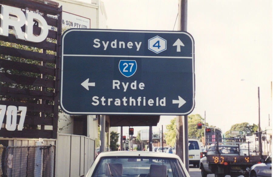
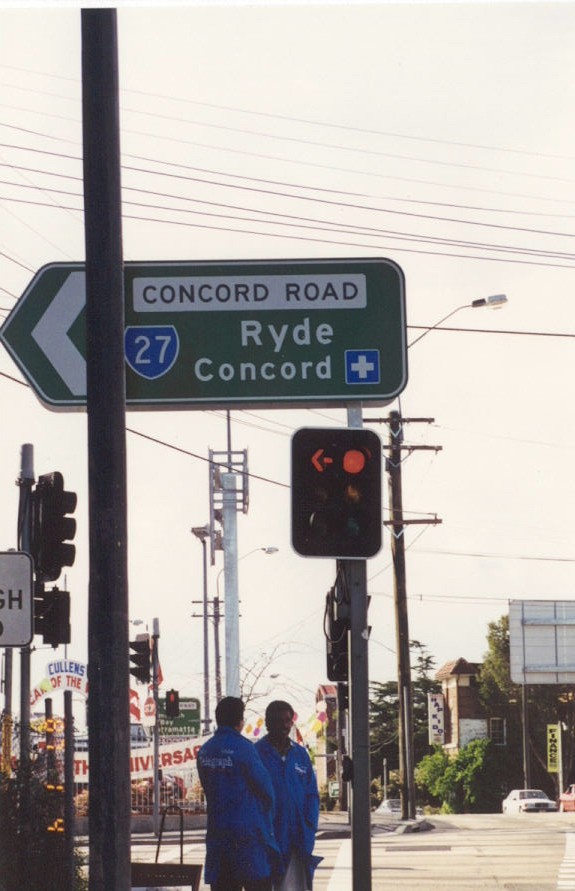
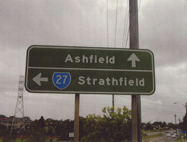
Concord Rd & Paterson St, North Strathfield. This sign has since been replaced. Photo taken 1996 (not 1987 like it says on the pic). |
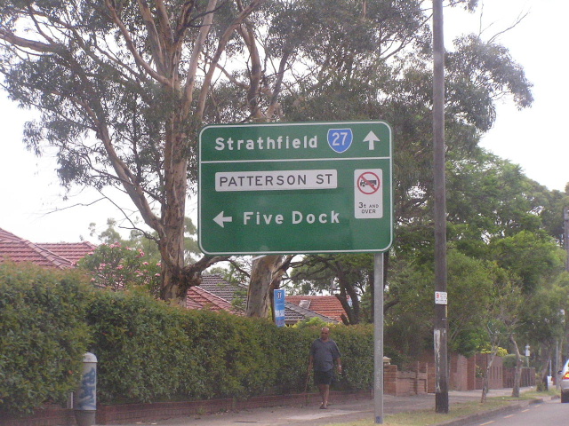 |
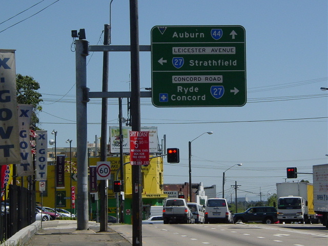
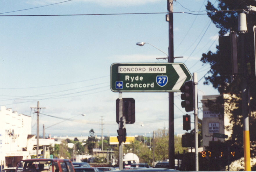
The sign that replaced the on int eh above photo. Note 'Five Dock' is on a coverplate over 'Five Dock/To Metroad 4 City'. Photo taken January 2004. |
 |
Concord Rd & Paterson St, North Strathfield. Photo taken 1996. |
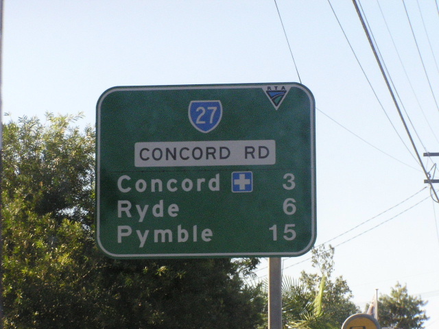 |
Concord Rd distance sign northbound from Paterson St. Photo taken January 2004. |
 |
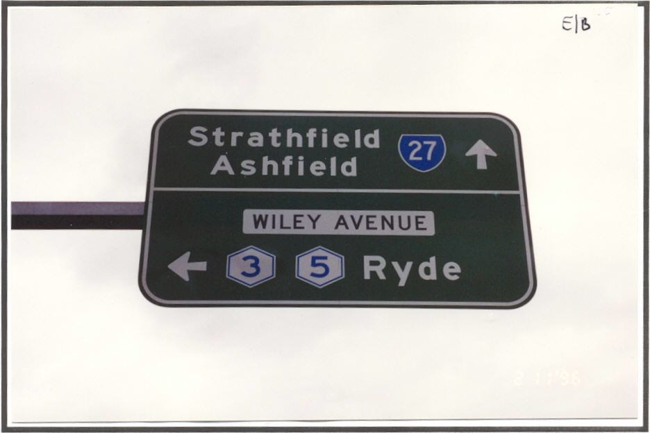
ID signs northbound at the M4 on-ramp, North Strathfield. Photo taken September 2003. |
Same signs, in 1996 before 'Homebush Bay' became 'Sydney Olympic Park'. |
|
 |
Black AD sign that survived the cull until the late 1990's, eastbound on Parramatta Rd. Photo taken 1996. |
 |
Parramatta Rd westbound AD sign. Photo taken September 2003. |
Southbound on Concord Rd approaching Parramatta Rd. Photo taken 1996. |
|
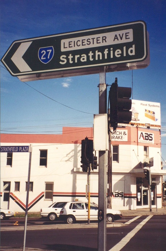
Leicester Ave northbound approaching Parramatta Rd. Photo taken 1996. |
|
 |
Leicester Ave ID sign at Parramatta Rd. Photo taken 1996. |
 |
Opposite side of the sign, 1996. |
 |
Concord Rd ID sign at Parramatta Rd. Photo taken 1996. |
 |
Opposite side of the sign, 1996. |
 |
The Boulevard southbound approaching Hume Hwy, Enfield. Photo taken 2001. |
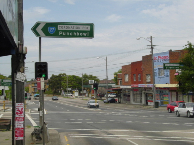 |
SR27 ID sign at the same intersection. Photo taken Jan 2004. |
 |
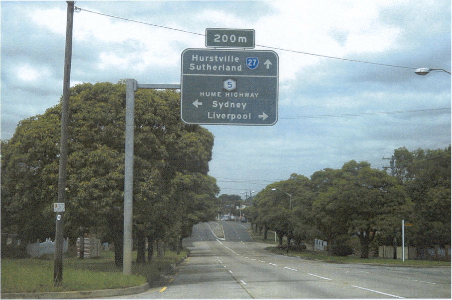
Distance sign south from the same intersection. Photo taken Jan 2004. |
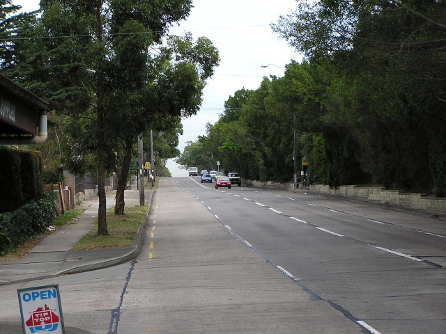 |
Looking south along Coronation Parade, Enfield South. Photo taken July 2004. |
 |
AD sign dating from the SR33 days on Punchbowl Rd approaching Coronation Pde. Photo taken Jan 2004. |
 |
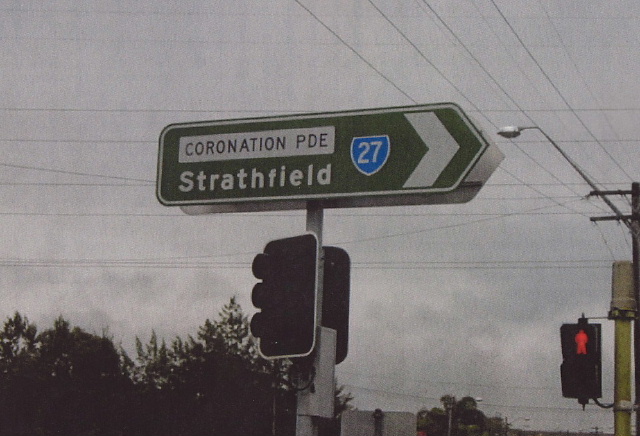
Coronation Pde southbound approaching Punchbowl Rd. Photo taken Jan 2004. |
 |
Georges River Rd south-west bound approaching SR27. Photo taken Jan 2004. |
 |
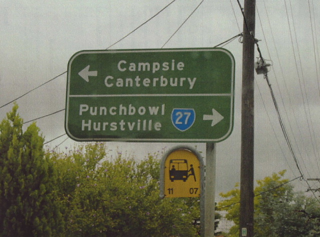
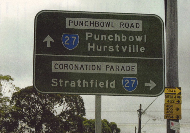
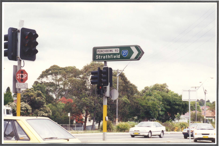
ID sign at the intersection of Coronation Pde, Punchbowl Rd & Georges River Rd, Croydon Park. Photo taken Jan 2004. |
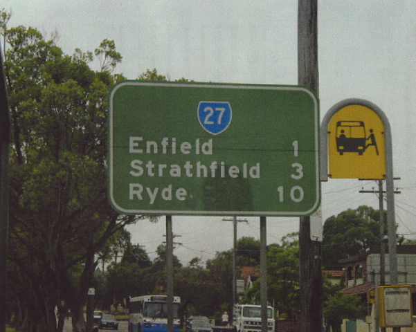 |
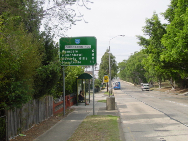
Coronation Parade distance sign. Photo taken Jan 2004. |
 |
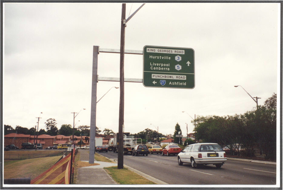
Punchbowl Rd distance sign. Note the coverplate over Sr33 shield. Photo taken Jan 2004. |
 |
Wiley Ave southbound approaching SR27, Wiley Park. Photo taken 1996. |
 |
King Georges Rd northbound approaching SR27, Wiley Park. Photo taken 1996. |
 |
Punchbowl Rd north-east bound approaching the start of SR27 at Wiley Park. Photo taken 1996. |
 |
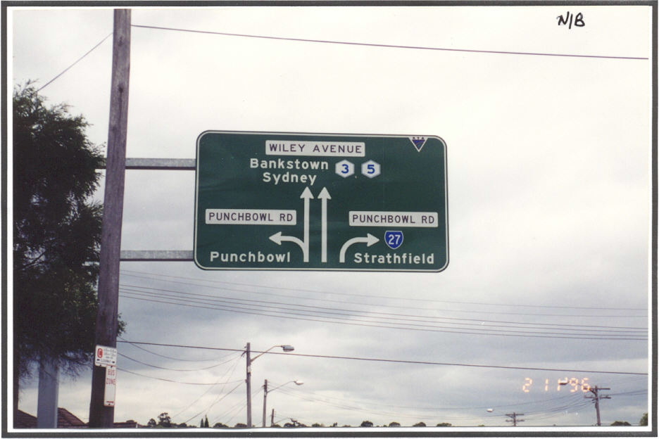
ID sign at the intersection of King Georges Rd & Punchbowl Rd & Wiley Ave, Wiley Park. Photo taken 1996. |
ID sign at the same intersection. Photo taken 1996. |
|