Former State Route 11 Pyrmont - Redfern - Darlinghurst |
Lifespan: 1974-92 (18 years)
Length: 7km
Eastern Terminus: Bayswater Rd & McLachlan Ave, Rushcutters Bay
Western Terminus: Bank St & Miller St, Pyrmont
Route taken: from Pyrmont via Bank St, Pyrmont Bridge Rd, Wattle St, Abercrombie St, Cleveland St, South Dowling St, Boundary St, McLachlan Ave (Neild Ave southbound) to Rushcutters Bay
Focal points: Pyrmont, Redfern, Waterloo/Darlinghurst, Rushcutters Bay
RTA Internal Classification: Main Road 594 (Wattle/Abercrombie), Main Road 330 (Cleveland), Main Road 593 (South Dowling), Main Road 625 (Boundary/McLachlan/Neild)
Replaced by: Metroad 2 (Wattle/Abercrombie), Metroad 4 (Cleveland), National Route 1 then Metroad 1 (South Dowling St)
Route Overview:
State Route 11 was the inner-most circumferential state route in Sydney, skirting the City of Sydney’s western, southern and eastern boundaries from Pyrmont to Rushcutters Bay.
It was introduced in 1974 to replace the former Ring Road 1, which followed the exact same alignment. However, as far as I have been able to tell State Route 11 was never signposted properly, if at all, as numerous Ring Road 1 signs survived until at least 1990.
The Department of Main Roads’ Schedule of Descriptions of State Routes from 1 st July 1982 provides the following description of State Route 11:
“From the junction of Main Road Nos. 523 (Pyrmont Bridge Road) and 594 (Wattle Street), then via Main Road Nos. 594 (Wattle St/Abercrombie St), 330 (Cleveland St) and 593 (South Dowling St, Barcom Ave, Boundary St and Neild Ave) to the junction with Main Road No. 173 (Bayswater Road) at Rushcutters Bay. (Existing Ring Route No. 1)”
That last part - ‘Existing Ring Route No. 1’ is quite interesting as it doesn’t appear as though a single State Route 11 shield was ever installed on a sign, perhaps indicating a Department of Main Roads’ decision to retain the Ring Road 1 signs rather the introduce State Route 11 on signs. Nonetheless, State Route was shown clearly in street directories and on maps of the time, so it does seem unusual that shields were never, as far as I can tell, erected.
The route of State Route 11 remained fairly static until its decommissioning, the only changes coming in the late 1980s with the introduction of one-way street systems in Ultimo, Chippendale and Darlinghurst. Southbound State Route 11 traffic was relocated from Wattle Street to Harris Street and from Abercrombie Street to Regent Street, whilst in Darlinghurst northbound State Route 11 traffic was diverted from Neild Ave onto McLachlan Street.
This is the way State Route 11 stayed until its quiet decommissioning in 1993, having been replaced by Metroads 1, 2 and 4 in various sections. The section through Darlinghurst was left unnumbered and southbound traffic can no longer use it as a through route following the conversion of Barcom Avenue to one-way northbound traffic.
No remnant signs exist.
Photos of the former State Route 11 |
|
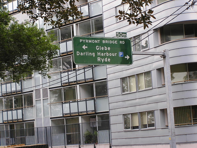
Pyrmont Bridge Rd & Wattle St intersection, Pyrmont. This sign dates from 1986 but does not contain a SR11 shield, evidence that it was never properly signposted. Photo taken August 1994. |
|
 |
Pyrmont Bridge Rd & Wattle St intersection again and again no SR11 shield or coverplate. This sign also dates from 1986. Photo taken March 2004. |
Same intersection, this sign was installed in 1990 and again has no trace of a SR11 shield. Photo taken August 1994. |
|
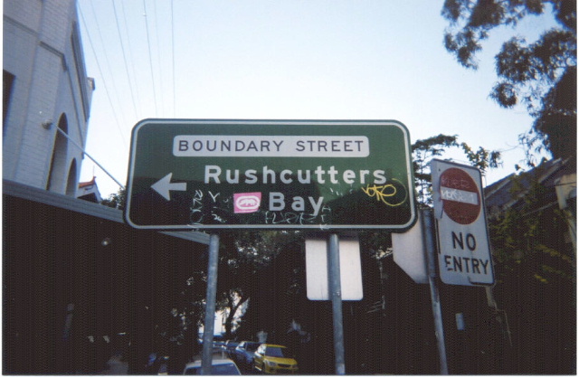 |
Boundary St & Liverpool St, Darlinghurst. This sign is a mid-90's installation. Photo taken July 2003. |
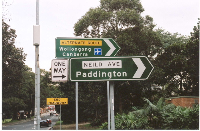 |
ID signs for the former SR11 at Bayswater Rd & Neild Ave, Rushcutters Bay. Photo taken July 2003. |
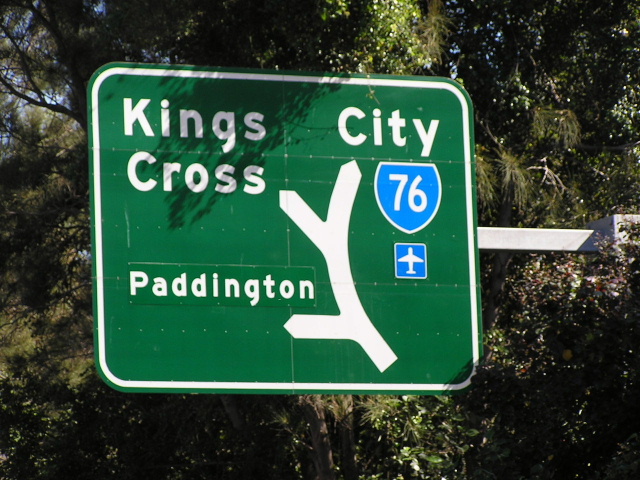 |
AD sign for the former SR11 on SR76 (Craigend St) at Rushcutters Bay. Note 'Paddington' is on a coverplate over 'Airport'. A SR11 shield was actually included in the design of this sign (albeit with a RR1 shield on a coverplate over it) but it seems the design was changed prior to installation. Photo taken April 2004. |