NATIONAL ROUTE 43
Decommissioned
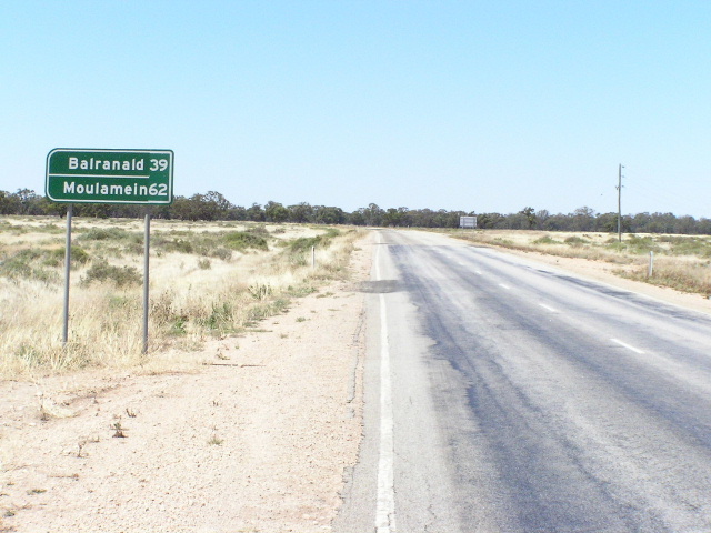
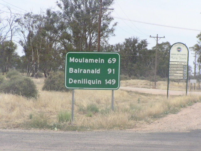
Distance sign on what was supposedly once NR43, heading south from Sturt Highway near Balranald. Jan 2004.
This page covers the "decommissioned" route National Route 43, which supposedly once followed the Balranald-Swan Hill road (Main Road No. 67) from the Sturt Highway near Balranald to the Murray River at Swan Hill.
National Route 43 appeared on a Department of Main Roads map i saw, dated 1-7-1982, showing the location of National Routes and State Routes in New South Wales. Whilst the map itself does not specify whether the routes shown are actually shown are signed, or whether it includes those officially approved as well, the exclusion of currently signed sections of various routes indicates that these routes were supposedly signed at this time. The route of National Route 43 shown on this map is from the Sturt Highway near Balranald, via Trunk Road No. 67 (now Main Road No. 67) to the Murry River at Swan Hill.
Fast forward 10.5 years to a Roads and Traffic Authority map that is dated 1-1-1993 and look for the Balranald-Swan Hill road. Here I find a single National Route 43 shield located adjacent to an then unsealed section of the road between Kyalite and Stony Crossing.
So it seems that National Route 43 did exist. However, signage remaining on the road dating from the 1980s (or possibly earlier) does not include the National Route 43 shield and also has no provision for the inclusion of a shield at all. New signage also does not include either shield or provision for one.
My conclusion: National Route 43 was a proposal introduced by the Department of Main Roads in conjunction with the State Route marking system (several other out-of-sequence National Routes were also introduced at this time). However, the fact that the road was not sealed until well into the 1990s would have put a stop to the introduction of a route marker on it and these days the RTA doesn't seem very interested in adding more rural routes (e.g. the abismal signage of SR87 on Kidman Way north of Hillston and, until very recently, of NR55 north of Walgett). Furthermore, Main Road No. 67 is now under the control of Balranald and Wakool shires, with funding assistance from the RTA.
In my humble opinion, a much better option is to sign the Tooleybuc-Kyalite road (Main Road No. 222) and the Kyalite-Sturt Hwy section of the Balranald-Swan Hill road (Main Road No. 67) as National Route 12 (well, B12 under the alpha-numeric system). This would provide a signed connection between the Mallee Highway in Victoria and the Sturt Highway in New South Wales, further promoting this fairly well-used alternative route to/from Adelaide. Such a move also has the potential of reducing the need for further town bypasses on the Sturt Highway as a portion of the through traffic would be diverted onto the Mallee Highway.
It has been proposed as part of the Road Classification Review in New South Wales (2003-2005) that the status of the Tooleybuc-Balranald route from Regional to State. This would entail the RTA assuming full control of the route and thus they should have no problems signing the route as B12. However, I wouldn't hold your breath.
Below are some photos of the route which was once unsigned National Route 43, and a few photos of the Tooleybuc-Kyalite road which would, under my proposal, have become National Route 12.
Photos of Balranald-Swan Hill road (former NR43) |
|
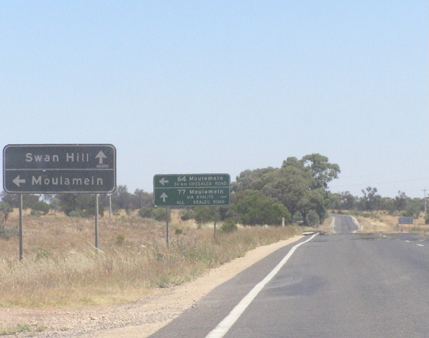 |
Southbound AD signs approaching the turnoff for Moulamein, between Sturt Hwy and Kyalite. The first sign dates from at least the early 1980s (if not the 1970s) and the second sign was installed in the 1990s, following completion of a sealed road between Kyalite and Moulamein. Jan 2004. |
 |
Another old black AD sign, this time westbound on the Moulamein-Balranald road, approaching the Balranald-Swan Hill road at the same intersection. Jan 2004. |
 |
Same intersection again, this time the northbound AD sign. Gotta love old black signs. Jan 2004. |
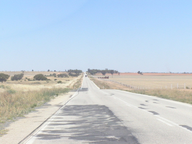 |
Typical view of the Balranald-Swan Hill road between Sturt Highway and Kyalite. The width of the road is surely worthy of B-status however a reseal would come in very handy. Jan 2004. |
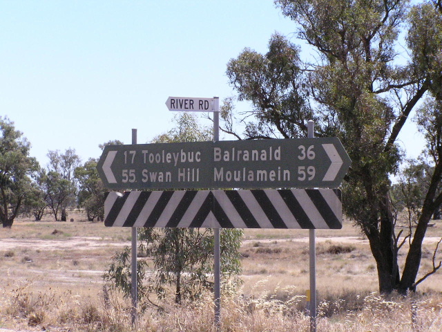 |
Black fingerboard sign at the junction with River Rd in Kyalite. Jan 2004. |
 |
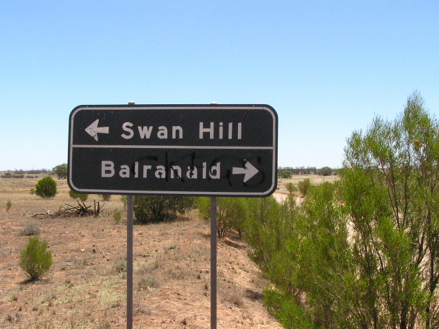
Dodgy Victorian-style AD sign southbound approaching the junction with the Kyalite-Tooleybuc road, 3km south of Kyalite. National Route 43 would have turned left here en route to Swan Hill whilst my proposal for NR12 would have continued straight to Tooleybuc. Jan 2004. |
 |
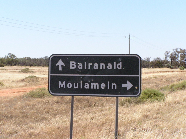
Distance sign heading north from the above intersection. Well they had two goes at making a decent looking sign and failed miserably both times. To steal a line from The Simpsons - the lesson is never try :-) Jan 2004. |
 |
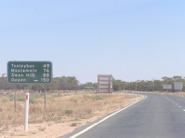
Distance sign heading north from the Murray River at Swan Hill. Jan 2004. |
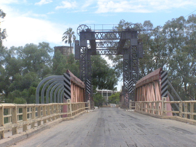 |
The very old single-lane timber truss bridge with an obsolete opening span that would have carried NR43 across the Murray River and into Swan Hill. Jan 2004. |
|
Photos of Kyalite-Tooleybuc road (my proposed NR12) |
|
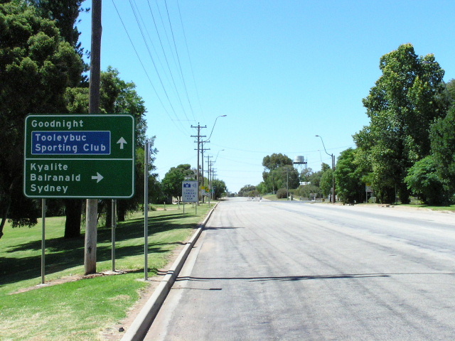 |
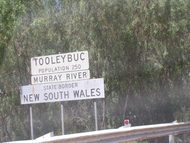
Signage on Main Road No. 222 (Kyalite-Tooleybuc road) in Tooleybuc. Someone has had the foresight to add "Sydney" as a focal point to this AD sign. Jan 2004. |
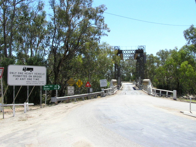 |
Looking west across the Tooleybuc bridge over the Murray River. This was the eastern terminus of National Route 12 (until it was replaced by route "B12" in the Victorian Statewide Route Numbering System in 1999) and the logical step would have been to extend it to the Sturt Hwy. Jan 2004. |
 |
Old school border signage (for non-preferred crossings) on the Victorian side of the Murray at Tooleybuc. Jan 2004. |