PRINCES HIGHWAY
Former Alignment: Batemans Bay
There have been two deviations of the Princes Highway constructed since 1920 at the town of Batemans Bay on the NSW South Coast. The first of which involved the construction of a bridge across the Clyde River to replace the ferry crossing. Construction of the bridge commenced soon after World War 2, in December 1947, but due to a shortage of steel supplies across the country, completion of the bridge was delayed until finally, in 21 November 1956, the new bridge was opened to traffic. The bridge features a lift span that opens to serve river traffic, however, I don't believe the bridge opens any longer. I was unable to find any reference to it on the RTA's website. The old alignment of the highway on the north side of the river is now accessible as a small section of the Kings Hwy and Old Punt Road. The southern ferry landing was located a few metres upstream of the bridge, at the end of Clyde Street.
The second deviation in Batemans Bay was completed in October 1981 and is known as the Vesper Street Deviation. It consisted of widening Vesper Street between Clyde St and Guy St to 4 lanes and constructing a new two-lane link between Guy St and the existing highway near Orient Street. This new route bypassed the town centre of Batemans Bay, thus allowing a more pedestrian friendly environment. The old highway is Clyde and Orient Streets. Note: Clyde Street is now one-way southbound between North St and Beach Rd.
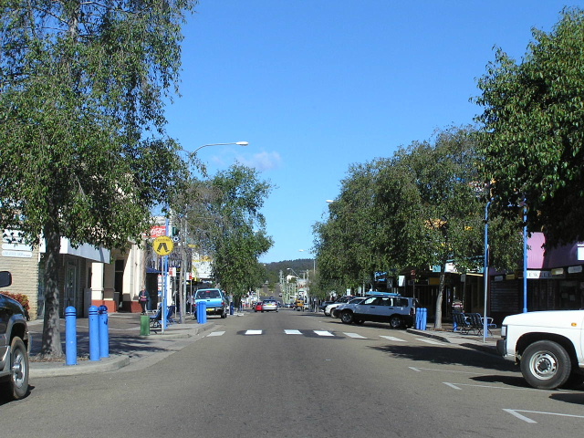 |
Looking south along Clyde Street through the main shopping centre of Batemans Bay. Jul 2005. |
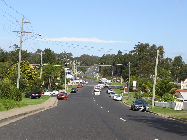 |
Looking south along Orient St towards where the old highway rejoins the new highway. Apr 2005. |
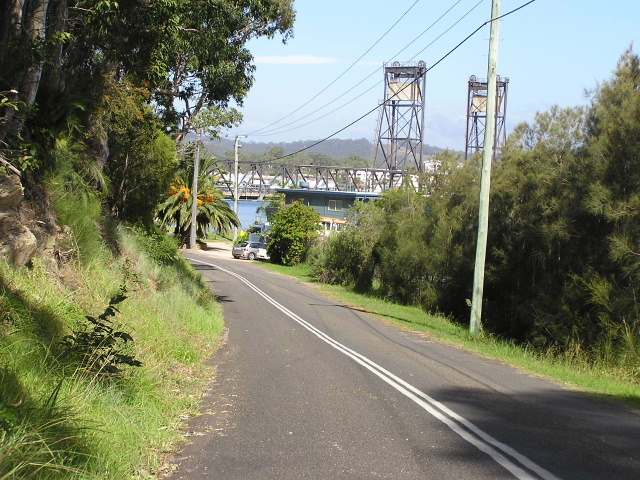 |
Looking south along Old Punt Road towards the former ferry crossing of the Clyde River, with the Princes Highway bridge in the background. Apr 2005. |