BRUXNER HIGHWAY
(including National Route 44)
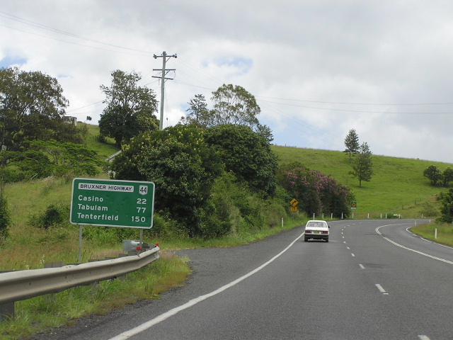
Distance sign heading west from Coraki Rd, 9km west of Lismore. Jan 2005.
Length: 420km
Eastern Terminus: Pacific Hwy at Emigrant Creek, 7km west of Ballina
Western Terminus: Newell Hwy, Boggabilla
Note: The current western extent of National Route 44 signage is Tenterfield, and it is unlikely to ever be extended despite this being (i believe) the original intention.
Route taken:
From the Pacific Highway, 7km west of Ballina, via Lismore, Casino, Mallanganee, Tabulam and Drake to the New England Highway at Tenterfield; then from the New England Highway 5km north of Tenterfield via Bonshaw and Yetman to the Newell Highway at Boggabilla.
Note: National Route 44 signage ends at Tenterfield - the western segment of the Bruxner Hwy has no route shield.
Focal Points: Ballina, Lismore, Casino, Tenterfield, Bonshaw, Yetman, Goondiwindi
Internal Classification: State Highway No. 16
Proclaimed a State Highway: March 1938
Named: 2 November 1959
The Bruxner Highway is an east-west highway in northern New South Wales, stretching 420km from the Pacific Highway, 7km west of Ballina, to the Newell Highway at Boggabilla. It serves the rapidly developing areas of Ballina, Alstonville, Wollongbar and Lismore before traffic volumes drop considerably between Casino and Tenterfield. West of the New England Highway, the Bruxner is under state control only as far as the Tenterfield Shire boundary where it becomes a Regional Road (administered by Local Government but funded by grants from the RTA). Traffic volumes are generally less than 1,000 vpd west of Tenterfield and there is still a 4.7km section of unsealed road between Yetman and Boggabilla.
The Bruxner Highway carries the National Route 44 shield from the Pacific Highway to Tenterfield, whilst west of Tenterfield the highway is un-numbered. I believe it was intended to extend National Route 44 from Tenterfield to Boggabilla once the Bruxner Highway was fully sealed, however with the introduction of alpha-numeric route marking to New South Wales it is unlikely to ever happen. National Route 44 signs were installed in 1974.
History and Development of the Bruxner Highway
Man Behind the Name: Sir Michael Bruxner (Extract from March 1968 edition of Main Roads)
“Lieutenant Colonel the Hon. Sir Michael Frederick Bruxner, K.B.E., D.S.O., M.Inst. T., represented the Tenterfield area in the Legislative Assembly of New South Wales for 42 years. He rendered distinguished services in the first world war at Gallipoli, in Egypt , Palestine and Syria.
“The first leader and a founder of the Country Party of New South Wales, Sir Michael, as Minister for Local Government from 1927 to 1930, was responsible for the amendment to the Main Roads Act which provided for the reclassification of the principal roads of the State. The Country Main Roads were classified in accordance with their order of importance, as –
State Highways,
Trunk Roads, or
Main Roads
And the Sydney Metropolitan Main Roads as –
State Highways, and
Main Roads.
In connection with this reclassification, the State accepted full financial responsibility for all work on State Highways.
This amendment has been of great benefit to the road system of New South Wales , in that it has resulted in the progressive improvement of the principal Main Roads of the State. Sir Michael was born and raised at Sandilands, near Tabulam, a property fronting State Highway No. 16 which stretches from Ballina to the Queensland Border (has since been truncated at both ends) at Goondiwindi and serves the district where he spent most of his life.
As a fitting tribute to Sir Michael towards the end of his career in the Legislative Assembly, State Highway No. 16 was named Bruxner Highway on 2nd November 1959.”
|
Photos of the Bruxner Highway |
|
 |
AD sign on the Pacific Highway northbound approaching the Bruxner Hwy, near Ballina. The two bridges depicted on the sign are across Duck Creek and Emigrant Creek. Jan 2005. |
 |
Second northbound AD sign on Pacific Hwy approaching Bruxner Hwy. The construction on the left looks to me as the beginnings of the Ballina Bypass. Jan 2005. |
 |
First southbound AD sign on Pacific Hwy approaching Bruxner Hwy. Jan 2005. |
 |
Second southbound AD sign on Pacific Hwy approaching Bruxner Hwy. Jan 2005. |
 |
Distance sign heading west from the Pacific Hwy. Jan 2005. |
 |
Looking west at the Ballina Cutting. Jan 2005. |
 |
Looking west into Alstonville. A 6km bypass of this town was to be commenced in 2005, but the RTA has postponed the project until the end of the 2008/2009 financial year - at the soonest. Jan 2005. |
 |
Unusually designed sign with an incorrect NH44 shield westbound approaching Daley St in Alstonville. Jan 2005. |
 |
Another sign of the same style, with the same error, this time on Daley St approaching the Bruxner Hwy. Note the TD28 shield which appears to have been somewhat randomly inserted onto the sign. Not sure which direction it should be pointing to. Jan 2005. |
 |
Looking east through Alstonville town centre. Jan 2005. |
 |
Looking west on the western outskirts of Alstonville. Jan 2005. |
 |
Fingerboard assembly at the turnoff to Pearces Creek, between Alstonville and Wollongbar. Jan 2005. |
 |
Looking west on the divided section through Goonellabah. Jan 2005. |
 |
Another poorly designed roundabout AD sign, this time westbound approaching Rous Rd in Goonellabah. Jan 2005. |
 |
Looking west down the hill between Lismore Heights and Lismore. Jan 2005. |
 |
Looking east along Ballina St towards the Wyrallah Rd roundabout. Jan 2005. |
 |
Assorted signs at the junction with Dawson St (Lismore-Bangalow-Byron Bay road). Jan 2005. |
 |
Very old black AD sign (which had been replaced when I returned in November 2005) on the Wilson River bridge westbound. Jan 2005. |
 |
Distance sign heading west (south) from Lismore, along Union Street. Jan 2005. |
 |
Unusually designed double-chevron ID sign at Coraki Rd. Jan 2005. |
 |
Typical Richmond Valley scenery between McKees Hill and Casino. Jan 2005. |
 |
Distance sign heading east from Casino. Jan 2005. |
 |
Summerland Way southbound approaching the Bruxner Hwy in Casino. Jan 2005. |
 |
Looking north across the Irving Bridge over the Richmond River in Casino. Jan 2005. |
 |
Summerland Way northbound approaching the Bruxner Hwy in Casino. Jan 2005. |
 |
Distance sign heading west from Casino. Jan 2005. |
 |
The old bridge over Ti-Tree Creek, near Tabulam, in 1971. (DMR) |
 |
The replacement bridge, opened to traffic in November 1971. (DMR) |
 |
Distance sign heading east through Tenterfield. Jan 2005. |
 |
Black ID signs at the junction with the New England Hwy in Tenterfield. Jan 2005. |
 |
Black AD sign southbound on New England Hwy approaching Bruxner Hwy in Tenterfield. Jan 2005. |
 |
AD sign northbound on New England Hwy approaching the Bruxner Hwy, 5km north of Tenterfield. Note there is now no route marker for the Bruxner Hwy. Jan 2005. |
 |
Distance sign heading west from the New England Hwy, 5km north of Tenterfield. Jan 2005. |
 |
Non-standard, haphazard assembly of fingerboards at the intersection of Bruxner Highway & Mingoola Station Rd, 56km west of Tenterfield. Source: Michael Gill, January 2008. |
 |
Distance sign heading east on Bruxner Highway from Rocky Creek Road, 95km west of Tenterfield. Source: Michael Gill, January 2008. |
 |
ID sign assembly at the intersection of Bruxner Highway & Rocky Creek Road, 95km west of Tenterfield. Source: Michael Gill, January 2008. |
 |
Distance sign heading west on Bruxner Highway from Rocky Creek Rd. Source: Michael Gill, January 2008. |
 |
Distance sign heading south from the junction with Inverell-Bonshaw road (Main Road No. 137), 4km south of Bonshaw. Note how there is no mention of any focal points beyond Tenterfield. April 2006. |
 |
Black AD sign eastbound on the Inverell-Bonshaw road approaching Bruxner Highway near Bonshaw. April 2006. |
 |
Double-chevron ID sign with Bruxner Hwy name plate at the above junction. Source: Michael Gill, February 2008. |
 |
AD sign southbound on Bruxner Highway approaching the Inverell-Bonshaw road junction. April 2006. |
 |
Distance sign heading north from the Inverell-Bonshaw road. Note no mention of Texas (which isn't mentioned on any of the Bruxner Highway disatnce signs) despite it being the largest town between Tenterfield and Goondiwindi and only 5km from the highway. April 2006. |
 |
Old black "T110" kilometre plate heading south near Bonshaw. April 2006. |
 |
AD sign acting as a Reassurance Direction (RD) sign, heading south from Bonshaw. April 2006. |
 |
Looking west through the tiny, tiny village of Bonshaw. Despite the much larger town of Texas being, located about 30km north of here just off the Bruxner Highway, Bonshaw still gets the nod as the focal point on Bruxner Highway. April 2006. |
 |
Looking east along Bruxner Highway from the western end of Bonshaw. April 2006. |
 |
Great old black distance sign on Bruxner Highway, heading west from Bonshaw. April 2006. |
 |
Non-standard ID sign acting as a fingerboard at the turnoff to Atholwood, 3km west of Bonshaw. April 2006. |
 |
Looking south into the Dumaresq River valley, about 5km north of Bonshaw. April 2006. |
 |
Another downhill view of the Bruxner Highway between Bonshaw and the Texas turnoff. Note the narrow-ish pavement with no shoulders or edge-lines. April 2006. |
 |
Degraded "B15" kilometre plate, headiung south 15km north of Bonshaw. April 2006. |
 |
Distance sign heading east from the junction with the Bruxner Highway-Texas road (Main Road No. 138). April 2006. |
 |
Sign assembly at the junction with Main Road No. 138. Note the newer, non-standard green signs and the older painted Bruxner Highway name plate. April 2006. |
A view of the junction in 1971, soon after opening of the 21km deviation. (DMR) |
|
 |
Non-standard AD sign eastbound approaching the Texas turnoff. April 2006. |
 |
Typical rural/outback services signage, eastbound on Bruxner Highway approaching the Texas turnoff. April 2006. |
One of the three bridges on the 21km deviation in 1971 (DMR). |
|
 |
Looking east on Bruxner Highway at the western end of the deviation constructed in 1971, between 5 and 18 miles west of Bonshaw. The old highway skirted the river valley and was susceptible to flooding in a number of locations, hence the DMR relocated the highway approximately 3km inland to higher ground. April 2006. |
 |
Looking east along an embankment with old chain-mail fencing and painted white guard rails. This scene could almost be a hark back to the 1970s. April 2006. |
 |
Looking east across a timber-decked bridge with white-painted guad rails. April 2006. |
 |
Sign assmebly at the junction with Camp Creek Rd, which is a 14km unsealed road from Bruxner Highway to the locality of Atholwood. April 2006. |
 |
Black fingerboards and a newer non-standard sign at the junction with Tarwoona Rd, 27km east of Yetman. April 2006. |
 |
Looking east along a tree-lined section of the Bruxner Highway with an old timber bridge over an unnamed watercourse, between Tarwoona Rd and Yetman. April 2006. |
 |
Black "G90" kilometre plate, heading west towards Yetman. April 2006. |
 |
A typical view of the Bruxner Highway between Yetman and Texas, showing an old surface with traces of yellow line-markings. April 2006. |
 |
Looking east at the turnoff fro Yelarbon, on the eastern side of the MacIntyre River at Yetman. April 2006. |
 |
Looking east across the MacIntyre River Overflow, on the eastern outksirts of Yetman. Note the very old and deteriorating painted nameplate. April 2006. |
 |
Looking east across the MacIntyre River proper, again with a very old and deteriorating nameplate. April 2006. |
 |
Very non-standard ID sign acting as a fingerboard in Yetman, at the junction with Warialda St (old Bruxner Highway). Between Yetman and Boggabilla, the Bruxner Highway followed the MacIntyre River and was susceptible to regular flooding. During the 1970s and early 1980s the current alignment was constructed, opening to traffic in December 1982. April 2006. |
 |
Looking east through the tiny village of Yetman. April 2006. |
 |
Looking east into Yetman, with signage showing the services available to motorists. April 2006. |
 |
Non-standard fingerboard sign at Bedwell Downs Road, 1km west of Yetman. April 2006. |
 |
Distance sign heading east from the junction with State Route 95 at Yetman. Bedwell Downs Road is in the middle distance whilst in the far distance is the bridge over MacIntyre River. April 2006. |
 |
Sign assembly at the junction with State Route 95 near Yetman. April 2006. |
 |
AD sign northbound on SR95 approaching Bruxner Highway. Note there is no mention of Yetman, which is the northbound focal point on SR95! April 2006. |
 |
AD sign eastbound approaching the junction with State Route 95 near Yetman. Note the incorrect NR95 shield and the very old "B65" kilometre plate. April 2006. |
 |
Distance sign heading west from State Route 95 and Yetman. April 2006. |
 |
Double-chevron ID sign at the junction with North Star Rd, 25km southeast of Yetman. July 2006 (Michael Gill). |
 |
AD sign eastbound approaching the junction with North Star Rd. July 2006 (Michael Gill). |
 |
Distance sign heading east on Bruxner Highway, 5km east of Yetman. This sign is just beyond the intersection where the old and current alignments opf Bruxner Hwy split for the journey between Yetman and Boggabilla. July 2006 (Michael Gill). |
 |
Unusual duplication of distance signs, this one is located eastbound on Bruxner Hwy just prior to the intersection with its former alignment. Note the Bruxner Hwy plate which is the only sign telling traffic to fork to the right. July 2006 (Michael Gill). |
 |
Distance sign heading east from the Newell Hwy at Boggabilla. Jan 2005. |
 |
Newell Highway southbound approaching the beginning of the Bruxner Hwy in Boggabilla. Jan 2005. |
 |
Newell Highway northbound approaching the beginning of the Bruxner Hwy in Boggabilla. Jan 2005. |
 |
Dual ID signs with name plates at the Newell Hwy junction in Boggabilla. Jan 2005. |
Last updated 30 January 2009 © Ozroads 2004-2009. |