F6 SOUTHERN FREEWAY
Historic Photos
The following photos have been scanned from Department of Main Roads publications unless otherwise noted.
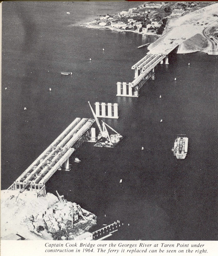 |
Southerly aerial view of construction of the Captain Cook Bridge in 1964. |
The completed bridge. 1965. |
|
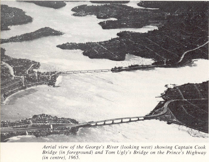 |
Aerial view looking west showing both the Georges River corssings. 1965. |
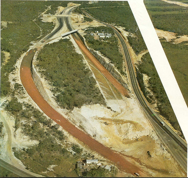
Looking south over the bridge and southern approach. The wide median provides for a future extension of the freeway which would head towards the white coloured land in the top right of the photo. 1970. |
|
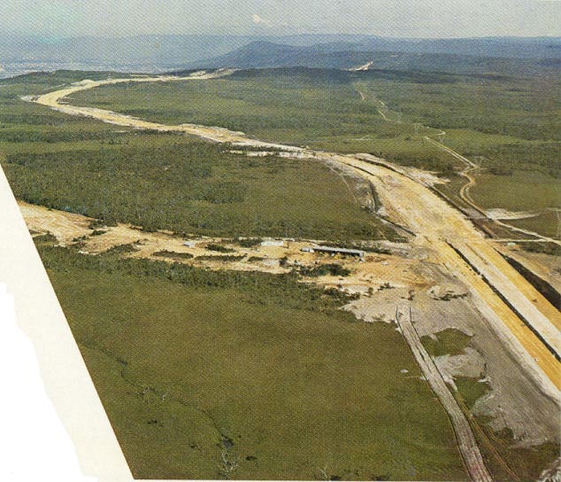
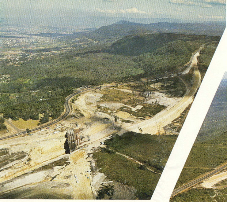
1970 southerly aerial view over the earthworks for the Waterfall Interchange. The large cutting down the centre of the photo was constructed so wide to allow for both mainline carriageways when the freeway was extended north (this is yet to happen). |
|
 |
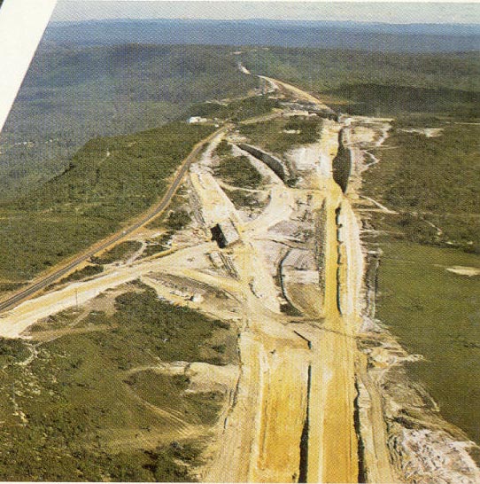
Same view, this time from 1974, showing the advanced progress of earthworks. |
Aerial view of the Waterfall Interchange in July 1975. |
|
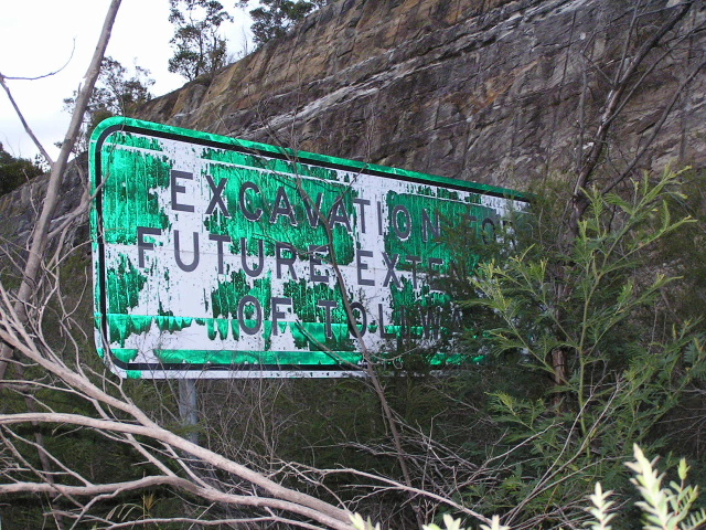 |
Very, very old sign in the median of the northbound carriageway at Waterfall. The sign reads "Excavation for future extension of Tollway". Taken by Sam Laybutt in July 2004. |
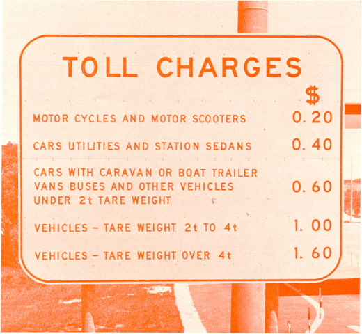 |
Toll charges signage at the Waterfall toll booths in 1976. |
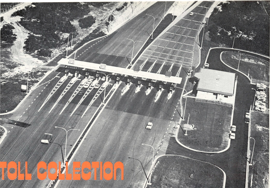 |
Aerial view of the Waterfall toll plaza looking south in 1976. |
Close-up view of one of the toll booths in 1976. |
|
 |
Looking south over construction on Maddens Plains. 1973. |
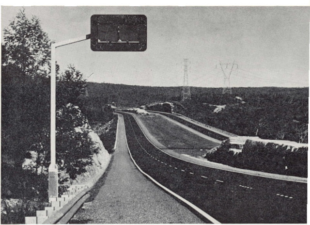 |
The old style fog warning signs on the freeway looking south across Maddens Plains. 1975. |
 |
Aerial view southwards over the Bulli Tops interchange construction in 1973. This photo really highlights just how sprawling the interchange is. |
 |
Another southerly view of Bulli Tops Interchange. 1973. |
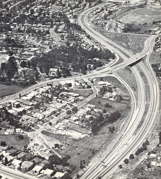
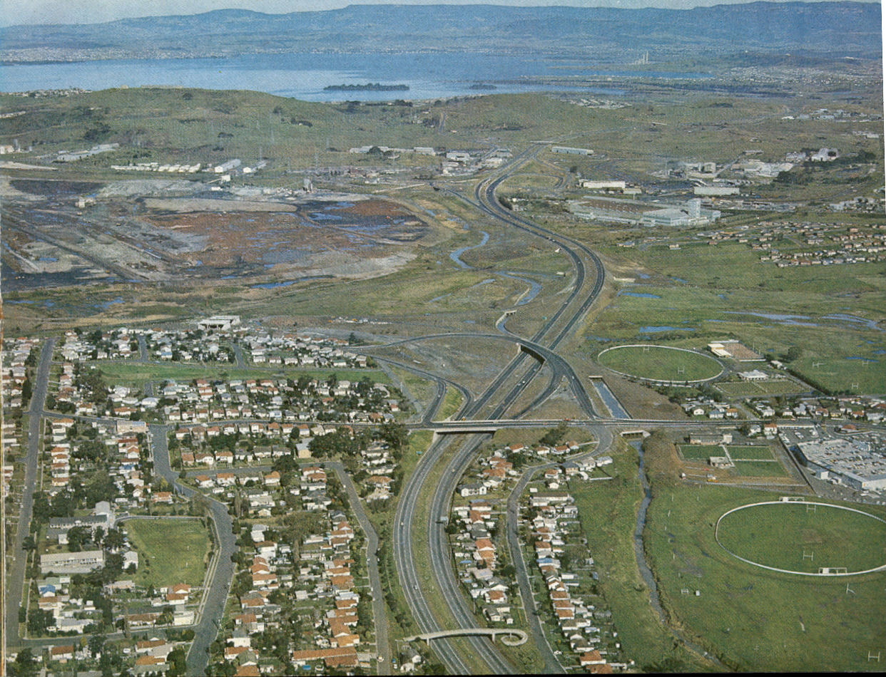
Southerly aerial view over the University Ave interchange in 1974. You can see the old at-grade intersection between the F6 and the F8 Northern Distributor in the background. |
|
 |
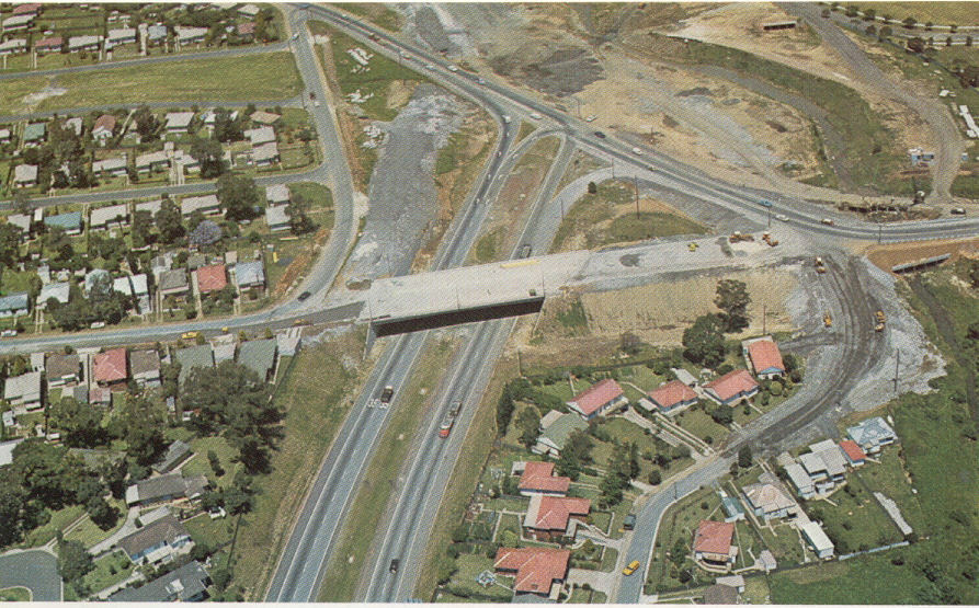
Southerly aerial view over the Ghosts Creek Interchange (Princes Hwy) in 1974. |
 |
Aerial view looking south over the F6's temporary terminus at Gladstone Ave (now Masters Road) in 1972. |
Construction of the Masters Road bridge across the F6 carriageways when the freeway ended at Gladstone Ave. Gladstone Ave reverted to a local road when Masters Road was opened in 1975. The black ID sign reads: "<PORT KEMBLA | TO PRINCES HWY>" with a Gladstone Ave nameplate. 1972. |
|
 |
Southerly aerial view beginning at the Byarong Ave footbridge, then The Avenue overpass, offramps to Gladstone Ave (with construction of Masters Road underway), the steelworks processing area and the Five Islands Road interchange. 1973. |
Construction of the Five Islands Road interchange in 1973. |
|
Looking south over construction of the freeway at Northcliffe Drive in 1974. |