NATIONAL HIGHWAY 1
Former alignment: Lenaghans Drive
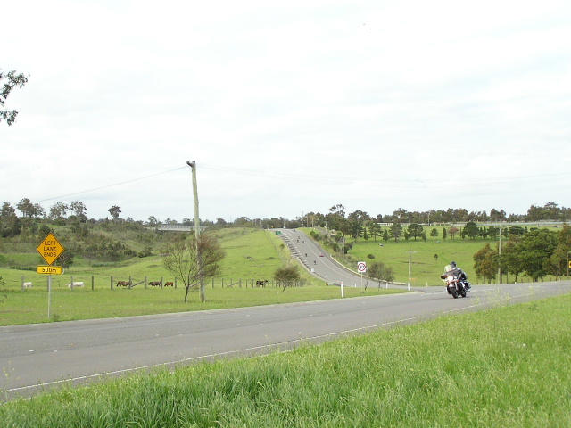
Looking north-west to Black Hill from the u-turn bays above Hexham Swamp. The bridge on the left carries Black Hill Rd across the F3 Freeway. Photo taken October 2004.
Lifespan: 1993-98 (5 years)
Length: 6km
Northern Terminus: F3 Freeway, Beresfield
Southern Terminus: Former Stockrington Interchange on the F3, now removed
Route taken: Lenaghans Drive
Focal Points: Maitland/Taree, Wallsend/Sydney
RTA Internal Classification: Not too sure about this one. It wasn't a classified road before the freeway and isn't classified now so I assmue it took the Main Road 6003 classification from the freeway between 1993-98.
Replaced by: Lenaghans Drive now has no route number
Route Overview:
Lenaghans Drive was nothing more than a developmental road constructed in the 1950's to open up the grazing land adjacent too Hexham Swamp, known as Minmi Rd. The road was of pretty dubious quality and commanded a huge upgrade of mainly pavement widening and overtaking lanes during the early 1990's to prepare it for the freeway traffic. In December 1993, the freeway opened to Minmi and Lenaghans Dr gained the National Highway 1 shield and the heavy inter-regional traffic.
Construction of a bypass of Lenaghans Dr began almost immediately, but took five years to complete due to the very unstable, swampy land this section traverses. To avoid the 'concrete cancer' that plagued other sections across floodplain, the fill was left to settle for over a year before the road base was applied. The freeway opened bypassing Lenaghans Dr in December 1998, ending the 5 year presence of NH1 on this road. The road has reverted back to control of Newcastle City Council as an unclassified road and the Stockrington Interchange was removed. It is quite unusual driving this road to see the dramatic drop in quality between the old NH1 section and the section through Minmi.
Photos of Lenaghans Drive |
|
 |
Northbound AD sign for the temporary Stockrington Interchange when the freeway ended at Lenaghans Drive. This interchange was removed when the freeway opened to Beresfield in December 1998. Photo taken c.1995. |
Southbound AD sign for the temporary Stockrington Interchange when the freeway ended at Lenaghans Drive. This interchange was removed when the freeway opened to Beresfield in December 1998. Photo taken c.1995. |
|
 |
Looking north as the freeway semalessly becomes Lenaghsn Drive Note the two-way signs reminding motorists that they are not on the dual carriageways anymore. Photo taken c.1995. |
 |
Looking north through a line of traffic banked up because of construction of the Minmi-Beresfield freeway stage. You can see the temporary off-ramp to Stockrington. Photo taken c.1997. |
 |
Looking north where the alomst seamless transition from freeway to Lenaghans Dr was. Photo taken c.1995. |
 |
Large AD sign advising motorists of the two alternate routes to Brisbane on Lenaghans Dr in 1994. |
 |
One of the two RD signs showing major towns and their distances along the two highways accessible from this road. There was also one for the New England Hwy with Maitland, Tamworth, Brisbane on it. These signs were removed in December 1998 and no similar sign was installed on the freeway itself. It's a shame because i thought it was a very good idea. Photo taken 1994. |
 |
AD sign on Lenaghans Dr when it was NH1 showing which route to take to the respective highways at the roundabout ahead. A similar sign was installed on the freeway proper when it opened in December 1998. Photo taken 1994. |
 |
Looking south on Lenaghans Dr from the Beresfield roundabout. Note the construction of the second freeway carriageway on the right. Photo taken 1994. |
 |
Lenaghans Drive northbound across Hexham Swamp, you can see by the widened pavement this is where the freeway joined for 5 years. Photo taken October 2004. |
 |
Lenaghans Dr northbound at the former intersection with Cedar Hill Dr. The freeway cut right across this road and it can now be accessed via the Stockrington Rd underpass. Photo taken October 2004. |
 |
Lenaghans Dr northbound across Hexham Swamp showing the close proximity of the freeway and the fill that keeps it flood free. Photo taken October 2004. |
 |
Looking north to Black Hill showing one fo the 3 overtaking lanes constructed for the freeway traffic during the early 1990's. Photo taken October 2004. |
 |
Looking south to Hexham Swamp showing the freeway and Lenaghans Dr side by side. Photo taken October 2004. |